 Ski New Zealand
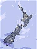
New Zealand is one of the four main southern hemisphere ski nations (along with Australia, Chile and Argentina) with skiing in New Zealand from late May (Mount Hutt is usually first to open) to late October or even early November (Mt Ruapehu often opens for what they call ‘Snovember’ and has re-opened at Christmas some years).
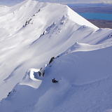
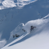
The country is famed for its challenging slopes which attract the world’s best skiers each winter and having some of the biggest lift served verticals south of the equator to enjoy it with. Several resorts operate international training facilities where World Cup race teams from the northern hemisphere go for their ‘summer training’, and the Winter Games NZ have become a major International Ski Federation (FIS) recognised competition each summer attracting the world’s best.
There are around 25 New Zealand ski resorts, half of them commercial ski resorts, the remainder club fields, usually run by local enthusiasts, generally dedicated volunteers.
When you ski New Zealand you’ll find that along with regular lift-served downhill skiing and boarding there’s cat skiing at Mt Potts and the country has a long standing reputation for its heli-skiing with operators like Mount Cook.
The country’s first club fields opened in the late 1920s with the first ski lifts arriving a few decades later. Most of the commercial operations did not really begin until the period from the 1960s to 1980s with Snow Park NZ, which opened in 2002, being the newest operator.
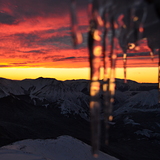
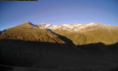
New Zealand is also famous for its spectacular scenery, as made famous worldwide by the Lord of the Rings and Hobbit films – many of the country’s resorts boast some of the world’s best mountainscapes from their slopes.
Snow conditions are normally good from June to late September, Mt Hutt has one of the largest snowmaking systems in the southern hemisphere to help ensure its normal early opening date, so long as temperatures are low enough.
The country can also offer great après ski and one of the Southern Hemisphere’s most active gay skiing scenes at Queenstown, the ‘outdoor capital of the world’ and base for three local ski hills.
This is also the base for many other high octane sports including bungee jumps and swings, white water rafting and jet boating and even sky diving among many others.
Along with domestic skiers, New Zealand’s ski resorts attract a large number of Australians to their slopes, on average 50,000 per annum, who usually benefit from a favourable exchange rate to offset the cost of flying over on a trip that takes about three hours, as well as ski fans from around the world.
On top of the usual challenges for extreme skiers, New Zealand can have a few added challenges, including tricky access roads (the route up to Treble Cone is especially notorious) – and volcanic eruptions, with Mt Ruapehu providing particularly impressive seismic activity every now and then.
-
9:58 pm 26 Aug 2012
-
-
12:09 pm 9 Aug 2012
-
New Zealand: latest snow conditions round-up
Summary of forecast snowfall and ski conditions for resorts in New Zealand. Fresh snow is forecast at 14 resorts. Powder is reported at 6 resorts and 6 are reporting good piste conditions.
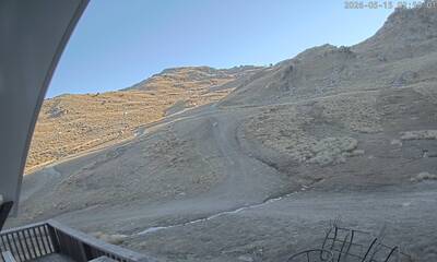
Recent Eyeball Snow Reports for New Zealand
-
 Recent light rain reported from Queenstown (ecowitt) at 335 metres elevation 6 kms WSW of Remarkables but it is forecast cold enough for snow at the ski area
-
Recent light rain reported from Queenstown (ecowitt) at 335 metres elevation 6 kms WSW of Remarkables but it is forecast cold enough for snow at the ski area
-
Recent light rain reported from Queenstown (ecowitt) at 335 metres elevation 6 kms WSW of Remarkables but it is forecast cold enough for snow at the ski area

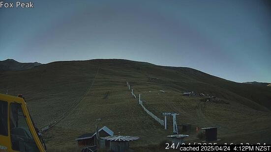
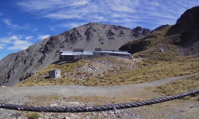
Ski resorts of New Zealand, alphabetically


|
|||||||||||||||||||||||||||||||||||||
|---|---|---|---|---|---|---|---|---|---|---|---|---|---|---|---|---|---|---|---|---|---|---|---|---|---|---|---|---|---|---|---|---|---|---|---|---|---|
| Resort |

|
snow depth top and bottom |
 on-piste |
 off-piste |
 Last Snow |
Next 9 Days 0–3 | 3–6 | 6–9 snow (cm) |
 Next 7 days weather forecast.
Freezing level (m) |
||||||||||||||||||||||||||||||
| Sat | Sun | Mon | Tue | Wed | Thu | Fri | |||||||||||||||||||||||||||||||
|
(1564 m — 2222 m) snow report yesterday |
|
|
|||||||||||||||||||||||||||||||||||
|
(2839 m — 3754 m) snow report yesterday |
|
|
|||||||||||||||||||||||||||||||||||
|
(1463 m — 1737 m) snow report yesterday |
|
|
|||||||||||||||||||||||||||||||||||
|
(1400 m — 1820 m) snow report yesterday |
|
|
|||||||||||||||||||||||||||||||||||
|
(1294 m — 1894 m) snow report yesterday |
|
|
|
||||||||||||||||||||||||||||||||||
|
(1187 m — 1649 m) snow report yesterday |
|
|
|||||||||||||||||||||||||||||||||||
|
(1422 m — 1922 m) snow report yesterday |
|
|
|||||||||||||||||||||||||||||||||||
|
(1170 m — 1851 m) snow report yesterday |
|
|
|
||||||||||||||||||||||||||||||||||
|
(1434 m — 1774 m) snow report yesterday |
|
|
|||||||||||||||||||||||||||||||||||
|
(1449 m — 2149 m) snow report yesterday |
|
|
|||||||||||||||||||||||||||||||||||
|
(1631 m — 2080 m) snow report yesterday |
|
|
|||||||||||||||||||||||||||||||||||
|
(1259 m — 1679 m) snow report yesterday |
|
|
|||||||||||||||||||||||||||||||||||
|
(1086 m — 2000 m) snow report yesterday |
|
|
|||||||||||||||||||||||||||||||||||
|
(1634 m — 1845 m) snow report yesterday |
|
|
|||||||||||||||||||||||||||||||||||
|
(1695 m — 2110 m) snow report yesterday |
|
|
|||||||||||||||||||||||||||||||||||
|
(1400 m — 1750 m) snow report yesterday |
|
|
|||||||||||||||||||||||||||||||||||
|
(1646 m — 2096 m) snow report yesterday |
|
|
|
||||||||||||||||||||||||||||||||||
|
(1160 m — 2231 m) snow report yesterday |
|
|
|||||||||||||||||||||||||||||||||||
|
(1400 m — 2086 m) snow report yesterday |
|
|
|||||||||||||||||||||||||||||||||||
|
(1425 m — 1825 m) snow report yesterday |
|
|
|||||||||||||||||||||||||||||||||||
|
(1310 m — 1980 m) snow report yesterday |
|
|
|||||||||||||||||||||||||||||||||||
|
(1540 m — 1760 m) snow report yesterday |
|
|
|||||||||||||||||||||||||||||||||||
|
(1522 m — 1990 m) snow report yesterday |
|
|
|||||||||||||||||||||||||||||||||||
|
(1350 m — 2133 m) snow report yesterday |
|
|
|||||||||||||||||||||||||||||||||||
|
(1550 m — 1800 m) snow report yesterday |
|
|
|||||||||||||||||||||||||||||||||||
|
(1420 m — 1530 m) snow report yesterday |
|
|
|||||||||||||||||||||||||||||||||||
|
(1425 m — 1929 m) snow report yesterday |
|
|
|||||||||||||||||||||||||||||||||||
|
(1493 m — 1923 m) snow report yesterday |
|
|
|
||||||||||||||||||||||||||||||||||
|
(1260 m — 1960 m) snow report yesterday |
|
|
|||||||||||||||||||||||||||||||||||
|
(1489 m — 1910 m) snow report yesterday |
|
|
|
||||||||||||||||||||||||||||||||||
|
(1602 m — 2322 m) snow report yesterday |
|
|
|
||||||||||||||||||||||||||||||||||
|
(1625 m — 2300 m) snow report yesterday |

|
|
|
||||||||||||||||||||||||||||||||||
|
(1737 m — 2165 m) snow report yesterday |
|
|
|||||||||||||||||||||||||||||||||||

 Nearest