

Global Weekly Snow Roundup #320
Weekly Snow News for the world, updated 25 June 2026: Chile and New Zealand's seasons proper set to begin, Tignes and Sunshine reopen for summer skiing. weekend as Riksgransen ends its 2026 season.

Next 4 days weather summary:Mostly dry. Freeze-thaw conditions (max 2°C on Fri night, min -2°C on Mon morning). Wind will be generally light. | Days 5-7 weather summary:Mostly dry. Freeze-thaw conditions (max 3°C on Wed night, min -1°C on Mon night). Wind will be generally light. | |||||||||||||||
Saturday 27 | Sunday 28 | Monday 29 | Tuesday 30 | Wednesday 1 | ||||||||||||
night | AM | PM | night | AM | PM | night | AM | PM | night | AM | PM | night | AM | PM | night | |
some clouds | some clouds | cloudy | some clouds | clear | some clouds | cloudy | cloudy | cloudy | clear | clear | clear | clear | clear | some clouds | clear | |
km/h | ||||||||||||||||
Snow map | 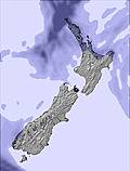 | 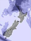 |  |  |  |  | ||||||||||
— | — | — | — | — | — | — | — | — | — | — | — | — | — | — | — | |
mm | — | — | — | — | — | — | — | — | — | — | — | — | — | — | — | — |
max °C | 2 | 0 | 1 | 1 | 0 | 0 | 0 | -2 | -1 | 1 | 1 | 2 | 1 | 2 | 2 | 3 |
min °C | 0 | 0 | 0 | 0 | 0 | 0 | -1 | -2 | -2 | -1 | 1 | 1 | 1 | 1 | 1 | 1 |
chill °C | -2 | -2 | 0 | 0 | -3 | -4 | -5 | -4 | -2 | -1 | -1 | -2 | -2 | 0 | 0 | 1 |
Humid % | 81 | 94 | 92 | 81 | 76 | 80 | 78 | 96 | 92 | 70 | 57 | 77 | 74 | 72 | 75 | 55 |
Freeze m | 2250 | 1750 | 1650 | 1850 | 1700 | 1600 | 1650 | 1350 | 1450 | 1650 | 2000 | 2050 | 2000 | 1950 | 2000 | 2050 |
— | 8:06 | — | — | 8:06 | — | — | 8:06 | — | — | 8:06 | — | — | 8:06 | — | — | |
— | — | 5:05 | — | — | 5:06 | — | — | 5:06 | — | — | 5:07 | — | — | 5:07 | — | |
Go pro and carve into:
Avalanche information: New Zealand Avalanche Advisory
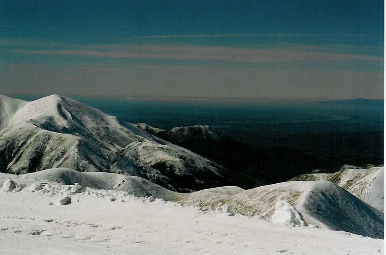
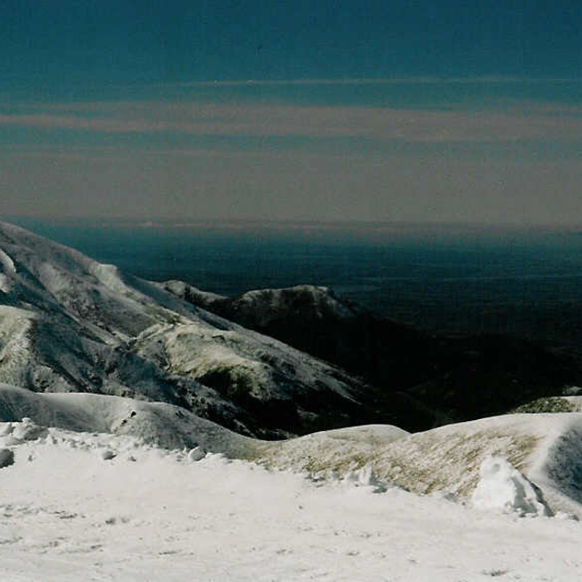
Latest snow reports near Porters:
| Top snow depth: | — |
|---|---|
| Bottom snow depth: | — |
| Fresh snowfall depth: | 30 cm |
| Last snowfall: | 25 Jun 2026 |
| Snow Alerts | Create Alert |
0.4 | Bluebird Powder days Fresh snow, mostly sunny, light wind. |
|---|---|
0.8 | Powder days Fresh snow, limited sun, any wind. |
1.0 | Bluebird days Average snow, mostly sunny, light wind. |
The above table gives the weather forecast for Porters at the specific elevation of 1645 m. Our sophisticated weather models allow us to provide snow forecasts for the top, middle and bottom ski stations of Porters. To access the weather forecasts for the other elevations, use the tab navigation above the table. For a wider view of the weather, check out the Weather Map of New Zealand.
Click here to read further information on freezing levels and how we forecast our temperatures.
Overall 3.5 Based on 10 votes and 9 reviews
Friendly, medium sized skifield that has a good Kiwi and international mix of staff. Best option for a beginner to get going as mum and dad can have a ski and still keep an eye on the kids on the platter lifts. Coffee is great. On a full snow clear day it is unbeatable for terrain. Local tip, head for first runs in the morning to the top of T3 and come down Sundance, 3 solid runs. Then coffee run, then a fast McBulty run, Big Mamma or Bluff, lunch, sleep and finish the afternoon with a cruisy Easy street.
colin from New Zealand writes:
Friendly, medium sized skifield that has a good Kiwi and international mix of staff. Best option for a beginner to get going as mum and dad can have a ski and still keep an eye on the kids on the platter lifts. Coffee is great. On a full snow clear day it is unbeatable for terrain. Local tip, head for first runs in the morning to the top of T3 and come down Sundance, 3 solid runs. Then coffee run, then a fast McBulty run, Big Mamma or Bluff, lunch, sleep and finish the afternoon with a cruisy Easy street.


 Nearest