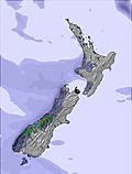
Mostly dry. Freeze-thaw conditions (max 5°C on Tue morning, min 0°C on Sun afternoon). Winds increasing (light winds from the NW on Sun afternoon, gales from the NW by Tue afternoon).
Days 4-6 weather summary:
Drizzle on Wed night turning to light snow on Sat morning. Freeze-thaw conditions (max 7°C on Fri morning, min -5°C on Sat morning). Winds increasing (light winds from the NW on Thu morning, fresh winds from the SSW by Fri night).
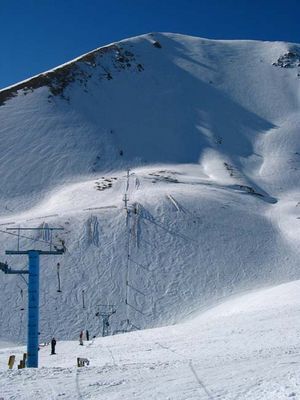
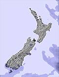
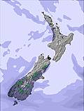
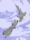
The above table gives the weather forecast for Mount Lyford at the specific elevation of 1575 m. Our sophisticated weather models allow us to provide snow forecasts for the top, middle and bottom ski stations of Mount Lyford. To access the weather forecasts for the other elevations, use the tab navigation above the table. For a wider view of the weather, check out the Weather Map of New Zealand.
Click here to read further information on freezing levels and how we forecast our temperatures.
We received a poor guest rating from the management where it was stated a 1 star for communication, 3 for house rules and overall experience and 4 for cleanliness.
Lets start with communication: we sent a few emails to clarify a few points and before our departure I called to make sure all was ok only to find out that the hot tub was $80 instead of $40 and we had to pay $20 pp for bedding or provide your own. We did not agree /request for the tub and or the bedding during that call. So on the day of arrival after asking us for bedding payment, which we did not request for as we had our own, a not so impressed manager spoke to us in a cold, quite disrespectful and stern manner. This attitude was far from professional and clearly not deserving from our end. She said rudely ”does it matter then” and gave us the keys. The place was comfortable but not completely cleaned. The stove and the grill were oily and the oven had some food residue. And, yes, the place was cleaner and the firewood basket was extra full after we left. So our guest cleanliness rating of 4 stars would mean the original state of the place was either 2 or 3.
So instead of being nasty and giving your guest a poor review because of your own stuff ups, do your job properly next time. Such a shame a majestic place like Mr Lyford has such a person working there.
[note from the editor: names of individuals are not included in reviews.]
Free Snow-Forecast.com weather widget for your website
Embed the Mount Lyford weather widget on your site for free. It provides a weekly snapshot of snow and rain conditions across all elevations. Follow the two quick steps to grab your custom code and paste it into your site. Choose between metric or imperial units. Click here to get the code.


 Nearest