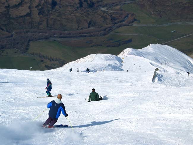


Banff Sunshine Village Opening for Summer Skiing
Banff Sunshine Village has confirmed it will reopen for a fortnight of summer skiing, from this weekend. The only ski area in Canada to be open into July.

Next 4 days weather summary:Mostly dry. Freeze-thaw conditions (max 1°C on Sun night, min -3°C on Mon night). Wind will be generally light. | Days 5-7 weather summary:A moderate fall of snow, heaviest on Wed night. Temperatures will be below freezing (max -1°C on Wed night, min -4°C on Fri morning). Wind will be generally light. | |||||||||||||||
Monday 22 | Tuesday 23 | Wednesday 24 | Thursday 25 | Friday 26 | ||||||||||||
night | AM | PM | night | AM | PM | night | AM | PM | night | AM | PM | night | AM | PM | night | |
clear | clear | clear | some clouds | cloudy | some clouds | some clouds | cloudy | cloudy | mod. snow | light snow | light snow | light snow | light snow | some clouds | some clouds | |
km/h | ||||||||||||||||
Snow map |  | 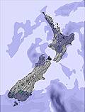 | 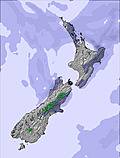 |  |  | 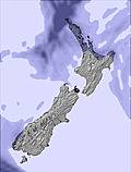 | ||||||||||
— | — | — | — | — | — | — | — | — | 6 | 4 | 3 | 5 | 2 | — | — | |
mm | — | — | — | — | — | — | — | — | — | — | — | — | — | — | — | — |
max °C | 1 | 1 | 1 | -1 | -2 | 0 | 0 | 1 | 1 | -1 | -3 | -2 | -3 | -3 | -3 | -3 |
min °C | 0 | 0 | 0 | -3 | -2 | -1 | -1 | 0 | 0 | -3 | -3 | -2 | -3 | -4 | -3 | -4 |
chill °C | 0 | -2 | -2 | -7 | -5 | -4 | -4 | -4 | -2 | -7 | -10 | -9 | -10 | -10 | -7 | -8 |
Humid % | 53 | 53 | 68 | 85 | 80 | 66 | 79 | 63 | 72 | 97 | 98 | 99 | 98 | 98 | 96 | 87 |
Freeze m | 1800 | 1750 | 1800 | 1250 | 1200 | 1550 | 1350 | 1700 | 1700 | 1150 | 1100 | 1200 | 1050 | 900 | 1000 | 750 |
— | 8:21 | — | — | 8:22 | — | — | 8:22 | — | — | 8:22 | — | — | 8:22 | — | — | |
— | — | 5:09 | — | — | 5:10 | — | — | 5:10 | — | — | 5:10 | — | — | 5:10 | — | |
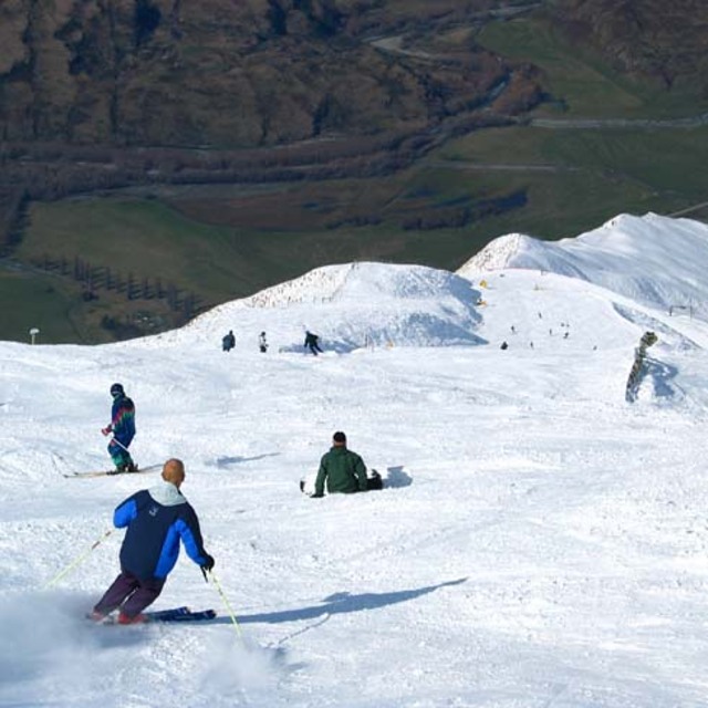
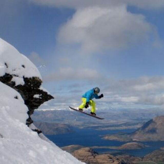
Go pro and carve into:
Avalanche information: New Zealand Avalanche Advisory
Latest snow reports near Treble Cone:
| Top snow depth: | 0 cm |
|---|---|
| Bottom snow depth: | 0 cm |
| Fresh snowfall depth: | — |
| Last snowfall: | 19 Jun 2026 |
| Snow Alerts | Create Alert |
0.5 | Bluebird Powder days Fresh snow, mostly sunny, light wind. |
|---|---|
1.2 | Powder days Fresh snow, limited sun, any wind. |
0.6 | Bluebird days Average snow, mostly sunny, light wind. |
The above table gives the weather forecast for Treble Cone at the specific elevation of 1610 m. Our sophisticated weather models allow us to provide snow forecasts for the top, middle and bottom ski stations of Treble Cone. To access the weather forecasts for the other elevations, use the tab navigation above the table. For a wider view of the weather, check out the Weather Map of New Zealand.
Click here to read further information on freezing levels and how we forecast our temperatures.
Overall 3.7 Based on 35 votes and 10 reviews
Needs the right conditions. The saddle is fun although they need a detachable lift as it'd be quicker to walk up and quite often closed due to avi risk so can be frustrating. If I had to choose between there and Cardrona and everything was open I'd go TC for sure unless you're a park rat. But, in all honestly, the best terrain in the country hands down is Turoa on the North Island. It's epic shits on anything the South Island has and anyone who has skied all over the country will tell ya the same and if they don't they haven't skied Turoa or Whakapapa. Go in spring as you will score good weather and the season will go through 'till the end of October.
kane from New Zealand writes:
Needs the right conditions. The saddle is fun although they need a detachable lift as it'd be quicker to walk up and quite often closed due to avi risk so can be frustrating. If I had to choose between there and Cardrona and everything was open I'd go TC for sure unless you're a park rat. But, in all honestly, the best terrain in the country hands down is Turoa on the North Island. It's epic shits on anything the South Island has and anyone who has skied all over the country will tell ya the same and if they don't they haven't skied Turoa or Whakapapa. Go in spring as you will score good weather and the season will go through 'till the end of October.


 Nearest