Southern Hemisphere Weekly Snow Roundup #327
🇦🇺🇳🇿🇨🇱🇦🇷🇿🇦 Weekly Snow News for Southern Hemisphere, updated 13 August 2026: Australia reaches nearly 80% open, New Zealand hits full operations, while Chile’s Portillo holds a 2.85m (114") snowpack.
- Australia: Conditions keep improving, with Perisher nearly 80% open after recent snowfall.
- New Zealand: Most resorts are fully or nearly fully open, with strong snow bases.
- South America: Argentina and Chile remain in excellent shape, with deep snow and mostly open terrain.
- Afriski: Enters its final week, with 67% of slopes open.
SOUTHERN HEMISPHERE INTRODUCTION
All Southern Hemisphere ski regions have seen fresh snow over the past week, generally light to moderate, but conditions vary widely. South America still has the world’s deepest snowpack after sustained storms through mid-July and early August, although some areas now want clearer weather to improve access and operations after repeated closures. Australia is seeing the opposite, with several 10–20 cm snowfalls improving conditions and pushing terrain availability to its highest level of the winter. Many centres are close to 80% open. New Zealand has also had fresh snow, adding to a solid mid-season base, while Lesotho Afriski has reported some snowfall ahead of its final week.
AUSTRALIA REPORT
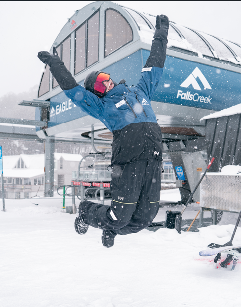
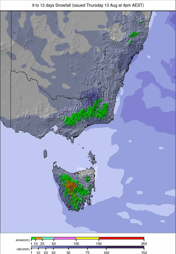
Australia’s season continues to improve, with another 10-20cm (4-8”) of snow reported at most resorts. Falls Creek (50/60cm / 20/24”) is now 70% open after fresh snow and temperatures of -1.8C. Perisher (55/95cm / 22/38”), Australia's largest ski area, has rebounded strongly and is now nearly 80% open, the highest proportion of open slopes of any ski area worldwide. An upper-mountain base approaching one metre has helped operations expand after a difficult start to winter. New early-morning alpine sessions on Blue Cow slopes will run from mid-August to early September. Australian resorts expect to operate into early October.
AUSTRALIA FORECAST
A spell of sunny, settled weather is expected, with crisp days and very cold nights. No new snow is forecast, while strong overnight refreezing should maintain good surface conditions. Light winds will provide ideal grooming conditions, with hard-packed mornings gradually softening in the afternoon.
NEW ZEALAND REPORT
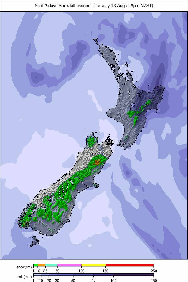
Conditions are the best of the season so far, with almost all ski areas fully or close to fully open. Mt Hutt (106/169 cm / 43"/68") remains the national leader, with 100% of terrain open and the deepest snow outside the Andes. Cardrona (45/55 cm / 18"/22") is close to fully open, while Coronet Peak (20/30 cm / 8"/12") reports full operations despite thinner cover. Cold nights and further snow showers are keeping conditions stable.
NEW ZEALAND FORECAST
Further light snow is expected over the next few days before mostly sunny weather returns. Cold temperatures will keep the new snow dry and firm, while nights could fall below -10C. Light winds and generally dry conditions should dominate into the weekend.
ARGENTINA REPORT
Mostly dry, sunny weather has returned after recent snowfall, with persistent cold maintaining a firm snowpack. Most areas now have 50% or more of their slopes open. Catedral (60/70cm / 24/28") near Bariloche has the most terrain open, while Las Leñas (120/230cm / 48/92") has some of the deepest cover in the world. Cerro Castor (25/50cm / 10/20") remains dry and colder in the far south.
ARGENTINA FORECAST
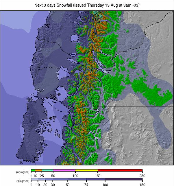
Mostly light snow is expected between sunny spells, with northern and central areas seeing occasional flurries and southern areas generally drier. Cold temperatures will preserve the snowpack, with nights below -10 °C in areas including Las Leñas. The pattern should become clearer and more settled towards the weekend.
CHILE REPORT
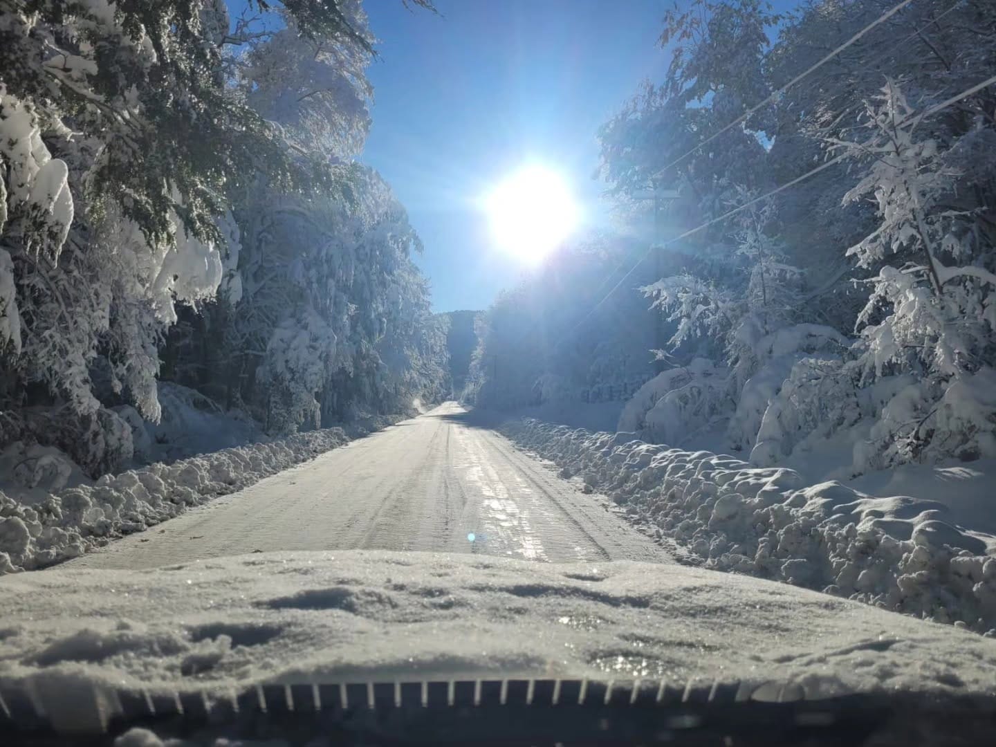
Most major Chilean resorts are fully open or close to it. Portillo (175/285cm / 70/114") still has the world’s deepest snow cover, but its access road has been closed for a month, meaning only helicopter arrivals/departures are currently possible.
Valle Nevado (90/180 cm / 36"/72") is 100% open, while La Parva (60/120 cm / 24"/47") and El Colorado (50/100 cm / 20"/40") remain close to full operations. Nevados de Chillán (60/125cm / 24"/50") is also looking good after fresh snow.
CHILE FORECAST
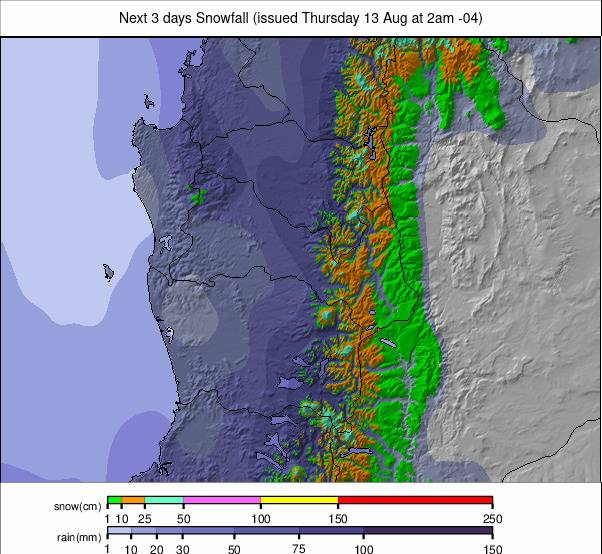
Light to occasionally moderate snow is expected over the next few days, with southern areas seeing the steadiest snowfall. Cold nights will keep morning conditions firm, while snowfall should ease towards the weekend, bringing brighter, more settled weather.
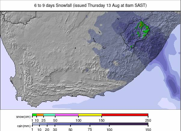
SOUTHERN AFRICA REPORT
Lesotho’s Afriski (5/15cm / 2/6”) is entering its final week, with 67% of slopes open and both lifts running. Some light snow was reported earlier in the week. Very cold nights have produced firm morning conditions, with temperatures reaching –14 °C at altitude.
SOUTHERN AFRICA FORECAST
Full sunshine and clear skies are expected for Afriski’s final week. No further snowfall is forecast, with cold nights providing strong refreezing. Skiers can expect frosty mornings, crisp corduroy and gradual softening in the afternoon sun.