
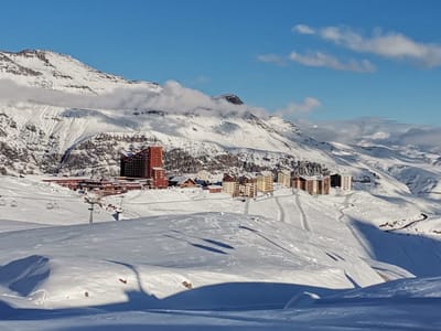
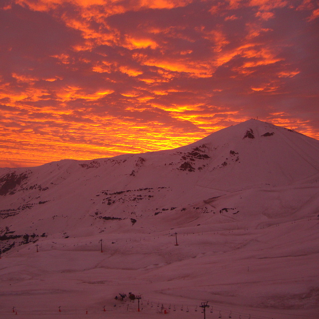
South America’s 2025 Ski Season Gets Underway As Snowstorm Hits
Chile’s Valle Nevado is opening a little earlier than expected, this Friday 13 June. It’s the first in Chile and believed to be the first in South America to open for winter 2025.
By using Snow-Forecast, you agree to our Terms & Services.
Don't have an account? Join now
Alternatively, you can now use your Outside account to sign in to any brand in the Outside digital ecosystem, including Snow-Forecast, Surf-Forecast, and Mountain-Forecast.

Valle Nevado Weather (Next 3 days): The snow forecast for Valle Nevado is: Some drizzle, heaviest during Sun night. Mild temperatures (max 7°C on Sat morning, min 1°C on Mon morning). Wind will be generally light.
Valle Nevado Weather (Days 4-6): Mostly dry. Temperatures will be slightly above freezing (max 4°C on Tue afternoon, min 1°C on Mon night). Wind will be generally light.
| Resort | Snow Depth | Temp. (°C) | Wind (km/h) | Weather | ||
|---|---|---|---|---|---|---|
| Top Lift: | 0.9 m | 2 | ||||
| Middle Lift: | 5 | |||||
| Bottom Lift: | 0.3 m | 4 |
Latest snow reports near Valle Nevado:

Fri 18 | Saturday 19 | Sunday 20 | Monday 21 | Tuesday 22 | Wednesday 23 | Thursday 24 | ||||||||||||||
PM | night | AM | PM | night | AM | PM | night | AM | PM | night | AM | PM | night | AM | PM | night | AM | PM | night | |
clear | clear | clear | clear | cloudy | cloudy | cloudy | light rain | cloudy | cloudy | cloudy | some clouds | cloudy | some clouds | clear | some clouds | some clouds | some clouds | cloudy | clear | |
km/h | ||||||||||||||||||||
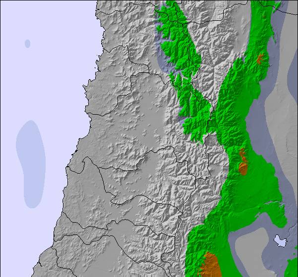
Snow map |  | 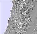 |  | 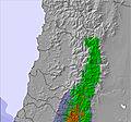 | 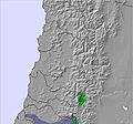 | 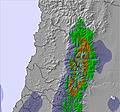 | 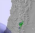 | |||||||||||||
— | — | — | — | — | — | — | — | — | — | — | — | — | — | — | — | — | — | — | — | |
— | — | — | — | — | — | — | 1 | — | — | — | — | — | — | — | — | — | — | — | — | |
max°C | 6 | 5 | 7 | 6 | 4 | 5 | 4 | 2 | 3 | 2 | 1 | 3 | 4 | 2 | 3 | 3 | 2 | 3 | 2 | -1 |
min°C | 5 | 5 | 5 | 5 | 4 | 3 | 3 | 2 | 1 | 2 | 1 | 1 | 3 | 1 | 1 | 2 | 1 | 2 | -1 | -5 |
4 | 3 | 3 | 3 | 2 | 0 | 0 | -1 | -2 | -2 | -2 | -2 | 1 | -2 | -1 | 1 | -2 | -2 | -5 | -11 | |
20 | 10 | 19 | 21 | 12 | 24 | 28 | 24 | 26 | 32 | 29 | 34 | 37 | 17 | 16 | 25 | 13 | 17 | 39 | 54 | |
4000 | 3900 | 4150 | 3950 | 3800 | 3850 | 3650 | 3550 | 3600 | 3500 | 3450 | 3700 | 3650 | 3450 | 3650 | 3550 | 3500 | 3600 | 3200 | 2700 | |
— | — | 7:41 | — | — | 7:39 | — | — | 7:39 | — | — | 7:39 | — | — | 7:37 | — | — | 7:37 | — | — | |
5:52 | — | — | 5:52 | — | — | 5:53 | — | — | 5:54 | — | — | 5:54 | — | — | 5:55 | — | — | 5:55 | — | |
Some drizzle, heaviest during Sun night. Mild temperatures (max 7°C on Sat morning, min 1°C on Mon morning). Wind will be generally light.
Mostly dry. Temperatures will be slightly above freezing (max 4°C on Tue afternoon, min 1°C on Mon night). Wind will be generally light.
Latest snow reports near Valle Nevado:
| Top snow depth: | 90 cm |
|---|---|
| Bottom snow depth: | 30 cm |
| Fresh snowfall depth: | — |
| Last snowfall: | 30 Jun 2025 |
| Snow Alerts | Create Alert |
0.6 | Bluebird Powder days Fresh snow, mostly sunny, light wind. |
|---|---|
1.3 | Powder days Fresh snow, limited sun, any wind. |
1.1 | Bluebird days Average snow, mostly sunny, light wind. |
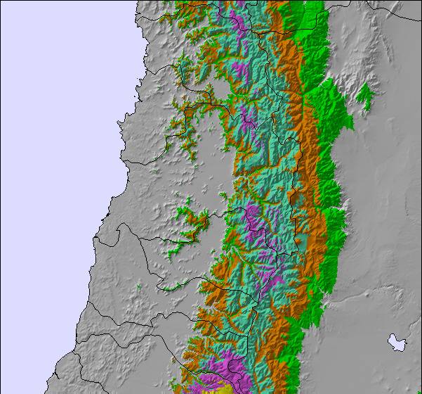
The above table gives the weather forecast for Valle Nevado at the specific elevation of 3264 m. Our sophisticated weather models allow us to provide snow forecasts for the top, middle and bottom ski stations of Valle Nevado. To access the weather forecasts for the other elevations, use the tab navigation above the table. For a wider view of the weather, check out the Weather Map of Chile.
Click here to read further information on freezing levels and how we forecast our temperatures.
Overall 3.4 Based on 78 votes and 99 reviews
Lamentablemente, el servicio de atención al cliente fue inadecuado porque no se dispusieron a resolver el problema de extranjeros que no podían comprar los tickets de forma presencial. No daban la alternativa de pago online. Sus soluciones fueron: hagan dedo o pidan Plata prestada. Pésimo servicio, no brindaron ninguna solución y trataron muy mal a los clientes indultándolos.
Juana from Argentina writes:
Lamentablemente, el servicio de atención al cliente fue inadecuado porque no se dispusieron a resolver el problema de extranjeros que no podían comprar los tickets de forma presencial. No daban la alternativa de pago online. Sus soluciones fueron: hagan dedo o pidan Plata prestada. Pésimo servicio, no brindaron ninguna solución y trataron muy mal a los clientes indultándolos.
The Valle Nevado skiing weather widget is available to embed on external websites free of charge. It provides a daily summary of our Valle Nevado snow forecast and current weather conditions. Simply go to the feed configuration page and follow the 3 simple steps to grab the custom html code snippet and paste it into your own site. You can choose the snow forecast elevation (summit, mid-mountain or bottom lift) and metric/imperial units for the snow forecast feed to suit your own website…. Click here to get the code.
View detailed snow forecast for Valle Nevado at:
snow-forecast.com

 Nearest