WORLD SNOW ROUNDUP #182
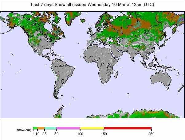
Issued: 10 March 2021
By Patrick “Snowhunter” Thorne
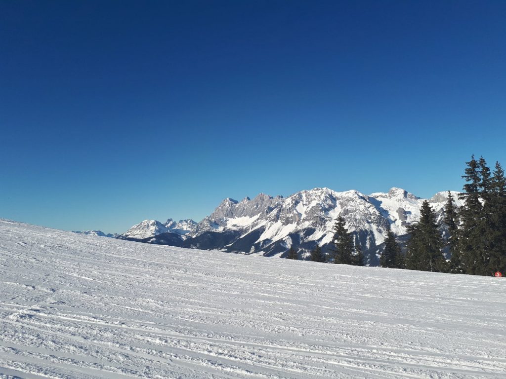
European Roundup
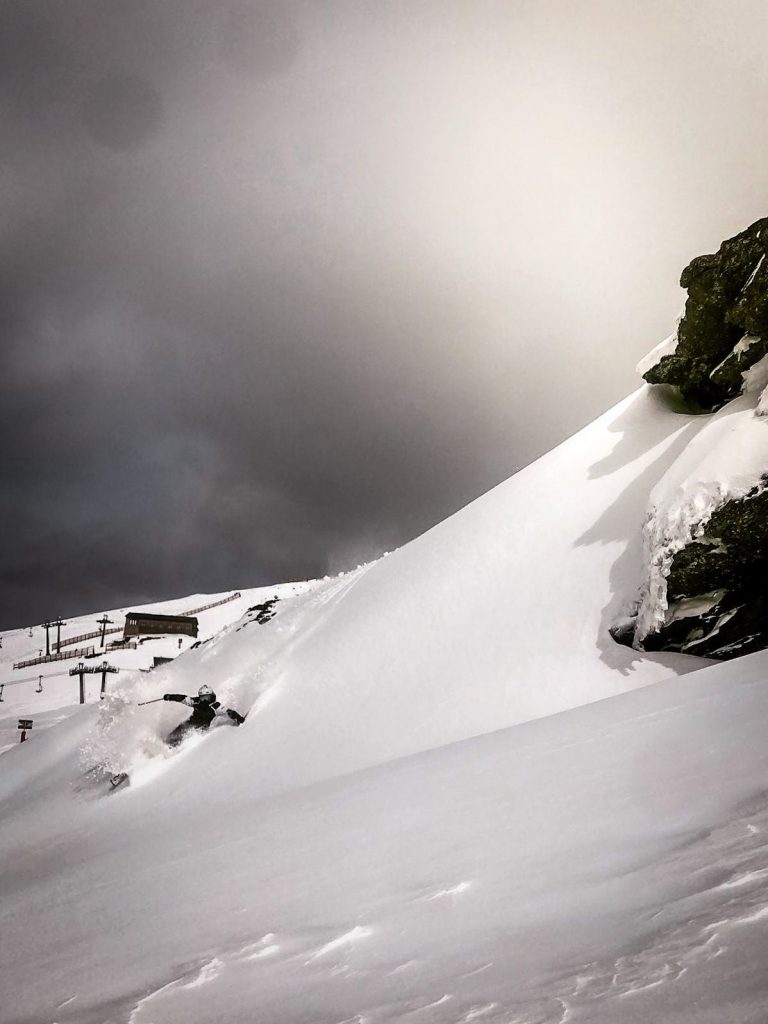
North American Roundup
Asia Roundup
EUROPE INTRODUCTION
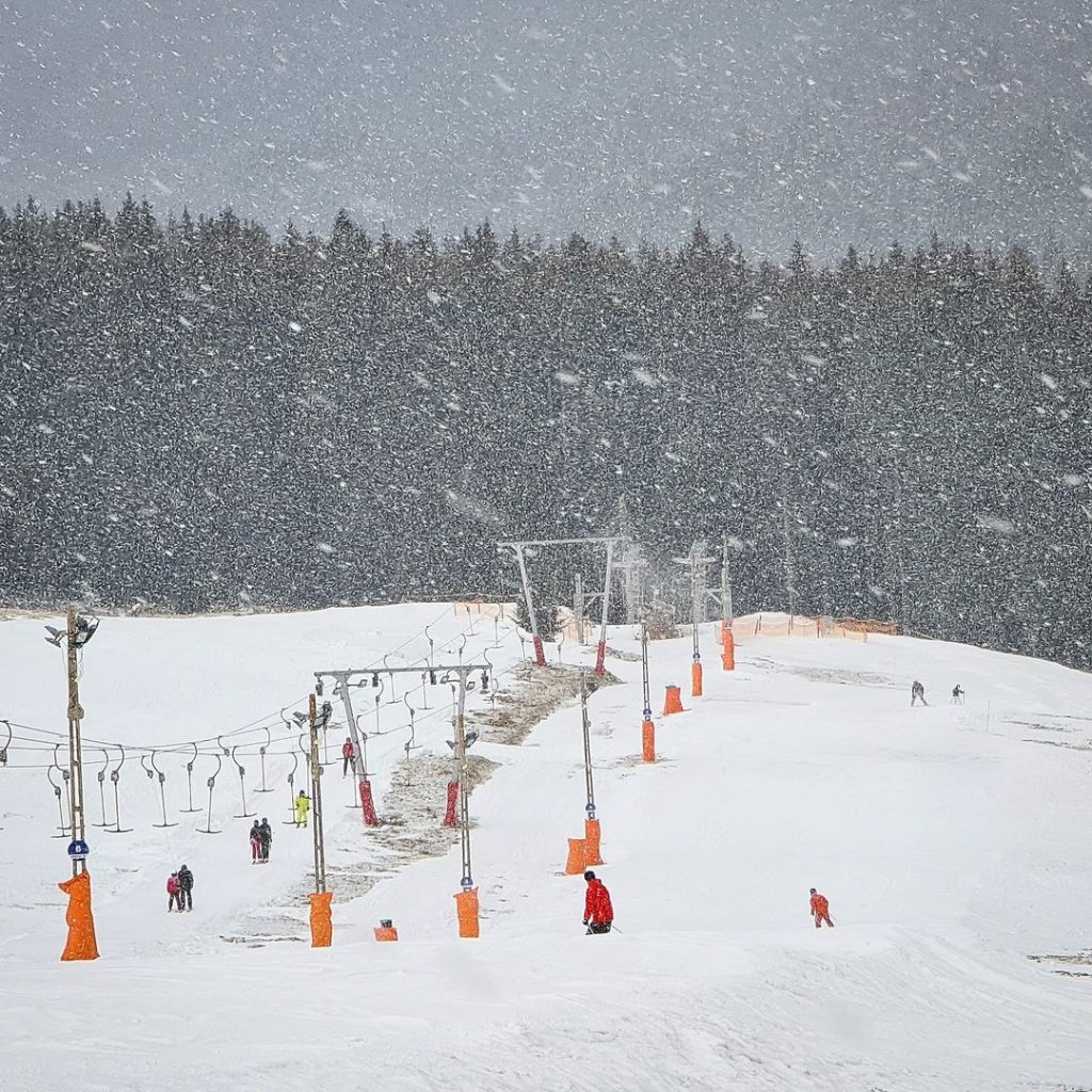
It has been a colder week than recently in much of Europe, with light to moderate snowfall reported at the weekend across the continent; ski centres in the Balkans, Alps, Dolomites, Pyrenees, Tatras and up in Scandinavia all reporting 5-15cm (2-6 inches) of fresh snowfall and predominantly sub-zero temperatures. After a brief warm spell midweek, it looks like there’s more cold and snowy weather on the way for many in the latter half of this week.
Regarding the pandemic, the big news is a few ski areas in Germany being allowed to open for the first time this season, leaving only France and Italy still fully shut down in terms of lift-accessed skiing. Elsewhere, several Austrian ski areas have announced they can’t justify opening any longer this season as they’re losing money every day doing so, the Skiwelt being one of them. Ischgl, which hadn’t opened this season anyway, now says it definitely won’t be.
AUSTRIA
AUSTRIA REPORT| Some Austrian resorts saw their first fresh snowfall for several weeks at the end of last week, but there was also low cloud and fog causing issues at times. It wasn’t much snow but nice to get a freshen up after several weeks of warm weather thaw. The sunshine returned for most areas at the weekend but it is far colder than it has been of late, with temperatures double digits below freezing on higher slopes, and overnight down in the valleys too. Hintertux (15/370cm / 6/148″), the country’s year-round ski area, currently has its deepest base upon the glacier, hopefully good news for skiing there over the next six months. Less good news is the ongoing pandemic operating restrictions which have led Ischgl to announce it won’t open at all now this winter and the Skiwelt, which had been open for 70 days, to call it a day on its 20-21 ski season last Sunday, over a month early. It says it’s losing money every day it’s open.
AUSTRIA FORECAST| There’s not much snow in the forecast for Austria at present but it will stay cold, not getting above freezing at all below about 1500 metres altitude. Later this week temperatures will creep up a little, getting into plus temps in the valleys, but staying dry.
SWITZERLAND
SWITZERLAND REPORT| Swiss ski areas have seen 10-20cm (4-8 inches) of fresh snowfall to start the week. Engelberg (15/490cm / 6/196″), which has had the upper end of that snowfall range, has Europe’s deepest base still and seen the numbers increase on its upper slopes but drop down at the base as the spring thaw continues to take its toll down in the lower valleys of the Alps. The 4 Valley (35/225cm / 14/90″) continue to post the biggest ski area open in Europe, with about 320km (200 miles) of slopes open, about 75% of the total. That is down a little with one sector closed early for the season at the weekend as the region tries to stem pandemic operating losses. Regarding the ongoing impact of the pandemic, non-essential shops are now open in Switzerland along with hotels but it is another week or so until restaurants are expected to be allowed to open.
SWITZERLAND FORECAST| After a sunny midweek period, it does look like it should be increasingly snowy on Swiss slopes through the latter half of this week and into the weekend. Temperatures will stay low and some areas may get as much as 50cm (20 inches) of fresh snowfall by Monday which will be the most for over a month if it arrives as expected.
FRANCE
FRANCE REPORT| Some muted excitement in the French Alps to start this week as ski areas reported 10-20cm of fresh snowfall (for some the first for a month) over Sunday/Monday. Avoriaz (145/265cm / 58/106″) reported one of the bigger accumulations. Muted because ski lifts remain out of action and there’s no real update on when that might change. Time is now of course against slopes re-opening as the natural season end comes closer. But otherwise, ski resorts are open, bases are good, ski touring and most other activities continue, as has been the case since December.
FRANCE FORECAST| There’s a bit of a mid-week warm spring-weather spell at present in France but conditions are set to get colder again in the latter half of this week with more snowfall expected from Friday through the weekend.
ITALY
ITALY REPORT| Italian ski areas remain closed into April by government order, although as in France, resorts themselves can open and offer other activities except for downhill, lift-served, skiing and snowboarding. The news last week that closure will continue into April led to several big Italian ski regions confirming they won’t be opening this winter now, whatever happens next month (including Bormio and the Dolomiti Superski region). As to the weather, the past week has been mostly cold and often sunny with the fresh snowfall to the north largely missing the country’s slopes. There were, however, some light snow showers in the Dolomites on Tuesday.
ITALY FORECAST| It should stay cold and cloudy for the remainder of this week with not much precipitation forecast. Temperatures are as low as 15 degrees below freezing on mountain slopes overnight, climbing to a few degrees above freezing in the daytime on lower runs, for a bit of a freeze-thaw scenario.
GERMANY
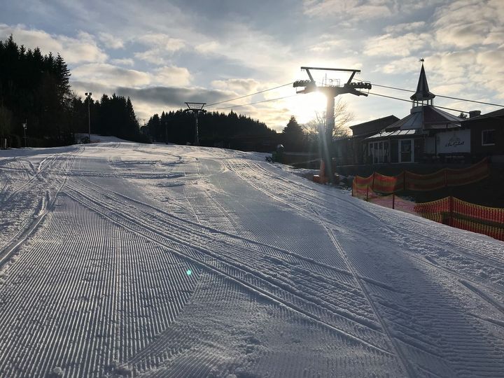
GERMANY REPORT| There’s some positive news from Germany this week with some ski areas allowed to finally open for the season after the country’s latest pandemic review at the end of last week. The decision is being made region by region with, so far, only one giving ski areas the green light, and that’s a place where most would be closed anyway now for lack of snow. But one, Willingen (0/80cm / 0/32”), has managed to open by spreading out snow piled up the middle of the piste back out on the runs. A second area, Winterberg, opened on Tuesday. It’s now hoped other regions will follow suit, particularly in areas like Bavaria where there’s still some snow left. Weather-wise, temperatures have been hovering around freezing over the past few days, varying between a few degrees above and a few below with a little fresh snowfall reported but also rain too at times.
GERMANY FORECAST| It is actually looking fairly wintery in Germany through the rest of this week, although with marginal conditions. Therefore, precipitation may fall as rain on lower slopes, snow higher up.
SCANDINAVIA
SCANDINAVIA REPORT| It has been generally cold and overcast with some snowfall in Scandinavia over the past week, but not much. Hemsedal (100/145cm / 40/58”), one of Norway’s largest areas, reported 5cm (2 inches) of fresh snowfall at the weekend. All ski areas in Scandinavia that wish to open remain open it seems, despite pandemic fluctuations and concerns. Most report decent cover and all, or virtually all, runs open. Daylight hours are also rapidly increasing.
SCANDINAVIA FORECAST| Staying cold and looking increasingly snowy for the latter half of this week with 20-40cm (8-16 inches) of snow in the forecast for many areas by Sunday.
SCOTLAND
SCOTLAND REPORT| After a sunny three weeks, it has got much more wintery over the past week on Scottish hills and mountains and fresh snowfall has been reported for the first time since mid-February. Ski areas remain closed by the country’s government as they have been for two months now. The current plan is they be allowed to open to local people in late April if there is any snow left then, but several ski areas are hoping that that date might be brought forward as golf courses and tennis courts in the country have been allowed to open. Spring ski touring at altitude is reported to be still good for those living close to the mountains and able to enjoy it.
SCOTLAND FORECAST| Warmer than the past week with temperatures staying back above freezing down at ski area bases; however, colder than it was in the latter half of February still with more cloud and precipitation, potentially falling as snow on higher slopes.
SPAIN / ANDORRA
SPAIN / ANDORRA REPORT| As with most western European ski nations, there’s not much change to report on previous weeks in the Pyrenees, with just half a dozen or so of the 50+ ski areas in the region reported open, including several of Spain’s largest resorts, as well as those in Andorra. Access to them remains limited to people living locally though so numbers on the slopes are low, and the amount of terrain open has been limited accordingly. The past week has been colder and some centres have reported a little snowfall. Baqueira Beret (100/120cm / 40/48”) which has about 40km (25%) of its terrain open reported 5cm of fresh to start the week.
SPAIN / ANDORRA FORECAST| Rather warm midweek but getting colder as we approach the weekend. Some sunshine Thursday/Friday before clouds carrying snowfall hopefully roll in for the weekend.
BULGARIA / ROMANIA REPORT
BULGARIA / ROMANIA REPORT| Ski areas in Bulgaria and Romania have seen some much colder weather in recent weeks and there has even been some light to moderate snowfall reported over the weekend. Opening restrictions in Bulgaria have also eased with more resort facilities opening. The thawing reported a week back has slowed and most ski areas are around 90-95% open. Bansko (20/150cm / 8/60”) continues to report the largest area open.
BULGARIA / ROMANIA FORECAST| It will remain subzero for the next few days but temperatures will climb at resort level and on lower slopes into the weekend. Staying dry with freeze-thaw conditions the order of the day.
CZECH REPUBLIC / SLOVAKIA
CZECH REPUBLIC / SLOVAKIA REPORT| Ski areas in the Czech and Slovak Republics remain closed by order of their governments due to the pandemic. With the normal season due to be winding down for many areas by now anyway, it is not clear how many will re-open if any are eventually allowed to re-open before April, which remains unknown. Slovakia’s Jasna was on global TV screens at the weekend hosting women’s world cup ski races. Although we are moving further into March it has been colder than it was in the latter half of February and earlier this month in the Tatras with some light fresh snowfall.
CZECH REPUBLIC / SLOVAKIA FORECAST| The cold weather is expected to continue in the region into the weekend with temperatures double digits below freezing. Dry for the next few days but light to moderate snowfalls expected to arrive by Friday/Saturday.
NORTH AMERICA
Conditions remain good across much of North America with most areas still posting temperatures at or below freezing and many reporting at least some fresh snowfall, although for most it is has been inches, rather than feet. Resorts in the Pacific Northwest continue to post the biggest accumulations though and the deepest bases on the continent, and indeed the entire world, as a result. Some have had another three feet (90cm) or more in the past seven days. Springtime is here though and there have been a few warmer periods that have brought a little rain and some thawing too.
In terms of the pandemic, all ski areas that wish to open remain open across the continent and there have been signs of a slight easing of restrictions in some areas. For example, ski areas in Maine can now welcome skiers from further afield with restrictions lifted on travel.
ROCKIES
ROCKIES REPORT| After the massive snowfalls in the northern US Rockies in recent weeks, it was the turn of more southerly ski areas to see some fresh snowfall at the end of last week with ski areas in Southern Colorado and New Mexico posting up to a foot (30cm) of snowfall on Friday/Saturday. Colorado’s Wolf Creek (100/109” / 249/272cm), which has now been open more than four months this season (longer than any other destination resorts in North America in fact), posted one of the bigger accumulations, getting 11 inches (28cm). Since the weekend it has been drier and often sunny but stayed cold.
ROCKIES FORECAST| It’s expected to stay cold and dry through the coming week with most ski areas seeing temperatures not getting above freezing, except perhaps mid-afternoon later in the week and down at the base. After more sunny days the week should end with a fresh band of snow moving across the region as we enter the weekend.
USA WEST
USA WEST REPORT| Not so snowy this past week and the world’s deepest base reported at 22 feet in Alpental (147/314” / 368/635cm ) is down about a foot (30cm) on a week ago. This is despite the area posting more snowfall in the past week, but warmer temperatures have had a bit of an impact too. Mt Baker (194/210” / 485/526cm), the “world’s snowiest resort” is currently second-placed ion the continent for snow depth this season and has had more snowfall than Alpental in the past week with several feet more. Although the snow depth is generally good news all the snow in the region does continue to pose a danger with avalanche and tree well deaths. Further south, in California, more snowfall has been reported too, if not so much, more like 4-8 inches (10-20cm) for most areas. All centres here are fully open with temperatures around freezing.
USA WEST FORECAST| For the rest of this week, it’s looking sunnier, drier and freeze-thaw conditions with temperatures yo-yoing between five or six degrees above and five or six below freezing up in the northwest. Further south, towards California, ski centres may actually be colder and snowier through the rest of this week with the sunshine arriving here at the weekend.
USA MIDWEST REPORT
MIDWEST REPORT| Fairly dry and in the last few days fairly warm in the Midwest, with temperatures climbing high for mid-March, to 10 degrees above freezing for some areas. It was colder up to the weekend, but still predominantly dry; however, ski areas that wanted to keep snow-making could do so with overnight lows of 10 below. Three of the four areas in the region posting the deepest bases are in Michigan, and all at around 60 inches (150cm), not that it matters much as almost all areas have enough snow to ski on and to open every trail.
MIDWEST FORECAST| The warm, often sunny weather will be with us for the rest of this week and we should see temperatures remaining well above freezing right up to the top of the slopes right through the weekend. The bad news is that besides causing a thaw, some precipitation expected later this week looks set to fall as rain rather than snow.
USA EAST
USA EAST REPORT| Conditions remain good in the Northeastern US, with more fresh snowfall reported at the end of last week and temperatures staying low. The only real negative weather factor has been strong winds at times. Most ski centres in the region are fully open. Stowe (30/60” / 76/152cm) got a few inches of snowfall ahead of the weekend and, like most ski centres in the region, enjoyed cold, clear and sunny weather for most of the time from then on.
USA EAST FORECAST| Sunny and rather warm over the next few days but temperatures are set to drop back below freezing and fresh snow clouds roll in at the weekend.
CANADA
CANADA WEST
CANADA WEST REPORT| Conditions remain good in western Canada. A drier week than previously with the biggest snowfall of the last seven days, a 40cm (16”) dump at the end of last week, reported by Mt Washington Alpine Resort (232/350cm / 93/140”) on Vancouver Island (off the west coast of the mainland). Since then it has been drier, although with 10cm (4 inches) or so more snow to start the week, but staying below freezing. Strong winds have been a factor though (Cypress Mountain closed on Saturday). On the mainland, the continent’s largest ski area, Whistler Blackcomb (293/293cm / 117/117″), reported an even bigger two foot (60cm) snowfall in the same period but remains fully open.
CANADA WEST FORECAST| The week ahead looks dry and predominantly sunny with temperatures climbing as we reach mid-March. Most areas will see temps reach +5C or warmer at their bases by the weekend but it should stay closer to freezing on the upper mountain.
CANADA EAST
CANADA EAST REPORT| The good start to spring (in contrast to the less good start to winter three months ago) continues in eastern Canada with temperatures staying low, some more fresh snowfall, and pretty much everything fully open (in contrast to a month ago when Ontario’s ski areas were shut down). Resorts along the US border, in the south of the region, have been reporting the most snowfall recently and some of the thickest snowpacks now. Mont Sutton (75/115cm / 30/46″) saw snowfall to end last week but then cloudy conditions gave way to sunshine from Sunday with temperatures staying cold. It’s the same report for most ski areas in the region.
CANADA EAST FORECAST| Staying dry for the remainder of the week, a mixture of sunny and overcast conditions. Temperatures will be climbing as we head towards the weekend. Although they’ll stay below freezing up on higher slopes, they’ll be in positive numbers down at the mountain base.
ASIA

JAPAN REPORT| A much drier week than it has been for much of the season so far for Japanese slopes with many areas reporting little or no snowfall over the past week, although for the majority temperature have stayed fairly low. Not everywhere though, with a number of areas reporting rain rather than snow at the weekend. Niseko (210/470cm / 84/188″) did get 50cm (20″) of snowfall a week ago and then light to moderate snowfall over the weekend but generally, it is starting to feel more springlike. It has now had nearly 11 metres of snowfall this season and has one of the world’s deepest base depths. All being well, the season does still have more than two months to run here and at a number of other major Japanese ski areas.
JAPAN FORECAST| The forecast is currently for increasingly springlike weather, with a mixture of dry and sunny days with some that are cloudy with rain or, if lucky, snow. Temperatures fluctuating between 5-10 below freezing on the slopes overnight and 5-10 degrees above on the warmest days in resort by mid-afternoon.


