WORLD SNOW ROUNDUP #104
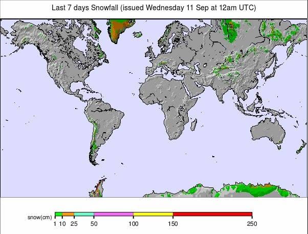
Issued: 11 September 2019
By Patrick “Snowhunter” Thorne
Our latest roundup of snow conditions around the world. Each section that follows below goes into detail country by country. Clicking the map thumbnail will take you to our dynamic snow forecast map for the latest detail (where you can also overlay live weather & reported conditions). Weather outlooks for Europe and North America can be found at the end of this roundup.
INTRODUCTION:
As we move a little further into meteorological autumn north of the equator and springtime to the south, there’s been plenty of snow for ski areas in both northern and southern hemispheres. Only five areas are currently open in the north but those lucky enough to be skiing or boarding have had some September powder to enjoy. In the Andes, Australia and New Zealand we’re into the final weeks of the 2019 season, so getting some late snowfalls to freshen things up is clearly good news too.
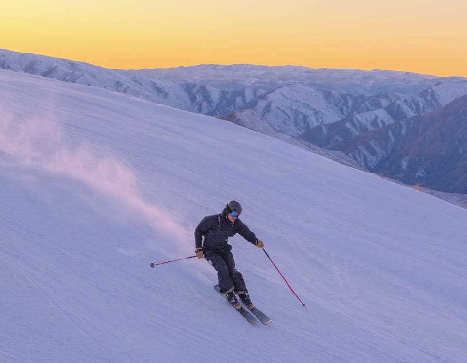
In the Andes, there’s been some fresh snow almost everywhere with the resorts in the south and east, that have reported the best conditions all winter, getting the most. There has been a little consolation fresh snow too for those in northern Chile that have had a very poor snowfall winter 2019. Australia and New Zealand have both seen a snowy few days with the heaviest snowfall in Australia on Friday/Saturday and snow in New Zealand through the weekend too. Most ski areas posted 20-30cm accumulations in 48-72 hour periods.
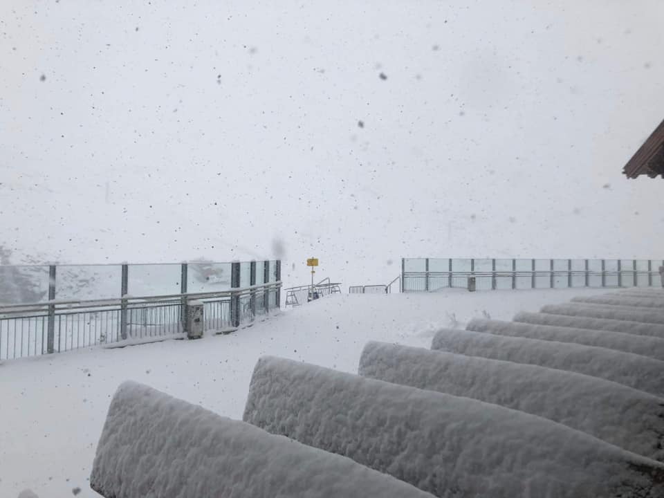
In the Alps the main news is that we’ve had our first taste of winter whilst it’s still summer (by the astronomical measure). Glacier ski areas reported up to 55cm (22 inches) of snowfall, in total, between Friday and Tuesday with the heaviest falls for most at the weekend. The snow wasn’t just up above 3,000 metres but came right down to half that height in some areas; at resort level for some.
With Cervinia closing at the weekend we’re down to just five glacier areas open at present: Passo Stelvio in Italy, Saas Fee and Zermatt in Switzerland and Hintertux in Austria as well as Galdhopiggen up in Norway. The latter is actually a bonus as it has re-opened earlier than expected after 40cm of snowfall in recent days, so we have five centres open rather than the four expected. In any case, we should be back to at least seven from this coming weekend as Austria’s Stubai has announced it will open for the season this Friday 13th and Val Senales is scheduled to kick off its 19-20 season on Saturday 14th. Half a dozen more glacier areas should join it over the following 2-3 weeks.
INDEX:
Australia / New Zealand / Argentina / Chile / South Africa / Lesotho / Austria / France / Switzerland / Italy / Andorra / Norway/Sweden / Germany / Bulgaria / Japan / Scotland / USA / Canada / South America Weather Outlook / Southern Hemisphere / Europe Weather Outlook / North America Weather Outlook
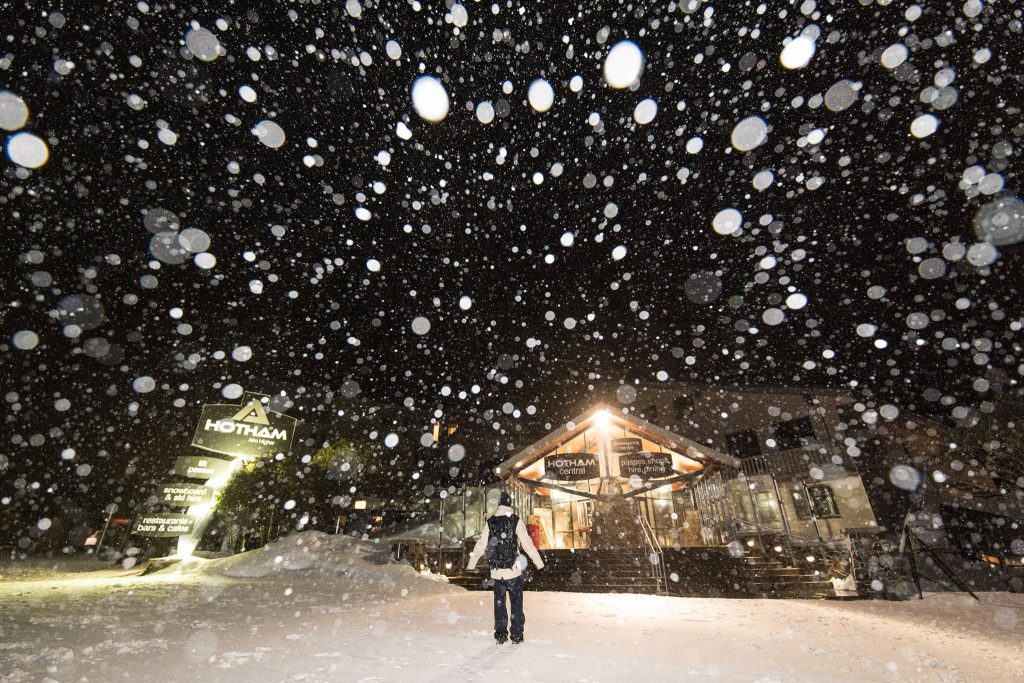
AUSTRALIA
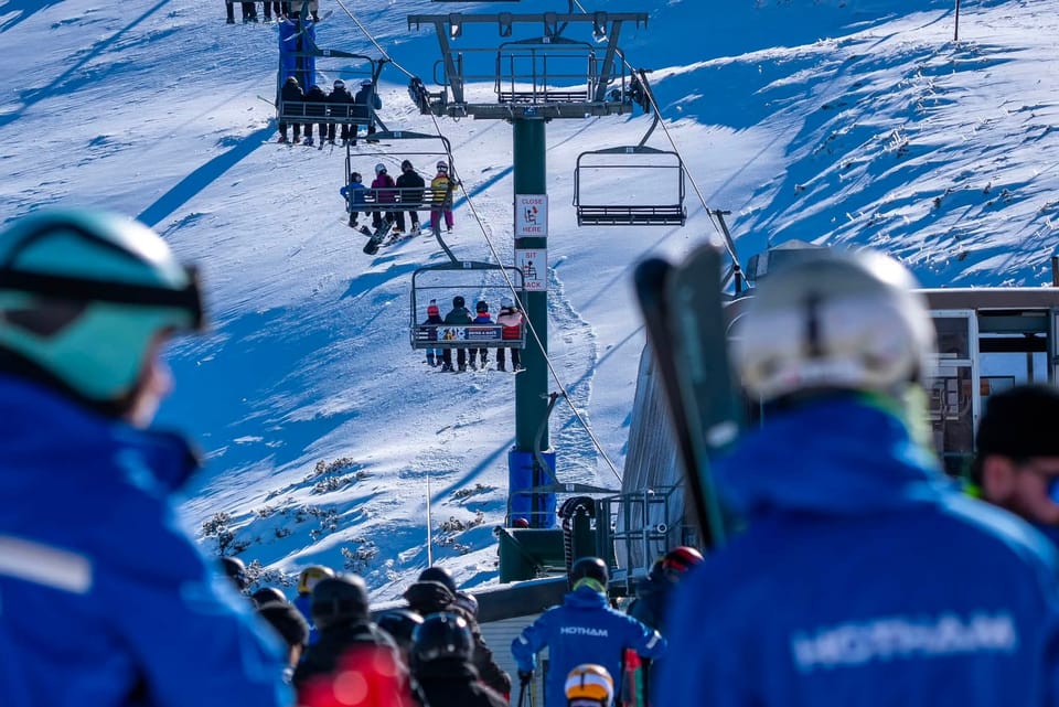
We may be entering the last month of the 2019 ski season in Australia but mother nature, who has been generous to a fault with snow this winter right since the end of May (and with regular top-ups through the winter), is still handing out the goods. The country’s leading ski areas all reported 20-25cm of fresh snowfall on Friday/Saturday leading to yet more great powder conditions to start this week. Bases are still holding up and are exceptionally good at several areas for this late in the season. Perisher (222/222cm) and Thredbo (132/222cm) still report over 2 metres/7ft and most of the country’s other areas still have at least a metre of snow lying on their slopes.
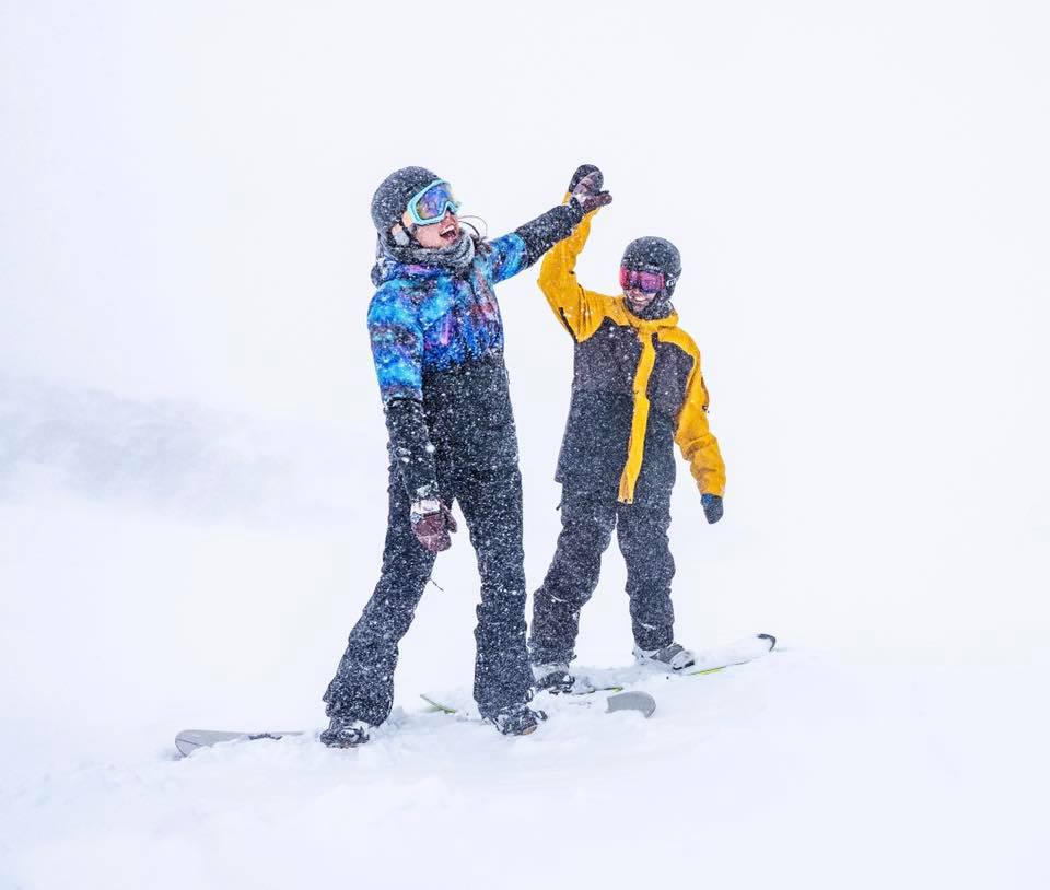
NEW ZEALAND
New Zealand’s ski areas have had another week of weather extremes including deep freezes, full-on blizzards and on the upside, a good deal more fresh snowfall. The country’s club fields are reporting the snow now lying up to 3 metres (10 feet) deep on upper slopes, whilst Turoa (90/262cm) is reporting the deepest base for the commercial areas. It often has the latest season-end of any southern hemisphere ski area (to late October or even early November) so that snow depth is good news there. Most of the country’s other areas are fully open when conditions allow.
ARGENTINA
Argentina’s ski slopes have had some light snowfall as the 2019 season enters its final weeks here. Cerro Castor (89/218cm) has the country’s deepest snow still and is one of the best in the southern hemisphere this season. At the other extreme the country’s biggest area (including the off-piste), Las Lenas (20/50cm), is struggling for powder again.
CHILE
With some reports now claiming it’s the worst winter in Chile for 60 years (which essentially means ever in the country’s ski history), there was some delight when snow began falling at the end of last week. For some areas that snowfall has carried through into the start of this week, so things have certainly been decidedly snowy again at some areas. The resort that certainly isn’t having it’s worst winter for six decades, Nevados de Chillan (100/200cm), down at the southern end of the country’s leading areas again saw some of the best snowfalls clocking up more than 30cm (1ft) more snow. But some of the areas that have endured the warmest, driest winters like Valle Nevado (60/80cm) up closer to capital Santiago, delightedly posted pics showing at least light snowfall there too.
SOUTH AFRICA
The 2019 ski season has ended in southern Africa and the only skiing possible in South Africa until June 2020 is likely to be on an artificial ski slope. However, Afriski, in Lesotho, reported last Friday (September 6th) that after an unseasonably warm August (the last month of winter there), they had actually seen a dusting of fresh snow that day.
LESOTHO
The 2019 season has now ended in Lesotho and South Africa. Ski areas will re-open there in June 2020.
AUSTRIA
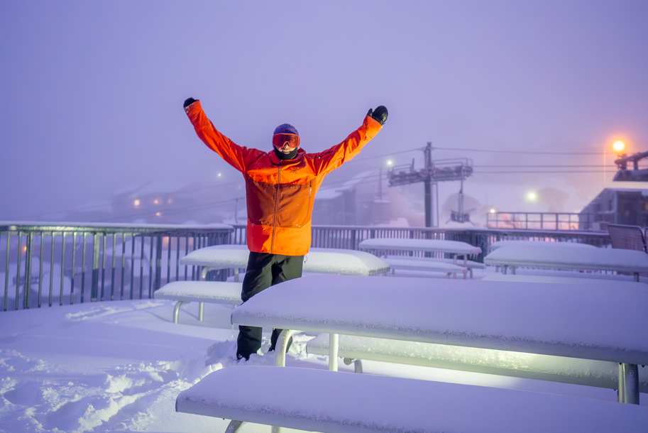
There’s been a good deal of excitement in Austria over the past week as the forecast snow arrived, dumping heavily on the country’s glaciers. One of which, Hintertux (0/45cm), is currently open. The weather brought snow down to quite low elevations (1500 metres) at times. This is not unusual and very much a repeat of the same scenario at the start of September last year and many years before that; however, it adds to the pre-season excitement, especially with images and videos shared instantly on social media to snow-starved skiers across the world. The latter half of September is due to see up to half a dozen Austrian glaciers open or re-open, although several of these say they’ll decide depending on the conditions. The Stubai has announced it will open for the season on Friday after it received 55cm of snowfall. The Pitztal says it will open the weekend after next (21st) and Kaunertal, on the last weekend of September (28th). The Dachstein and Solden glaciers may also open whilst the Molltal glacier should currently be open but was closed by the summer heat melting snow cover from its glacial ice. It could re-open as soon as the fresh snow cover is adequate. The country’s 8th glacier, that usually opens in early Autumn, the Kitzsteinhorn, should open in early October.
FRANCE

The start of the ski season in France is creeping closer with Tignes due to re-open on the last weekend of this month and Les 2 Alpes announcing it intends to open for its usual nine-day glacier ski testing weekends, with a week in-between, at the end of next month/start of November (if the conditions are good enough). Until Tignes re-opens there’s nowhere currently open in France; however, as with the rest of the Alps, it has turned cold up high with some fresh snow up on the glaciers and mountain tops.
SWITZERLAND

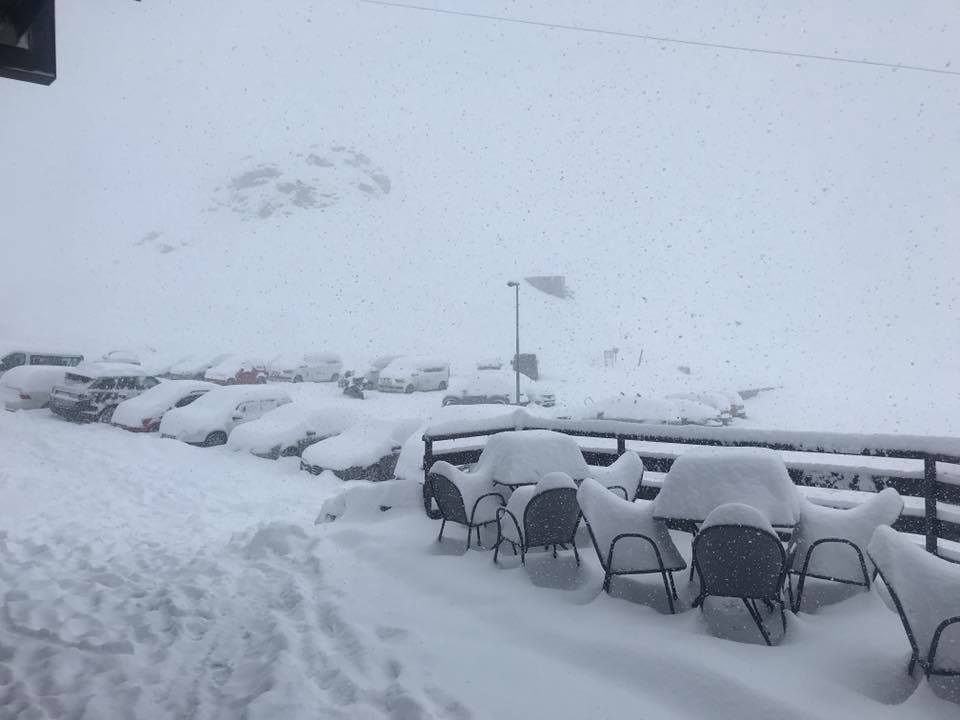
Up to 50cm of fresh snow was reported on high slopes in Switzerland over the weekend with the snow falling down to as low as 1500 metres; turning to rain on lower slopes. Switzerland can now claim to have the most ski areas open in the northern hemisphere (two) which is indeed half the total for the Alps and 40% of all centres open north of the equator until this coming Saturday, at least. Saas Fee (0/50cm) and Zermatt (0/200vcm) are in much better shape after up to 50cm fell on upper slopes over the weekend.
ITALY

Cervinia ended its summer ski season with fresh snow on Sunday, the last of the handful of ski areas that open for a distinct summer period and then a separate main winter season. It won’t be closed for long though, winter 2019-20 will get underway there next month. That leaves Passo Stelvio (0/180cm) as the only Italian glacier area currently open. It reported heavy snowfall right down to its base at the end of last week, continuing into the weekend with a total of 50cm accumulated by Sunday evening for a great start to this week; however, another Italian area is scheduled to open next weekend, Val Senales (Schnalstal) the former summer glacier ski area, will start its nine month 2019-20 ski season on Saturday. Plenty of other Italian areas posted pictures of heavy snowfall on upper slopes over the weekend, including Bormio which sometimes opens in mid-autumn.
ANDORRA
There are currently no ski areas open in Andorra or the wider Pyrenees. Winter sports will resume here next autumn.
NORWAY/SWEDEN

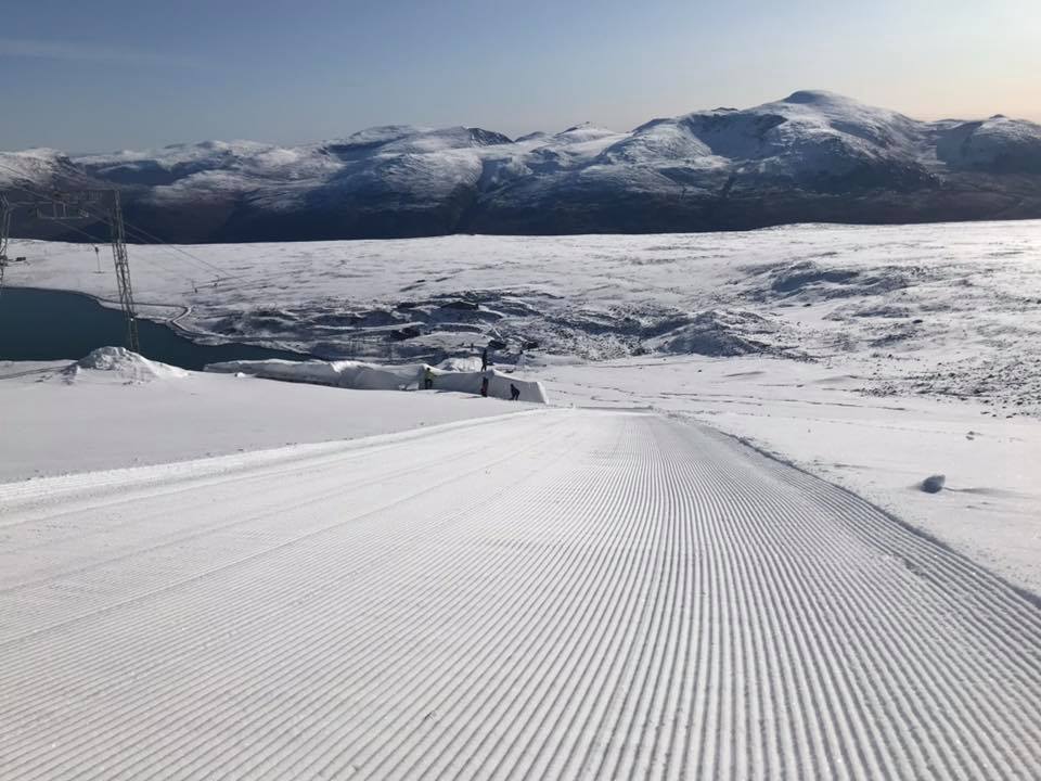
Norway is open for snow-sports again after the Galdhopiggen ski area, on Scandinavia’s highest mountain, re-opened earlier than expected last weekend after a 40cm snowfall. Normally open from spring to late autumn, it was forced to close in late July due to extreme heat and has been temporarily closed for six weeks. It had hoped to re-open on the 20th of September but has been able to do so sooner due to the snow. Next after them should be Ruka, in Finland, which will open at the start of October thanks to snow-farming techniques.
GERMANY

There are currently no ski areas open in Germany, other than the country’s half-dozen indoor snow centres. Outdoor winter sports will resume here next autumn.
BULGARIA
There are currently believed to be no ski areas open in Bulgaria or anywhere in Eastern Europe. Winter sports will resume in the region in the autumn.
JAPAN
There are currently believed to be no ski areas open in Japan. Winter sports will resume in the region in the autumn.
SCOTLAND

There are currently no ski areas open in Scotland other than the Snow Factor indoor snow centre and the country’s dry slopes. Winter sports will resume in the region in the autumn.
USA

With Timberline ski area on Mt Hood, in Oregon, ending its 10+ month season at the start of this month, there’s currently nowhere open in the US for snow-sports, although at least half a dozen are lined up and ready to open in October if conditions are right. Several moved snow-making guns into position last week ready to start snow-making overnight when temperatures dip low enough. Arapahoe Basin, in Colorado, probably has the strongest reputation for a mid-October opening of all of them.
CANADA

There are currently no ski areas open in Canada. Outdoor winter sports will resume here next autumn. Usually, ski areas in Alberta including Sunshine, Lake Louise, Mt Norquay and Nakiska are amongst the first to open for the season at the very start of November.
SOUTHERN HEMISPHERE WEATHER OUTLOOK
In Australia it looks like a fairly benign week as we move further into spring (or the final weeks of summer if you measure your season the traditional ‘astronomical’ way). There is some snowfall currently forecast towards the weekend. But at present, it looks like it will be fairly light compared to the snowfall at the end of last week and earlier this week. Conditions remain changeable and fairly wintery at times in New Zealand with little change on the horizon. Currently, significant snowfall bringing as much as 30-60cm of snow is forecast right across the country for the end of this week, after more mixed conditions with some light snowfalls in places through the week. Temperatures have been well below zero in the Andes during the past week of often snowy weather, with some centres seeing the mercury drop to double digits below zero Celsius at the top of the mountain and stay well below freezing down at the base too. It’s looking like it will be warming up later in the week though with drier, warmer and sunnier weather currently in the forecast for most areas by the weekend. Many ski areas in South America traditionally tend to end their seasons in the latter half of September.
EUROPEAN WEATHER OUTLOOK

After the heavy snowfall on higher slopes over the past six days, it looks like things will be a bit more seasonal weather in the Alps over the coming week with temperatures climbing and the skies clearing. That said there are early signs of more snowfall on the way (although currently it only looks like light snow this time) towards the end of the week.
NORTH AMERICAN WEATHER OUTLOOK

As we move deeper into September the cooler temperatures look set to bring more snowfall to mountain tops in the north and west of the continent. So 5-10cm falls are possible later this week on the peaks in states and provinces like Alberta, Wyoming, Montanaand BC.