


Portillo Storm Snowfall Total Passes 5m / 17 Feet
A snow storm that has now continued for nine days has taken Chilean ski resort Portillo to a snowfall total of 5.2 metres (17 feet) so far, with more snow forecast.

Next 3 days weather summary:Moderate rain (total 19.0mm), heaviest on Wed afternoon. Warm (max 26°C on Wed morning, min 12°C on Wed night). Wind will be generally light. | Days 4-6 weather summary:Some drizzle, heaviest during Thu afternoon. Warm (max 29°C on Sat afternoon, min 13°C on Thu night). Wind will be generally light. | ||||||||||||||||
Mon 27 | Tuesday 28 | Wednesday 29 | Thursday 30 | Friday 31 | Saturday 1 | ||||||||||||
PM | night | AM | PM | night | AM | PM | night | AM | PM | night | AM | PM | night | AM | PM | night | |
t-storm risk | t-storm risk | some clouds | t-storm risk | rain shwrs | some clouds | rain shwrs | rain shwrs | some clouds | t-storm risk | clear | clear | some clouds | clear | clear | clear | some clouds | |
km/h | |||||||||||||||||
Snow map | 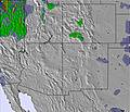 | 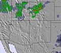 | 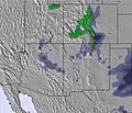 | 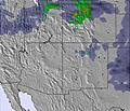 |  |  | |||||||||||
— | — | — | — | — | — | — | — | — | — | — | — | — | — | — | — | — | |
mm | 2 | 3 | — | 2 | 2 | — | 8 | 2 | — | 1 | — | — | — | — | — | — | — |
max °C | 23 | 17 | 25 | 25 | 16 | 26 | 19 | 16 | 23 | 23 | 16 | 26 | 28 | 18 | 28 | 29 | 20 |
min °C | 19 | 14 | 21 | 23 | 13 | 22 | 15 | 12 | 19 | 22 | 13 | 22 | 27 | 14 | 24 | 28 | 15 |
chill °C | 19 | 14 | 21 | 23 | 13 | 22 | 15 | 12 | 19 | 22 | 13 | 22 | 27 | 14 | 24 | 28 | 15 |
Humid % | 45 | 76 | 59 | 42 | 73 | 51 | 81 | 85 | 59 | 39 | 53 | 32 | 17 | 35 | 23 | 13 | 32 |
Freeze m | 5850 | 5550 | 5550 | 5700 | 5400 | 5450 | 5200 | 5100 | 5400 | 5650 | 5550 | 5600 | 5800 | 5600 | 5700 | 5850 | 5650 |
— | — | 6:00 | — | — | 6:01 | — | — | 6:01 | — | — | 6:03 | — | — | 6:03 | — | — | |
8:22 | — | — | 8:22 | — | — | 8:21 | — | — | 8:20 | — | — | 8:19 | — | — | 8:17 | — | |
Go pro and carve into:
Avalanche information: Colorado Avalanche Information Center
Latest snow reports near Vail:
Light rain reported from Breckenridge at 9334 feet 6 miles SSW of Keystone but it is forecast cold enough for snow at higher elevations in the ski area from Keystone
| Top snow depth: | 0 cm |
|---|---|
| Bottom snow depth: | 0 cm |
| Fresh snowfall depth: | — |
| Last snowfall: | 21 May 2026 |
| Snow Alerts | Create Alert |
0.0 | Bluebird Powder days Fresh snow, mostly sunny, light wind. |
|---|---|
0.0 | Powder days Fresh snow, limited sun, any wind. |
0.0 | Bluebird days Average snow, mostly sunny, light wind. |


The above table gives the weather forecast for Vail at the specific elevation of 2474 m. Our sophisticated weather models allow us to provide snow forecasts for the top, middle and bottom ski stations of Vail. To access the weather forecasts for the other elevations, use the tab navigation above the table. For a wider view of the weather, check out the Weather Map of United States.
Click here to read further information on freezing levels and how we forecast our temperatures.
Overall 4.3 Based on 20 votes and 18 reviews
One reviewer states the following: "Europe is sick on its day, but the powder is not as light as the Rockies, and is much more avalanche prone if you go off-piste." --- This is a disservice to the community here and gravely understates the risk to off-piste skiers in the Vail area. Colorado and it's continental snowpack is one of the most dangerous in the world for avalanche risk. The Alps are much safer, as the snowpack stabilizes much faster after storms versus the long-term and deep instabilities found in the USA's Central Rcckies. Do not take out-of-bounds or off-piste skiing lightly at Vail or anywhere else in Colorado. To suggest that somehow the snowpack in Vail is "safe" is akin to saying that a revolver with only one bullet in the six chamber gun is is "safe" when playing Russian Roulette. For those that would ski Vail's off-piste (outside the controlled ski area boundary), you will need a beacon, shovel, probe and the ability to use these tools. The best source of snowpack and avalanche information for backcountry and off-piste travellers in the Vail area and the rest of Colorado is the Colorado Avalanche Information Center. Google it and check out the local and regional forecasts prior to leaving the resort boundaries.
heavy winter from United States writes:
One reviewer states the following: "Europe is sick on its day, but the powder is not as light as the Rockies, and is much more avalanche prone if you go off-piste." --- This is a disservice to the community here and gravely understates the risk to off-piste skiers in the Vail area. Colorado and it's continental snowpack is one of the most dangerous in the world for avalanche risk. The Alps are much safer, as the snowpack stabilizes much faster after storms versus the long-term and deep instabilities found in the USA's Central Rcckies. Do not take out-of-bounds or off-piste skiing lightly at Vail or anywhere else in Colorado. To suggest that somehow the snowpack in Vail is "safe" is akin to saying that a revolver with only one bullet in the six chamber gun is is "safe" when playing Russian Roulette. For those that would ski Vail's off-piste (outside the controlled ski area boundary), you will need a beacon, shovel, probe and the ability to use these tools. The best source of snowpack and avalanche information for backcountry and off-piste travellers in the Vail area and the rest of Colorado is the Colorado Avalanche Information Center. Google it and check out the local and regional forecasts prior to leaving the resort boundaries.


 Nearest