

America’s Next Indoor Snow Centre Takes Shape
Construction of a new indoor snow centre for skiers, boarders and tubers appears to be making good progress at Heritage Farm in Wayne County, West Virginia.

Next 3 days weather summary:Moderate rain (total 12.0mm), heaviest on Tue afternoon. Mild temperatures (max 9°C on Tue afternoon, min 5°C on Wed night). Winds increasing (light winds from the NW on Tue night, near gales from the NNW by Thu night). | Days 4-6 weather summary:Light rain (total 6.0mm), mostly falling on Sun afternoon. Very mild (max 16°C on Sun morning, min 6°C on Fri morning). Winds increasing (calm on Fri night, fresh winds from the SSW by Sat night). | |||||||||||||||||
Tuesday 21 | Wednesday 22 | Thursday 23 | Friday 24 | Saturday 25 | Sunday 26 | |||||||||||||
AM | PM | night | AM | PM | night | AM | PM | night | AM | PM | night | AM | PM | night | AM | PM | night | |
some clouds | rain shwrs | some clouds | some clouds | light rain | rain shwrs | light rain | light rain | rain shwrs | some clouds | rain shwrs | rain shwrs | some clouds | some clouds | some clouds | some clouds | light rain | light rain | |
km/h | ||||||||||||||||||
Snow map | 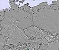 | 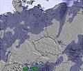 | 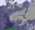 | 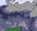 | 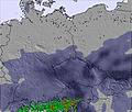 | 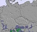 | ||||||||||||
— | — | — | — | — | — | — | — | — | — | — | — | — | — | — | — | — | — | |
mm | — | 2 | — | — | 2 | 2 | 2 | 2 | 2 | — | 2 | 1 | — | — | — | — | 2 | 1 |
max °C | 7 | 9 | 8 | 9 | 9 | 8 | 6 | 7 | 6 | 7 | 10 | 10 | 11 | 15 | 15 | 16 | 15 | 15 |
min °C | 6 | 8 | 8 | 9 | 9 | 5 | 5 | 6 | 6 | 6 | 9 | 10 | 10 | 13 | 15 | 16 | 14 | 10 |
chill °C | 1 | 5 | 4 | 6 | 5 | 0 | -1 | 1 | 0 | 1 | 6 | 8 | 8 | 11 | 14 | 15 | 13 | 8 |
Humid % | 87 | 77 | 63 | 74 | 83 | 94 | 99 | 90 | 84 | 83 | 77 | 62 | 65 | 47 | 41 | 45 | 68 | 84 |
Freeze m | 2600 | 2600 | 2500 | 2650 | 2800 | 2700 | 2350 | 2450 | 2600 | 2700 | 2950 | 3250 | 3450 | 3550 | 3500 | 3450 | 3250 | 3250 |
5:07 | — | — | 5:09 | — | — | 5:09 | — | — | 5:11 | — | — | 5:13 | — | — | 5:13 | — | — | |
— | — | 8:59 | — | — | 8:58 | — | — | 8:57 | — | — | 8:54 | — | — | 8:53 | — | — | 8:52 | |
Go pro and carve into:
Avalanche information: European Avalanche Warning Services (EAWS)
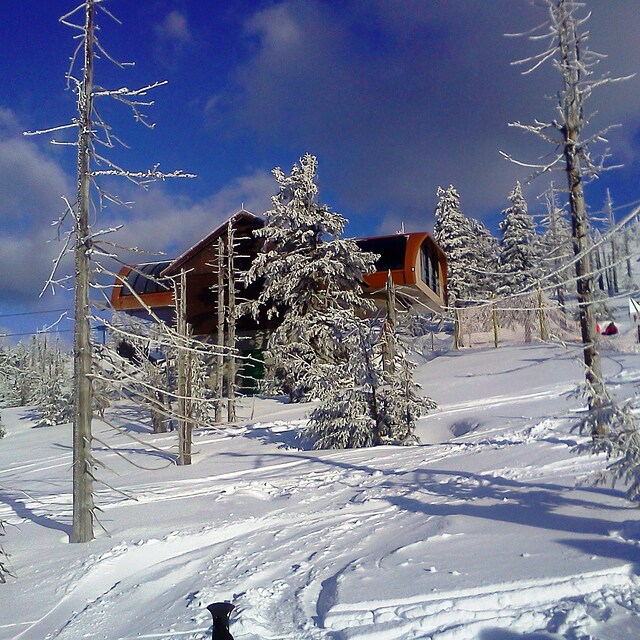
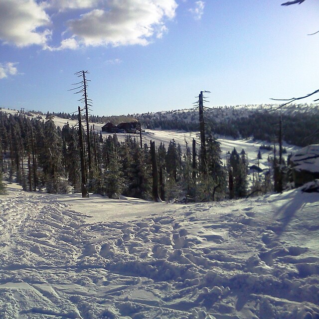
Latest snow reports near Szklarska Poręba:
| Top snow depth: | 0 cm |
|---|---|
| Bottom snow depth: | 0 cm |
| Fresh snowfall depth: | — |
| Last snowfall: | 12 May 2026 |
| Snow Alerts | Create Alert |
0.0 | Bluebird Powder days Fresh snow, mostly sunny, light wind. |
|---|---|
0.0 | Powder days Fresh snow, limited sun, any wind. |
0.0 | Bluebird days Average snow, mostly sunny, light wind. |
The above table gives the weather forecast for Szklarska Poręba at the specific elevation of 1361 m. Our sophisticated weather models allow us to provide snow forecasts for the top, middle and bottom ski stations of Szklarska Poręba. To access the weather forecasts for the other elevations, use the tab navigation above the table. For a wider view of the weather, check out the Weather Map of Poland.
Click here to read further information on freezing levels and how we forecast our temperatures.
Resort name is also written as Szklarska Poreba.
Overall 1.9 Based on 12 votes and 10 reviews
Parki Narodowe w Polsce to grupa biznesowa, a nie obrońcy przyrody. Ich zadaniem jest wycisnąć jak największy haracz od ludzi i firm, a rośliny i zwierzęta dobrze żyją bez ich niby pomocy. Sudety Lift stosują chytry system opłat. Nieważne o której godzinie rozpoczniesz jazdę zawsze zapłacisz za 7.5h lub za 3.5h. Na szczęście dla narciarzy wyrasta im nowa konkurencja w rejonie Kowar. Niedługo chytruski zauważą ubytek w kasie. Sudety Lift potrzebuje do zarządzania człowieka rozumiejącego specyfikę działania firmy usługowej. Zobaczcie na stronę Białki Tatrzańskiej i bierzcie z nich przykład. Zarządcy Kotelnicy wykosili już chytrusów z Zakopanego. Czy tego samego chce prezes Sudety Lift?
Mietek from Poland writes:
Parki Narodowe w Polsce to grupa biznesowa, a nie obrońcy przyrody. Ich zadaniem jest wycisnąć jak największy haracz od ludzi i firm, a rośliny i zwierzęta dobrze żyją bez ich niby pomocy. Sudety Lift stosują chytry system opłat. Nieważne o której godzinie rozpoczniesz jazdę zawsze zapłacisz za 7.5h lub za 3.5h. Na szczęście dla narciarzy wyrasta im nowa konkurencja w rejonie Kowar. Niedługo chytruski zauważą ubytek w kasie. Sudety Lift potrzebuje do zarządzania człowieka rozumiejącego specyfikę działania firmy usługowej. Zobaczcie na stronę Białki Tatrzańskiej i bierzcie z nich przykład. Zarządcy Kotelnicy wykosili już chytrusów z Zakopanego. Czy tego samego chce prezes Sudety Lift?


 Nearest