

Global Weekly Snow Roundup #320
Weekly Snow News for the world, updated 25 June 2026: Chile and New Zealand's seasons proper set to begin, Tignes and Sunshine reopen for summer skiing. weekend as Riksgransen ends its 2026 season.

Next 3 days weather summary:Heavy rain (total 26.0mm), heaviest during Mon afternoon. Warm (max 31°C on Sat afternoon, min 15°C on Mon night). Wind will be generally light. | Days 4-6 weather summary:Heavy rain (total 24.0mm), heaviest during Wed afternoon. Warm (max 22°C on Tue afternoon, min 12°C on Wed night). Wind will be generally light. | ||||||||||||||||
Sat 27 | Sunday 28 | Monday 29 | Tuesday 30 | Wednesday 1 | Thursday 2 | ||||||||||||
PM | night | AM | PM | night | AM | PM | night | AM | PM | night | AM | PM | night | AM | PM | night | |
clear | clear | clear | clear | t-storm risk | clear | t-storm risk | rain shwrs | rain shwrs | t-storm risk | t-storm risk | t-storm risk | mod. rain | light rain | rain shwrs | clear | some clouds | |
km/h | |||||||||||||||||
Snow map |  |  |  | 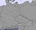 | 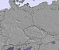 | 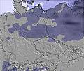 | |||||||||||
— | — | — | — | — | — | — | — | — | — | — | — | — | — | — | — | — | |
mm | — | — | — | — | 1 | — | 14 | 10 | 1 | 3 | 3 | 1 | 9 | 4 | 1 | — | — |
max °C | 31 | 27 | 30 | 31 | 27 | 26 | 25 | 19 | 20 | 22 | 19 | 20 | 18 | 15 | 14 | 19 | 17 |
min °C | 31 | 22 | 27 | 31 | 21 | 24 | 21 | 15 | 18 | 20 | 16 | 19 | 16 | 12 | 12 | 18 | 13 |
chill °C | 31 | 22 | 27 | 31 | 21 | 24 | 21 | 15 | 18 | 20 | 16 | 19 | 15 | 10 | 10 | 18 | 12 |
Humid % | 39 | 57 | 36 | 34 | 67 | 68 | 81 | 90 | 85 | 93 | 89 | 86 | 91 | 93 | 81 | 54 | 65 |
Freeze m | 4500 | 4600 | 4600 | 4550 | 4400 | 4350 | 4450 | 4450 | 4250 | 4300 | 4200 | 4100 | 3900 | 3600 | 3500 | 3600 | 3350 |
— | — | 4:46 | — | — | 4:47 | — | — | 4:47 | — | — | 4:48 | — | — | 4:48 | — | — | |
— | 9:15 | — | — | 9:15 | — | — | 9:15 | — | — | 9:14 | — | — | 9:14 | — | — | 9:14 | |
Go pro and carve into:
Avalanche information: European Avalanche Warning Services (EAWS)
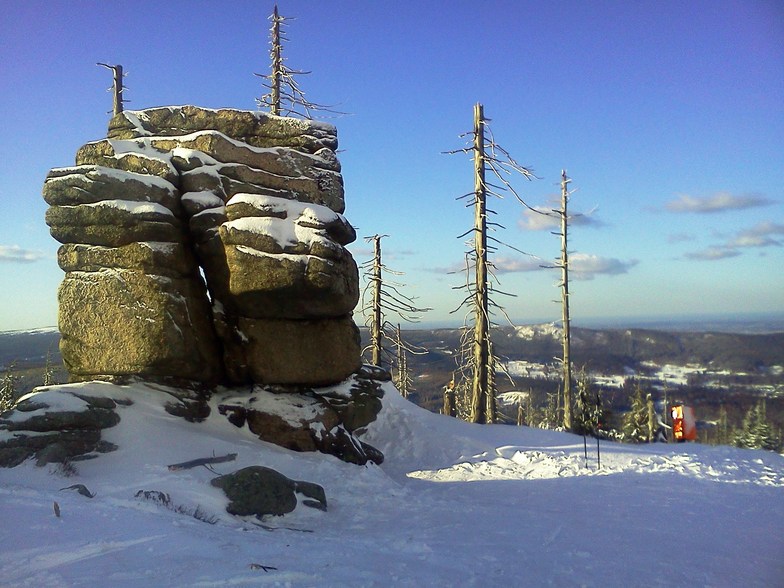
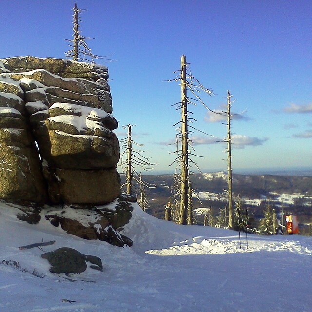
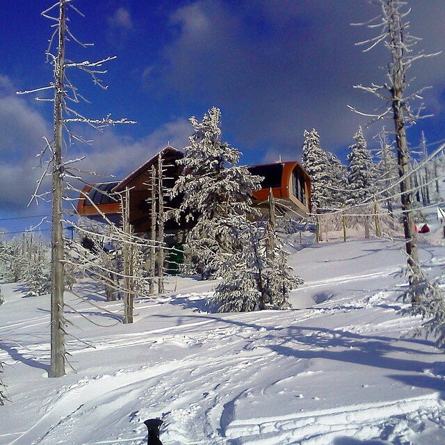
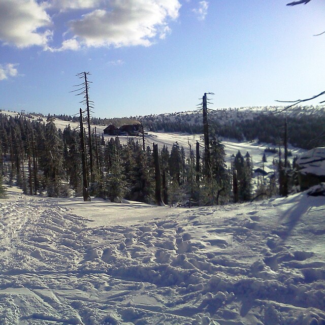
Latest snow reports near Szklarska Poręba:
| Top snow depth: | 0 cm |
|---|---|
| Bottom snow depth: | 0 cm |
| Fresh snowfall depth: | — |
| Last snowfall: | 12 May 2026 |
| Snow Alerts | Create Alert |
0.0 | Bluebird Powder days Fresh snow, mostly sunny, light wind. |
|---|---|
0.0 | Powder days Fresh snow, limited sun, any wind. |
0.0 | Bluebird days Average snow, mostly sunny, light wind. |
The above table gives the weather forecast for Szklarska Poręba at the specific elevation of 708 m. Our sophisticated weather models allow us to provide snow forecasts for the top, middle and bottom ski stations of Szklarska Poręba. To access the weather forecasts for the other elevations, use the tab navigation above the table. For a wider view of the weather, check out the Weather Map of Poland.
Click here to read further information on freezing levels and how we forecast our temperatures.
Resort name is also written as Szklarska Poreba.
Overall 1.9 Based on 12 votes and 10 reviews
SkiArena to skansen narciarski. Co z tego że wybudowali kanapę 6 osobową jak przez tyle mroźnych dni naśnieżyli zaledwie 3,6 km nartostrad(Śnieżynka i Puchatek). Narciarze już omijają kompleks szerokim łukiem(w pobliskich Czechach ośrodki pękają w szwach w czasie ferii) i nie ma się co dziwić. Przytoczę kolejne absurdy: w kasie nie można zapłacić kartą, wybierając się na narty o godzinie 11 muszę kupić karnet całodniowy, wyciągi startują o godzinie 8.30 i o 8.30 otwierane są kasy. Takie jawne bimbanie z narciarzy pokazuje że ktoś kto zarządza ośrodkiem stracił poczucie czasu i nie wie jak buduje się w Polsce nowoczesne ośrodki narciarskie.
Kris from Poland writes:
SkiArena to skansen narciarski. Co z tego że wybudowali kanapę 6 osobową jak przez tyle mroźnych dni naśnieżyli zaledwie 3,6 km nartostrad(Śnieżynka i Puchatek). Narciarze już omijają kompleks szerokim łukiem(w pobliskich Czechach ośrodki pękają w szwach w czasie ferii) i nie ma się co dziwić. Przytoczę kolejne absurdy: w kasie nie można zapłacić kartą, wybierając się na narty o godzinie 11 muszę kupić karnet całodniowy, wyciągi startują o godzinie 8.30 i o 8.30 otwierane są kasy.
Takie jawne bimbanie z narciarzy pokazuje że ktoś kto zarządza ośrodkiem stracił poczucie czasu i nie wie jak buduje się w Polsce nowoczesne ośrodki narciarskie.


 Nearest