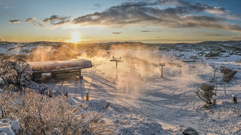

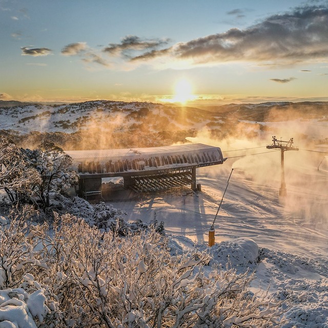
Australia's 2026 Season Starting With Fresh Snow
Mother Nature has delivered across the Australian Alps with near perfect timing for the start of the 2026 snow season tomorrow at most of the country's leading resorts, Saturday 6 June.

Next 3 days weather summary:Mostly dry. Freeze-thaw conditions (max 5°C on Mon morning, min -1°C on Sat night). Wind will be generally light. | Days 4-6 weather summary:A moderate fall of snow, heaviest on Tue night. Temperatures will be below freezing (max 0°C on Tue afternoon, min -6°C on Tue night). Winds decreasing (near gales from the WNW on Tue night, light winds from the S by Fri morning). | ||||||||||||||||
Sat 25 | Sunday 26 | Monday 27 | Tuesday 28 | Wednesday 29 | Thursday 30 | ||||||||||||
PM | night | AM | PM | night | AM | PM | night | AM | PM | night | AM | PM | night | AM | PM | night | |
some clouds | clear | clear | clear | clear | clear | clear | clear | clear | light snow | snow shwrs | snow shwrs | light snow | light snow | snow shwrs | light snow | clear | |
km/h | |||||||||||||||||
Snow map | 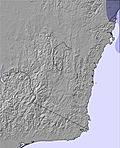 | 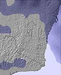 | 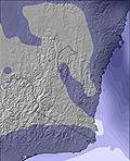 | 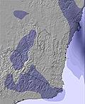 | 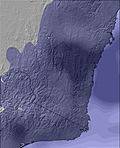 | 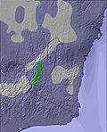 | |||||||||||
— | — | — | — | — | — | — | — | — | — | 5 | 3 | 1 | 1 | — | — | — | |
mm | — | — | — | — | — | — | — | — | — | — | — | — | — | — | — | — | — |
max °C | 1 | 1 | 3 | 4 | 2 | 5 | 4 | 1 | 2 | 0 | 0 | -5 | -5 | -5 | -2 | -2 | -3 |
min °C | 1 | -1 | 1 | 2 | 2 | 3 | 1 | -1 | 1 | 0 | -6 | -6 | -5 | -6 | -3 | -3 | -4 |
chill °C | -4 | -5 | -2 | 1 | 2 | 2 | -3 | -6 | -4 | -7 | -15 | -14 | -13 | -14 | -10 | -8 | -8 |
Humid % | 76 | 72 | 61 | 55 | 67 | 56 | 59 | 74 | 60 | 77 | 84 | 88 | 88 | 79 | 69 | 67 | 65 |
Freeze m | 2450 | 1900 | 2100 | 2450 | 2400 | 2600 | 2550 | 1650 | 2200 | 1900 | 1750 | 1050 | 1200 | 800 | 1250 | 1350 | 850 |
— | — | 7:09 | — | — | 7:07 | — | — | 7:07 | — | — | 7:05 | — | — | 7:05 | — | — | |
5:15 | — | — | 5:15 | — | — | 5:16 | — | — | 5:17 | — | — | 5:19 | — | — | 5:19 | — | |
Go pro and carve into:
Avalanche information: Mountain Safety Collective
Latest snow reports near Perisher:
| Top snow depth: | 69 cm |
|---|---|
| Bottom snow depth: | 44 cm |
| Fresh snowfall depth: | — |
| Last snowfall: | 12 Jul 2026 |
| Snow Alerts | Create Alert |
0.6 | Bluebird Powder days Fresh snow, mostly sunny, light wind. |
|---|---|
0.4 | Powder days Fresh snow, limited sun, any wind. |
0.5 | Bluebird days Average snow, mostly sunny, light wind. |
The above table gives the weather forecast for Perisher at the specific elevation of 1867 m. Our sophisticated weather models allow us to provide snow forecasts for the top, middle and bottom ski stations of Perisher. To access the weather forecasts for the other elevations, use the tab navigation above the table. For a wider view of the weather, check out the Weather Map of Australia.
Click here to read further information on freezing levels and how we forecast our temperatures.
Overall 3.3 Based on 44 votes and 50 reviews
I am now 79 and going to ski Perisher for 2 weeks. I started ⛷️ skiing in Perisher in around 1970 and remember a day ticket $6.00. The ticket person would use a different colour permanent marker to write a date on the ticket. You had to attach it permanently to your outer garment. Those were the days never to be forgotten. Perisher is a great ski resort, especially after Blue Cow and Guthega were combined. I have been skiing ⛷️ Perisher for 55 years and have no complains. Sure we had good and not so good seasons with the snow. I lived in Canberra, so it was a 2.5 hour drive to get to to Perisher. Only thing was they were a bit slow putting in new lifts. I would give Perisher 9 out of 10. (note from the editor: names of individuals are not included in resort reviews.)
Chris Czarnik from Australia writes:
I am now 79 and going to ski Perisher for 2 weeks. I started ⛷️ skiing in Perisher in around 1970 and remember a day ticket $6.00. The ticket person would use a different colour permanent marker to write a date on the ticket.
You had to attach it permanently to your outer garment. Those were the days never to be forgotten. Perisher is a great ski resort, especially after Blue Cow and Guthega were combined. I have been skiing ⛷️ Perisher for 55 years and have no complains. Sure we had good and not so good seasons with the snow.
I lived in Canberra, so it was a 2.5 hour drive to get to to Perisher.
Only thing was they were a bit slow putting in new lifts. I would give Perisher 9 out of 10.
(note from the editor: names of individuals are not included in resort reviews.)


 Nearest