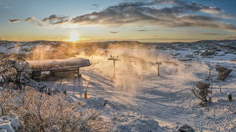

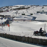
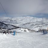
Australia's 2026 Season Starting With Fresh Snow
Mother Nature has delivered across the Australian Alps with near perfect timing for the start of the 2026 snow season tomorrow at most of the country's leading resorts, Saturday 6 June.

Next 3 days weather summary:Drizzle at first, then turning colder with dusting of snow on Mon night. Freeze-thaw conditions (max 5°C on Sun morning, min -4°C on Mon night). Winds decreasing (strong winds from the NW on Sun night, light winds from the W by Tue afternoon). | Days 4-6 weather summary:Mostly dry. Freeze-thaw conditions (max 5°C on Fri morning, min -4°C on Wed night). Wind will be generally light. | |||||||||||||||||
Sunday 2 | Monday 3 | Tuesday 4 | Wednesday 5 | Thursday 6 | Friday 7 | |||||||||||||
AM | PM | night | AM | PM | night | AM | PM | night | AM | PM | night | AM | PM | night | AM | PM | night | |
clear | clear | rain shwrs | clear | snow shwrs | snow shwrs | snow shwrs | snow shwrs | snow shwrs | snow shwrs | clear | some clouds | some clouds | clear | clear | clear | clear | clear | |
km/h | ||||||||||||||||||
Snow map |  |  |  | 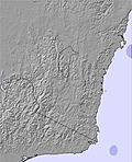 | 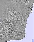 | 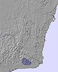 | ||||||||||||
— | — | — | — | — | 2 | — | — | 1 | 1 | — | — | — | — | — | — | — | — | |
mm | — | — | 1 | — | — | — | — | — | — | — | — | — | — | — | — | — | — | — |
max °C | 5 | 4 | 2 | 2 | 1 | -2 | -1 | -2 | -3 | 1 | 1 | -4 | 3 | 2 | -3 | 5 | 4 | -1 |
min °C | 3 | 1 | 0 | 1 | -1 | -4 | -3 | -4 | -4 | -1 | -3 | -4 | 1 | -3 | -3 | 3 | 0 | -2 |
chill °C | 0 | -4 | -7 | -5 | -6 | -10 | -8 | -8 | -8 | -5 | -7 | -8 | 0 | -3 | -3 | 3 | 0 | -5 |
Humid % | 68 | 61 | 62 | 56 | 67 | 86 | 80 | 77 | 90 | 83 | 69 | 67 | 67 | 67 | 67 | 57 | 58 | 54 |
Freeze m | 2300 | 2350 | 2250 | 1800 | 1800 | 1350 | 1200 | 1400 | 1100 | 1450 | 1800 | 1400 | 1750 | 2000 | 1600 | 2100 | 2300 | 2150 |
7:03 | — | — | 7:01 | — | — | 7:01 | — | — | 7:00 | — | — | 6:58 | — | — | 6:58 | — | — | |
— | 5:22 | — | — | 5:22 | — | — | 5:22 | — | — | 5:23 | — | — | 5:24 | — | — | 5:25 | — | |
Go pro and carve into:
Avalanche information: Mountain Safety Collective
Latest snow reports near Perisher:
| Top snow depth: | 88 cm |
|---|---|
| Bottom snow depth: | 50 cm |
| Fresh snowfall depth: | — |
| Last snowfall: | 29 Jul 2026 |
| Snow Alerts | Create Alert |
0.1 | Bluebird Powder days Fresh snow, mostly sunny, light wind. |
|---|---|
0.8 | Powder days Fresh snow, limited sun, any wind. |
0.3 | Bluebird days Average snow, mostly sunny, light wind. |
The above table gives the weather forecast for Perisher at the specific elevation of 1700 m. Our sophisticated weather models allow us to provide snow forecasts for the top, middle and bottom ski stations of Perisher. To access the weather forecasts for the other elevations, use the tab navigation above the table. For a wider view of the weather, check out the Weather Map of Australia.
Click here to read further information on freezing levels and how we forecast our temperatures.
Overall 3.3 Based on 44 votes and 50 reviews
Perisher is still the best resort In Australia when you compare the terrain of the other Auz resorts. The downside is a rise of the bogan demographic.
Joe from Australia writes:
Perisher is still the best resort In Australia when you compare the terrain of the other Auz resorts. The downside is a rise of the bogan demographic.


 Nearest