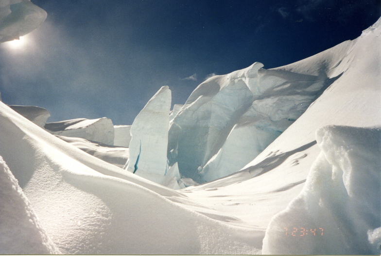


Portillo Storm Snowfall Total Passes 5m / 17 Feet
A snow storm that has now continued for nine days has taken Chilean ski resort Portillo to a snowfall total of 5.2 metres (17 feet) so far, with more snow forecast.

Next 3 days weather summary:A heavy fall of snow, heaviest during Thu afternoon. Temperatures will be well below freezing (max -8°C on Tue night, min -18°C on Thu night). Winds increasing (light winds from the W on Tue afternoon, gales from the N by Thu afternoon). | Days 4-6 weather summary:A heavy fall of snow, heaviest during Fri morning. Extremely cold (max -11°C on Sun night, min -17°C on Fri morning). Winds increasing (light winds from the WSW on Fri afternoon, near gales from the S by Sat night). | |||||||||||||||||
Tuesday 28 | Wednesday 29 | Thursday 30 | Friday 31 | Saturday 1 | Sunday 2 | |||||||||||||
AM | PM | night | AM | PM | night | AM | PM | night | AM | PM | night | AM | PM | night | AM | PM | night | |
clear | some clouds | clear | some clouds | snow shwrs | snow shwrs | snow shwrs | heavy snow | heavy snow | mod. snow | mod. snow | snow shwrs | clear | clear | clear | clear | clear | clear | |
km/h | ||||||||||||||||||
Snow map |  |  |  | 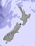 |  |  | ||||||||||||
— | — | — | — | 3 | 1 | 1 | 26 | 23 | 10 | 10 | 2 | — | — | — | — | — | — | |
mm | — | — | — | — | — | — | — | — | — | — | — | — | — | — | — | — | — | — |
max °C | -9 | -9 | -8 | -11 | -12 | -12 | -13 | -13 | -16 | -16 | -16 | -15 | -14 | -14 | -15 | -14 | -12 | -11 |
min °C | -9 | -9 | -10 | -12 | -12 | -13 | -13 | -13 | -18 | -17 | -17 | -17 | -14 | -14 | -16 | -15 | -13 | -12 |
chill °C | -16 | -14 | -18 | -22 | -22 | -24 | -26 | -28 | -32 | -30 | -23 | -25 | -26 | -26 | -30 | -28 | -23 | -17 |
Humid % | 52 | 40 | 30 | 62 | 91 | 83 | 90 | 92 | 96 | 95 | 97 | 77 | 20 | 35 | 54 | 6 | 20 | 23 |
Freeze m | 1850 | 1950 | 1400 | 1600 | 1700 | 1700 | 1500 | 1550 | 1450 | 1250 | 1350 | 1150 | 400 | 950 | 800 | 1150 | 1550 | 1150 |
7:58 | — | — | 7:56 | — | — | 7:56 | — | — | 7:54 | — | — | 7:52 | — | — | 7:52 | — | — | |
— | 5:34 | — | — | 5:35 | — | — | 5:36 | — | — | 5:37 | — | — | 5:37 | — | — | 5:38 | — | |
Go pro and carve into:
Avalanche information: New Zealand Avalanche Advisory
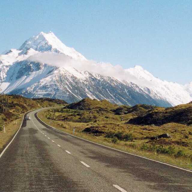
Latest snow reports near Aoraki-Mt Cook:
| Top snow depth: | — |
|---|---|
| Bottom snow depth: | — |
| Fresh snowfall depth: | — |
| Last snowfall: | 24 Jul 2026 |
| Snow Alerts | Create Alert |
2.2 | Bluebird Powder days Fresh snow, mostly sunny, light wind. |
|---|---|
0.8 | Powder days Fresh snow, limited sun, any wind. |
2.7 | Bluebird days Average snow, mostly sunny, light wind. |
The above table gives the weather forecast for Aoraki-Mt Cook at the specific elevation of 3754 m. Our sophisticated weather models allow us to provide snow forecasts for the top, middle and bottom ski stations of Aoraki-Mt Cook. To access the weather forecasts for the other elevations, use the tab navigation above the table. For a wider view of the weather, check out the Weather Map of New Zealand.
Click here to read further information on freezing levels and how we forecast our temperatures.
Fantastic review - I too have enjoyed the family friendly atmosphere that Mount Cook offers. There are a wealth of routes and entertainment for all. The grand traverse is a particular treat if you like to get off the beaten track but it is always good to get back to the warmth and hospitality of the Plateau Hut Resort. If you get board of the many routes on Mt Cook and need more challenge then Mount Tasman is just around the corner. Only disappointment was that the Plateau Resort gets very crowded and can be noisy at night, however, the view more than makes up for it. The mountain could also do with a few more lifts.
David Jones from New Zealand writes:
Fantastic review - I too have enjoyed the family friendly atmosphere that Mount Cook offers. There are a wealth of routes and entertainment for all. The grand traverse is a particular treat if you like to get off the beaten track but it is always good to get back to the warmth and hospitality of the Plateau Hut Resort. If you get board of the many routes on Mt Cook and need more challenge then Mount Tasman is just around the corner.
Only disappointment was that the Plateau Resort gets very crowded and can be noisy at night, however, the view more than makes up for it. The mountain could also do with a few more lifts.


 Nearest