

Global Weekly Snow Roundup #320
Weekly Snow News for the world, updated 25 June 2026: Chile and New Zealand's seasons proper set to begin, Tignes and Sunshine reopen for summer skiing. weekend as Riksgransen ends its 2026 season.

Next 3 days weather summary:Moderate rain (total 13.0mm), heaviest on Fri morning. Very mild (max 15°C on Fri morning, min 7°C on Sun night). Winds increasing (calm on Fri morning, fresh winds from the SSW by Sat morning). | Days 4-6 weather summary:Heavy rain (total 27.0mm), heaviest during Wed morning. Very mild (max 12°C on Mon afternoon, min 8°C on Mon night). Wind will be generally light. | |||||||||||||||||
Friday 26 | Saturday 27 | Sunday 28 | Monday 29 | Tuesday 30 | Wednesday 1 | |||||||||||||
AM | PM | night | AM | PM | night | AM | PM | night | AM | PM | night | AM | PM | night | AM | PM | night | |
light rain | light rain | light rain | cloudy | light rain | cloudy | rain shwrs | clear | some clouds | some clouds | light rain | light rain | light rain | light rain | light rain | rain shwrs | mod. rain | light rain | |
km/h | ||||||||||||||||||
Snow map | 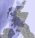 | 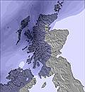 | 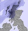 | 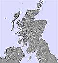 | 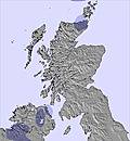 | 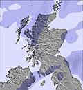 | ||||||||||||
— | — | — | — | — | — | — | — | — | — | — | — | — | — | — | — | — | — | |
mm | 4 | 4 | 1 | — | 2 | — | 2 | — | — | — | 1 | 2 | 2 | 2 | 3 | 5 | 8 | 4 |
max °C | 15 | 14 | 14 | 15 | 14 | 14 | 13 | 12 | 9 | 11 | 12 | 10 | 10 | 11 | 10 | 12 | 12 | 10 |
min °C | 13 | 14 | 13 | 15 | 14 | 13 | 13 | 11 | 7 | 9 | 11 | 8 | 8 | 11 | 9 | 11 | 11 | 9 |
chill °C | 13 | 14 | 12 | 13 | 12 | 11 | 11 | 8 | 3 | 6 | 9 | 7 | 6 | 9 | 9 | 11 | 11 | 9 |
Humid % | 99 | 98 | 97 | 70 | 90 | 93 | 83 | 57 | 64 | 72 | 73 | 77 | 92 | 74 | 92 | 84 | 84 | 95 |
Freeze m | 3950 | 3850 | 3950 | 3450 | 3300 | 3300 | 2800 | 2500 | 2350 | 2200 | 2350 | 2350 | 2100 | 2300 | 2300 | 2300 | 2500 | 2400 |
4:18 | — | — | 4:18 | — | — | 4:18 | — | — | 4:18 | — | — | 4:20 | — | — | 4:20 | — | — | |
— | — | 10:13 | — | — | 10:12 | — | — | 10:12 | — | — | 10:12 | — | — | 10:10 | — | — | 10:10 | |
Go pro and carve into:
Avalanche information: European Avalanche Warning Services (EAWS)
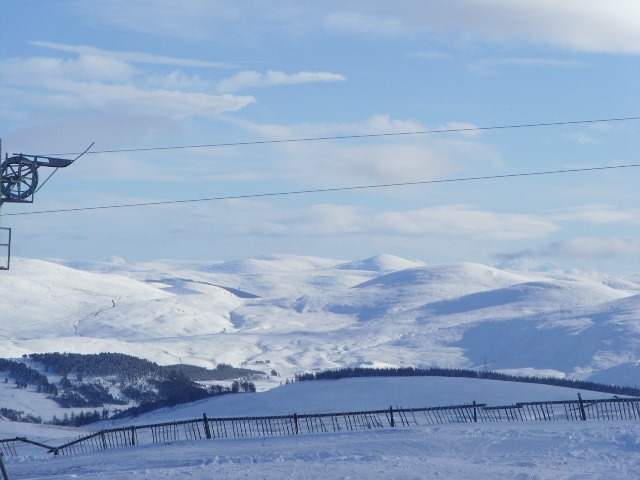
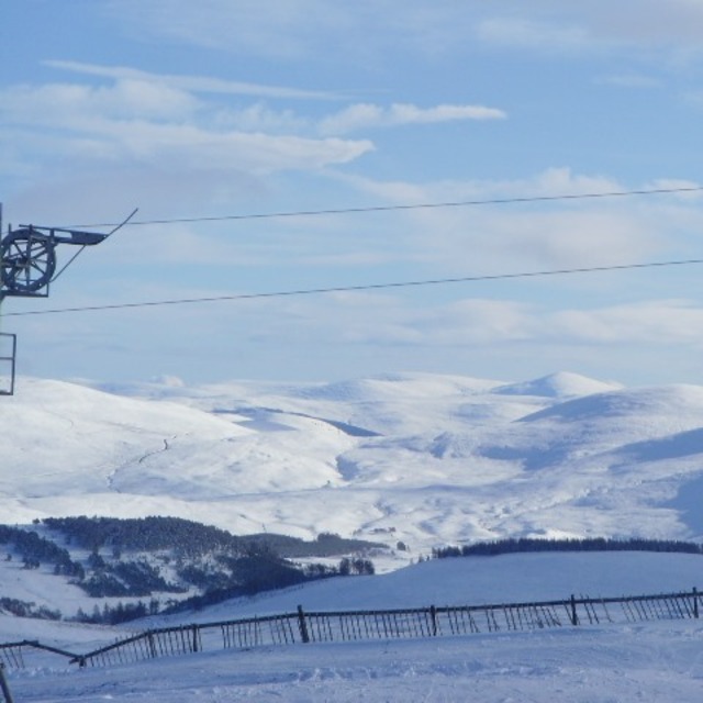
Latest snow reports near The Lecht:
| Top snow depth: | 0 cm |
|---|---|
| Bottom snow depth: | 0 cm |
| Fresh snowfall depth: | — |
| Last snowfall: | 14 May 2026 |
| Snow Alerts | Create Alert |
0.0 | Bluebird Powder days Fresh snow, mostly sunny, light wind. |
|---|---|
0.0 | Powder days Fresh snow, limited sun, any wind. |
0.0 | Bluebird days Average snow, mostly sunny, light wind. |


The above table gives the weather forecast for The Lecht at the specific elevation of 732 m. Our sophisticated weather models allow us to provide snow forecasts for the top, middle and bottom ski stations of The Lecht. To access the weather forecasts for the other elevations, use the tab navigation above the table. For a wider view of the weather, check out the Weather Map of United Kingdom.
Click here to read further information on freezing levels and how we forecast our temperatures.
Overall 2.5 Based on 19 votes and 18 reviews
A total disgrace today starting late, told there would be runs opening, which was a lie. Extremely unprofessional staff. Tow kept breaking down and they over sold tickets for the number of uplift tows. They appealed for support recently but the best option would be if they went into receivership and got taken over by a proper management team. By 12.30 some skiers only had one run and the staff had no idea how to arrange queues. Lecht, you should have refunded your customers after a disgraceful day with old poorly maintained equipment.
Ronnie MacDonald from United Kingdom writes:
A total disgrace today starting late, told there would be runs opening, which was a lie. Extremely unprofessional staff. Tow kept breaking down and they over sold tickets for the number of uplift tows. They appealed for support recently but the best option would be if they went into receivership and got taken over by a proper management team.
By 12.30 some skiers only had one run and the staff had no idea how to arrange queues.
Lecht, you should have refunded your customers after a disgraceful day with old poorly maintained equipment.


 Nearest