

Portillo Storm Snowfall Total Passes 5m / 17 Feet
A snow storm that has now continued for nine days has taken Chilean ski resort Portillo to a snowfall total of 5.2 metres (17 feet) so far, with more snow forecast.

Next 4 days weather summary:Light rain (total 7.0mm), mostly falling on Thu morning. Very mild (max 12°C on Thu morning, min 4°C on Thu night). Winds decreasing (fresh winds from the WNW on Thu afternoon, light winds from the WSW by Thu night). | Days 5-7 weather summary:Light rain (total 6.0mm), mostly falling on Mon night. Very mild (max 12°C on Sun morning, min 6°C on Sat night). Wind will be generally light. | |||||||||||||||
Thursday 30 | Friday 31 | Saturday 1 | Sunday 2 | Monday 3 | ||||||||||||
night | AM | PM | night | AM | PM | night | AM | PM | night | AM | PM | night | AM | PM | night | |
clear | light rain | rain shwrs | clear | some clouds | light rain | some clouds | rain shwrs | rain shwrs | clear | some clouds | cloudy | cloudy | light rain | light rain | light rain | |
km/h | ||||||||||||||||
Snow map | 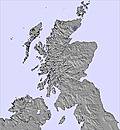 | 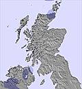 | 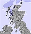 | 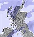 | 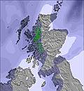 | 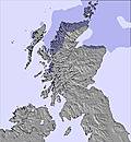 | ||||||||||
— | — | — | — | — | — | — | — | — | — | — | — | — | — | — | — | |
mm | — | 2 | 2 | — | — | 1 | — | 1 | 1 | — | — | — | — | 1 | 2 | 3 |
max °C | 9 | 12 | 10 | 6 | 11 | 12 | 7 | 11 | 12 | 8 | 12 | 11 | 8 | 12 | 12 | 8 |
min °C | 6 | 11 | 9 | 4 | 10 | 10 | 5 | 11 | 12 | 6 | 11 | 11 | 7 | 11 | 9 | 7 |
chill °C | 4 | 8 | 5 | 1 | 9 | 8 | 2 | 9 | 9 | 2 | 10 | 11 | 6 | 11 | 8 | 7 |
Humid % | 84 | 75 | 79 | 79 | 67 | 60 | 83 | 71 | 66 | 79 | 70 | 72 | 91 | 80 | 82 | 99 |
Freeze m | 2450 | 1900 | 2000 | 1900 | 1700 | 1950 | 1950 | 1950 | 2200 | 2100 | 2000 | 2200 | 2450 | 2250 | 2300 | 2150 |
— | 5:05 | — | — | 5:07 | — | — | 5:09 | — | — | 5:11 | — | — | 5:13 | — | — | |
— | — | 9:31 | — | — | 9:29 | — | — | 9:27 | — | — | 9:24 | — | — | 9:22 | — | |
Go pro and carve into:
Avalanche information: European Avalanche Warning Services (EAWS)
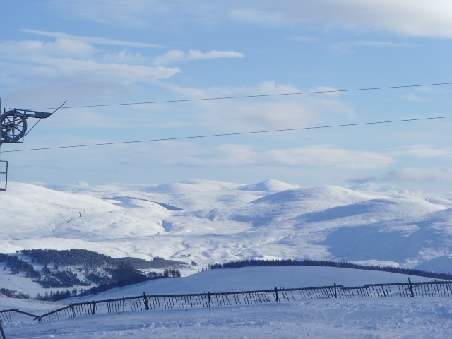
Latest snow reports near The Lecht:
| Top snow depth: | 0 cm |
|---|---|
| Bottom snow depth: | 0 cm |
| Fresh snowfall depth: | — |
| Last snowfall: | 14 May 2026 |
| Snow Alerts | Create Alert |
0.0 | Bluebird Powder days Fresh snow, mostly sunny, light wind. |
|---|---|
0.0 | Powder days Fresh snow, limited sun, any wind. |
0.0 | Bluebird days Average snow, mostly sunny, light wind. |


The above table gives the weather forecast for The Lecht at the specific elevation of 640 m. Our sophisticated weather models allow us to provide snow forecasts for the top, middle and bottom ski stations of The Lecht. To access the weather forecasts for the other elevations, use the tab navigation above the table. For a wider view of the weather, check out the Weather Map of United Kingdom.
Click here to read further information on freezing levels and how we forecast our temperatures.
Overall 2.5 Based on 19 votes and 18 reviews
We visited the Lecht in Feburary 2013. We were a mixed ability group, some complete beginners and some intermediates. We found a great mixture of runs for all our levels. Short, but I found more interesting than over at Cairngorm. No queues and we found an efficient system for hiring equipment. All in all, we had a great day on the slopes. We were staying in Tomintoul, just a few minutes down a very snowing road, which meant we had flexibility about which day we went. I strongly advise that future visitors show flexibility when visiting, as we waited all week for the right conditions (15cm the night before). This covered up all icy patches that you often find in Scotland. One more thing, I also advise potential visitors to check this website and the webcams before visiting, and not trust the Lecht website. Though personally I would only choose to ski in Scotland when there has been some fresh snow a day or two before, if there is no snow in the week, the conditions are most likely icy.
Sam from United Kingdom writes:
We visited the Lecht in Feburary 2013. We were a mixed ability group, some complete beginners and some intermediates. We found a great mixture of runs for all our levels. Short, but I found more interesting than over at Cairngorm. No queues and we found an efficient system for hiring equipment. All in all, we had a great day on the slopes.
We were staying in Tomintoul, just a few minutes down a very snowing road, which meant we had flexibility about which day we went. I strongly advise that future visitors show flexibility when visiting, as we waited all week for the right conditions (15cm the night before). This covered up all icy patches that you often find in Scotland.
One more thing, I also advise potential visitors to check this website and the webcams before visiting, and not trust the Lecht website. Though personally I would only choose to ski in Scotland when there has been some fresh snow a day or two before, if there is no snow in the week, the conditions are most likely icy.


 Nearest