

Global Weekly Snow Roundup #320
Weekly Snow News for the world, updated 25 June 2026: Chile and New Zealand's seasons proper set to begin, Tignes and Sunshine reopen for summer skiing. weekend as Riksgransen ends its 2026 season.

Next 3 days weather summary:Moderate rain (total 13.0mm), heaviest on Sat night. Warm (max 27°C on Sat afternoon, min 14°C on Sun night). Wind will be generally light. | Days 4-6 weather summary:Heavy rain (total 34.0mm), heaviest during Tue afternoon. Warm (max 22°C on Tue morning, min 11°C on Wed night). Wind will be generally light. | ||||||||||||||||
Fri 26 | Saturday 27 | Sunday 28 | Monday 29 | Tuesday 30 | Wednesday 1 | ||||||||||||
PM | night | AM | PM | night | AM | PM | night | AM | PM | night | AM | PM | night | AM | PM | night | |
clear | clear | some clouds | t-storm risk | rain shwrs | clear | t-storm risk | rain shwrs | t-storm risk | mod. rain | rain shwrs | some clouds | heavy rain | rain shwrs | rain shwrs | rain shwrs | rain shwrs | |
km/h | |||||||||||||||||
Snow map |  |  |  |  |  |  | |||||||||||
— | — | — | — | — | — | — | — | — | — | — | — | — | — | — | — | — | |
mm | — | — | — | 2 | 4 | — | 1 | 4 | 2 | 7 | 2 | — | 16 | 1 | 3 | 4 | 1 |
max °C | 25 | 21 | 25 | 27 | 16 | 25 | 25 | 19 | 19 | 19 | 16 | 22 | 20 | 14 | 17 | 17 | 15 |
min °C | 25 | 17 | 20 | 23 | 15 | 20 | 22 | 14 | 17 | 19 | 13 | 16 | 13 | 12 | 14 | 17 | 11 |
chill °C | 25 | 17 | 20 | 23 | 14 | 20 | 22 | 14 | 17 | 19 | 13 | 16 | 12 | 12 | 14 | 17 | 11 |
Humid % | 38 | 55 | 47 | 60 | 54 | 38 | 52 | 58 | 67 | 67 | 61 | 50 | 72 | 77 | 69 | 54 | 57 |
Freeze m | 4500 | 4600 | 4650 | 4650 | 4600 | 4450 | 4550 | 4400 | 4350 | 4350 | 4300 | 4300 | 4250 | 4050 | 3950 | 3750 | 3500 |
— | — | 5:20 | — | — | 5:20 | — | — | 5:20 | — | — | 5:22 | — | — | 5:22 | — | — | |
— | 9:16 | — | — | 9:16 | — | — | 9:16 | — | — | 9:15 | — | — | 9:15 | — | — | 9:15 | |
Go pro and carve into:
Avalanche information: European Avalanche Warning Services (EAWS)
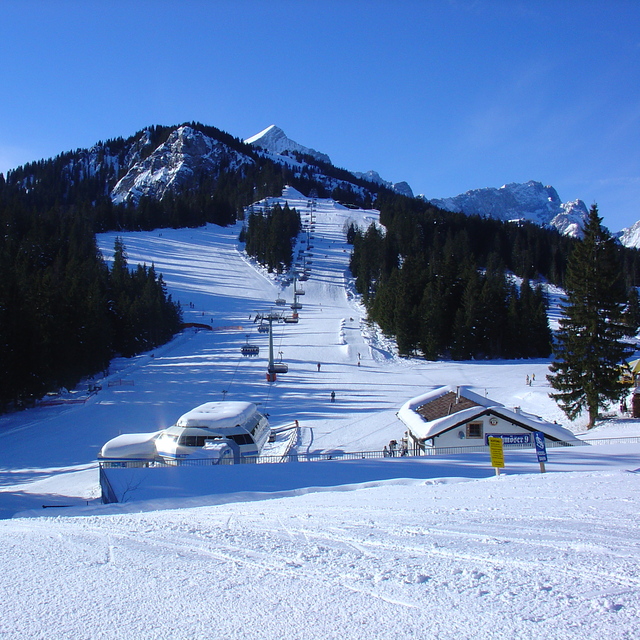
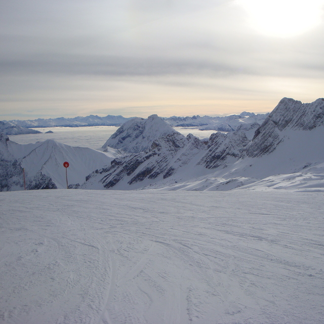
Latest snow reports near Garmisch-Partenkirchen-Zugspitze:
| Top snow depth: | 0 cm |
|---|---|
| Bottom snow depth: | 0 cm |
| Fresh snowfall depth: | — |
| Last snowfall: | 10 Jun 2026 |
| Snow Alerts | Create Alert |
0.0 | Bluebird Powder days Fresh snow, mostly sunny, light wind. |
|---|---|
0.0 | Powder days Fresh snow, limited sun, any wind. |
0.0 | Bluebird days Average snow, mostly sunny, light wind. |
The above table gives the weather forecast for Garmisch-Partenkirchen-Zugspitze at the specific elevation of 1480 m. Our sophisticated weather models allow us to provide snow forecasts for the top, middle and bottom ski stations of Garmisch-Partenkirchen-Zugspitze. To access the weather forecasts for the other elevations, use the tab navigation above the table. For a wider view of the weather, check out the Weather Map of Germany.
Click here to read further information on freezing levels and how we forecast our temperatures.
Overall 4.1 Based on 15 votes and 10 reviews
I was there on 19th February 2011. Very good ski center. However, I prefer Garmisch Classic (refer to my review there). The good thing with Zugspitze is the high elevation (it is a glacier) with means snow reliability. When I was there, it had not snowed for 3 weeks. However, pistes were very well groomed. The snow was good except in Super G piste, where it was really frozen and difficult / dangerous to ski. Zugspitze is a bit limited. One can ski the whole ski center in 1 day. It is best suitable for intermediate. To reach Zugspitze one has to travel from Munich to Garmisch by train (90 min) and then take from Garmisch Zahnradbahn (80 min more). ticket for the lift (including ticket for Zahnradbahn 38 euro). Total ski set rental available up to the Glacier at about 30 euro. A nice place to ski, although I prefer Garmisch Classic
Derion from Greece writes:
I was there on 19th February 2011. Very good ski center. However, I prefer Garmisch Classic (refer to my review there). The good thing with Zugspitze is the high elevation (it is a glacier) with means snow reliability. When I was there, it had not snowed for 3 weeks. However, pistes were very well groomed. The snow was good except in Super G piste, where it was really frozen and difficult / dangerous to ski. Zugspitze is a bit limited. One can ski the whole ski center in 1 day. It is best suitable for intermediate. To reach Zugspitze one has to travel from Munich to Garmisch by train (90 min) and then take from Garmisch Zahnradbahn (80 min more). ticket for the lift (including ticket for Zahnradbahn 38 euro). Total ski set rental available up to the Glacier at about 30 euro. A nice place to ski, although I prefer Garmisch Classic
Read 9 more reviews of Garmisch-Partenkirchen-Zugspitze or submit your own


 Nearest