

Global Weekly Snow Roundup #320
Weekly Snow News for the world, updated 25 June 2026: Chile and New Zealand's seasons proper set to begin, Tignes and Sunshine reopen for summer skiing. weekend as Riksgransen ends its 2026 season.

Next 3 days weather summary:Mostly dry. Freeze-thaw conditions (max 4°C on Sun afternoon, min 0°C on Sat afternoon). Wind will be generally light. | Days 4-6 weather summary:Mostly dry. Mild temperatures (max 7°C on Thu afternoon, min 1°C on Tue morning). Wind will be generally light. | |||||||||||||||||
Saturday 27 | Sunday 28 | Monday 29 | Tuesday 30 | Wednesday 1 | Thursday 2 | |||||||||||||
AM | PM | night | AM | PM | night | AM | PM | night | AM | PM | night | AM | PM | night | AM | PM | night | |
clear | clear | clear | clear | clear | clear | clear | some clouds | clear | clear | clear | clear | clear | some clouds | clear | clear | clear | clear | |
km/h | ||||||||||||||||||
Snow map | 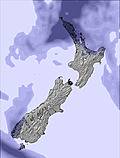 |  |  |  |  |  | ||||||||||||
— | — | — | — | — | — | — | — | — | — | — | — | — | — | — | — | — | — | |
mm | — | — | — | — | — | — | — | — | — | — | — | — | — | — | — | — | — | — |
max °C | 3 | 3 | 0 | 3 | 4 | 1 | 3 | 4 | 0 | 5 | 6 | 1 | 5 | 6 | 1 | 6 | 7 | 2 |
min °C | 1 | 0 | 0 | 0 | 0 | 0 | 0 | 1 | 0 | 1 | 1 | 1 | 1 | 1 | 1 | 2 | 2 | 1 |
chill °C | 1 | 0 | 0 | -2 | 0 | 0 | -2 | 1 | 0 | -1 | -1 | -1 | -1 | 1 | 0 | 1 | 0 | -2 |
Humid % | 69 | 75 | 80 | 74 | 67 | 74 | 86 | 82 | 77 | 66 | 67 | 69 | 64 | 52 | 53 | 59 | 51 | 52 |
Freeze m | 1650 | 1800 | 1650 | 1550 | 1750 | 1750 | 1450 | 1650 | 1700 | 1900 | 2100 | 2000 | 1850 | 2100 | 2100 | 2150 | 2500 | 2750 |
8:11 | — | — | 8:11 | — | — | 8:11 | — | — | 8:11 | — | — | 8:11 | — | — | 8:11 | — | — | |
— | 5:07 | — | — | 5:07 | — | — | 5:07 | — | — | 5:07 | — | — | 5:08 | — | — | 5:08 | — | |
Go pro and carve into:
Avalanche information: New Zealand Avalanche Advisory
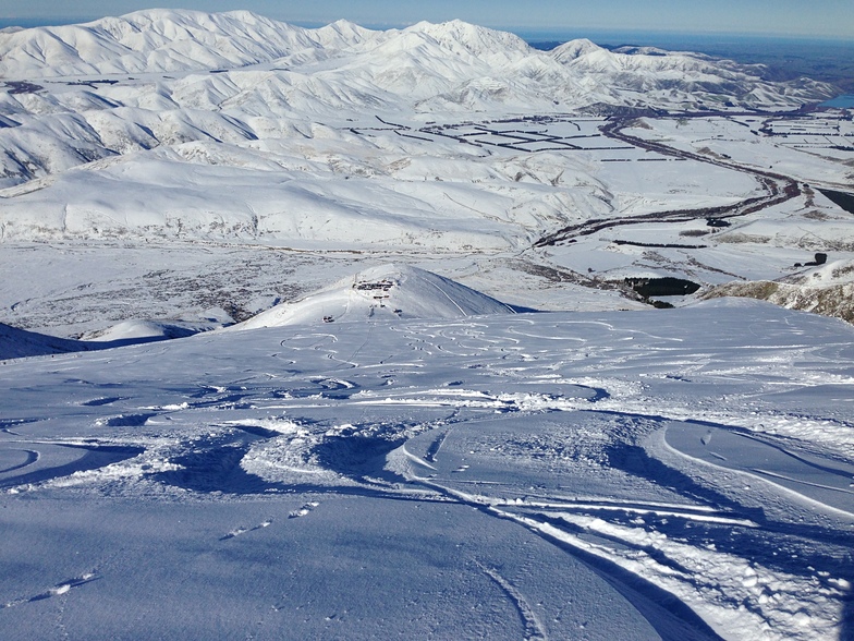
Latest snow reports near Fox Peak:
| Top snow depth: | — |
|---|---|
| Bottom snow depth: | — |
| Fresh snowfall depth: | — |
| Last snowfall: | 25 Jun 2026 |
| Snow Alerts | Create Alert |
0.1 | Bluebird Powder days Fresh snow, mostly sunny, light wind. |
|---|---|
0.4 | Powder days Fresh snow, limited sun, any wind. |
0.1 | Bluebird days Average snow, mostly sunny, light wind. |
The above table gives the weather forecast for Fox Peak at the specific elevation of 1170 m. Our sophisticated weather models allow us to provide snow forecasts for the top, middle and bottom ski stations of Fox Peak. To access the weather forecasts for the other elevations, use the tab navigation above the table. For a wider view of the weather, check out the Weather Map of New Zealand.
Click here to read further information on freezing levels and how we forecast our temperatures.


 Nearest