

Banff Sunshine Village Opening for Summer Skiing
Banff Sunshine Village has confirmed it will reopen for a fortnight of summer skiing, from this weekend. The only ski area in Canada to be open into July.

Next 3 days weather summary:Moderate rain (total 18.0mm), heaviest on Wed night. Warm (max 23°C on Tue afternoon, min 12°C on Wed night). Winds increasing (calm on Wed night, strong winds from the SSW by Fri morning). | Days 4-6 weather summary:Light rain (total 2.0mm), mostly falling on Sat night. Warm (max 20°C on Fri afternoon, min 3°C on Sun morning). Winds decreasing (gales from the SSW on Sat afternoon, calm by Sun night). | ||||||||||||||||
Tue 23 | Wednesday 24 | Thursday 25 | Friday 26 | Saturday 27 | Sunday 28 | ||||||||||||
PM | night | AM | PM | night | AM | PM | night | AM | PM | night | AM | PM | night | AM | PM | night | |
clear | some clouds | clear | light rain | rain shwrs | some clouds | rain shwrs | rain shwrs | some clouds | some clouds | some clouds | clear | clear | rain shwrs | rain shwrs | clear | some clouds | |
km/h | |||||||||||||||||
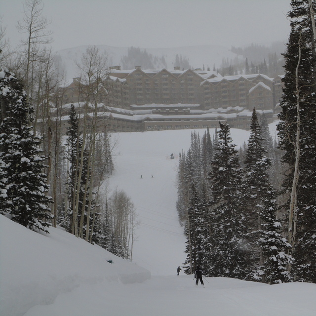
Snow map |  |  |  | 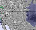 | 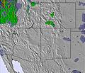 | 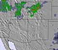 | |||||||||||
— | — | — | — | — | — | — | — | — | — | — | — | — | — | — | — | — | |
mm | — | — | — | 4 | 8 | — | 5 | 1 | — | — | — | — | — | 1 | 1 | — | — |
max °C | 23 | 20 | 22 | 23 | 13 | 19 | 20 | 16 | 19 | 20 | 12 | 15 | 18 | 15 | 7 | 9 | 7 |
min °C | 22 | 17 | 20 | 13 | 12 | 16 | 14 | 14 | 16 | 17 | 10 | 13 | 18 | 4 | 3 | 9 | 6 |
chill °C | 22 | 16 | 20 | 11 | 11 | 15 | 14 | 13 | 14 | 16 | 9 | 12 | 16 | 0 | 0 | 6 | 4 |
Humid % | 14 | 17 | 25 | 21 | 73 | 53 | 32 | 43 | 28 | 12 | 65 | 52 | 32 | 73 | 86 | 35 | 33 |
Freeze m | 5050 | 5100 | 4900 | 5100 | 4550 | 4650 | 4900 | 5000 | 4750 | 4850 | 4250 | 4350 | 4850 | 4150 | 2800 | 3650 | 3600 |
— | — | 5:54 | — | — | 5:56 | — | — | 5:56 | — | — | 5:56 | — | — | 5:56 | — | — | |
— | 9:00 | — | — | 9:00 | — | — | 9:00 | — | — | 9:00 | — | — | 9:00 | — | — | 9:00 | |
Go pro and carve into:
Avalanche information: National Avalanche Center
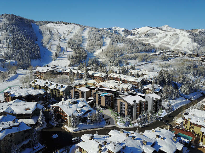
Latest snow reports near Deer Valley:
| Top snow depth: | 0 cm |
|---|---|
| Bottom snow depth: | 0 cm |
| Fresh snowfall depth: | — |
| Last snowfall: | 18 May 2026 |
| Snow Alerts | Create Alert |
0.0 | Bluebird Powder days Fresh snow, mostly sunny, light wind. |
|---|---|
0.0 | Powder days Fresh snow, limited sun, any wind. |
0.0 | Bluebird days Average snow, mostly sunny, light wind. |

The above table gives the weather forecast for Deer Valley at the specific elevation of 2460 m. Our sophisticated weather models allow us to provide snow forecasts for the top, middle and bottom ski stations of Deer Valley. To access the weather forecasts for the other elevations, use the tab navigation above the table. For a wider view of the weather, check out the Weather Map of United States.
Click here to read further information on freezing levels and how we forecast our temperatures.
Overall 4.4 Based on 17 votes and 8 reviews
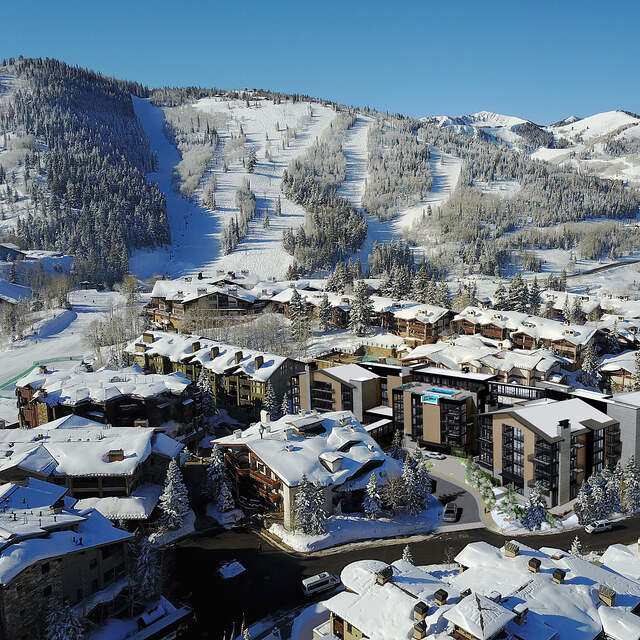
Deer Valley Resort was wonderful, the runs were great, and the views were spectacular. It's everything you would want in a ski-only resort. But what really sets this place apart is the staff that works there. Our car key was accidentally locked in the trunk of our car in the parking lot. Ski School Instructor (ed: name removed for the sake of privacy) not only called AAA for us, when AAA got repeatedly delayed, he waited with us in the freezing cold weather for a total of 3 hours (after his shift). He even ran late to his family dinner appointment for us. And he wasn't even our ski instructor! We couldn't have been more grateful. The warm hospitality and patience showed to us definitely made us want to come back again to Deer Valley very soon.
Alen from United States writes:
Deer Valley Resort was wonderful, the runs were great, and the views were spectacular. It's everything you would want in a ski-only resort. But what really sets this place apart is the staff that works there.
Our car key was accidentally locked in the trunk of our car in the parking lot. Ski School Instructor (ed: name removed for the sake of privacy) not only called AAA for us, when AAA got repeatedly delayed, he waited with us in the freezing cold weather for a total of 3 hours (after his shift). He even ran late to his family dinner appointment for us. And he wasn't even our ski instructor!
We couldn't have been more grateful.
The warm hospitality and patience showed to us definitely made us want to come back again to Deer Valley very soon.


 Nearest