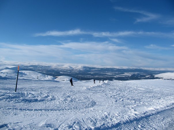
comScore pixel
Cairngorm snow
Ski United Kingdom

Cairngorm Snow Forecast

Weather Forecast for Cairngorm at 823 m
Issued: 11 pm  23 Mar 2026 (local time)

New snow in Cairngorm

1.4cm0.6in
Tue 24th (PM)
The snow forecast for Cairngorm is: A light covering of new snow on Wed afternoon turning to drizzle on Thu afternoon. Freeze-thaw conditions (max 5°C on Mon night, min -5°C on Wed night). Winds decreasing (severe gales from the WSW on Mon night, light winds from the WNW by Thu morning).

Cairngorm Weather (Next 3 days): The snow forecast for Cairngorm is: A light covering of new snow on Wed afternoon turning to drizzle on Thu afternoon. Freeze-thaw conditions (max 5°C on Mon night, min -5°C on Wed night). Winds decreasing (severe gales from the WSW on Mon night, light winds from the WNW by Thu morning).

Cairngorm Weather (Days 4-6): A light covering of new snow, mostly falling on Sat afternoon. Becoming milder with light rain (total 5.0mm) on Sun afternoon. Freeze-thaw conditions (max 5°C on Sun afternoon, min -4°C on Sat afternoon). Winds increasing (fresh winds from the W on Thu night, severe gales from the WSW by Sun afternoon).


Cairngorm Live Weather

ResortSnow DepthTemp. (°C)Wind (km/h)Weather
Top Lift: 0.3m
-1
75
part cloud
Middle Lift: 
1
65
part cloud
Bottom Lift: 0.25m
3
55
part cloud
6 Day Forecast
Issued: 11 pm 23 Mar 2026 / Updates in ::
Change Forecast Height
Choose Forecast
Last 6 daysScroll left for last 6 daysNow
Tuesday
24
Wednesday
25
Thursday
26
Friday
27
Saturday
28
night
AM
PM
night
AM
PM
night
AM
PM
night
AM
PM
night
AM
PM
night
part cloud
part cloud
light snow
light snow
light snow
snow showers
snow showers
part cloud
light snow
part cloud
snow showers
snow showers
snow showers
light snow
light snow
light snow
some clouds
some clouds
light snow
light snow
light snow
snow shwrs
snow shwrs
some clouds
light snow
some clouds
snow shwrs
snow shwrs
snow shwrs
light snow
light snow
light snow
 km/h
80
WSW
55
WSW
25
W
45
NW
50
WNW
40
NNW
35
NW
15
WNW
25
SW
40
W
40
WSW
45
W
45
W
55
W
55
NW
40
WNW
Snow map
1
1
1
3
1
2
2
1
max °C
5
1
1
-2
-3
-3
-5
-1
2
3
0
-1
-3
-2
-3
-2
min °C
1
0
-1
-3
-4
-4
-5
-3
0
-2
-1
-2
-3
-3
-4
-4
-8
-8
-7
-12
-14
-13
-14
-8
-6
-9
-9
-11
-11
-13
-14
-13
91
93
95
93
91
84
84
79
92
88
88
92
94
89
91
94
1700
900
900
450
400
500
0
400
750
1350
700
700
400
500
500
300
Sea lvl1000m2000m3000m4000m5000m
1-2-2-5-6-6-7-5-1-1-3-4-5-5-6-5542-1-1-1-412231-11-1-2
Sunrise
6:05
6:03
6:01
5:58
5:54
Sunset
6:36
6:37
6:39
6:43
6:45

Snow Radar

Latest snow reports near Cairngorm:

No recent snow reports

No recent snow reports

Cairngorm Snow Conditions

Top snow depth:30cm
Bottom snow depth:25cm
Fresh snowfall depth:
Last snowfall:15 Mar 2026
Snow AlertsCreate Alert
Other resorts in United Kingdom are reporting: powder (0) / good piste (0)


Snow History

Week 4 of March has on average:
0.2
Bluebird Powder days
Fresh snow, mostly sunny, light wind.
0.6
Powder days
Fresh snow, limited sun, any wind.
0.5
Bluebird days
Average snow, mostly sunny, light wind.

Map placeholder