

Global Weekly Snow Roundup #314
Weekly Global Snow News, updated 14 May 2026: Fresh snowfall in Argentina, Australia and Lesotho signals winter’s approach, while Japan maintains the world’s deepest snowpack.

Next 3 days weather summary:Moderate rain (total 14.0mm) heaviest on Sun afternoon, then becoming colder with a dusting of snow on Mon morning. Freeze-thaw conditions (max 12°C on Fri afternoon, min -1°C on Sun night). Wind will be generally light. | Days 4-6 weather summary:A moderate fall of snow, heaviest on Tue afternoon. Freeze-thaw conditions (max 5°C on Thu morning, min -7°C on Tue night). Wind will be generally light. | ||||||||||||||||
Fri 15 | Saturday 16 | Sunday 17 | Monday 18 | Tuesday 19 | Wednesday 20 | ||||||||||||
PM | night | AM | PM | night | AM | PM | night | AM | PM | night | AM | PM | night | AM | PM | night | |
some clouds | some clouds | some clouds | some clouds | snow shwrs | rain shwrs | mod. rain | light snow | light snow | mod. snow | light snow | light snow | mod. snow | light snow | snow shwrs | light snow | snow shwrs | |
km/h | |||||||||||||||||
Snow map |  |  |  |  |  |  | |||||||||||
— | — | — | — | — | — | — | 1 | 1 | 5 | 2 | 1 | 7 | 2 | — | 1 | — | |
— | — | — | — | 1 | 1 | 6 | 2 | 4 | — | — | — | — | — | — | — | — | |
max °C | 12 | 7 | 11 | 12 | 7 | 6 | 7 | 2 | 2 | 1 | -2 | 0 | -2 | -3 | 0 | 1 | -1 |
min °C | 12 | 3 | 9 | 11 | 0 | 4 | 4 | -1 | 0 | -1 | -6 | -1 | -2 | -7 | -3 | 1 | -3 |
10 | 3 | 7 | 9 | -3 | 2 | 3 | -5 | -3 | -4 | -9 | -4 | -2 | -10 | -6 | -4 | -6 | |
16 | 36 | 34 | 32 | 60 | 60 | 49 | 93 | 94 | 83 | 93 | 75 | 92 | 92 | 72 | 64 | 75 | |
4600 | 3950 | 4250 | 4450 | 3700 | 3700 | 4100 | 3300 | 3150 | 3350 | 2650 | 3050 | 2950 | 2150 | 2850 | 3350 | 2750 | |
— | — | 5:47 | — | — | 5:46 | — | — | 5:45 | — | — | 5:45 | — | — | 5:43 | — | — | |
8:09 | — | — | 8:10 | — | — | 8:12 | — | — | 8:13 | — | — | 8:14 | — | — | 8:15 | — | |
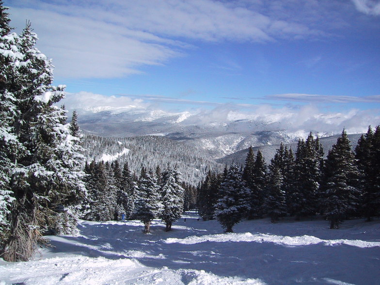
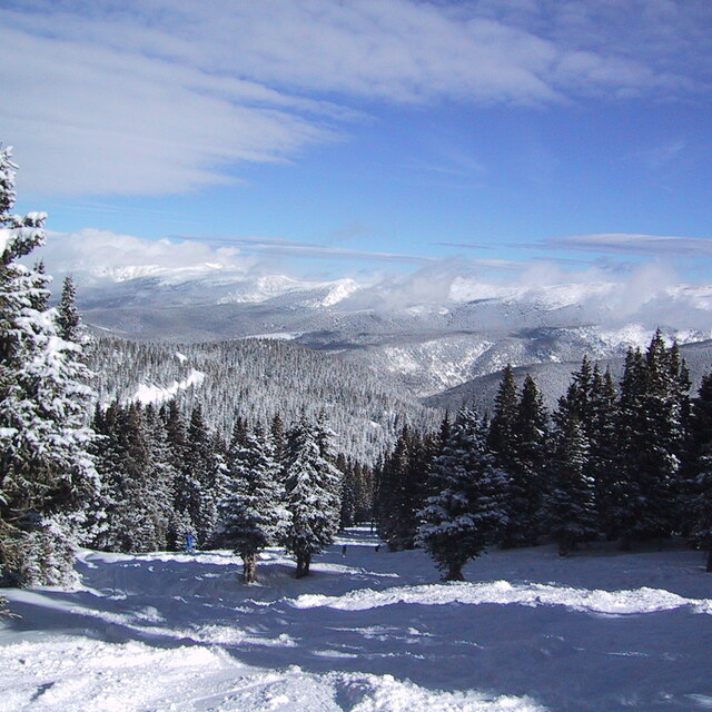
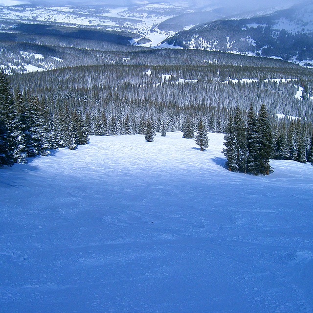
Latest snow reports near Winter Park:
| Top snow depth: | 0 cm |
|---|---|
| Bottom snow depth: | 0 cm |
| Fresh snowfall depth: | — |
| Last snowfall: | 7 May 2026 |
| Snow Alerts | Create Alert |
0.3 | Bluebird Powder days Fresh snow, mostly sunny, light wind. |
|---|---|
0.5 | Powder days Fresh snow, limited sun, any wind. |
0.1 | Bluebird days Average snow, mostly sunny, light wind. |
The above table gives the weather forecast for Winter Park at the specific elevation of 3208 m. Our sophisticated weather models allow us to provide snow forecasts for the top, middle and bottom ski stations of Winter Park. To access the weather forecasts for the other elevations, use the tab navigation above the table. For a wider view of the weather, check out the Weather Map of United States.
Click here to read further information on freezing levels and how we forecast our temperatures.
Overall 4.1 Based on 22 votes and 6 reviews
Went there 5 years ago. It’s the worst ski field I have experienced in Colorado. Huge crowds and some old slow lifts. The base facilities are poor. The digger clearing the car parks at 3.00am was incredibly noisy and woke many guests. I would never return as there are way better places to visit.
Graham from New Zealand writes:
Went there 5 years ago.
It’s the worst ski field I have experienced in Colorado. Huge crowds and some old slow lifts. The base facilities are poor.
The digger clearing the car parks at 3.00am was incredibly noisy and woke many guests.
I would never return as there are way better places to visit.


 Nearest