

Global Weekly Snow Roundup #314
Weekly Global Snow News, updated 14 May 2026: Fresh snowfall in Argentina, Australia and Lesotho signals winter’s approach, while Japan maintains the world’s deepest snowpack.

Next 3 days weather summary:Mild with moderate rain (total 14.0mm) on Mon morning, Becoming colder with a light covering of snow, mostly falling on Mon afternoon. Freeze-thaw conditions (max 16°C on Sat afternoon, min -4°C on Mon night). Wind will be generally light. | Days 4-6 weather summary:A dusting of snow giving way to moderate rain (total 18.0mm) heaviest on Thu afternoon. Freeze-thaw conditions (max 9°C on Wed afternoon, min -4°C on Thu night). Wind will be generally light. | |||||||||||||||||
Saturday 16 | Sunday 17 | Monday 18 | Tuesday 19 | Wednesday 20 | Thursday 21 | |||||||||||||
AM | PM | night | AM | PM | night | AM | PM | night | AM | PM | night | AM | PM | night | AM | PM | night | |
cloudy | light rain | some clouds | rain shwrs | risk thun- der | light snow | light snow | mod. snow | light snow | light snow | light rain | light snow | some clouds | rain shwrs | rain shwrs | light rain | mod. rain | snow shwrs | |
km/h | ||||||||||||||||||
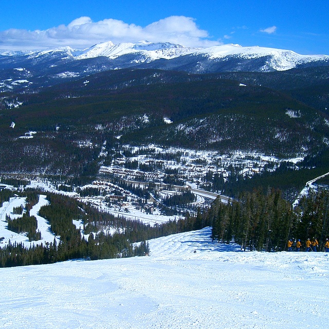
Snow map |  |  |  |  |  |  | ||||||||||||
— | — | — | — | — | 1 | 1 | 6 | 1 | — | — | 1 | — | — | — | — | — | — | |
— | 2 | — | 2 | 3 | 1 | 4 | 2 | — | 2 | 5 | — | — | 1 | 1 | 2 | 7 | — | |
max °C | 14 | 16 | 9 | 8 | 9 | 2 | 3 | 2 | -3 | 3 | 5 | 1 | 7 | 9 | 2 | 7 | 4 | 1 |
min °C | 12 | 13 | 2 | 7 | 9 | 0 | 1 | 0 | -4 | 1 | 4 | -3 | 3 | 9 | 0 | 6 | 3 | -4 |
12 | 12 | 1 | 5 | 6 | -3 | -3 | -2 | -7 | 0 | 3 | -3 | 0 | 6 | 0 | 4 | 3 | -4 | |
32 | 22 | 62 | 57 | 49 | 95 | 89 | 91 | 97 | 80 | 70 | 97 | 76 | 42 | 72 | 50 | 96 | 93 | |
4150 | 4550 | 3750 | 3750 | 3900 | 3050 | 3000 | 2800 | 2350 | 2850 | 3400 | 2750 | 3150 | 4000 | 3100 | 3700 | 3350 | 2750 | |
5:47 | — | — | 5:46 | — | — | 5:45 | — | — | 5:45 | — | — | 5:43 | — | — | 5:43 | — | — | |
— | 8:10 | — | — | 8:12 | — | — | 8:13 | — | — | 8:14 | — | — | 8:15 | — | — | 8:15 | — | |
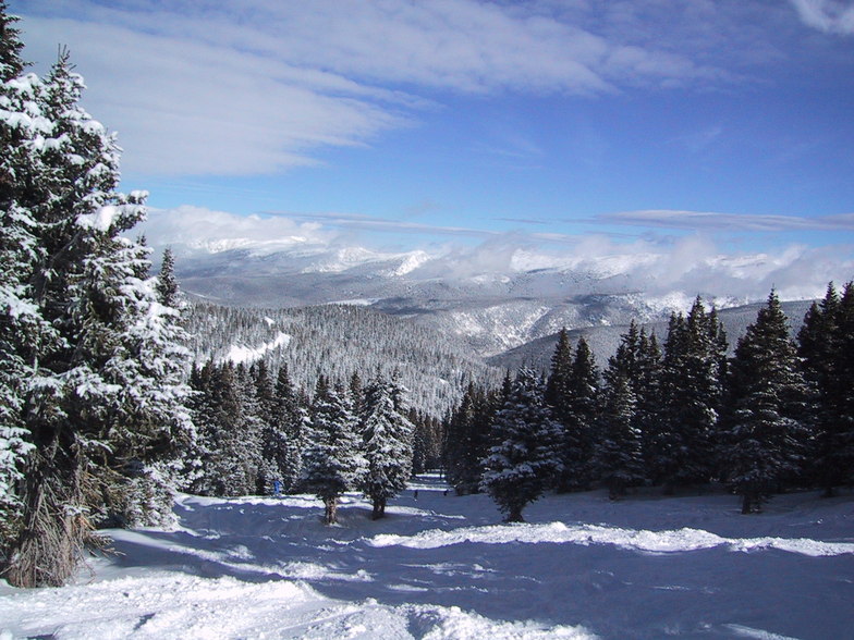
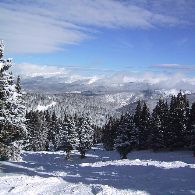
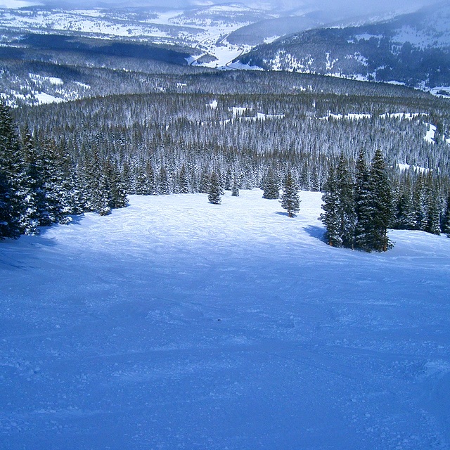
Latest snow reports near Winter Park:
| Top snow depth: | 0 cm |
|---|---|
| Bottom snow depth: | 0 cm |
| Fresh snowfall depth: | — |
| Last snowfall: | 7 May 2026 |
| Snow Alerts | Create Alert |
0.0 | Bluebird Powder days Fresh snow, mostly sunny, light wind. |
|---|---|
0.2 | Powder days Fresh snow, limited sun, any wind. |
0.0 | Bluebird days Average snow, mostly sunny, light wind. |
The above table gives the weather forecast for Winter Park at the specific elevation of 2742 m. Our sophisticated weather models allow us to provide snow forecasts for the top, middle and bottom ski stations of Winter Park. To access the weather forecasts for the other elevations, use the tab navigation above the table. For a wider view of the weather, check out the Weather Map of United States.
Click here to read further information on freezing levels and how we forecast our temperatures.
Overall 4.1 Based on 22 votes and 6 reviews
Just back from a week in Winter Park, after skiing there once before (in 2005). In short, we had forgotten just how incredible the ski area is! Fantastic snow conditions (the natives cannot begin to understand the concept of "ice" and refer to hard packed snow as such), no lift queues of more than 5 minutes - even on a UK half-term week/US bank holiday weekend (in fact, no queues at all, midweek) and a largely deserted ski area with challenging bump runs (endless, thigh burners, with the biggest moguls imaginable), incredible skiing in the trees (ranging from steady blues to ferocious - 50 degrees plus - blacks), 50 degree couloirs and chutes plus vertical open faces that you have to hike to. Oh, and lots of great cruising on immaculately groomed pistes in between! Think I'm raving about it? Well, you'd be right! If you haven't been yet, and like a ski challenge, you can't go wrong with a trip to WP! I've skied several times at numerous resorts in Colorado, Utah, California, Vermont, Wyoming and Canada - and Winter Park is most definitely up there with the best of them! Although it's a quiet village, in downtown Winter Park there's a wide choice of cheap, good quality restaurants, which suited us fine as we were too exhausted to shuffle around the streets after 9.30 pm... zzzzzzzz.
John Crawford from United Kingdom writes:
Just back from a week in Winter Park, after skiing there once before (in 2005).
In short, we had forgotten just how incredible the ski area is!
Fantastic snow conditions (the natives cannot begin to understand the concept of "ice" and refer to hard packed snow as such), no lift queues of more than 5 minutes - even on a UK half-term week/US bank holiday weekend (in fact, no queues at all, midweek) and a largely deserted ski area with challenging bump runs (endless, thigh burners, with the biggest moguls imaginable), incredible skiing in the trees (ranging from steady blues to ferocious - 50 degrees plus - blacks), 50 degree couloirs and chutes plus vertical open faces that you have to hike to. Oh, and lots of great cruising on immaculately groomed pistes in between!
Think I'm raving about it? Well, you'd be right! If you haven't been yet, and like a ski challenge, you can't go wrong with a trip to WP! I've skied several times at numerous resorts in Colorado, Utah, California, Vermont, Wyoming and Canada - and Winter Park is most definitely up there with the best of them!
Although it's a quiet village, in downtown Winter Park there's a wide choice of cheap, good quality restaurants, which suited us fine as we were too exhausted to shuffle around the streets after 9.30 pm... zzzzzzzz.


 Nearest