

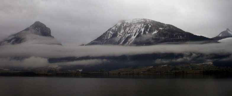
Whakapapa's Future Seems Secured As Snow Dumps On New Zealand
New Zealand ski area Whakapapa’s future seems secured as a new operator has been confirmed several years after the previous operators ran into financial problems.
Please sign in with your Snow-Forecast account details below.

St Wolfgang Weather (Next 3 days): The snow forecast for St Wolfgang is: Heavy rain (total 75.0mm), heaviest during Sun night. Very mild (max 18°C on Fri night, min 4°C on Mon afternoon). Wind will be generally light.
St Wolfgang Weather (Days 4-6): Moderate rain (total 17.0mm), heaviest on Mon night. Mild temperatures (max 8°C on Wed afternoon, min 3°C on Mon night). Wind will be generally light.
| Resort | Snow Depth | Temp. (°C) | Wind (km/h) | Weather | ||
|---|---|---|---|---|---|---|
| Top Lift: | 16 | |||||
| Middle Lift: | 18 | |||||
| Bottom Lift: | 17 |
Latest snow reports near St Wolfgang:

Saturday 3 | Sunday 4 | Monday 5 | Tuesday 6 | Wednesday 7 | Thursday 8 | ||||||||||||||
night | AM | PM | night | AM | PM | night | AM | PM | night | AM | PM | night | AM | PM | night | AM | PM | night | |
some clouds | cloudy | rain shwrs | heavy rain | mod. rain | mod. rain | heavy rain | mod. rain | light rain | light rain | light rain | light rain | light rain | rain shwrs | cloudy | light rain | light rain | light rain | light rain | |
km/h | |||||||||||||||||||
Snow map |  |  |  |  |  |  |  | ||||||||||||
— | — | — | — | — | — | — | — | — | — | — | — | — | — | — | — | — | — | — | |
— | — | 1.0 | 17 | 10 | 6 | 29 | 9 | 3 | 5 | 2.0 | 2.0 | 2.0 | 1.0 | — | 1.0 | 2.0 | 2.0 | 2.0 | |
max°C | 18 | 17 | 18 | 15 | 11 | 11 | 8 | 6 | 5 | 4 | 3 | 5 | 5 | 7 | 8 | 8 | 7 | 8 | 7 |
min°C | 16 | 17 | 15 | 12 | 11 | 9 | 7 | 5 | 4 | 3 | 3 | 4 | 4 | 5 | 7 | 6 | 6 | 7 | 5 |
16 | 17 | 15 | 10 | 11 | 9 | 7 | 5 | 3 | 3 | 3 | 4 | 4 | 5 | 7 | 6 | 6 | 6 | 5 | |
55 | 58 | 64 | 77 | 88 | 99 | 95 | 99 | 99 | 99 | 98 | 95 | 86 | 72 | 71 | 82 | 72 | 81 | 91 | |
3400 | 3350 | 3400 | 2900 | 2800 | 2700 | 2400 | 2150 | 1950 | 1650 | 1500 | 1850 | 1950 | 2100 | 2250 | 2000 | 1950 | 2050 | 1850 | |
— | 5:46 | — | — | 5:45 | — | — | 5:43 | — | — | 5:41 | — | — | 5:39 | — | — | 5:39 | — | — | |
— | — | — | 8:20 | — | — | 8:21 | — | — | 8:22 | — | — | 8:23 | — | — | 8:25 | — | — | 8:27 | |
Heavy rain (total 75.0mm), heaviest during Sun night. Very mild (max 18°C on Fri night, min 4°C on Mon afternoon). Wind will be generally light.
Moderate rain (total 17.0mm), heaviest on Mon night. Mild temperatures (max 8°C on Wed afternoon, min 3°C on Mon night). Wind will be generally light.
Latest snow reports near St Wolfgang:
| Top snow depth: | — |
|---|---|
| Bottom snow depth: | — |
| Fresh snowfall depth: | — |
| Last snowfall: | 1 Apr 2025 |
| Snow Alerts | Create Alert |
0.0 | Bluebird Powder days Fresh snow, mostly sunny, light wind. |
|---|---|
0.1 | Powder days Fresh snow, limited sun, any wind. |
0.0 | Bluebird days Average snow, mostly sunny, light wind. |
The above table gives the weather forecast for St Wolfgang at the specific elevation of 995 m. Our sophisticated weather models allow us to provide snow forecasts for the top, middle and bottom ski stations of St Wolfgang. To access the weather forecasts for the other elevations, use the tab navigation above the table. For a wider view of the weather, check out the Weather Map of Austria.
Click here to read further information on freezing levels and how we forecast our temperatures.
Overall 3.5 Based on 1 vote and 7 reviews
I love St Wolfgang and the best hotel in the world is Weissen Rossel! It has luxury and I am treated like a returning family member every year.....and there is great nightlife...just get out of your hotel and look for it! The ski bus takes 50 mins and I'm on the black and red runs at Dachstein west by 10.15 daily and home again by 5 that's more than enough skiing for a 49 year old. My husband and I come back every year and nowhere else compares. I tried St Anton.....too many queues and too pricey for poorer quality! The skiing at Postalm is great for beginners then just move on up to Dachstein west for advanced and intermediate. I'll be going again and have already booked for 2013.
Sandra Bennett from United Kingdom writes:
I love St Wolfgang and the best hotel in the world is Weissen Rossel! It has luxury and I am treated like a returning family member every year.....and there is great nightlife...just get out of your hotel and look for it! The ski bus takes 50 mins and I'm on the black and red runs at Dachstein west by 10.15 daily and home again by 5 that's more than enough skiing for a 49 year old. My husband and I come back every year and nowhere else compares. I tried St Anton.....too many queues and too pricey for poorer quality! The skiing at Postalm is great for beginners then just move on up to Dachstein west for advanced and intermediate. I'll be going again and have already booked for 2013.
The St Wolfgang skiing weather widget is available to embed on external websites free of charge. It provides a daily summary of our St Wolfgang snow forecast and current weather conditions. Simply go to the feed configuration page and follow the 3 simple steps to grab the custom html code snippet and paste it into your own site. You can choose the snow forecast elevation (summit, mid-mountain or bottom lift) and metric/imperial units for the snow forecast feed to suit your own website…. Click here to get the code.
View detailed snow forecast for St Wolfgang at:
snow-forecast.com


 Nearest