


View forecast
St Wolfgang at 640 m altitude
Issued by Snow-Forecast.com at: 7 am (local time) / 19 Apr 2024
Now
Friday 19 | Saturday 20 | Sunday 21 | Monday 22 | Tuesday 23 | Wednesday 24 | Thursday 25 | |||||||||||||||
AM | PM | night | AM | PM | night | AM | PM | night | AM | PM | night | AM | PM | night | AM | PM | night | AM | PM | night | |
light rain | light rain | light snow | light snow | light snow | light snow | light snow | light snow | light snow | snow shwrs | light rain | light rain | cloudy | light rain | light rain | light rain | light rain | light rain | light rain | rain shwrs | cloudy | |
km/h | |||||||||||||||||||||
Snow map |  |  |  |  |  |  |  | ||||||||||||||
— | — | 2.0 | — | 2.0 | 3 | 1.0 | — | — | — | — | — | — | — | — | — | — | — | — | — | — | |
1.0 | 2.0 | 12 | 2.0 | 4 | — | — | 2.0 | — | — | 2.0 | 1.0 | — | 2.0 | 3 | 4 | 2.0 | 5 | 2.0 | 2.0 | — | |
max°C | 5 | 7 | 3 | 3 | 2 | 1 | 1 | 3 | -1 | 2 | 4 | 1 | 5 | 6 | 4 | 3 | 4 | 3 | 5 | 8 | 5 |
min°C | 2 | 6 | 2 | 1 | 2 | -1 | 0 | 3 | -6 | -2 | 4 | -4 | 1 | 6 | 1 | 2 | 4 | 2 | 3 | 7 | 1 |
0 | 5 | -1 | -3 | -2 | -4 | -2 | 1 | -6 | -2 | 4 | -6 | 1 | 5 | 1 | 1 | 3 | 2 | 3 | 7 | -1 | |
75 | 79 | 99 | 96 | 98 | 98 | 86 | 77 | 92 | 83 | 81 | 91 | 86 | 89 | 98 | 99 | 95 | 97 | 90 | 75 | 83 | |
1150 | 1300 | 1100 | 950 | 900 | 750 | 700 | 900 | 0 | 800 | 1100 | 550 | 1100 | 1350 | 1200 | 1050 | 1200 | 1150 | 1200 | 1650 | 1700 | |
6:09 | — | — | 6:07 | — | — | 6:05 | — | — | 6:03 | — | — | 6:01 | — | — | 6:00 | — | — | 5:58 | — | — | |
— | — | 8:01 | — | — | 8:02 | — | — | 8:05 | — | — | 8:06 | — | — | 8:07 | — | — | 8:08 | — | — | 8:09 | |
Next 0-3 days weather summary:
Heavy rain (total 23.0mm), mainly falling Fri night. Becoming colder with a light covering of snow, mostly falling on Fri night. Freeze-thaw conditions (max 7°C on Fri afternoon, min -6°C on Sun night). Wind will be generally light.
Next 4-6 days weather summary:
Moderate rain (total 19.0mm), heaviest on Wed morning. Freeze-thaw conditions (max 6°C on Tue afternoon, min -4°C on Mon night). Wind will be generally light.
Popular St Wolfgang Pages
Snow Radar
Submit a reportLatest snow reports near St Wolfgang:
48 km away from St Wolfgang
2 hours ago
Rain reported from Bad Mitterndorf at 802 metres elevation only 4 kms WSW of Tauplitz but it is forecast cold enough for snow at the ski area from Tauplitz
49 km away from St Wolfgang
3 hours agoRain reported from Groebming at 770 metres elevation only 2 kms N of Gröbming but it is forecast cold enough for snow at the ski area from Gröbming
48 km away from St Wolfgang
5 hours agoLight rain showers reported from Bad Mitterndorf at 802 metres elevation only 4 kms WSW of Tauplitz but it is forecast cold enough for snow at the ski area from Tauplitz
St Wolfgang Snow Conditions
| Top snow depth: | — |
|---|---|
| Bottom snow depth: | — |
| Fresh snowfall depth: | 14 cm |
| Last snowfall: | 18 Apr 2024 |
| Snow Alerts | Create Alert |
Other resorts in Austria are reporting: powder (4) / good piste (4)
Snow-Forecast Partner Offers
Show your business here
Snow History
Week 3 of April has on average:
0.0 | Bluebird Powder days Fresh snow, mostly sunny, light wind. |
|---|---|
0.1 | Powder days Fresh snow, limited sun, any wind. |
0.0 | Bluebird days Average snow, mostly sunny, light wind. |

St Wolfgang Forecast Snowfall


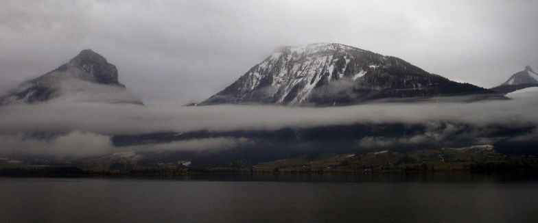
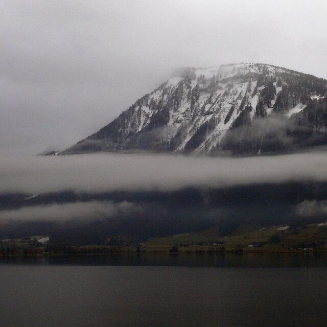
Photos of St Wolfgang
Other resorts in Austria are reporting: powder (4) / good piste (4)
The above table gives the weather forecast for St Wolfgang at the specific elevation of 640 m. Our sophisticated weather models allow us to provide snow forecasts for the top, middle and bottom ski stations of St Wolfgang. To access the weather forecasts for the other elevations, use the tab navigation above the table. For a wider view of the weather, check out the Weather Map of Austria.
Click here to read further information on freezing levels and how we forecast our temperatures.
Visitor Reviews of St Wolfgang
Overall 3.5 Based on 1 vote and 7 reviews
- Snowsure
- Variety of pistes
- Vote
- Julian Mead from Portugal writes:
If you accept that St.Wolfgang is a beginner/intermediate resort it is also a low hassle, super little resort. Yes, the slopes are a 40 minute (not 1.5 hrs) drive away in the coach and when you arrive at the slopes you can get straight on to the lifts with NO queues. If the snow is good you can ski off-piste through the trees and on completely virgin snow. On the basis I don't want to scare myself silly every day, I love the place and have been there 7 times. It is also possible to get buses to other resorts nearby where there is some seriously challenging skiing. The night life is quiet but last time I was there Karl-Heinz had a great club.....ask around to find it. Rosies Bar is also open into the wee hours! It is ideal for families or couples with mixed abilities, safe and friendly.......I am going back in 2009!
Visitor Reviews of St Wolfgang
Julian Mead from Portugal writes:
If you accept that St.Wolfgang is a beginner/intermediate resort it is also a low hassle, super little resort. Yes, the slopes are a 40 minute (not 1.5 hrs) drive away in the coach and when you arrive at the slopes you can get straight on to the lifts with NO queues. If the snow is good you can ski off-piste through the trees and on completely virgin snow.
On the basis I don't want to scare myself silly every day, I love the place and have been there 7 times. It is also possible to get buses to other resorts nearby where there is some seriously challenging skiing.
The night life is quiet but last time I was there Karl-Heinz had a great club.....ask around to find it. Rosies Bar is also open into the wee hours!
It is ideal for families or couples with mixed abilities, safe and friendly.......I am going back in 2009!
Free Snow-Forecast.com weather widget for your website
The St Wolfgang skiing weather widget is available to embed on external websites free of charge. It provides a daily summary of our St Wolfgang snow forecast and current weather conditions. Simply go to the feed configuration page and follow the 3 simple steps to grab the custom html code snippet and paste it into your own site. You can choose the snow forecast elevation (summit, mid-mountain or bottom lift) and metric/imperial units for the snow forecast feed to suit your own website…. Click here to get the code.
View detailed snow forecast for St Wolfgang at:
snow-forecast.com

 Nearest