WORLD SNOW ROUNDUP #184
Issued: 24 March 2021
By Patrick “Snowhunter” Thorne
EUROPE INTRODUCTION
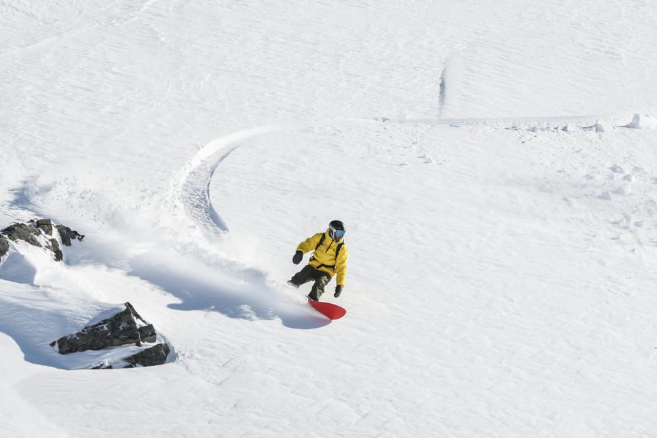
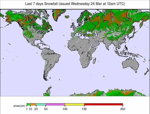
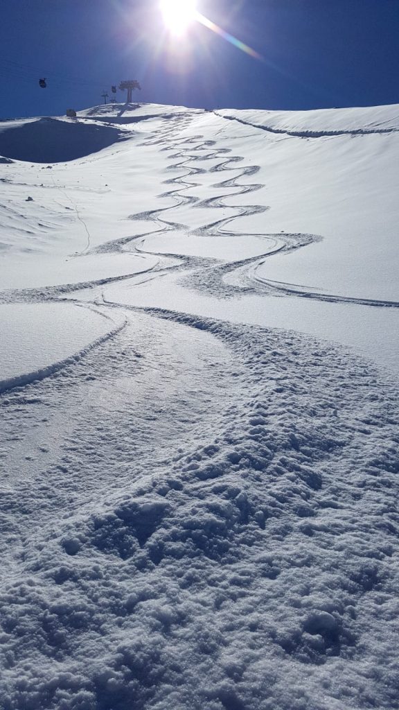
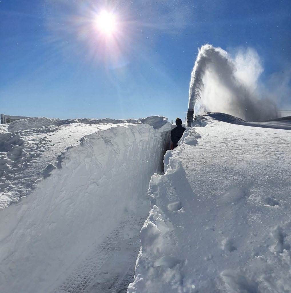
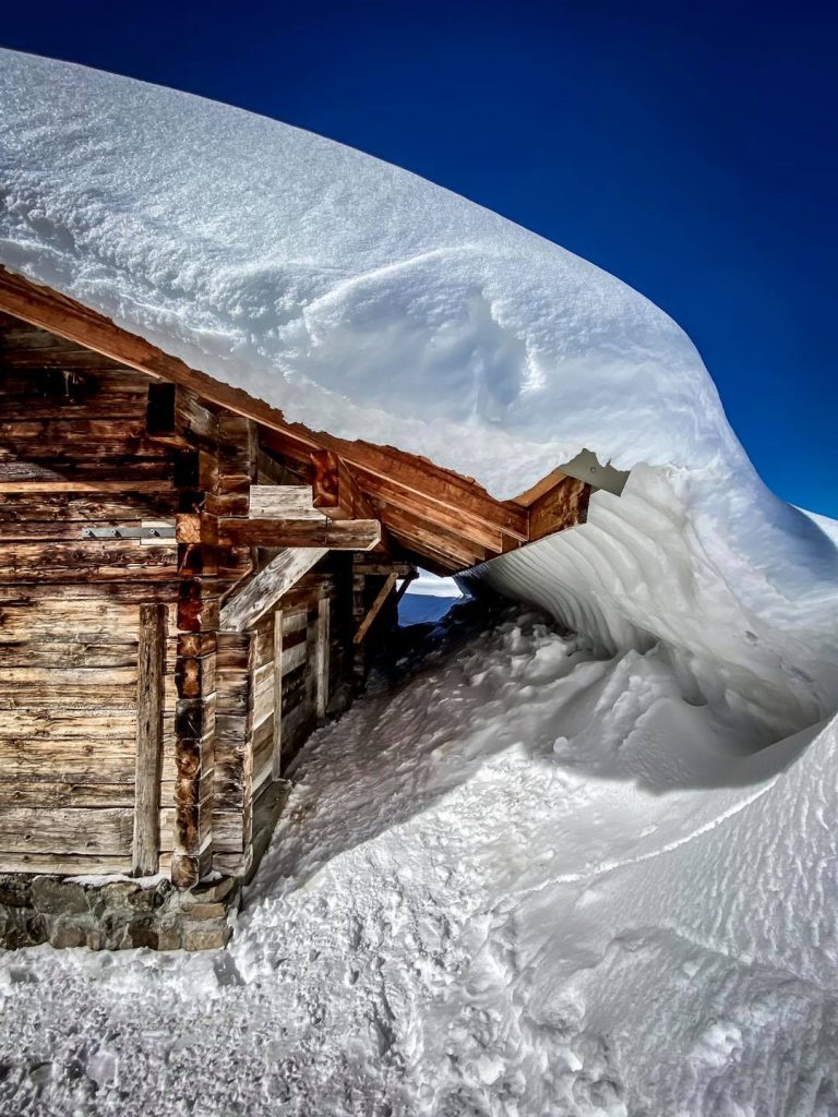
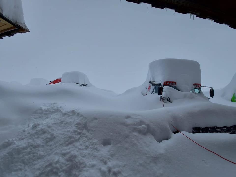
The big news in Europe this week were the big snowfalls in the final week of winter, which brought big accumulations and high avalanche danger to many resorts. Austria, France and particularly Switzerland posted the biggest snowfall totals, up to 2.4 metres (eight feet). In fact, it was the snowfall this year, rather than the pandemic last year, which caused problems for the Alpine Skiing World Cup finals at Lenzerheide, in Switzerland. Downhill and Super G races scheduled for Wednesday and Thursday were cancelled although other races did take place. The team Parallel took place on Friday, for the first time in two years, once the skies cleared. By the end of last week, the storm had passed, the sun was back out, and in most open areas conditions were superb. It wasn’t just the Alps that got the snowfall though, there was fresh snowfall reported later in the week in the Pyrenees, if not so much. More fell in Scandinavia and a there was a big dump over the weekend and start of this week in south eastern Europe, thanks to an unusually intense weather system feeding in from the Mediterranean.
AUSTRIA
AUSTRIA REPORT| After the heavy snowfall buried Austrian ski slopes last week, the snow clouds seemed to keep rolling around here through the weekend and into the start of the week, as they cleared away elsewhere. So Flachauwinkl (60/120cm / 24/48”), in Salzburgerland, for example, claimed another 60cm (two feet) of snowfall over the weekend. For most others, it was closer to a foot (12″) of fresh snow whilst others saw sunshine. More Austrian ski areas are closing now with the ongoing pandemic restrictions not likely to be lifted before the end of the season for most (if they are at all). So we are down to some of the big players who’ve said they’ll keep going at least to Easter, albeit with limited open terrain in most cases. Year-round (hopefully) Hintertux (230/410cm / 12/164”) has meanwhile become the first in the country to reach a four-metre base.
AUSTRIA FORECAST| The snowfall appears to be over for the time being and we’re looking at clear, sunny weather for the coming week. Staying cold for the next few days but temperatures climbing towards above-freezing levels from the weekend.
SWITZERLAND
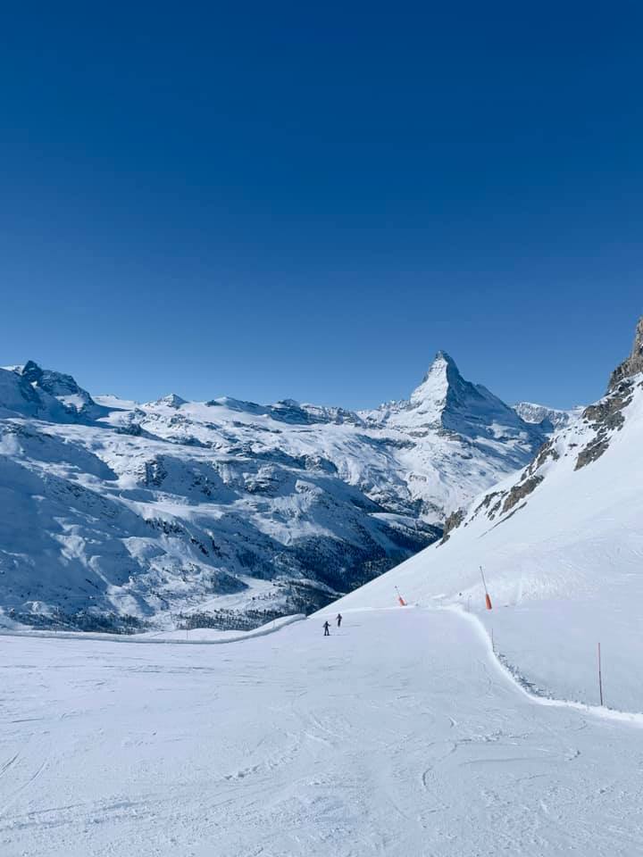
SWITZERLAND REPORT| Swiss ski resorts saw some of the biggest snowfalls of last week’s big storms in the Alps. As a result, Engelberg (50/600cm / 20/240″) became the first area in Europe to reach a 5 metre (200 inches) base this season, then a six-metre (20 feet) one, briefly overtaking the deepest base in the world at the end of last week over in Washington State. It has kept snowing in the US though, not in the Alps. The snowfall did continue until Thursday at some Swiss resorts, several reporting more than 1.5 metres (five feet) storm totals in the end. Of course, this put the avalanche danger up near maximum too. From Friday though, most Swiss areas reported sublime conditions with the sun now out and a lot of fresh snow. The 4 Valleys, about 75% open around Verbier (100/310cm / 40/124”), continue to report the most terrain open, some 330km (over 200 miles) of runs.
SWITZERLAND FORECAST| It looks dry for the coming week with temperatures mostly below freezing but starting to climb up into positive figures later this week. Cloud will also build but there’s no sign of any precipitation in the forecast at present.
FRANCE
FRANCE REPORT| The big snowfall in the French Alps eventually brought up to a metre of fresh snow to resorts there by the time it blew through on Thursday. Since then, conditions have been mostly cold, sunny and the high avalanche risk has diminished somewhat. This leaves excellent ski touring and cross-country skiing conditions with the fresh snow. Most French ski resorts remain open and have good coverage on their slopes (typically reported at 2-3 metres / 7-10 feet) without lifts operating but there remains no news and no sign of any change that will allow lifts to run again before the end of the season.
FRANCE FORECAST| The current cold, sunny weather will continue but with clouds rolling in and temperatures starting to rise as the week progresses. It will be plus temps above freezing below 2000 metres later in the week but cold enough for the snow in the forecast to fall on higher slopes at the weekend.
ITALY
ITALY REPORT| Italy is into its third lockdown with cases of the virus rising once again there. Unfortunately, this appears to mean the ski season is now a complete write-off and those few ski areas that thought about opening if they could have pretty much ‘given up the ghost’ now. Most had already said it was too late to open now even if permitted. So, though nothing is certain, the next hope is for summer ski areas like Passo Stelvio and Cervinia to be permitted to open, later in the spring, if things finally improve by then. As to the weather, for most Italian ski areas the past week has been dry, predominantly cold and mostly sunny.
ITALY FORECAST| It looks like the remainder of the week will continue cold and sunny; however, from the weekend clouds will roll in, temperatures will rise well above freezing in the valleys and there may be some fresh snowfall.
GERMANY
GERMANY REPORT|Hopes of more German regions allowing their centres to open are fading. Ski areas in the German region of Bavaria, home to most of the country’s larger resorts, say they won’t now be opening this season, even if they are eventually allowed to by the regional government. It seemed unlikely Bavarian ski areas would be allowed to open though as Bavaria’s government was a leader in the move, back in December, to try to close all European ski areas at the start of the season. That policy was agreed with France, Italy and the rest of Germany, as well as Andorra and Austria (partially), but ignored by Switzerland, Scandinavian ski areas plus there was a 50/50 split in eastern European ski nations, but some skiers had still held out faint hope. So there remain two centres open: Winterberg (40/60cm / 16/24”) and 14km (9 miles) of trails open and Willingen (0/60cm / 0/24”) with 7km (4.5 miles) of runs open. The former announcing more terrain open this week to try to meet demand. The Zugspitze glacier ski area, Germany’s highest, still officially holds out hope it might re-open later in spring as it has good snow conditions later in the season than most of the other German ski areas, potentially into May.
GERMANY FORECAST| Germany’s open slopes will be battling the weather a little over the coming week as it will be plus temperatures, generally. Therefore, they will see some thawing. It will be mostly dry but with a little weekend precipitation, hopefully bringing snow not rain.
SCANDINAVIA
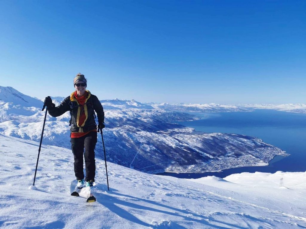
SCANDINAVIA REPORT| It’s been cold, snowy and frequently windy across Scandinavia over the past week. Sweden’s Are (70/110 / 28/44”), the region’s largest ski area, saw fresh snowfall refreshing cover on Monday morning. Riksgränsen (85/150cm / 34/60”) has the deepest base in Sweden, which should see it through the next two months of its 2021 season, although it is much lower than a year ago. Bjorli (70/70 / 28/28”) posted one of the biggest snowfalls in the region with 25cm (10”) over the weekend.
SCANDINAVIA FORECAST| Warmer and sunny the rest of this week for many areas so there could be a bit of a thaw on lower slopes, especially at more southerly areas. Colder with the chance of fresh snowfall at the weekend.
SCOTLAND
SCOTLAND REPORT| Scotland has had a mostly warm and sunny week with the snowpack hit hard, particularly in the east at Glenshee and The Lecht, where webcam images show the huge snow accumulations of January and February largely melted away on the slopes. Ski centres remain closed and it is unclear when they will be allowed to open after the pandemic restrictions in Scotland ease. It seems like it could be the end of April but the country’s government announced indoor facilities could re-open early in the month (which seems nonsensical in the lack of any scientific clarification and the fact that facilities like golf courses can open to locals). It is getting colder again but the re-opening date may prove to be unobtainable.
SCOTLAND FORECAST| A mixture of sunny and cloudy days with precipitation returning at the weekend, potentially as snowfall, most likely at higher elevations. Probably rain in the valleys with temperatures yo-yoing around freezing point.
SPAIN / ANDORRA
SPAIN / ANDORRA REPORT| After the big snowfalls in the Alps in the first half of last week, it was the Pyrenees’ turn to get dumped on at the weekend, with Spain’s Baqueira Beret (130/150cm / 52/60”) reporting a 30cm (foot) of fresh snowfall on Saturday. The snow comes as Spain eases some of its pandemic restrictions a little, allowing people to travel a little further than before to the slopes. This, in turn, seems to have encouraged resorts to open a little more terrain with Baqueira increasing their open terrain by a quarter to over 50km (30 miles), still less than half of the capacity though. Masella did the same, increasing its open terrain to 41 runs totalling 52km (33 miles) of slopes served by 9 ski lifts
SPAIN / ANDORRA FORECAST| The forecast is for continuing dry conditions with some sunshine and cloud. Temperatures will climb to get above freezing in valleys later in the week before falling back again at the weekend. Further north, the snow is set in until Thursday when cold weather and overcast skies should take over.
BULGARIA / ROMANIA REPORT
BULGARIA / ROMANIA REPORT| Europe’s southeastern corner braced for one of its biggest late-season snowstorms in years, over the past three days, as an unusually strong weather system formed north of Libya over the Mediterranean and headed for the Balkans with anything up to a metre (40”) of snow forecast. Bansko (50/200 / 20/80”) was in line for half that but with snow before the weekend too it has almost doubled its base stats from seven days ago, particularly good news for remaining open later in the season. The fresh powder in late March has been good news too of course.
BULGARIA / ROMANIA FORECAST| The largely cold and sometimes snowy conditions are forecast to continue for the rest of this week although it will get warmer towards the weekend and the snowfall, lighter. Sunshine returning from Friday and a sunny weekend.
CZECH REPUBLIC / SLOVAKIA
CZECH REPUBLIC / SLOVAKIA REPORT| Sadly, ski areas in the Czech and Slovak Republic remain closed as the countries continue to grapple with what is among the worst infection rates in Europe and the world. Officially, the ski area closures (part of wider measures) remain temporary. But with most of the ski areas in both countries usually closing by Easter time anyway, the re-opening of many seems unlikely, even if it is possible to permit it to happen. At least the Slovak Republic can celebrate Petra Vlhova becoming the first Slovakia to win the overall Crystal Globe in the 20-21 World Cup competition, which concluded in Switzerland at the weekend. As to the weather, it has been predominantly cold this past week in the Tatras with some snow flurries.
CZECH REPUBLIC / SLOVAKIA FORECAST| Staying cold midweek but with temperatures climbing towards the weekend to four or five degrees above freezing at ski area bases. Some precipitation forecast which will be snowfall at higher elevations, but rain in the valleys.
NORTH AMERICA
A fairly benign week for weather in much of North America. The biggest accumulations of the last seven days have been reported right on the west coast with ski centres from California up to BC reporting up to two feet (60cm) of fresh snowfall. Some snow in the Rockies too, heaviest further north and some at the end of last week in the east. On the one hand, the season is beginning to wind down with ski centres in the midwest, in particular, calling it a day on the 20-21 season. But on the other hand there has been loosening of lockdown. Rules have led some resorts to have a second lease of life for springtime and talk about staying open later into April than usual and even into May, to cope with increasing demand.
ROCKIES
ROCKIES REPORT| Wolf Creek (105/115” / 262/287cm), in Colorado, has been open longer than any other major North American ski area, now having been open for five months of continual operation. It also has the deepest reported snowpack in the Rockies. It was dry and sunny there in the latter half of last week whilst it was snowing further north in Idaho and Wyoming; however, since the weekend (and the start of spring) things have turned more wintry and Wolf Creek has been reporting a few inches more snow freshening up the slopes each morning. It’s a similar picture further north, which has had the lion’s share of the snow this winter, whilst Colorado has rather under-performed.
ROCKIES FORECAST| Staying cold with a mixture of dry and often sunny, as well as snowy, days over the coming week. Temperatures double digits below freezing; not bad for late March.
USA WEST
USA WEST REPORT| The US west has had another snowy week with ski areas in California reporting plenty of fresh snowfall into the weekend. Sugarbowl (79/133” / 198/333cm) now has the deepest base in the state after reporting an 18 inch / 46cm three-day total into the weekend. It has been dry, cool and largely sunny since then, giving some epic powder conditions. Further north in Washington State the snow arrived later, beginning at the weekend and continuing through this week. Alpental (133/248” / 333/620cm) briefly lost its position of ‘snowiest ski resort in the world’ when its base dropped below 240” (6m) at the end of last week, just as a ski area in the European Alps hit that mark for the first time this winter, but it has bounced back since.
USA WEST FORECAST| Staying dry in California over the rest of this week with temperatures close to freezing. More snow forecast further north. More cold, mostly sunny weather for the coming week. Getting above freezing at base levels and with some more snowfall forecast for Friday, but probably only 6-12” (15-30cm) for most areas.
USA MIDWEST REPORT
MIDWEST REPORT| More and more ski areas have been calling it a day on their 20-21 ski season in the midwest and moving on to golf and bike season. That’s understandable for many with sunny weather and temperatures climbing up to double figures above freezing. But on the other hand, there was more snow last week in Minnesota and parts of Michigan for the final days of winter, so it’s not over everywhere. Crystal Mountain (36/49″ / 91/122cm), in Michigan, and Lutsen Mountains (24/49” / 61/122cm), in Minnesota, are both reporting the deepest snowpacks in the region with Lutsen Mountains reporting every run open and Crystal Mountain nearer to 80% of its terrain available. It has been warm and mostly dry since the weekend.
MIDWEST FORECAST| No sign of any unexpected return of winter in the region with temperatures above freezing and the occasional precipitation falling as rain now, not snow. It should be mostly dry, however.
USA EAST
USA EAST REPORT| It’s been a largely warm and sunny week so far in the northeast. This weather did come after a little fresh snowfall at the end of last week though. Sugarbush (49/73” / 122/183cm) has the deepest base of the larger resorts in the region, reporting 5cm (two inches) of snowfall at the end of last week. Since then, temperatures have been predominantly above freezing. In fact, they’ve been reaching double digits about freezing at bases; very mild and a thaw is underway on lower runs. But almost all of the larger ski areas in the region remain fully open.
USA EAST FORECAST| A slightly cooler, but still above-freezing period of weather in the latter half of this week. More precipitation in the forecast towards Friday but most likely to fall as rain at this stage. Warmer again and sunny at the weekend.
CANADA
CANADA WEST
CANADA WEST REPORT| Quite a cold and snowy week in western Canada, snowier the further towards the Pacific you go. Whistler (185/185cm / 74/74″) has had about 50cm (20″) of fresh snowfall on higher runs over the past seven days, the heaviest at the end of last week, and remains fully open. Along with ski areas around Banff, it has a few months more of the season left, currently due to stay open well into May. Less snowfall on the eastern side of BC and in Alberta but some light falls to give the slopes a refresh and temperatures remain mostly well below freezing as we move in to spring.
CANADA WEST FORECAST| Staying cold and frequently snowy for the remainder of this week towards the west, some sunny spells and warming up towards freezing level at the weekend. Heavier snowfall (but still only moderate accumulations at most) in the west of the region, lighter snowfall and colder in eastern BC and Alberta.
CANADA EAST
CANADA EAST REPORT| Predominantly dry and sunny weather in Quebec and Ontario, but with temperatures generally staying at or below freezing, with some glorious spring skiing as a result. Tremblant (76/127cm / 30/49”) has around 90% of its terrain open and reports just a few centimetres more snowfall at the end of last week. Most other areas remain open, generally fully open, with Massif du Sud (338/374cm / 135/150”) posting the region’s deepest base by some distance.
CANADA EAST FORECAST| The sunshine is set to continue over most of the coming week, but temperatures look set to rise in to double-plus figures Celsius through the remainder of this week. Cooling again by the weekend when precipitation is expected but at this point, it is difficult to predict if it will be cold enough by then for snow or if it will be rain.
ASIA
JAPAN REPORT| It has been a mostly mild, generally dry week in Japan. Where ski resorts have had precipitation, it has more often fallen as rain rather than snow, although there have been overnight flurries on higher slopes. So the mood is definitely one of spring ski conditions. Fortunately, most areas have had loads of snowfall through the winter, one of the three snowiest of the past decade for many. So the resulting base thawing away before the end of the season is not an issue. Niseko (200/475cm / 80/190″) has good top-to-bottom cover. It is just a few centimetres/an inch off hitting a 12 metre (40 feet) season-to-date snowfall total.
JAPAN FORECAST| It should be cooler for the latter half of this week with some light snowfall possible at times. Temperatures around freezing, alternating between a few degrees below and a few above.