WORLD SNOW ROUNDUP #183
Issued: 17 March 2021
By Patrick “Snowhunter” Thorne
European Roundup
North American Roundup
Asia Roundup
EUROPE INTRODUCTION
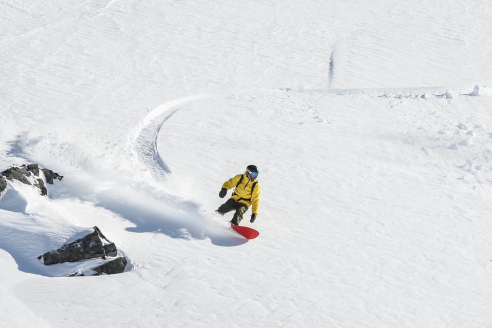
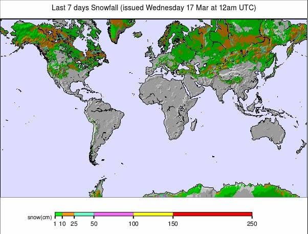
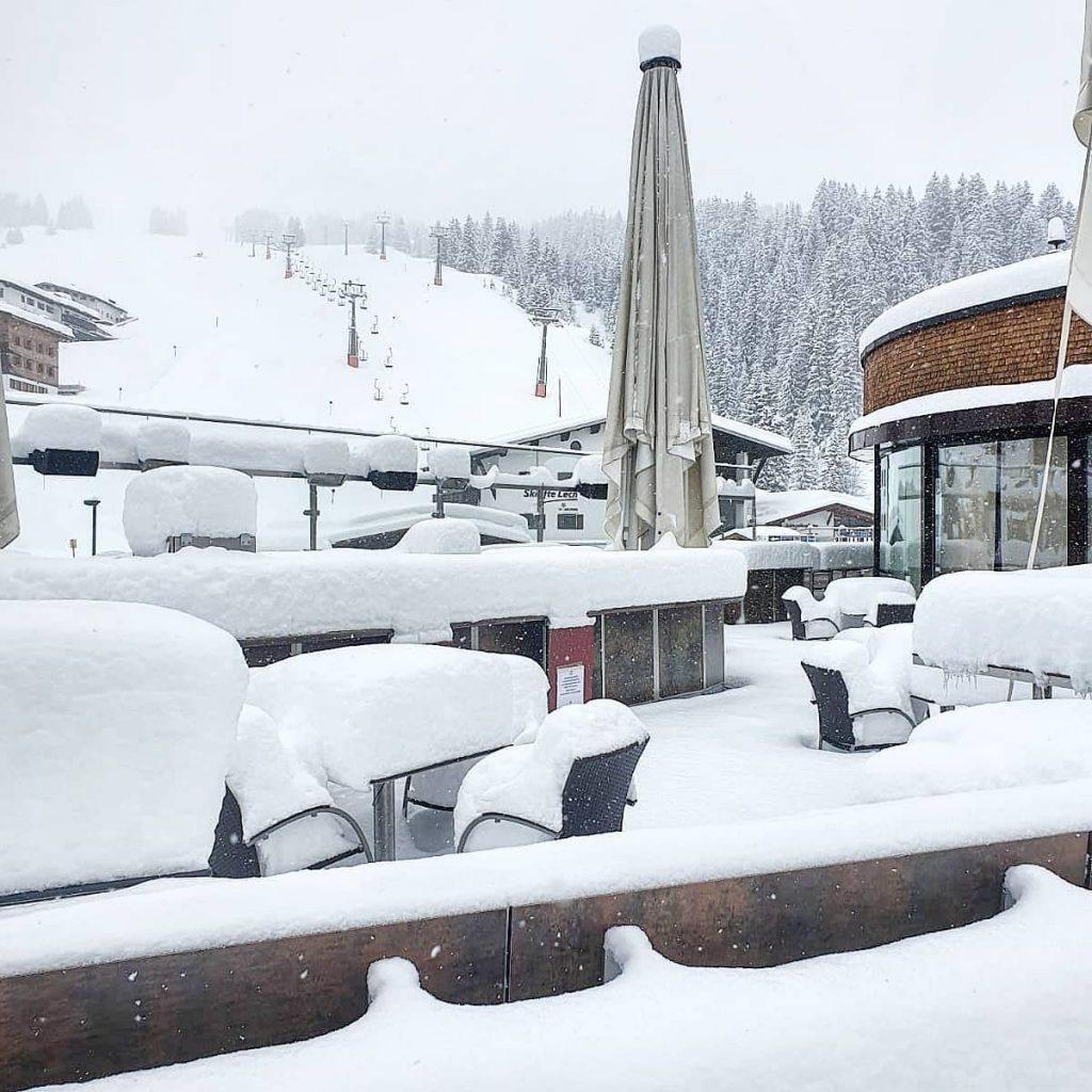
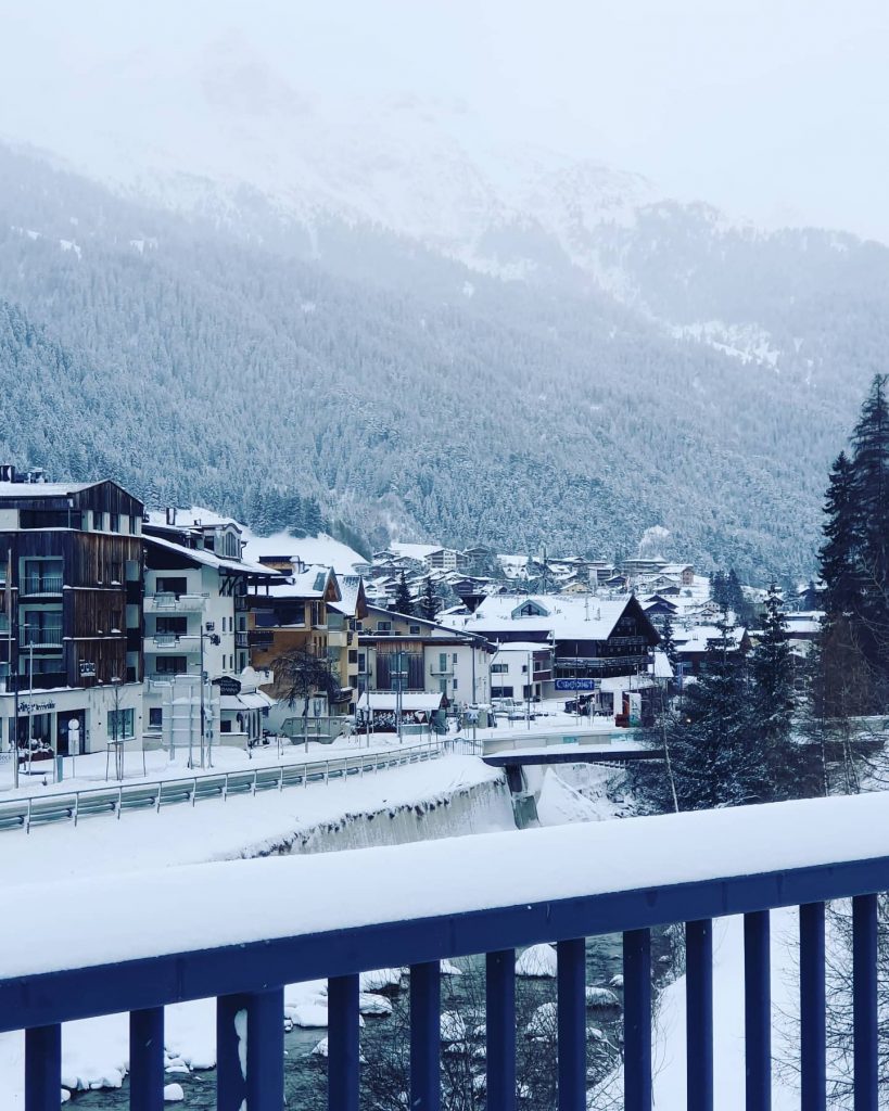
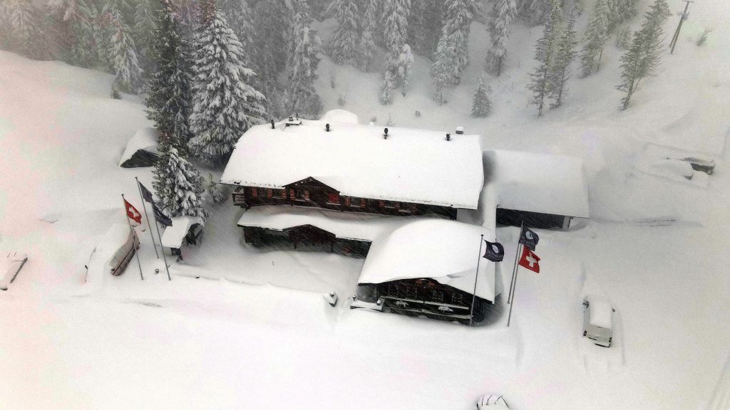
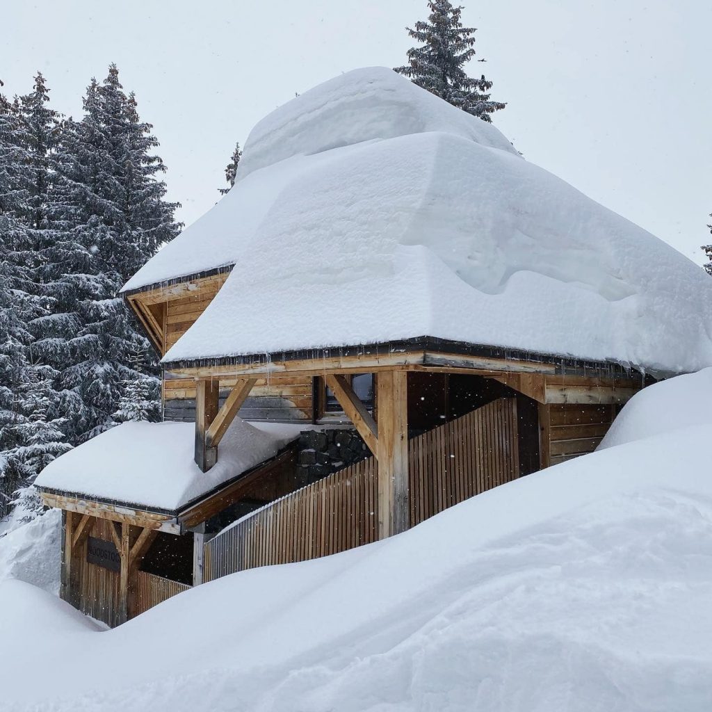
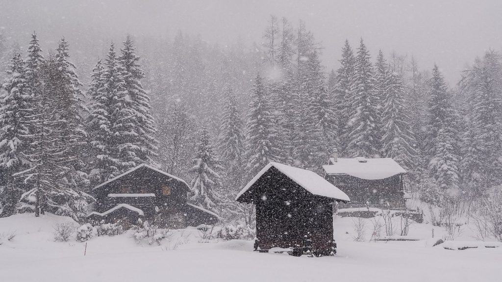
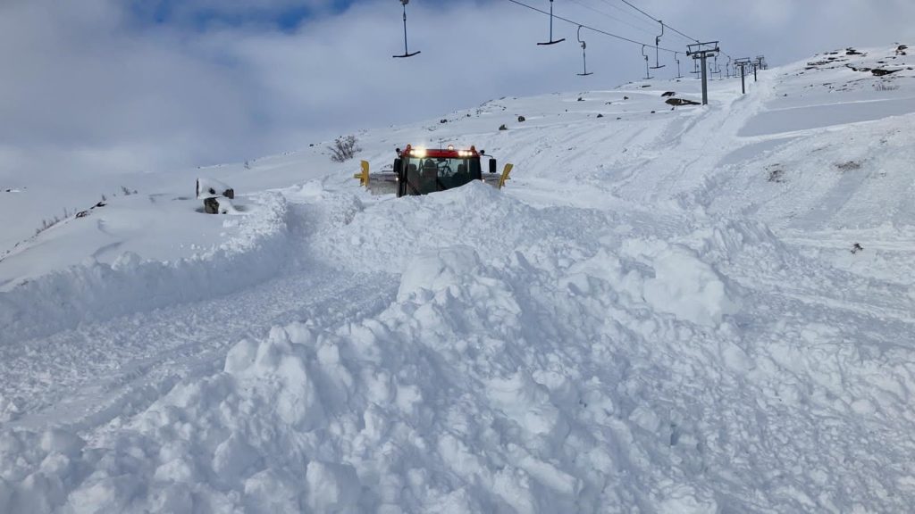
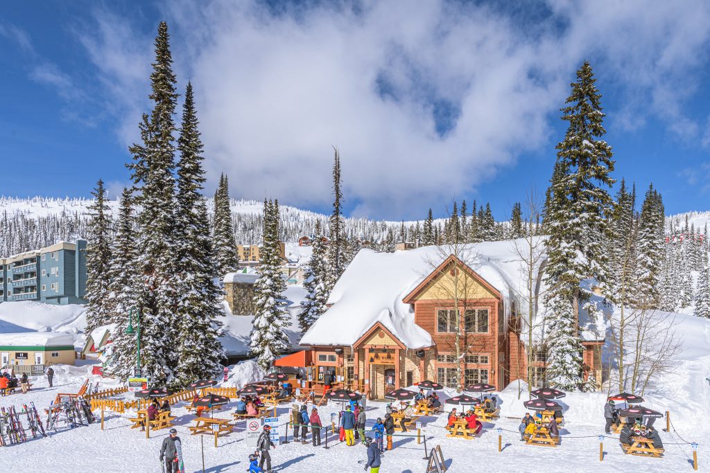
With less than a week until the start of springtime theAlps are currently enjoying the biggest snowstorm since early January, with an increasing number of ski areas reporting more than a metre (40 inches) of snowfall since it all began at the weekend. By midweek some Swiss areas were claiming totals approaching two metres (80 inches).
The snowfall is being driven in on strong winds causing logistical and safety issues leading to some ski area closures. All the snow, along with the strong winds, have inevitably pushed the avalanche danger level up high in many areas. It is typically at level 4, on the scale to 5, in many areas and there’s a warning that mitigation work may not be getting carried out as normal at some resorts due to limited operations during the pandemic.
Of course, we recently passed the one year mark since the Italian lockdown started, and now the lockdown for much of the rest of Europe has passed its first anniversary. So some ski areas in France, Germany and Italy, as well as other countries, have not operated their lifts for over a year now and the storm closure makes little difference.
Some though, lucky enough to live near still open ski areas, have been able to get out to enjoy it, and the deepest base in Europe, posted by Engelberg in Switzerland, has finally passed the five-metre (17 feet) mark and raced on up towards six metres (20 feet).
AUSTRIA
AUSTRIA REPORT| The snow arrived in Austria a little later than further west in France and Switzerland, with the first significant accumulations reported by Monday morning. But it has hardly stopped snowing since and doesn’t look like it will do for the rest of this week either. St. Anton am Arlberg (120/260cm / 48/104”) reported one of the biggest accumulations in the first 24 hours of the storm, with 45cm/18 inches falling by Monday morning. The resort went through the 60cm/two feet mark on Tuesday. Austria has begun a very gradual easing of lockdown which should see restaurants re-open this week in a test opening in the Vorarlberg province, with the rest of the country due to follow later this month if this goes well.
AUSTRIA FORECAST| After the snowy start to the week lighter snowfall is forecast to continue for some Austrian areas, whilst others will see drier weather now. It should remain well below freezing for most areas up to the weekend when we’ll creep back into positive temperatures at resort level.
SWITZERLAND
SWITZERLAND REPORT| Switzerland is in the midst of what may turn out to be its snowiest week of the year so far. Resorts in Valais, in the west of the country, reported up to 70cm (28”) of snow at the weekend and the snowfall has just got heavier and more widespread since, with it expected to continue through to next weekend. Engelberg became the first resort in Europe to post a 5m (200”) plus base on Sunday as it hit 505cm (202”) on its Titlis glacier as the snow kept falling. Strong winds driving the snow in have closed slopes and in some cases entire ski areas.
SWITZERLAND FORECAST| As mentioned, there’s currently no clear end in sight to the ongoing snowfall with most areas expecting 10-20cm (4-8″) more snow every day through the weekend. Temperatures staying well below freezing even down at lower lying resorts until around Sunday when we should get back into positive temperatures lower down as we reach the start of astronomical springtime.
FRANCE
FRANCE REPORT| There remains no sign ofFrench ski areas being permitted to open lifts so the skiing here continues to be dominated by ski touring, the use of beginner areas and many other non-ski and non-lift-assisted ski activities. The big storm started to rack up impressive snow depth numbers by Sunday morning with some ski areas reporting half a metre (20 inches) of snow had accumulated by then. That’s when it was suggested that it was time to restart winter 20-21 and this time do it right. By Tuesday morning the numbers had grown closer to the metre mark for the most heavily impacted ski areas. Last weekend marked the anniversary of the sudden closure of ski areas just as tens of thousands of people had arrived in the French Alps, booked their ski passes and lessons, filled their fridges and were ready to go out skiing on the Sunday morning.
FRANCE FORECAST| Staying cold and snowy for the remainder of this week with more snow accumulating every day until Friday. The weekend should see skies clear and some great powder conditions for tourers who can get to the slopes and identify safer terrain, if or when the avalanche danger has reduced.
ITALY
ITALY REPORT| Italian ski areas have been posting significant snowfall too, particularly along the country’s northern border, although with Italy moving into its third lockdown and no real prospect of ski centres opening now, a sizable number are not currently updating snow totals. Of those that are, ski areas in the Aosta Valley have posted the biggest accumulations with La Thuile (30/180cm / 12/72”) reporting 30cm (a foot) of fresh snowfall on Monday. Since then it has been cloudy, very cold but mostly dry.
ITALY FORECAST| It will remain very cold over the coming week and largely cloudy until the weekend, but with no snow forecast for most Italian areas, Sunshine returning at the weekend and the longer-term forecast is for warmer weather next week.
GERMANY
GERMANY REPORT| Exciting times in Germany with two of the bigger ski areas in Sauerland opening last week following a relaxation of restrictions in the province. Willingen (0/80cm / 0/32”) opened first followed by Winterberg (0/50cm / 0/20”) a day or so later. The announcement that the centres could open came too late for most ski areas in the region, and is so far only for ski areas in a few parts of Germany, not the whole country. So these two could only open with white ribbon pistes on green hillsides thanks to snow stockpiling against the early spring thaw. It has been more wintery in the past few days though with some fresh snow falling to freshen up the cover.
GERMANY FORECAST| The rest of this week does look quite promising for late-season conditions in the region with temperatures remaining below freezing and some light to moderate snowfall expected over the next few days.
SCANDINAVIA
SCANDINAVIA REPORT| Almost all Scandinavian ski areas remain open and are reporting pretty nice spring conditions, with long daylight hours and sub-zero temperatures maintaining snow quality with some light fresh snowfall on top. The region’s largest area, Åre (70/120cm / 28/48″), in Sweden, reported another 5cm (2″) of snowfall at the weekend and all of its terrain open. There were bigger snowfalls, with up to 50cm (20″) reported in the past week, most of it before the weekend in parts of coastal Norway. Voss (30/100cm / 12/40″) had off-piste powder conditions at the weekend.
SCANDINAVIA FORECAST| Largely overcast skies, sub-zero temperatures and not much snow in the forecast up to the weekend. Temperatures creeping up above freezing at the as we approach the start of spring.
SCOTLAND
SCOTLAND REPORT| It has definitely been a colder, snowier week in Scotland with base depths moving back in the right direction for the first time in around four weeks. Lower slopes, which had turned back to brown and green, are all white again. Ski resorts in the country remain closed due to the Scottish government’s pandemic spread prevention measures. The latest announcement on 16th March (Tuesday) appears to indicate ski areas may be able to reopen to locals in early April, if there’s snow left, but it’s not fully clear yet.
SCOTLAND FORECAST| It is looking a little warm once more for the coming week which may impact snow cover on lower slopes at Scottish centres. Mostly dry but with the likelihood of rain/snow next weekend.
SPAIN / ANDORRA
SPAIN / ANDORRA REPORT| Cold and some snowfall in the Pyrenees but not so much as further north in the Alps. Some areas posted 5-10cm (2-4 inches), along with some strong winds, at the weekend but the vast majority remain closed due to the pandemic and those that are open, with only limited demand from locals, continue to only open limited terrain. Grandvalira (30/80cm / 12/32”) in Andorra has the most available, about a third of its terrain.
SPAIN / ANDORRA FORECAST| The weather looks like its staying cold as we approach the start of astronomical springtime next week. In fact, it’s actually looking much snowier with as much as half-a-metre (20 inches) of snowfall forecast by the end of the weekend, with snowfall expected most days from midweek on.
BULGARIA / ROMANIA REPORT
BULGARIA / ROMANIA REPORT| It has been another snowy week in parts of southeastern Europe with fresh snowfall reported at some resorts in Romania, Bulgaria and Servia at the weekend. Bulgaria’s Bansko (20/150cm / 8/60”) has reported a slight increase in its lower slope depth and fresh snowfall on higher slopes at the start of this week. Temperatures did climb quite high at the weekend though, hitting +1 degrees C in the village, and it was rain there when snowing up on the slopes.
BULGARIA / ROMANIA FORECAST| The remainder of this week looks colder than the first half with temperatures around freezing or below in the region. More snowfall is expected for many areas, most of it falling towards the coming weekend.
CZECH REPUBLIC / SLOVAKIA
CZECH REPUBLIC / SLOVAKIA REPORT| Ski areas remain closed due to the pandemic in both the Czech and Slovak republics. Ski conditions have been challenging this past few days in any case with moderate to heavy snowfall and strong winds in the Giant and the Tatra Mountains. Of course, it means the snow is now looking good for the end of the season if ski areas are allowed to reopen, but with cases of the virus surging in both countries, that currently seems unlikely.
CZECH REPUBLIC / SLOVAKIA FORECAST| The stormy, snowy weather looks set for the next few days with temperatures at, or just below, freezing. More snowfall is expected then with conditions clearing as we move through the weekend.
NORTH AMERICA
The main news from North America over the past week has been heavy snowfall. First, several feet (60cm+) for ski areas in California and the west coast into last weekend, then heavy snowfall in Colorado and the Rockies (actually the biggest dumps of over 40 inches/a metre were claimed up in Wyoming), after a rather warmer drier season to date than most would like (since the weekend).
The dump in the Rockies was not quite the ‘snow-pocalpse’ predicted by some forecasters, the most excited of whom reckoned over a metre of snow was on the way in the biggest snowstorm for 120 years, but it still provided some deep weekend powder.
In terms of the pandemic, it seems to be a very gradually improving predictions with a slight easing of restrictions continually announced in different US states and Canadian provinces. Well almost all, some areas including the area around Mammoth Mountain, in California, have recently returned to a tighter lockdown, although the resort remains open. More resorts, particularly in the west of the continent, are also announcing extended seasons, in most cases switching from earl to mid-April closure days. At the same time though, some ski areas which traditionally have shorter season into March (some in parts of the midwest, others in southern states like Arizona), announced their seasons end last weekend or will do next weekend, more or less as expected as per a normal season.
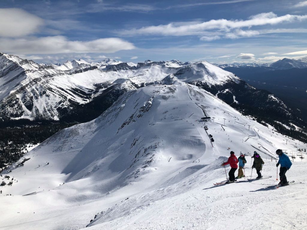
ROCKIES
ROCKIES REPORT| As mentioned in our introduction, the Rockies did not receive their historic snowstorm; however, they did receive a pretty big one, with reports of up to two feet of snow falling at the start of the weekend. Wolf Creek (116/126” / 290/315cm) was one of the big beneficiaries seeing 22 inches (56cm) of snowfall on Friday/Saturday, but most resorts in the region posted at least a foot (30cm) of snowfall and great conditions once skies cleared at the weekend. It has been cold, but mostly sunny, ever since.
ROCKIES FORECAST| The current cold, clear weather is expected to continue for the remainder of this week. Temperatures should warm, up towards freezing by the weekend and there’s a chance of light-to-moderate snowfall from around Sunday.
USA WEST
USA WEST REPORT| Heavy snowfall in the western US led to ski areas in California topping the world snowfall tables in the seven days up to Sunday, with Mt Shasta (80/80” / 201/201cm) posting 45” (113cm) of fresh snow in the latter half of last week, Donner Ranch (50/63” / 124/157cm) got 30” (75cm). Of the bigger resorts in the state, Squaw Valley (75/75” / 188/188cm) had just an inch less with 29” (73cm) of snowfall in the same period. The result was powder skiing nirvana over the weekend as the sunshine came out, and that has been the picture pretty much since the weekend, with just some light snowfall on Monday. Unusually, there’s been much less snowfall further north, where it had been dumping down in the northwest corner of the US up to now; however, Alpental (141/207” / 353/617cm) remains the only ski area in the world posting a base of more than 200 inches (6 metres).
USA WEST FORECAST| More cold, mostly sunny weather for the coming week. Getting above freezing at base levels and with some more snowfall forecast for Friday, but probably only 6-12” (15-30cm) for most areas.
USA MIDWEST REPORT
MIDWEST REPORT| The end of the 2020-21 ski season appears to be nigh for some ski areas in the Midwest as warm temperatures (meaning rain rather than snow when there is precipitation) and a general desire to put the pandemic ski season behind them and move on to biking and golf, has impacted some areas. Bittersweet ski resort, in Michigan, and Paoli Peaks, in Indiana, are among those making the switch from winter to summer operations a week earlier than planned (last weekend) and there are about a dozen more which have done the same. The move may have been a little premature though, some regions have seen more wintery weather in the last few days, with several inches of snowfall on ski slopes in Wisconsin, among others.
MIDWEST FORECAST| The end of the season does feel near for much of the Midwest with temperatures double-digits above freezing and getting warmer, along with full sun in states like Indiana (all ski areas are closed there now). In other states, like Michigan, it’s a little colder and although no snow is forecasts snow depths will allow many areas to stay open later into the spring should they wish to.
USA EAST
USA EAST REPORT| It has been sunny but staying below freezing for much of the Northeast since the weekend giving some perfect bluebird days. A little fresh snowfall for some to start the week, but predominantly sunshine. Sugarbush (49/73” / 122/183cm) tops the table for snow depth at the large centres in the region but most ski areas are reporting healthy snow depth and everything open as they enter what will be, for many, the final month of the 2020-21 season.
USA EAST FORECAST| A midweek warm snap will see quite warm daytime temperatures and freeze-thaw conditions for the next few days, along with overcast skies. Temperatures are expected to dip back below freezing by the weekend though and the sunshine return with no fresh snowfall currently forecast.
CANADA
CANADA WEST
CANADA WEST REPORT| Predominantly dry conditions in Alberta and BC over the past seven days but with some moderate snowfall to start this week. Temperatures have been typically freeze-thaw through the week and some low elevation areas, like Whistler’s (275/275cm / 110/110″) base, reported rain whilst there was snow up high. But most ski areas remain fully open, with all lifts turning and all lifts accessible. Coronavirus operating restrictions have also been eased slightly (larger groups allowed) and Big White (235/235cm / 94/94″) has announced it is now ‘virus-free’, having had a spike in infections earlier in the season. Conditions remain good in western Canada. A drier week than previously with the biggest snowfall of the last seven days, a 40cm (16”) dump at the end of last week, reported by Mt Washington Alpine Resort (232/350cm / 93/140”) on Vancouver Island (off the west coast of the mainland). Since then it has been drier, although with 10cm (4 inches) or so more snow to start the week, but staying below freezing. Strong winds have been a factor though (Cypress Mountain closed on Saturday). On the mainland, the continent’s largest ski area, Whistler Blackcomb (293/293cm / 117/117″), reported an even bigger two foot (60cm) snowfall in the same period but remains fully open.
CANADA WEST FORECAST| Staying mostly dry for the rest of this week in much of western Canada. Temperatures continuing to fluctuate between above/below freezing at all altitudes giving typical springtime freeze/thaw conditions. Some snowfall is forecast for the weekend.
CANADA EAST
CANADA EAST REPORT| A week of mixed weather in Canada’s east. Some stunning spring days but also periods of rain for some and a few periods of very strong winds which led to temporary resort closures. Freezing weather at the start of the week also led some areas to close as it was deemed too cold for safe operations during the pandemic. Owls Head (180/180cm / 72/72”), down in the south of Quebec, is posting the deepest base in the region at present. Mont St Sauveur (36/36cm / 14/14”) isn’t posting such impressive stats but has announced with, its concerted snow-making efforts, it is aiming to do its usual thing and keep a terrain park open late in to spring.
CANADA EAST FORECAST| A similar looking week ahead with mostly cold, dry and often sunny conditions, well below freezing but with warmer fronts moving through bringing plus temps and occasional precipitation. Sometimes this will be rain, other times snow, depending a good deal on the height and latitude of each ski area.
ASIA
JAPAN REPORT| It has been a quiet week on Japanese slopes as spring continues to take hold. Very little fresh snowfall has been reported anywhere, just the odd centimetre/inch now and then, with some seeing rain, but mostly it has been clear skies. Temperatures have been hovering in the five-below to five-above range, for freeze-thaw conditions. Generally though, dry and sunny weather with some excellent spring skiing. Niseko (220/475cm / 88/190″) reported 20cm (eight inches) of snowfall in total over the past week and is closing in on the 12 metres (40 feet) snowfall season-to-date total. That puts it at one of the three best snowfall totals of the past decade.
JAPAN FORECAST| The spring conditions look set for the time being and are very much in line with the March norm in Japan. Therefore, expect fluctuating temperatures (increasing above freezing) and more thawing. With most resorts having thick bases, the season can continue for many well into May, should they wish it to during these difficult times.