WORLD SNOW ROUNDUP #171
Issued: 23 December 2020
By Patrick “Snowhunter” Thorne
European Roundup
North American Roundup
Asia Roundup
EUROPE INTRODUCTION
There’s not much fresh snow to report in Europe this week, instead the focus has been on which ski areas can open for Christmas week and which aren’t depending on their government’s response to the coronavirus.
It’s a very mixed picture. Of the big four alpine ski nations, Austria is due to open most ski areas to locals from Christmas Eve, this Thursday, but tourists are banned. France has fully opened its ski resorts for all activities except using lifts to ski downhill, Italy is in full lockdown and Switzerland had hundreds of ski areas open at the weekend but is deciding canton by canton which ski areas will stay open through Christmas depending on local infection rates.
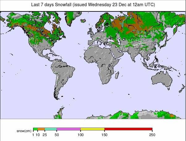
Elsewhere, Germany is in full lockdown and Andorra is also closed; however, most resorts in Spain, Scandinavia, Scotland (for now) and across most nations in the eastern half of Europe are now all open. In fact, more than 30 European nations should have lifts turning over Christmas with about two-thirds of the 10 or so with skiing that won’t be open, closed due to virus restrictions, the rest due to a lack of snow.
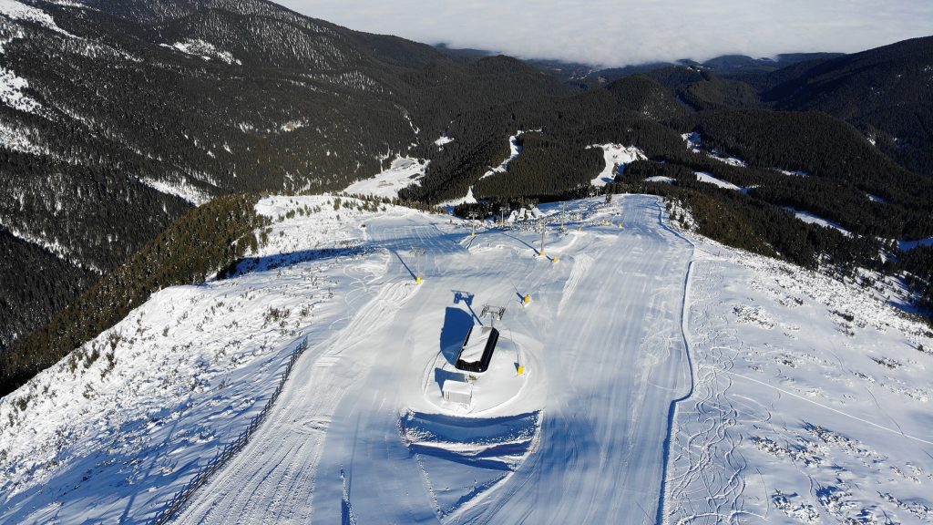
Most of the snowfall that has been reported in Europe over the last seven days has been up in Scandinavia, with the Alps, Dolomites and Pyrenees largely sunny, although many resorts did see some brief periods of snowfall (some unfortunately getting rain at lower elevations on Monday too). The amount of snow cover varies but is much better on higher slopes with little or no cover down in lower alpine valleys. Most open areas have enough snow to push down to create runs to the base though if needed.
AUSTRIA
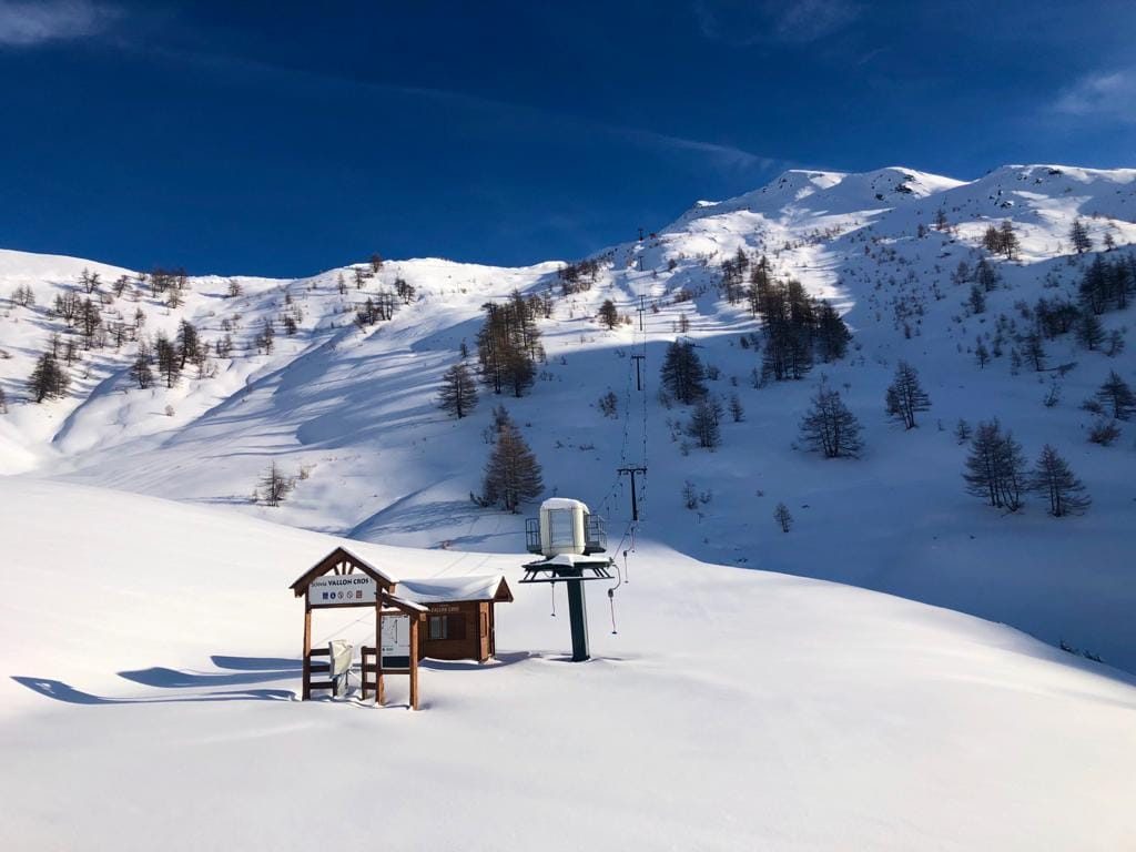
AUSTRIA REPORT| Excitement is building on Austrian ski slopes with most of the country’s ski areas due to open this Thursday, December 24th, for the 20-21 ski season. The current plan is that the slopes are open to locals only from Christmas Eve (some centres are opening a day or two later), then to tourists from January 7th (a few areas up on the German border are waiting until then to open at all, rather than tempt skiers over the border when they’re not supposed to travel. The country’s glaciers had already been open earlier in the autumn before Austria’s second lockdown and have seen significant snowfall through the closed period with a number likely to open with the snow lying at least 3 metres (10 feet) deep, including the Stubai which has announced it will have 15 “perfectly groomed slopes” served by nine lifts open from Christmas Eve. Conditions on lower slopes are now less good than they were a fortnight ago with little fresh snow falling since the huge dumps at the start of December and low altitude snow cover melting back, but runs to the valley have largely been maintained. But it has been snowing in recent days and it is an improving picture.
AUSTRIA FORECAST| It is looking increasingly good for Austria’s delayed season start from Thursday with cold weather and plenty of snow in the forecast. Temperatures should stay at 5-1 degrees below freezing for many areas through the remainder of the week with snow falling in most areas and on most days from Thursday onwards.
SWITZERLAND
SWITZERLAND REPORT| Hundreds of Swiss ski areas are now open for Christmas week, but the decision from government as to whether they should be or not has been marginal, with decisions taken at a national and regional level; taken on the grounds of whether hospitals in each area could be overwhelmed by too many Covid cases as well as ski injury cases. So far, the political leaders of each of the main cantons, where most of the big-name ski areas are located, have decided to keep their resorts open but the decision in Graubunden on Monday was particularly marginal with restrictions announced including closing more ‘dangerous’ slopes where hospital treatment requiring injuries might be deemed more likely and banning alcohol sales. The canton of Uri, home to Andermatt (50/290/20/14”), has closed the resort, but much of its ski area, located over the canton border and also accessible from neighbouring Disentis and Sedrun, remains open. A review of the closure is due next week. The region actually has the deepest base in the country although another mostly dry, mostly sunny week has led to it dropping back down below 3 metres/10 feet; however, snow has started falling again in the last few days with Leukerbad (20/50cm / 8/20”) reporting 15cm (6 inches) of snowfall on Tuesday morning.
SWITZERLAND FORECAST| Swiss slopes have seen rather warm temperatures at lower elevations to start this week, but as we approach Christmas Day we’ll see temperatures drop below freezing right down to the valley floor and get to double-digits below on the mountain. Snowfall is expected Christmas Eve and Christmas Day for many then skies clear over the weekend but staying cold.
FRANCE
FRANCE REPORT| The French 20-21 winter holiday season in the mountains is officially underway, just without ski lifts operating. Many ski schools and mountain guides are working however, offering guided ski touring, so for those prepared to hike up there are turns to be earned. Resorts report that without their lifts running though, business is dramatically down by three quarters or more for many. Snow conditions look good, with some fresh snow falling at the weekend and resorts hope that a planned Jan 7th opening date, in a fortnight , will happen as hoped.
FRANCE FORECAST| It has been a little warm in French valleys but should be below freezing in resorts by Christmas Day and by then on-mountain temperatures should be double digits below freezing. Snowfall is expected on the 25th and 26th , perhaps 20-30cm on some higher slopes, before clear sunny skies, but still cold, at the weekend.
ITALY
ITALY REPORT| Italy is in a full national lockdown although ski areas currently hope they will be permitted to open from January 7th like neighbouring Austria and France. That’s yet to be confirmed, however. The past week’s developments have included the Saslong lift company, at Val Gardena, announcing it won’t be operating this season. Otherwise, Italy has been the focus of world attention this past week with world cup ski races stages as usual in Alta Badia, Val Gardena and Madonna di Campiglio and Bormio coming up next. Not much weather news in the past week for Italy with primarily sunny weather and most resorts still with a good base; the type of conditions Italian skiers love if the slopes were open.
ITALY FORECAST| There’s more sunshine for the next few days with temperatures staying below freezing but fresh snowfall is expected in the mountains over Christmas Eve and Christmas Day before the sunshine returns.
GERMANY
GERMANY REPORT| Germany has extended its partial lockdown, which ran to December 20th , to a full lockdown continuing into January. Currently, ski areas are hoping they’ll be able to open perhaps at the same time as ski areas in France and Italy hope to, from January 7th. The past week has been mostly dry in the country but, unfortunately, many areas saw rain on Monday with temperatures too far above freezing as precipitation arrived.
GERMANY FORECAST| After the wet start to the week for many it will hopefully be a white Christmas for many German ski areas as temperatures dip mid-week. The precipitation should fall as snow over Christmas and into the weekend.
SCANDINAVIA
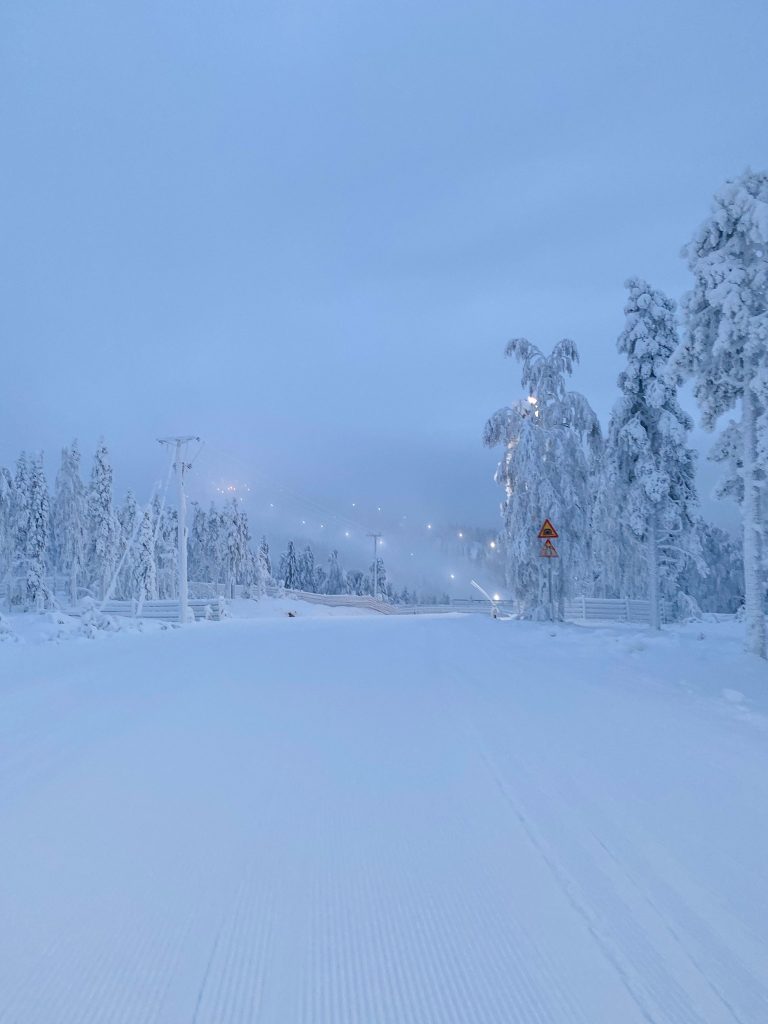
SCANDINAVIA REPORT| The vast majority of ski areas are now open in Scandinavian with the last of the big-name resorts opening at the weekend in time for Christmas. Virus rates are relatively low in Finland and Norway and restrictions there are less extensive than Sweden, where it is relatively high at present. Besides the virus issue, the autumn has been warmer and wetter in Scandinavia than usual and the result of both these factors is that areas have less terrain open than many would like, and thinner bases. Hemsedal (45/96cm / 18/38”), in Norway, has one of the deepest bases and one of the larger areas open in the region with 30km of runs. The region’s biggest resort, Are (35/45cm / 14/ 18”), opened at the weekend and has the most terrain open, some 65km.
SCANDINAVIA FORECAST| It’s a sunny but cold Christmas ahead for much of Scandinavia with clear skies and temperatures 5-20 degrees below freezing forecast up to the weekend. Snowfall is expected for many from Saturday, further improving conditions.
SCOTLAND
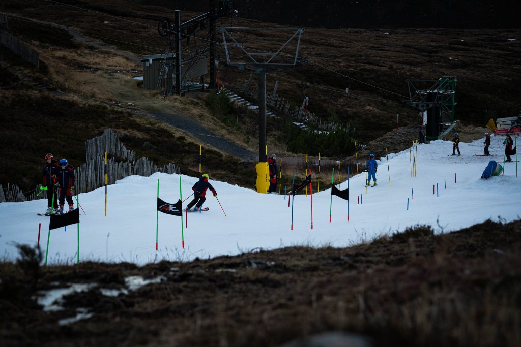
SCOTLAND REPORT| Scotland’s ski season officially began on Saturday, but that day the Scottish Government announced the country was going into lockdown from this coming Saturday, December 26th, for at least three weeks. As a result, Cairngorm has said it is closing from Christmas Eve for the lockdown period; however, Lecht and Glencoe say they’re staying open, as they believe it is permitted to do so, although only locally based skiers are allowed to visit. Glenshee’s plans have not been confirmed at time of compiling this report. In any case, snow cover is currently limited with very little natural snow, it’s mostly all-weather snow-making machines being used to make nursery slopes, sledging areas and runs up to a maximum of about 200 metres.
SCOTLAND FORECAST| The usual mixed bag of weather in the forecast for the Scottish mountains with temperatures varying between about freezing and 10 degrees above. So periods of precipitation will probably fall as rain in the valleys, snow on higher slopes. The weekend forecast looks set to bring serious snowfall to the slopes.
SPAIN / ANDORRA
SPAIN / ANDORRA REPORT| Only half-a-dozen Spanish areas are currently open due to the pandemic but they do include some of the country’s largest centres. Ski areas in Andorra and France will be closed into January. There has been more fresh snow for the Pyrenees and Baqueira Beret (60/70cm / 24/28”) has opened a little more terrain, now with nearly 40km of runs open. Sierra Nevada (40/100cm / 16/40”), in the south, has the country’s highest slopes, deepest reported base and 26 runs open at present.
SPAIN / ANDORRA FORECAST| It should stay close to freezing and drop below from around Christmas Eve with light to moderate snowfall expected on Christmas day and the 26th, then clear skies again from the latter half of the weekend.
BULGARIA / ROMANIA REPORT
BULGARIA / ROMANIA REPORT| The 2020-21 ski season got underway in Bulgaria at the weekend, although not all areas are open yet. Bansko (0/60cm / 0/24″) has reported great sunny weather with fresh snow cover to start the season there. Therefore, looking much better than just a few weeks ago. Borovets, however, says they don’t have enough snow cover to open for Christmas; lifts are running for sightseers. Temperatures remain quite warm, particularly down at mountain bases which have been seeing daytime highs ten degrees above freezing, closer to zero on the mountain.
BULGARIA / ROMANIA FORECAST| It is getting colder in Bulgaria, although it’s likely to stay well above freezing at bases. On the mountain though heavy snowfall is forecast over the weekend with some areas potentially seeing 60cm (two feet) of snowfall.
CZECH REPUBLIC / SLOVAKIA

CZECH REPUBLIC / SLOVAKIA REPORT| Ski areas in the Czech Republic joined those in Slovakia opening at the weekend, including the country’s biggest resorts like Špindlerův Mlýn (40/42cm / 16/17”). Conditions remain rather marginal across the region with fairly limited terrain open at all areas, usually just a handful of runs partly due to limited early season cover, partly virus restrictions.
CZECH REPUBLIC / SLOVAKIA FORECAST| A little warm (a few degrees above freezing) over the next few days and it’s 50/50 whether precipitation falls as snow or rain. It will be getting below freezing from Friday (Christmas Day) with a white Christmas weekend and snow forecast from then on.
NORTH AMERICA
NORTH AMERICA INTRO| Conditions in the northeast of the continent saw a dramatic improvement in many areas with a big snowstorm last Thursday bringing up to 30 inches (75cm) of fresh snow to New York state, New Hampshire, Vermont and others. Ski resorts that had been shuffling around machine-made snow to open a few runs suddenly found their entire mountains buried in powder.
There has also been more snowfall in the Rockies and for most ski areas on the western side of the continent, although coronavirus operating restrictions also remain very tight. Several leading areas are reporting lift tickets sold out over Christmas and new year as increased demand meets limited supply.
In Canada, one resort has passed the 4 metres (13 feet) base depth mark, the first in the world to do so this season. But there have also been a few virus infection clusters among staff at two resorts. In the east, where resorts have suffered a warm and wet autumn until a week or so back, conditions are now improving.
ROCKIES
ROCKIES REPORT| It has been a snowy week in the Rockies after the rather warm and dry autumn, greatly improving conditions and leading resorts to open up much more terrain. Some have reported as much as two feet (60cm) of fresh snowfall in the past seven days. Along with the good news that more can open, the bad news has been an increasing avalanche danger with The Colorado Avalanche Information Center saying more than 300 avalanches have been reported in the past week, about a third of them human triggered. Two, sadly, caused fatalities (one of two skiers), the other, Crested Butte ski patroller and prolific backcountry skier Jeff Schneider. The Colorado Avalanche Information Center warn of the most unstable snowpack since 2012 at present due to climatic and snow conditions and variations in recent weeks and months. Wolf Creek Ski Area (62/76” / 155/191cm), which was the first ski area in the west to open for the 21-22 season two months ago now, is posting the region’s deepest base.
ROCKIES FORECAST| Conditions are dry again this week for much of the Rockies after a snowy end to last week and it will remain dry for most through the Christmas weekend. From Sunday a series of snowstorms are expected to begin moving through with significant fresh accumulations likely by New Year’s Day.
USA WEST
USA WEST REPORT| Quite a mixed picture on the US West with some of the big-name ski areas in California’s Sierras reporting up to two feet (60cm) of snowfall over the weekend, to resorts in the Pacific northwest reporting rain as well as snow. Some areas in the far south are not opening yet as it remains too warm for snow-making or adequate natural snowfall. It’s not been that great further north either with ski areas up in Alaska having a mixed run-up to the season start, although most there have opened for the season in the past week. Mt Baker (87/87″ / 218/218cm) has the deepest base in the region. The virus remains especially bad in California where most resort facilities are closed and non-essential travel banned but, so far, ski areas remain open.
USA WEST FORECAST| A mixture of sunny and overcast days for the week ahead, with temperatures falling away. They’re already well below freezing on the mountain for most areas, but some have temps 5-10 degrees above freezing in the daytime down at their bases. The best chance for snowfall looks to be the coming weekend, particularly Sunday.
USA MIDWEST REPORT
MIDWEST REPORT| Almost all ski areas in the Midwest are now open for the season, with just a handful staying closed over Christmas due to inadequate snow cover. Unfortunately, daytime temperatures in recent days have been climbing above freezing in many Midwest states, not helpful for snow cover although overnights have allowed some to continue snow-making top-ups. Ski Brule (49/57″ / 122/142cm), in Michigan, reports the deepest base in the region.
MIDWEST FORECAST| It will be much colder over the coming week with temperatures below freezing night and day for most ski areas in the Midwest. Better still, after the recent dry weather, snowfall is expected on Wednesday/Thursday bringing 4-8 inches (10-20cm) of natural snowfall to most areas. Drier to end the week but very cold so good for more snow-making.
USA EAST
USA EAST REPORT| As mentioned in our introduction there were some huge snowfalls in the Northeast last Thursday which transformed the rather poor start-of-season conditions after the often warm and wet autumn at many areas, which suddenly found themselves feet deep in snow. There were initial problems with roads and lifts buried, but once those were cleared many powder days were enjoyed. Among the bigger totals reported were two feet (60cm) at Bromley Mountain (24/53” / 60/127cm), in Vermont, and (20 inches) 50cm at Pats Peak (18/30” / 45/76cm), in New Hampshire, for opening day. Temperatures dropped to very cold (10-20 degrees below freezing) and sunshine returned over the weekend.
USA EAST FORECAST| It has been drier and warmer after the recent snowfalls but a new snowstorm is moving in and should hit the East around Christmas Eve bringing plenty of precipitation, although later on strong winds are forecast through Christmas day and the start of the weekend. Hopefully, most ski areas in the region will receive more snow but there is a danger some in more marginal locations will see more rain than snow.
CANADA
CANADA WEST
CANADA WEST REPORT| Western Canadian ski areas have been posting some very snowy images over the past week with many areas in Alberta and BC reporting 20-65cm (8-26 inches) of fresh snow since the weekend and ever more terrain open. Kicking Horse (181/418cm / 71/167”) is the first ski area in the world this season to go past the 4 metre base depth mark following more than 65cm (26 inches) of snowfall since Saturday. Unfortunately, the region is under tight coronavirus operating restrictions with non-essential travel not permitted and there have been infection clusters in staff quarters at both Big White, in BC, and Nakiska, in Alberta, although both remain open with no reported danger to skiers who follow pandemic operating procedures.
CANADA WEST FORECAST| It’s very cold and clear midweek in western Canada with most resorts seeing temperatures 10-20 degrees below freezing. Things are looking increasingly snowy again towards the end of the week and into the weekend.
CANADA EAST
CANADA EAST REPORT| This time last week Eastern Canada was unusual in that ski areas could open (no virus restrictions stopping them), but most weren’t able to as they didn’t have adequate snow cover. But several weeks of low temperatures followed by 10-20cm (4-8 inch) snowfalls over the weekend has led most to be open for Christmas now, although here too virus restrictions are at a high level. Tremblant (31/74cm / 12/30”) is posting both the deepest snow and the most terrain open but it’s still not massive, somewhere between a quarter and a third of its capacity. So things remain far from normal.
CANADA EAST FORECAST| Sadly, the spell of warm weather in the east does not look to be over as after recent very cold temperatures it may shoot well above freezing on Christmas Eve and Christmas Day with rain in the forecast more than snow. This warm snap will pass quickly though with a return to cold temperatures, 5 to 20 below freezing, from the 26th (Saturday). Not much snow forecast though.
ASIA
JAPAN REPORT| It has been quite a week on Japanese ski slopes, and indeed across the wider Japanese mountains, with up to 3 metres (10 feet) of snowfall reported in the last 7 days at some ski areas including Myoko. This has been part of a major weather event in the country that caused lots of travel issues and power outages, despite the famous national efficiency, due to the scale and speed of the snowfall. Niseko (120/200cm / 48/80”) reported two metres (80 inches) of snowfall over the past week, Nozawa Onsen, (175/215cm / 70/86″), which has debuted its new gondola, around 1.5 metres (five feet). It’s all great news after last season’s warmest, lowest-snow-ever stats for many of the country’s ski regions. This feels like a return to normal.
JAPAN FORECAST| After a brief lull in the snowfall, with temperatures staying close to zero, snowfall resumes from Thursday to Sunday.


