WORLD SNOW ROUNDUP #105
Issued: 18 September 2019
By Patrick “Snowhunter” Thorne
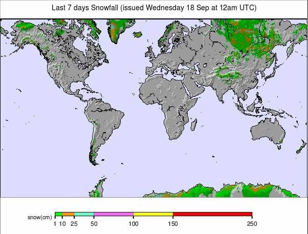
Our latest roundup of snow conditions around the world. Each section that follows below goes into detail country by country. Clicking the map thumbnail will take you to our dynamic snow forecast map for the latest detail (where you can also overlay live weather & reported conditions). Weather outlooks for Europe and North America can be found at the end of this roundup.
INTRODUCTION:
It is beginning to feel a little like the start of the end of the season in the southern hemisphere where most ski areas will be closing over the next three weekends. Indeed, two of South America’s biggest names: Las Leñas, in Argentina, and El Colorado, in Chile, have already called it a day for the 2019 winter and moved to summer operations. Generally, temperatures are gradually climbing and the amount of snowfall is diminishing in many areas; however, New Zealand saw quite a lot of fresh snowfall in the latter half of last week.
Things have turned much more wintry in the northern hemisphere with significant snowfall on higher slopes in Europe and North America over the past week. As a consequence, the level of excitement have been rising.
Although the 2019-20 season in Canada and the US remains about a month off, in Europe the number of glacier areas open is increasing with three new openings in Austria and Italy at the weekend; the same number of open ski areas as last July. At least one more will open this week and by the end of this month we’ll be back in to double figures.
INDEX:
Australia / New Zealand / Argentina / Chile / South Africa / Lesotho / Austria / France / Switzerland / Italy / Andorra / Norway/Sweden / Germany / Bulgaria / Japan / Scotland / USA / Canada / South America Weather Outlook / Southern Hemisphere / Europe Weather Outlook / North America Weather Outlook
AUSTRALIA
Australia has had a mostly dry week with temperatures climbing well above freezing and reaching double digits Celcius at times during the day; however, temps are generally dropping back down below freezing overnight. As a result, there have been some glorious sunny days on the slopes and with the snow still lying deep at most areas, thawing isn’t a big problem as yet. Several Aussie ski areas, that had planned to close for the season in less than a fortnight now, say they’ll stay open into October. Mt Hotham (110/136) which reports more than 50cm of spring snowfall so far this month is one, saying they’ll stay open for an extra week until the end of the school holidays in Victoria (with the slopes now staying open until Sunday 6 October). Perisher (222/222cm) is also staying open an extra week.
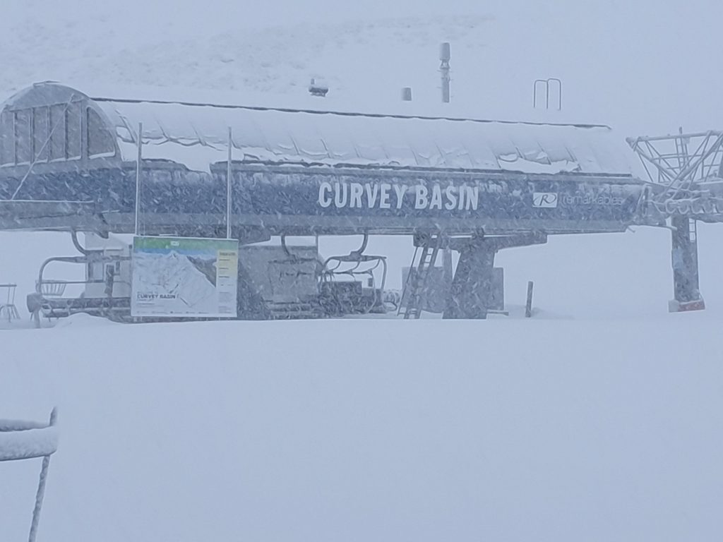
NEW ZEALAND
New Zealand’s ski areas have seen the snowiest week of pretty much everywhere north or south of the equator after the previous “snowy everywhere” week. That said there have not been any really massive falls; 10-30cm accumulations for most Kiwi ski centres since the end of last week. Friday was a particularly snowy day in the country with several areas reporting 10-20cm in 24 hours. The issue of strong winds occasionally closing slopes has been a factor for much of the latter half of this season and the problem shows no real sign of easing. Coronet Peak (45/125cm) was closed on Thursday due to strong winds although it says it’s actually its first closure day of the whole winter. Others had similar issues at times but there have been more great days straight after the stormy, snowy weather.
ARGENTINA
There’s a definite ‘end of the season’ feel in Argentina with one of the country’s largest resorts, Las Leñas, which had been struggling with low snow cover for the past month, deciding to call it a day early and closing down its ski operations and moving quickly in to summer mountain sports mode. Although most other Argentinan ski areas will close in the next week or two as well, so far the other leading areas in the country continue to operate, although only small snowfalls have been reported this week. Cerro Castor (90/200cm), in the south of the country, has the deepest snow and reports all runs open. Cerro Catedral (43/110cm), the biggest area and that got a dusting of snow at the end of last week has the most terrain open with more than 30 runs to enjoy.
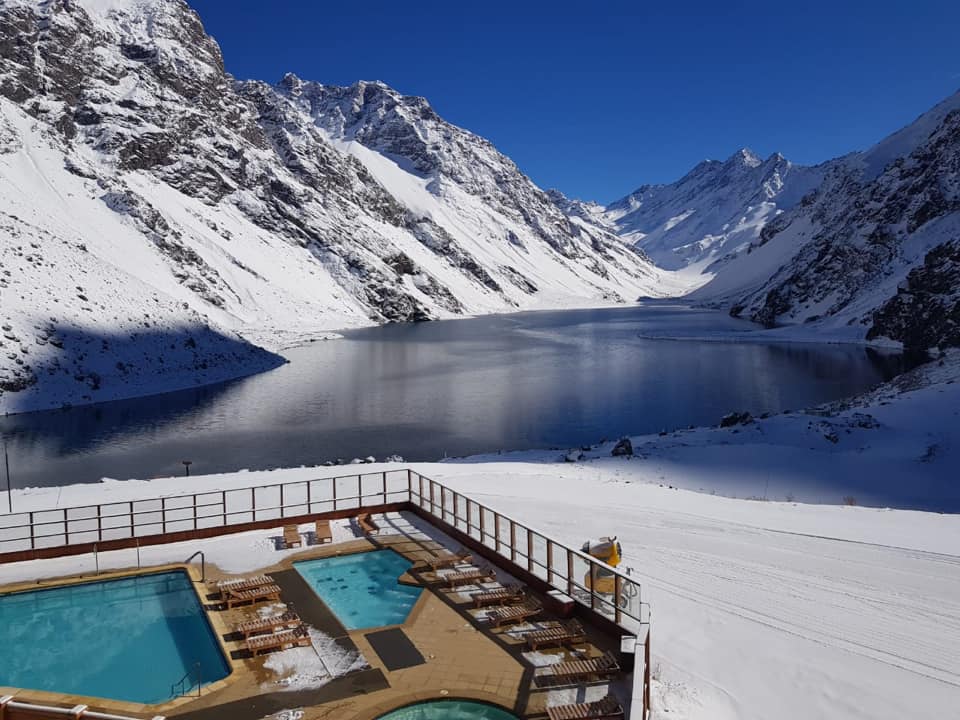
CHILE
The season is almost over for most resorts in Chile with poor snow conditions the norm through winter 2019. Some areas are claiming the country has had the least snow since the 1950s; they will be relieved it’s over. El Colorado was the first of the country’s big-name resorts to call it a day on the season last week and are already looking ahead to 2020 on their website. Rather ironically, temperatures were sub-zero with snow falling there at the weekend. Nevados de Chillan (100/200cm), which has been posting the best conditions all winter in Chile, continue to look like the best bet. The ski area is due to stay open to the end of the month.
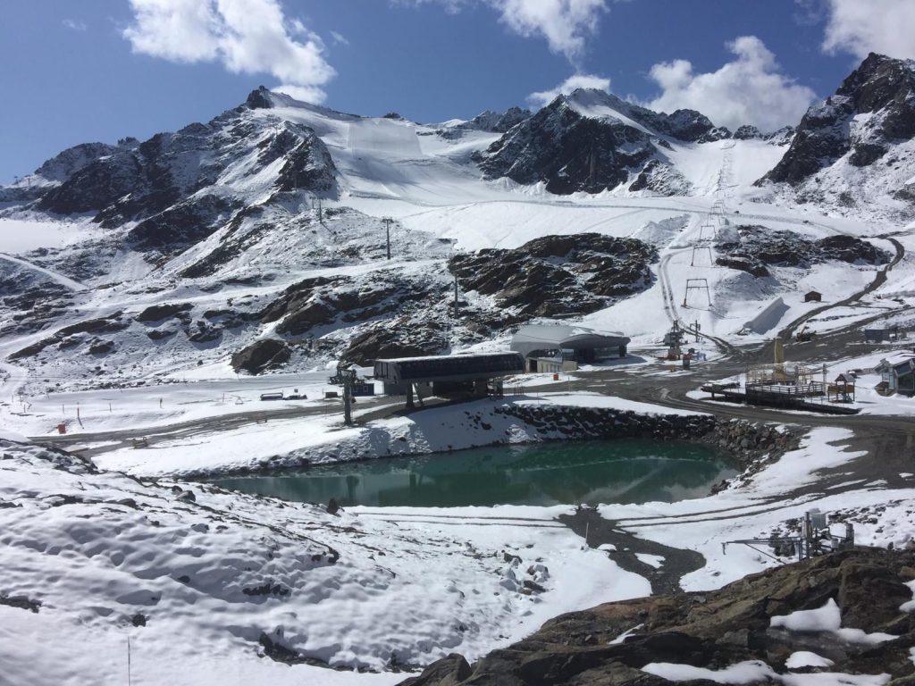
AUSTRIA
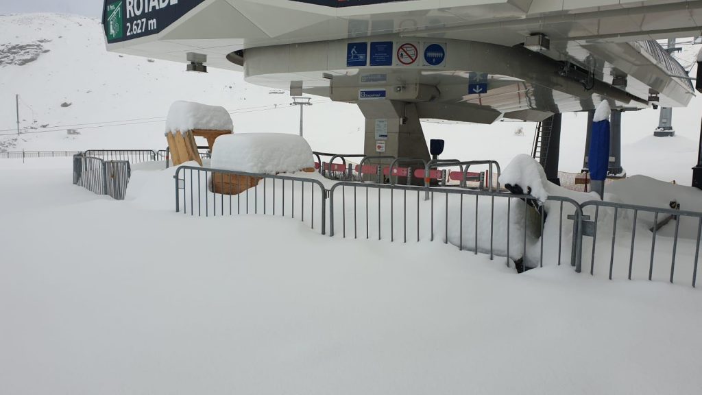
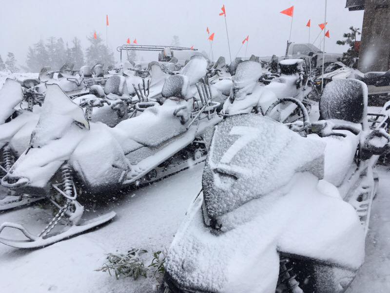
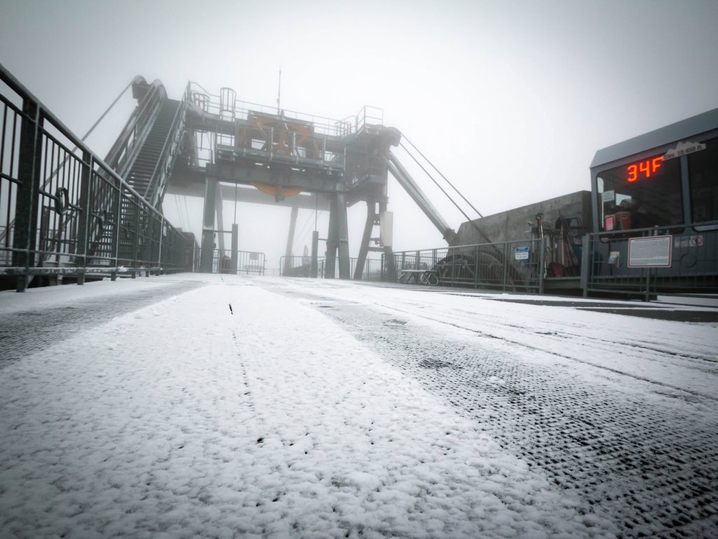
Things have started to take off in Austria with the 2019-20 ski season starting at two ski areas in the Tirol at the weekend after the big snowfalls there a week ago. The Stubai (0/55cm) and Solden (5/51cm) both opened for the season on Friday, 13th September, each with just a couple of lifts and runs operating initially. The Stubai had reported 55cm of fresh snowfall in the previous week’s storm whilst Solden was opening ahead of hosting the first World Cup ski races of the 2019-20 season next month. They join already open, year-round Hintertux (0/45cm) which, with 20km of runs open, has the biggest ski area currently skiable north of the equator. Two more Austrian areas, the Dachstein glacier and Molltal glacier say they’ll re-open when there’s more fresh snow. The latter should be open now but has closed temporarily due to lack of snow cover on its glacial ice following the hot summer; however, it does look white again in the cam images. In any case, a fourth Austrian area, Pitztal, will open next weekend and a fifth, Kaunertal, the weekend after (the last weekend of September). This means at least half the open ski areas in the Alps, this month, will be in Austria and all or most in the Tirol region.
FRANCE

There was heavy snowfall above 2,000 metres altitude in the French Alps early last week with snow falling on slopes in the French Pyrenees too. Although nowhere in France is currently open for snow-sports this is hopefully good news for the planned opening of Tignes at the end of next week, for its 2019-20 season.
SWITZERLAND

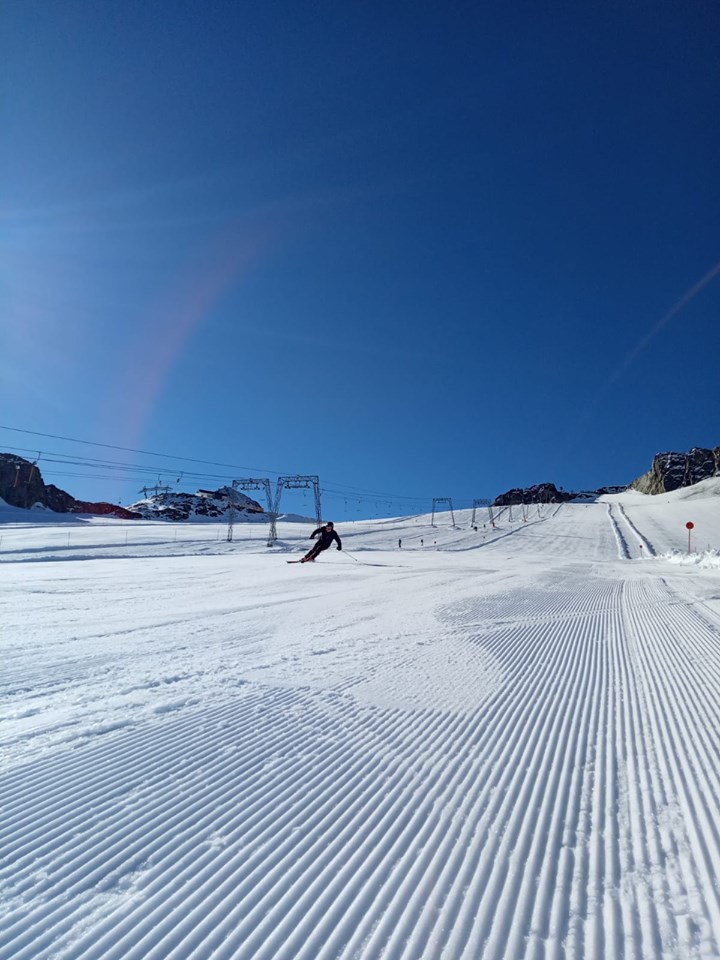
The snowfall that ended a week ago on higher slopes in Switzerland has melted again from non-glacier slopes but for the two open resorts, year-round Zermatt (0/200cm) and Saas Fee (0/50cm) the weather has definitely bolstered conditions on the glaciers with base depths growing for the first time since last spring. It has been mostly sunny conditions with 132km of piste currently reported open at Saas Fee and 15km above Zermatt.
ITALY

Last week saw the number of ski areas open in Italy drop to one (Passo Stelvio, 5/190cm) after Cervinia ended its summer skiing just as a huge 50cm September snowfall blessed its slopes. The snow was good news for Passo Stelvio though, greatly refreshing depleted cover on the glacier where the base has grown 40cm compared to a week ago. The number of open Italian areas is back to two since Saturday as well with the glacier area of Val Senales opening for its eight month 2019-20 ski season at the weekend.
ANDORRA
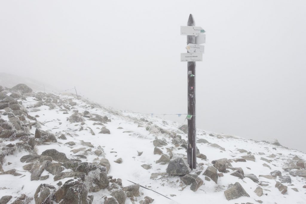
There are currently no ski areas open in Andorra or the wider Pyrenees. Winter sports will resume here next autumn. However, the first fresh snow of the autumn fell on higher slopes in the Pyrenees last week, raising anticipation levels.
NORWAY/SWEDEN

The Galdhoppigen ski area, which re-opened last week after its unexpected closure due to warm temperatures through August, is now operating normally; however, it was closed at the weekend by gale-force winds. Since then there has been more fresh snow with a covering also reported on higher slopes and the more northerly latitudes on Tuesday morning at ski areas across Norway, including Roldal and Voss. Next to open will be Ruka, in Finland, which uses snow ‘farmed’ (stockpiled) from last season to spread on three pistes to get the season started in just over a fortnight’s time; at the start of October.
GERMANY

There are currently no ski areas open in Germany, other than the country’s half-dozen indoor snow centres. Outdoor winter sports will resume here next autumn.
BULGARIA
There are currently believed to be no ski areas open in Bulgaria or anywhere in Eastern Europe. Winter sports will resume in the region in the autumn.
JAPAN
There are currently believed to be no ski areas open in Japan. Winter sports will resume in the region in the autumn. Low temperatures were reported in some ski regions over the past week; however, not yet quite low enough for early snow.
SCOTLAND

There are currently no ski areas open in Scotland other than the Snow Factor indoor snow centre and the country’s dry slopes. Winter sports will resume in the region in the autumn.
USA

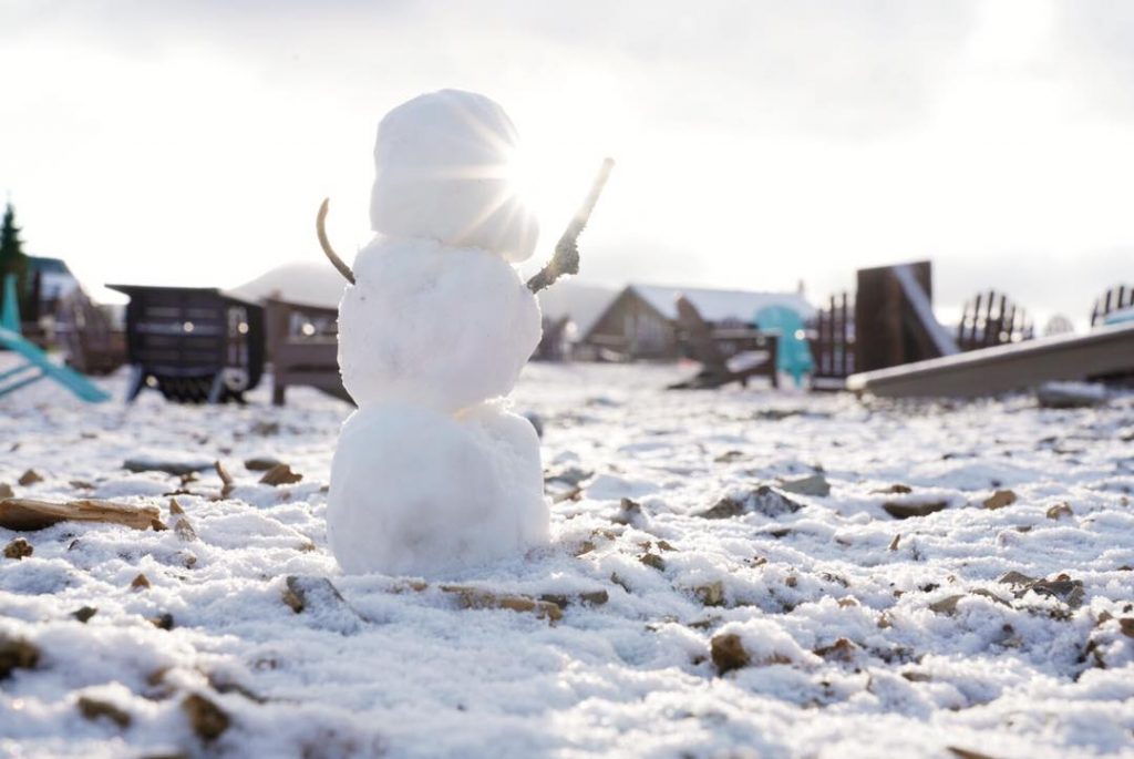
There has been excitement in the US over the past week with the first significant snowfall of 2019-20 reported on high slopes in northwestern states including Utah, Wyoming and Montana although the snowfall was as far south as Colorado. Up to 25cm (10 inches) accumulations were reported at resorts like Jackson Hole and at Keystone (they made a small snowman). The latest snowfalls were in the Tahoe region of California on Mondat where most resorts posted images and video of light September snow cover. US ski areas will most likely begin opening from mid-October with at least half-a-dozen in the battle to be first to open for the season in the country.
CANADA

There are currently no ski areas open in Canada. Outdoor winter sports will resume here next autumn. Usually, ski areas in Alberta including Sunshine, Lake Louise, Mt Norquay and Nakiska are amongst the first to open for the season at the very start of November. Sunshine posted images of more fresh snow on its higher slopes last week.
SOUTHERN HEMISPHERE WEATHER OUTLOOK
In Australia it looks like mostly sunny weather ahead with any precipitation that does arrive most likely falling as rain rather than snow now. That’s because temperatures are continuing to climb with daytime double digits above freezing increasingly the norm, although a return to freezing temperatures overnight on the ski slopes is still forecast at most areas for the next week at least.
After another often snowy week for most parts of New Zealand, it’s looking rather calmer over the coming week with clear sunny days dominating the forecast into the weekend, after the last of the snow flurries finish. Temperatures may also start climbing a little; looking to get a little above freezing towards the weekend.
For the Andes, there are fluctuating conditions as we move further into meteorological spring or late astronomical winter. Some ski areas will see temperatures hit double digits below overnight and there’s the potential of 20-30cm more snowfall over the next week; others will remain dry. In either case, temperatures will be climbing above freezing and sometimes top double digits above freezing in the daytime down at resort level; real springtime stuff.
EUROPEAN WEATHER OUTLOOK

After the snowy weather during the weekend before last it has been mostly dry and sunny in the Alps and that remains the case for the next few days; however, some precipitation is in the forecast for later this week which could fall as fresh snow up high, albeit with just a few centimetres currently expected; nothing too significant.
NORTH AMERICAN WEATHER OUTLOOK

With the 19-20 ski season quickly approaching in Canada and the US, the temperatures are continuing to drop and the forecast is for more snow on higher slopes in the northwestern US and in western Canada with ski areas like Revelstoke and Whistler potentially seeing as much as 30cm of snow on higher slopes, 5-10cm more likely the norm up high elsewhere.


