WORD SNOW ROUNDUP #101
Issued: 21 August 2019
By Patrick “Snowhunter” Thorne
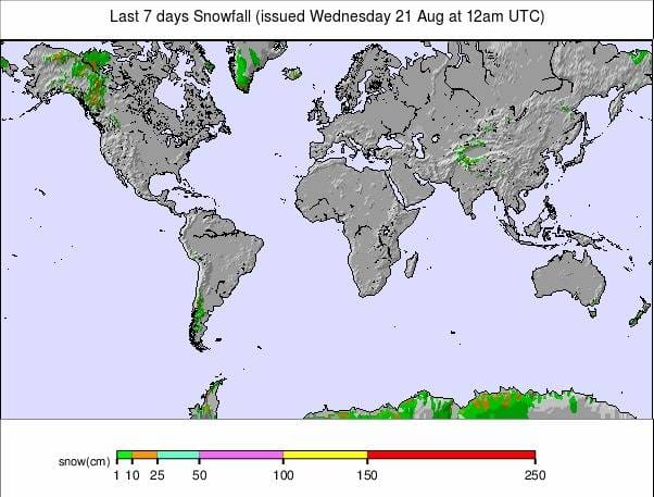
Our latest roundup of snow conditions around the world. Each section that follows below goes into detail country by country. Clicking the map thumbnail will take you to our dynamic snow forecast map for the latest detail (where you can also overlay live weather & reported conditions). Weather outlooks for Europe and North America can be found at the end of this roundup.
INTRODUCTION:
There are some signs of changing seasons around the world with fresh snow falling in both Europe and North America in the past few days, as well as south of the equator in South America, Australia and New Zealand.
The snowfall in the north was up high on Alpine glaciers or at northerly latitudes in Scandinavia and north-western North America but it could be taken as a sign that autumn is less than a fortnight away by the meteorological measure.
In the southern hemisphere it was more full-on winter weather, particularly welcome in New Zealand and boosting already good conditions in Australia and Argentina, the former saying snow depths are now heading towards being the best for two decades.
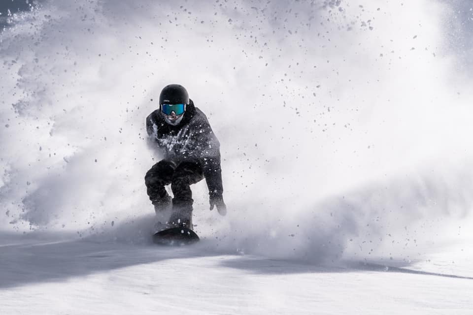
New Zealand saw some particularly spectacular snowfalls with resulting great powder conditions and it looks like there’s plenty more on the way for the week ahead as the country enjoys a late spurt to its slow-starting 2019 season.
In another sign of change though, in Southern Africa, we’re into the final days of the 2019 season with the small ski areas in Lesotho and South Africa getting near to their closing days for another year.
INDEX:
Australia / New Zealand / Argentina / Chile / South Africa / Lesotho / Austria / France / Switzerland / Italy / Andorra / Norway/Sweden / Germany / Bulgaria / Japan / Scotland / USA / Canada / South America Weather Outlook / Southern Hemisphere / Europe Weather Outlook / North America Weather Outlook

AUSTRALIA
It has been snowing once again in Australia as the country enjoys one of the best seasons of the century. Indeed local reports are claiming that with more snow forecast some ski areas are on the brink of setting âbest for 20 yearsâ natural snow depth levels. With resorts reporting 20-30cm more snowfall since the weekend the country’s largest ski area, Perisher (202/202cm) has gone through the two-metre base depth mark joining Thredbo (127/218cm) which was already up there. Both areas reported another 20cm of fresh snow on Monday and great powder conditions to start this week as a result. But conditions are looking good across the country and most areas are anywhere between 75% and 100% open as we near the final month on the season for most.
NEW ZEALAND
Base depths are continuing to build in New Zealand as ski areas recover lost ground this season and open more terrain, usually with great conditions. The snow has been so heavy that some areas have been forced to close for periods whilst stormbound but then re-open to superb conditions, as was the case at Mt Hutt (130/200cm) on Sunday when it re-opened with blue skies and perfect powder conditions for what was widely agreed to be the best day of the season so far. Mt Hutt is one of more than half a dozen ski areas in the country to have reached a two-metre upper slope base depth – that’s now more than any other country on the planet. It’s also the only country with a ski area posting a three metre/10 foot upper slope base depth – Manganui (0/300cm). Al the snowfall has led to increased off-piste avalanche danger, however, with video of a massive avalanche set off at Mt Ruapehu going viral, so it is the usual case of being aware of conditions and very cautious before heading out.
ARGENTINA
The excellent winter of 2019 continues in Argentina where the healthy bases were regularly top[ed up again through the past week with some nice moderate snowfalls – enough to give a good layer of powder on the slopes but not enough to cause any operational difficulties! Cerro Castor (75/200cm) is posting the deepest base in the country still and has all of its terrain open but all of Argentina’s areas are fully open, or very nearly so. Cerro Catedral (40/105CM), THE largest area by uplift posted a ‘winter wonderland’ image on Saturday morning after 10cm of fresh snow there and even Las Lenas (25/55cm)
CHILE
There’s been a little fresh snow in Chile but it continues to be one of the worst seasons in recent years with mostly dry weather and temperatures often too warm for snow to fall anyway. It continues to be the case that the further south you head, the better the conditions are likely to be. Navodos de Chillan (100/180cm) is probably the main exception to the Chilean 2019 season rile and has had more fresh snowfall and is [pretty much fully open. At the other end of the scale, Valle Nevado (60/80cm) could still do with more snow although it does have about two-thirds of its groomed runs open now. Portillo (60/139) still reports less than half of its terrain able to open.
SOUTH AFRICA
We are ion to the last week or so of the 2019 ski season at Tiffindell and conditions have been warming up but the centre’s snowmakers have been managing to maintain snow cover, staging the prestigious annual South African Ski Championships at the weekend.
LESOTHO
It’s the last week of the 2019 ski season in Lesotho and what Afriski is describing as an unprecedented warm August has disrupted their, until now, perfect winter skiing conditions and brought spring skiing conditions to the slopes. This has meant the main slope has shrunk to 400 metres, about half its maximum length and the terrain park has been forced to close, although other areas like the nursery slope remain open and cold weather is expected.
AUSTRIA
Austrian ski areas reported from August snowfall above 3,000 metres at the end of last week, with up to 10cm of fresh snow reported at Hiinterux (0/55cm) and on some currently closed (but due to open in about 4 weeks for the 19-20 season) ski areas like the Dachstein and Stubai. Against that bit of brief good news though temperatures are generally above zero and glacier thicknesses at the two open Austrian areas continue to diminish fast and are now starting to reach rather worryingly thin numbers. At Molltal(0/80cm), the other normally open area, the slopes were closed at the start of the week due to fog
FRANCE

Following the earlier-than-hoped-for end of the summer ski season at Les 2 Alpes nearly a fortnight ago there are currently no lift-served snow slopes open in France. Tignes is aiming to open on the last weekend of September for a nine-month season through to May 2020, if conditions on its glacier allow.
SWITZERLAND

Saas Fee and Zermatt (0/200cm) remain the two open ski areas in Switzerland and should be the only two options in the country for the next few months until other glacier areas begin to open in October. Conditions are little changed on a week ago with some great summer ski conditions mixed in with closure days due primarily to foggy or white-out conditions at times.
ITALY

A similar picture to Austria and Switzerland as you would expect with a little fresh snow reported up high last week but temperatures back above freezing and reaching as high as +10C at 3,000 metres over the past few days. Cervinia (0/100cm) skiing on Plateau Rosa was closed on Monday, apparently due to thick fog but the other open area Passo Stevio (150/350cm), continues to report all runs open and all lifts operating.
ANDORRA
There are currently no ski areas open in Andorra or the wider Pyrenees. Winter sports will resume here next autumn.
NORWAY/SWEDEN

There are currently no ski areas open in Scandinavia. Two Norwegian summer ski areas that had aimed to be open through the summer have had to close early as it has been too warm. The Galdhoppigen ski area, in Norway, hopes to re-open during September and Ruka, in Finland, will open at the start of October thanks to snow-farming techniques.
GERMANY

There are currently no ski areas open in Germany, other than the country’s half-dozen indoor snow centres. Outdoor winter sports will resume here next autumn.
BULGARIA
There are currently believed to be no ski areas open in Bulgaria or anywhere in Eastern Europe. Winter sports will resume in the region in the autumn.
JAPAN
Japan’s Gassan ski area which is open from April to July most years, giving the only lift-served outdoor snow sports in the country in June and July is believed to have now closed for 2019.
SCOTLAND

There are currently no ski areas open in Scotland other than the Snow Factor indoor snow centre and the country’s dry slopes. Winter sports will resume in the region in the autumn.
USA

Timberline ski area on Mt Hood in Oregon remains the only ski area open in North America at present. No fresh snowfall has been reported and temperatures are reported to be in the high teens on the slopes but the ski runs and terrain parks remain open between 7am and 2pm daily. This is believed to be the 11th consecutive months of snowsports operations. Timberline normally closes for a month or so in September/October each year, starting its annual total snowfall calculation (currently at 496 inches or 12.6 metres for 2018-19) on the first of September each year. Other ski areas in Colorado are likely to begin opening in less than 8 weeks, subject to conditions in early October.
CANADA

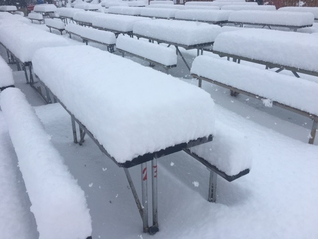
There are currently no ski areas open in Canada. Outdoor winter sports will resume here next autumn – usually, ski areas in Alberta including Sunshine, Lake Louise, Mt Norquay and Nakiska are amongst the first to open for the season at the very start of November. It’s a bit early to be getting excited but Sunshine did indeed report a healthy August snowfall at the top of the slopes over the weekend as up to 3-0cm of snow was reported in Alberta and BC.
SOUTHERN HEMISPHERE WEATHER OUTLOOK
It is forecast to be another snowy week ahead in Australia with 15-25cm more snow expected at almost all of the country’s ski slopes. It’s looking like fairly light snow accumulating a few centimetres a day on most days of the week ahead as temperatures stay down close to zero rather than any big falls currently forecast. Winter may have been a little slow getting started in New Zealand but it seems to be making up for lost ground now with some big snowfalls over the past week set to be followed by some huge accumulations over the next seven days – current models predict more than a metre of snowfall in total for some areas by this time next week and at least 30cm almost everywhere. The snowfall is expected to be continuous through the coming week with Thursday (and though it’s still too far of to be certain) Sunday likely to see the biggest dumps of all. Over in the Andes where Argentina, like Australia, has been having one of its better winters, the snow is still falling and the coming week looks similar to the Aussie one with most Argentinian areas likely to get some snow, most days, just not that much this week. Here to the coming 7-day totals are in the 10-30cm bracket with most areas only getting a few centimetres each day, which should be a nice daily top up if it arrives each day as per forecast. For Chile, once again the forecast is not looking so promising with some snow expected for smaller centres in the south of the country but nothing really likely to bolster the areas further north that need snow more. In Southern Africa, after a mostly warmer than usual August, a cold front has hit Durban and snowmaking teams are on standby in the mountains for the final weekend of the season to make snow at the first sign of the cooler weather up there.
EUROPEAN WEATHER OUTLOOK

It looks like a typical late-summer week ahead in the Alps. There’s a slight chance of more light snowfall midweek on high glacier slopes but mostly we are looking at zero to plus ten temperatures and more thawing rather snow accumulation for the remaining snow cover.
NORTH AMERICAN WEATHER OUTLOOK

After the snowy conditions in the far northwest of the continent in recent days it’s looking less like August snow over the coming week even up at northerly latitudes. That said up around Jasper and at other very northern areas temperatures may drop to 3C ort below at the weekend so another overnight snow covering cannot be ruled out as autumn gets closer.


