Argentina Awaits Much-Needed 40cm Snowfall After Patchy Midwinter
Updated August 20, 2025: Australia readies for a foot (30cm) of snow, Argentina’s Andes eye 15" (42cm), and New Zealand holds deepest base worldwide. Read the full report here.
- Australia Set for Half-Metre Snow Blast
- Mt Hutt Leads New Zealand Slopes as South Island Nears 100% Open
- Chile’s Portillo and Tres Valles Keep 90%+ Terrain Skiable Despite Lows
- Afriski Prepares Final Week of 2025 Season With Main Run Intact
SOUTHERN HEMISPHERE INTRO
We’re less than a fortnight from the start of spring, by the meteorological measure of the seasons, but things have been mostly quite wintry in the Andes, Australia, and New Zealand over the past week. Only Lesotho, which sees the last week of its 2025 season begin next weekend, is starting to warm up a little. Lows down as far as -10°C have been reported in New Zealand, and it’s been well below freezing in Argentina, Australia, and Chile too, with each ski nation reporting periods of fresh light to moderate snowfalls, if not anything huge to report this week. There have been plenty of sunny spells to enjoy it all too.
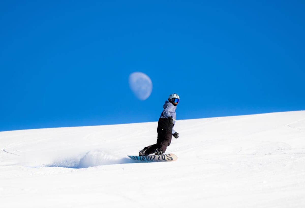
AUSTRALIA REPORT
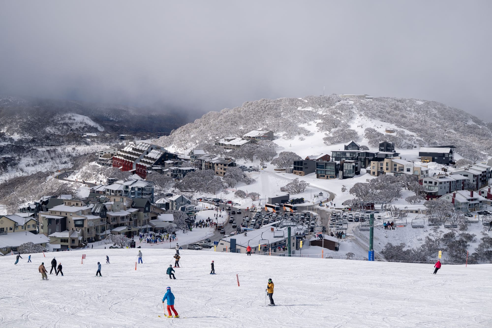
There was a break in Australia’s recent spell of dry weather over the weekend with 10–20cm (4–8”) accumulations across the country’s ski fields. Otherwise, beyond some days of low cloud and limited visibility, it has been mostly sunny conditions continuing. Overnight lows have been down to low single figures, daytime highs climbing to high singles too. But the fresh snow was well timed for some weekend powder skiing. Conditions remain good across the country’s ski areas, with most posting metre (40”) plus bases and most of their slopes open and lifts turning. Perisher (100/160cm / 40/64”) reports the deepest base in the country (and one of the three deepest worldwide) and the most terrain open too, at 60km (37 miles), about 95% of its slopes. That’s also the most of a single ski area open worldwide at present, although Chile’s three-linked ski areas of Tres Valles have nearly double that between them. Thredbo (70/125cm / 28/50”) has the second deepest snowpack and is 90% open, and Hotham (58/117cm / 23/47”) and Falls Creek (64/110cm / 26/44”) are both 95% or more open.
“The flakes were coming down,” said Sarah Gamon, Falls Creek’s Field Marketing Coordinator, on Sunday, by which time they’d received 14cm (6”) of fresh snow. “It might be a chilly morning in the city, but we’re loving it up on the mountain and we’re looking forward to enjoying some beautiful spring riding in the coming weeks!” she added.
AUSTRALIA FORECAST
Heavy snowfall is expected midweek into the weekend, especially across the NSW and Victorian Alps. Up to 30cm (a foot) more is forecast by the weekend, with thundersnow (snow + thunderstorm) possible in alpine regions. Snow levels may drop to 700m, potentially dusting areas like the Blue Mountains.
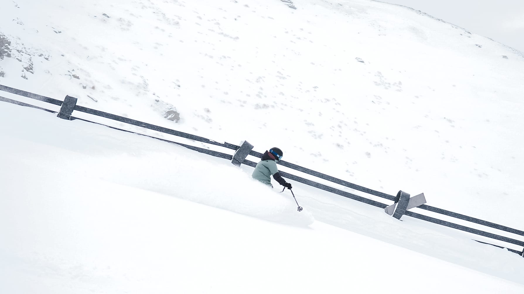
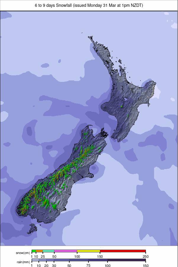
NEW ZEALAND REPORT
The start of the week brought cold weather with some snowfall to New Zealand’s slopes, the snowline dropping as low as 200m on the South Island, nearer 700m on the North. The Remarkables was one of the ski areas posting the most fresh snowfall, reaching 20cm (8”) by Wednesday morning. That meant up at ski slope level temperatures have been mostly below freezing, getting as low as -10°C at some spots overnight, daytime highs only a little above freezing. Mt Hutt (130/165cm / 52/66”) continues to post the country’s and the Southern Hemisphere’s deepest snowpack, and more than 95% of its slopes are open. Most other South Island commercial areas report their runs are 80–90% open, but Treble Cone (42/82cm / 17/33”) and Mt Dobson (55/65cm / 22/26”) are both among the few worldwide posting they’re 100% open. On the North Island, which has had less snowfall so far this season, leaving centres battling to open terrain, Whakapapa (35/40cm / 14/16”) on Mt Ruapehu announced its key Valley T-Bar would open at the weekend, although the thin cover makes the slopes there only really suited to good skiers at present. It means it has jumped from less than 10% open to nearly 40% open now. Its neighbour, Turoa, is also about a third open now, also at a season high.
NEW ZEALAND FORECAST
Drier weather is expected for the latter half of this week with strong cold southerlies sweeping across the country on Wednesday, bringing a wintry chill. By Thursday, a high-pressure ridge should settle over the South Island while cold southerlies persist across the North Island. On Friday, high pressure will drift eastward over New Zealand, with settled weather. Fresh snowfall potential currently looks limited, with cold air more likely to reinforce existing cover than deliver fresh accumulation.
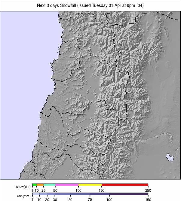
ARGENTINA REPORT
Sunny weather has dominated again for much of the past week in Argentina, meaning, unfortunately, no big improvement in conditions. The best continue to be in the far south with Cerro Castor (65/100cm / 26/40”) reporting both the deepest snow in the country and the highest percentage of terrain open, more than 80% of its runs. By contrast, South America’s largest area, Cerro Catedral (15/30cm / 6/12”) near Bariloche, continues to post less than 10% of its slopes open. Things have started to improve in the last few days with a fresh front moving through and bringing snowfall, though whether it’s too little too late remains to be seen. Although most Argentinian ski areas are still reporting less than half of their terrain open due to the poor snow cover, Cerro Bayo (0/15cm / 0/6”) is reporting nearly 75% of theirs open despite apparently very thin cover. Las Leñas (40/65cm / 16/26”), famed for its epic powder in good seasons, is nearly 50% open now.
ARGENTINA FORECAST
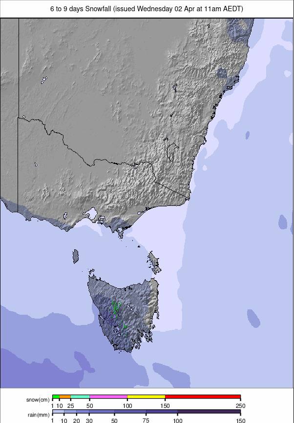
Much-needed fresh snowfall is expected across the Andes, especially in Las Leñas, Catedral Alta Patagonia, and Los Penitentes over the latter half of this week, with up to 42cm (15”) in total forecast at Las Leñas, with other major resorts seeing 15–24cm (6–10”). Snowfall will taper slightly by the weekend but remain steady at higher elevations. A cold air mass will be settling over Patagonia, with mountain temps ranging from –9°C to +4°C depending on elevation.
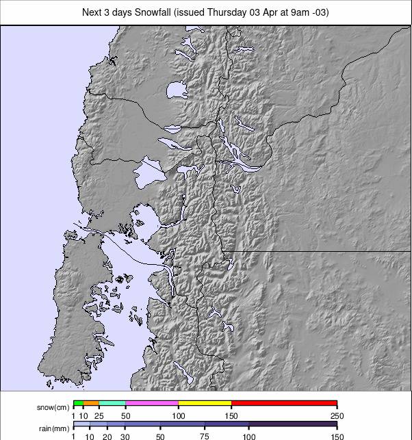
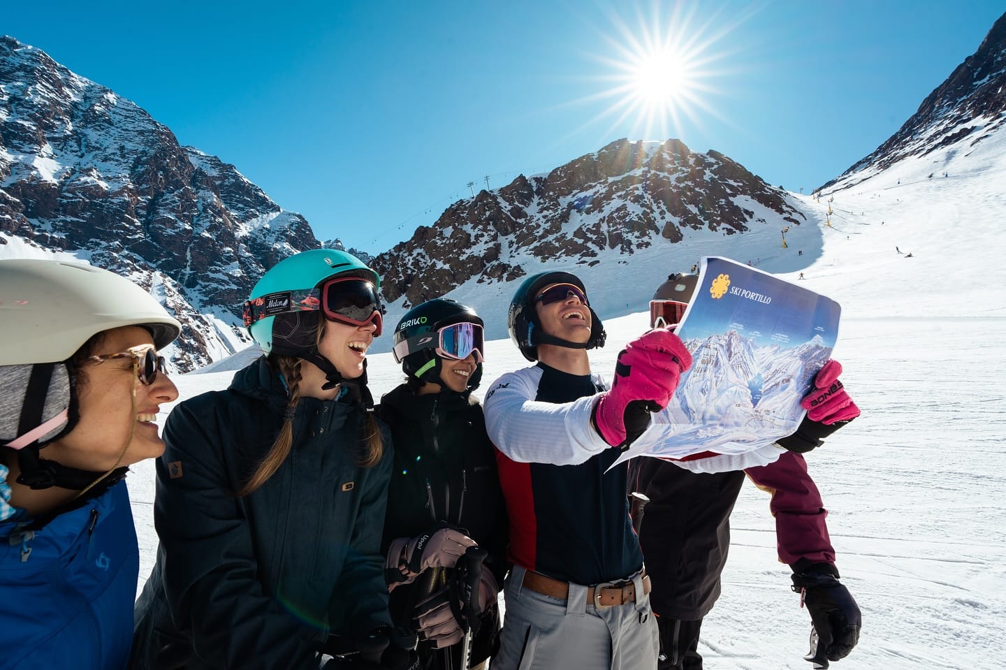
CHILE REPORT
Chile has had a mostly dry and sunny week with just a few snow flurries reported. We’re approaching the final month of the season for most of the country’s ski areas now, and snowfall and snow depth levels remain well below average, but that said, most centres do have most of their terrain open, so it’s a slightly brighter picture than over the border. It’s been cold too, with temperatures down as low as -10°C, highs only getting a few degrees above freezing. Portillo (50/160cm / 20/64”) is posting Chile and South America’s deepest snow and has more than 90% of its terrain open. The Tres Valles is about 90% open, which means about 110km (70 miles) of runs are available between Valle Nevado (20/100cm / 8/40”) – which is one of the few resorts worldwide reporting 100% open right now, along with La Parva (35/125cm / 14/50”) and El Colorado (30/125cm / 12/50”). Some Chilean ski areas are only 50% open or less, though, as in Argentina, including Antillanca (5/65cm / 2/26”), which unfortunately had to postpone a planned freeride competition this past week due to inadequate snow cover.
CHILE FORECAST
Cold alpine conditions will persist, with summit temperatures ranging from –12°C to –4°C across major resorts like Valle Nevado, La Parva, and Portillo. Healthy fresh snowfall is expected across the central and southern Andes, with Pucón leading the pack at up to 31cm (12”). El Colorado, Valle Nevado, and Termas de Chillán are forecast to receive 12–17cm (5–7”), with lighter accumulations at Portillo and La Parva. Snowfall will be heaviest midweek, easing by the weekend, with daytime highs around 1–6°C, supporting snow retention and snowmaking. Freeze-thaw cycles are expected at lower elevations, so snow quality may vary by altitude.
LESOTHO REPORT
We’re approaching the final week of Southern Africa’s 2025 season with Afriski (20/40cm / 8/16”)’s focus continuing to be on their big Winterfest celebrations that mark the end of winter there the weekend after next. The centre’s mile (1.6km) long main run is believed to still be intact despite continuing mostly sunny weather and temperatures getting ever warmer now, with overnight lows only just touching freezing and daytime highs getting above +10°C.
LESOTHO FORECAST
Afriski should stay mostly dry from 20–24 August, with no significant snowfall expected. Temperatures range from 1°C to 20°C, and freezing levels remain well above summit height. Winds increase midweek, but snow depths remain modest, with no fresh accumulation since early August.