Cerro Castor Leads Argentina With 80% Open Slopes Amid Patchy Coverage
Updated August 13, 2025: NZ scores 20" fresh, Aussie resorts near 100% open, Chile boasts S. Hemisphere’s deepest base, while Argentina still battles thin cover.
- Half-Metre Snowfall Revives New Zealand Club Fields After Tough Season
- Perisher Takes Deepest Snow Title in Australia With Near-Full Operations
- Portillo Sports Deepest Snow in Southern Hemisphere, Near-Full Chilean Slopes
- Afriski Nears Winterfest Finale With Full Run Open Despite Bare Surroundings
SOUTHERN HEMISPHERE INTRO
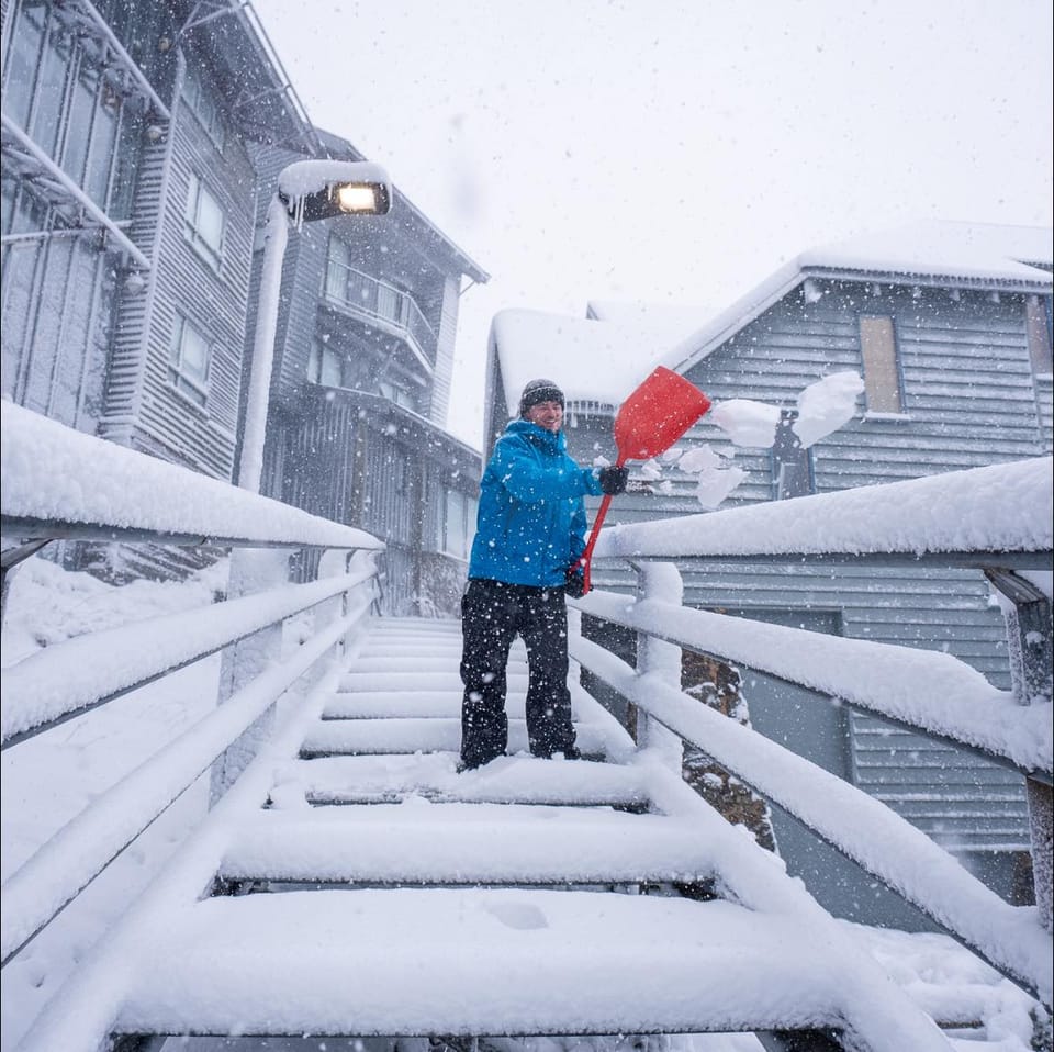
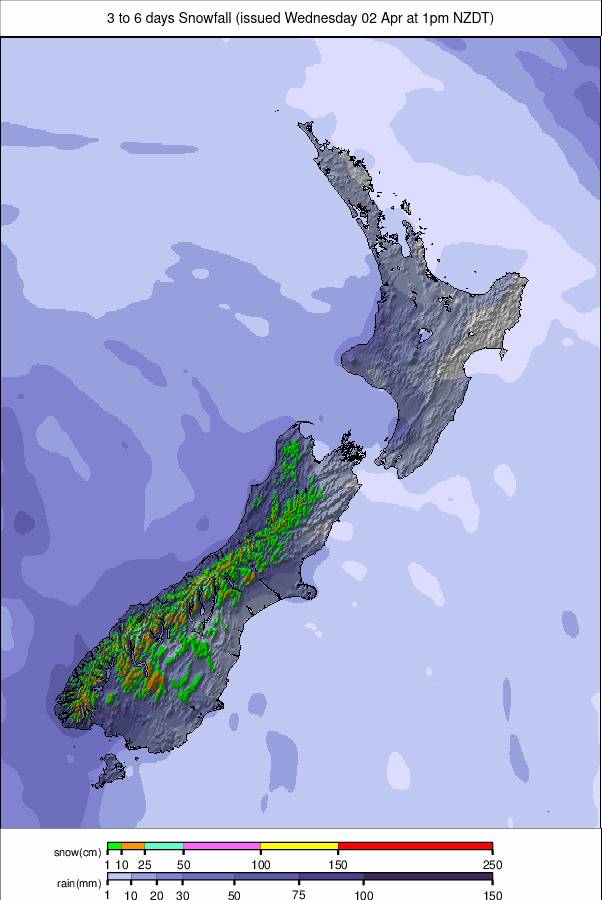
Although there’s been some more snowfall in the Andes, the most fresh snow has been reported in New Zealand this week, with up to half a metre recorded. That's allowed some of the country's club fields without snowmaking, which hadn't managed to open at all this year to date, to do so. Elsewhere, Australia and Chile continue to lead the way in terms of snow depths and open terrain, with most resorts in both areas close to full slope openings, and many now posting snow a metre deep or more. Alas, most ski areas in Argentina continue to suffer despite some good snowfalls at the start of the month, with many still posting only 10–25% of their slopes open due to thin cover. It's the same story on New Zealand's North Island. Both have seen some improvement over the past week, though nothing hugely transformational. The season also continues in southern Africa at Lesotho's Afriski centre. There's just over a fortnight of the 2025 season left to run here, culminating with their Winterfest celebrations at the end of the month.
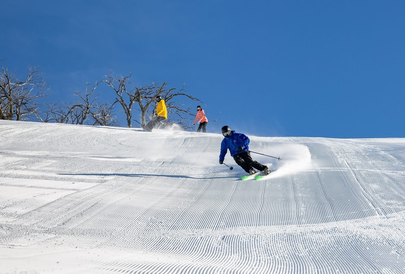
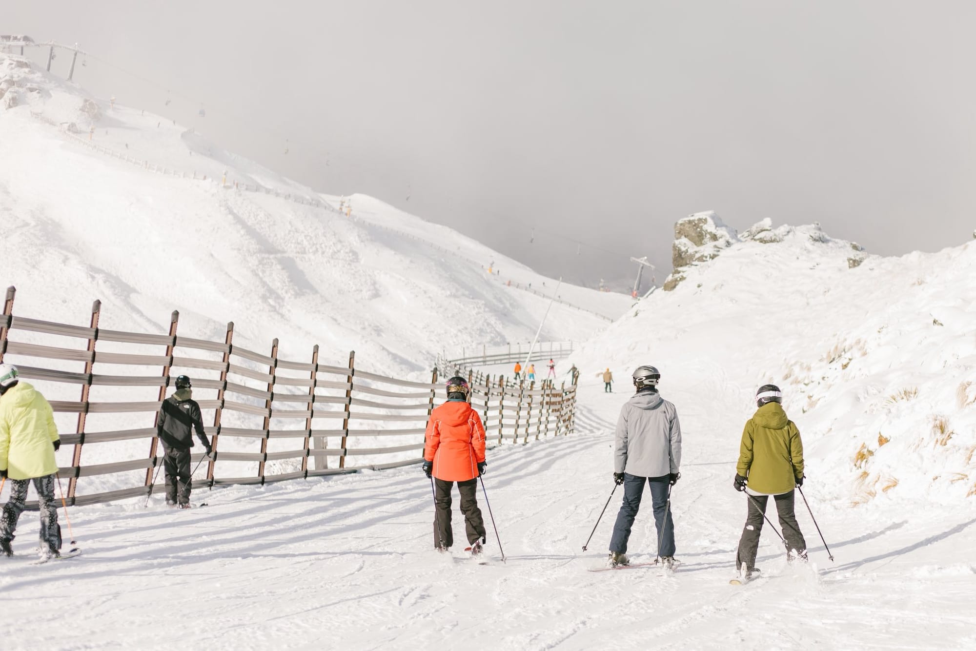
AUSTRALIA REPORT
After the excellent first half of the season for Australian ski areas, the series of snowstorms has taken a break over the last week, with dry, sunny conditions dominating. Daytime highs have been a little warm, reaching as high as +12°C at resort bases in the afternoons, but it's still dropped 1–5 degrees below freezing overnight. Aussie areas remain at or close to full operations, with the largest centre, Perisher (80/150cm / 32/60") now also posting the country's deepest snow. Its runs are around 90% open, delivering about 60km (38 miles) of terrain, the most of any single area in the world at present. Mt Hotham (58/117cm / 23/47") has an even higher percentage of its terrain open at 95%, as does Falls Creek (64/115cm / 26/46”).
AUSTRALIA FORECAST
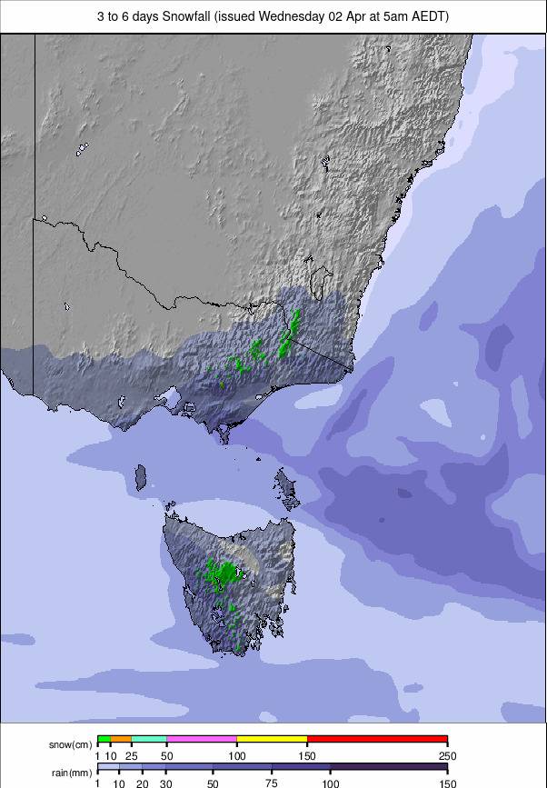
Australian ski areas are expected to see a wintry shift from the end of the week. After a dry start, a cold front is expected to bring rain, turning to snow across the Australian Alps, with some areas forecast to receive up to 25cm (10”). Snowfall should continue into Saturday and Sunday, with freezing overnight temperatures aiding snowmaking. Conditions look promising for fresh cover and solid weekend skiing.
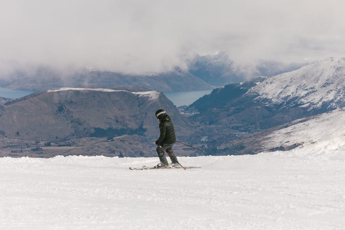
NEW ZEALAND REPORT
A good week overall for New Zealand’s ski areas, with snowfall—heaviest for most at the weekend—giving a welcome refresh to the South Island’s slopes. Mt Hutt (130/168cm / 52/67”) continues to post the world’s third-deepest base at present and has almost all of its slopes open. The snowfall has been good news for some of New Zealand's club fields, which, lacking snowmaking, have had a challenging winter with warm temperatures (July was the country’s fourth warmest on record) and/or a lack of snowfall, and were yet to open. That's led to reports that this could be the first season some fail to open, with climate change blamed.
However, Broken River, which had been reported to be one of them, opened for its 2025 season thanks to the snowfall this past weekend. A front moved through at the start of the week, bringing a mix of rain, sleet, and fresh snowfall. Mt Lyford and Hanmer Springs Ski Areas, which had opened previously but were forced to close again, also reopened at the weekend after about half a metre of snowfall.
Hanmer Springs described snow cover as:
“...a little variable, very thin in places and then good pockets of wind-blown powder.”
Conditions remain challenging on the North Island, but Turoa (55/80cm / 22/32") and Whakapapa (30/28cm / 12/15") have managed to open slightly more terrain after dealing first with strong winds and iced-up infrastructure. They are each about 10% open, now reporting the best conditions of winter so far.
NEW ZEALAND FORECAST
New Zealand’s ski fields are forecast to stay mostly dry, with cool temperatures and light winds. Daytime highs on the slopes should be around 5–7°C and overnight lows near -1°C. No significant snowfall is expected during this period, though conditions remain stable for on-piste skiing. Light flurries may return early next week, especially in the Southern Alps.
ARGENTINA REPORT
Last week's snowstorms have brought some respite to Argentina's beleaguered ski areas, and collectively they're posting the most terrain open of the winter to date. However, it remains pretty thin pickings and rather dire at some centres, although southerly Cerro Castor (65/100cm / 26/40") is now past 80% open—the most any Argentinian area has reached this winter—as is its metre base up top. Most of the rest remain at less than 50cm, with 50% of runs open. Most marked is the southern hemisphere’s largest single area by uplift, Cerro Catedral (12/35cm / 5/14”). Its base is up slightly and its open terrain too, but it's still at just a couple of miles (3km), less than 10% of its total domain. Most of the rest of Argentina's ski areas fall somewhere between these two seasonal extremes. Las Leñas (40/65cm / 16/26") is now nearly half open, and Cerro Bayo (0/15cm / 0/6"), despite publishing very thin base stats, reports about three-quarters of its slopes are open, second only to Cerro Castor. The past week has seen high pressure dominating, and while overnight lows have still been below freezing, daytime highs continue to impact the thin cover and prevent much change for the better in what's open.
ARGENTINA FORECAST
Ski areas in Argentina face mostly dry and overcast conditions. Cerro Castor remains cool and cloudy, with temperatures hovering around 2–3°C and light winds. Snow is unlikely until Sunday, when light showers may bring around 1cm of fresh snow. Elsewhere, resorts like Las Leñas and Catedral Alta Patagonia are expected to stay dry through the weekend, with cooler-than-average temperatures but no significant snowfall. Snowpack remains stable, though fresh accumulation is limited. Southern resorts may see minor flurries late Sunday.
CHILE REPORT
Chile's ski season is in full swing, with fresh snow and solid coverage across the Central Andes. Most areas are fully open or close to it and have had fresh snowfall over the past few days following big falls last week. Base depths are below historic averages, but in most areas, it’s deep enough that operations are not being significantly impacted. Valle Nevado (20/100cm / 8/39") is reported to be fully open with all 44 slopes available. Together with neighbouring El Colorado (30/125cm / 12/49") and La Parva (35/125cm / 14/49"), the region—comprising the Tres Valles, the largest combined ski area in the southern hemisphere—is about 90% open, with around 120km (75 miles) of runs available, the most in the world at present. Famous Portillo (63/172cm / 25/68") is at 85% open and has the deepest base in Chile, South America, and the southern hemisphere, and the second-deepest in the world at present. The biggest falls were again reported further south at Nevados de Chillán (50/120cm / 20/47"), which recorded 92cm (36") last week and has over 90% of its slopes open.
CHILE FORECAST
Chile’s ski regions are forecast to remain mostly dry and sunny, with daytime highs around 5°C and lows near -1°C. Valle Nevado and other Central Andes resorts should see stable conditions, ideal for skiing, though no significant new snowfall is expected. In the mid-term, light snowfall may return early next week. Winds are expected to be light, and visibility should be good throughout the weekend.
LESOTHO REPORT
Another week of the usual sunny weather dominating conditions at Lesotho’s Afriski (20/40cm / 8/16"). The centre reports that its approximately one-mile (1.6km) main run remains fully open, but there's no snow left around the run. Overnight temperatures continue to drop below freezing, but with the end of the season now only three weeks away, it's no surprise that daytime highs have been reaching up to +9°C.
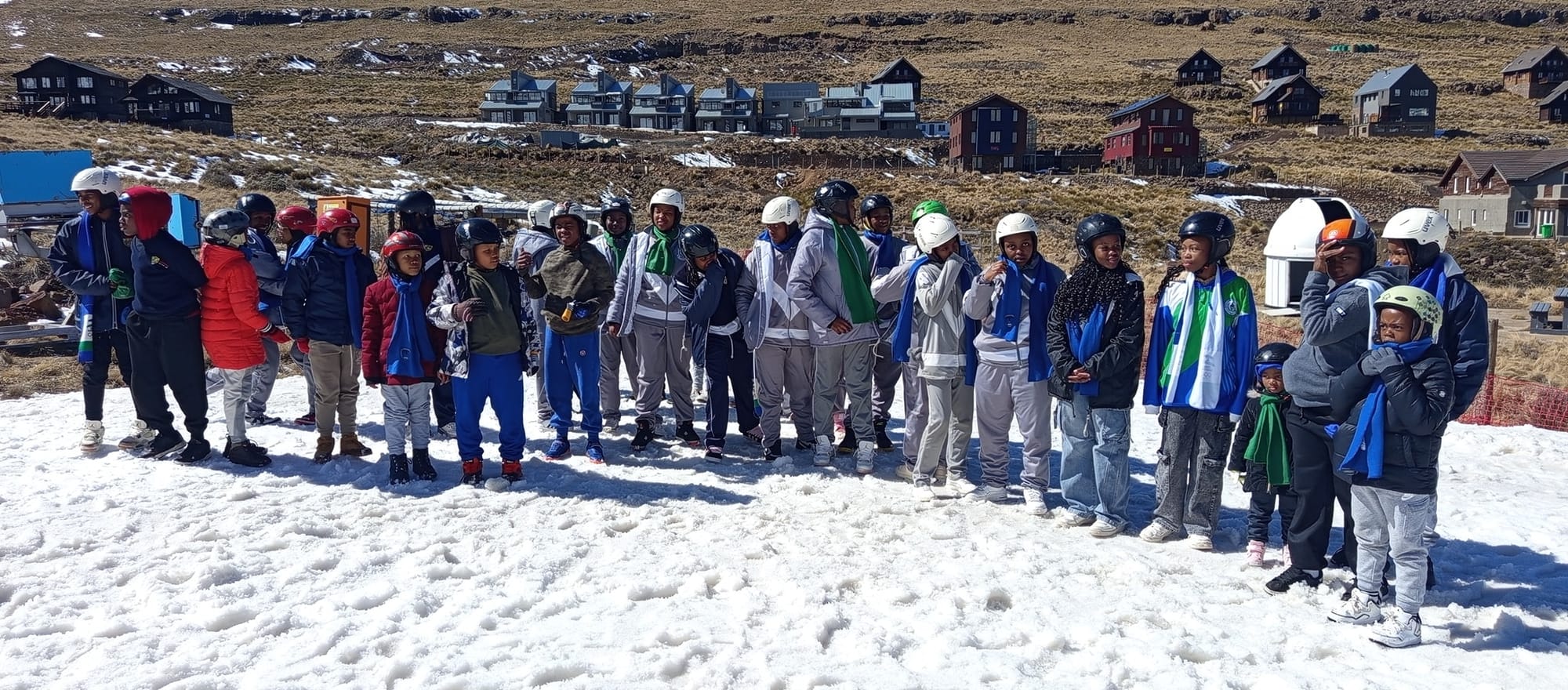
LESOTHO FORECAST
A similar week is expected with predominantly sunny weather, temperatures perhaps creeping up a degree or so. There is a chance of showers going into the weekend, but they currently look more likely to fall as rain than snow due to the temperatures.