Australia Scores Season’s Best Snow With 56cm and 70% Terrain Open
Updated July 16, 2025: Massive July snowfalls blanket Australia, Chile boasts world’s most open terrain, and New Zealand hits global base-depth highs—click for the full snow story!
- Chile’s Tres Valles Reigns Supreme with World’s Most Open Terrain
- Mt Hutt Posts Deepest Snow Base on Earth at 155cm
- Falls Creek First in State to Hit 100% Open—Summit Chair Now Spinning
- Argentina Struggles On—Cerro Catedral Still Only 10% Open
SOUTHERN HEMISPHERE INTRO
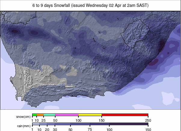
After heavy early-July snowfall, things have quietened slightly on southern slopes, though many regions continue to report fresh accumulations. Australia led the way last week with up to 56cm (23”) of new snow across several resorts. Chile and New Zealand also registered fresh falls, while the high peaks of the Alps saw light dustings at altitude. In South America, there’s a marked west-east divide. Chile’s Tres Valles region, near Santiago, currently boasts the most open terrain globally—over 100km and more than 90% operational coverage. In contrast, Argentina’s Cerro Catedral, the continent’s largest ski area, remains under 10% open, with just 10km of terrain available. Australia and New Zealand are showing encouraging signs, with bases increasing and more lifts spinning. In Africa, Lesotho’s Afriski has now completed its main run.
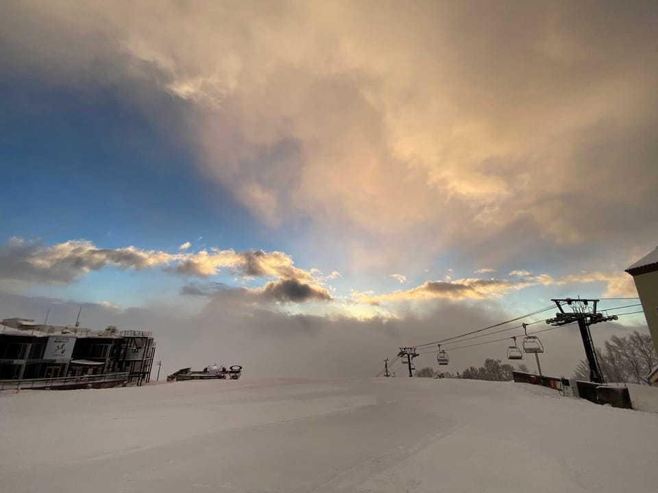
AUSTRALIA REPORT
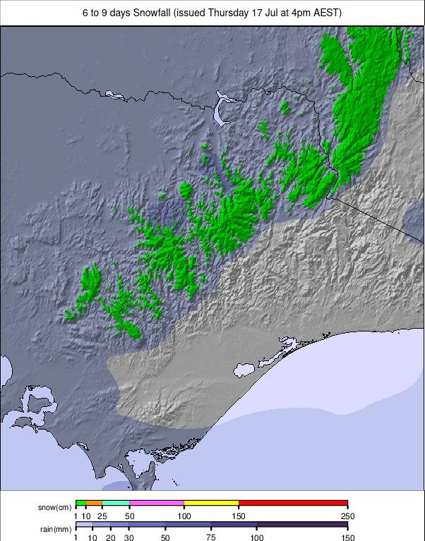
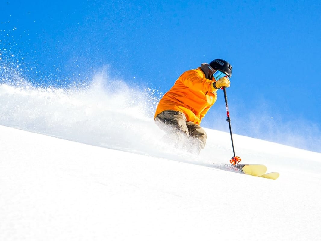
After significant snowfall last week, which brought up to 50cm (20”) of fresh cover to Aussie slopes, the past few days have seen more sunshine, but still more light snow showers and fairly low temperatures. Resorts are also bolstering conditions with extensive snowmaking, making this one of the strongest mid-July snow periods in recent years—good news, hopefully, for the rest of the season. As a result, bases have continued to grow, and resorts have been able to open more and more terrain. Perisher (60/80cm / 24/32”) reported 20cm (8”) of fresh snowfall in the 24 hours going into the weekend, bringing their storm total to 37cm (15”). With a low of -3°C overnight, 146 snowguns were also firing to help Mother Nature blanket the resort in white.
The Interceptor Quad Chair opened for the season, allowing more terrain and riding access between the Perisher and Blue Cow resort areas. Piper and Link T-Bars are also set to spin, allowing access between the Perisher and Smiggin Holes resort areas. Perisher’s ski area is now up to 70% open, with around 48km (30 miles) of slopes open – the most in the country and the most of any one ski area in the Southern Hemisphere now. Meanwhile, Hotham (48/82cm / 19/73”) said it got over 40cm (16”) last week and noted the snow quality.
“It just keeps turning on, it doesn’t stop snowing,” said skier Alan Luong at Hotham on Thursday morning. “It’s great out there – super nice and dry powder; it’s awesome.”
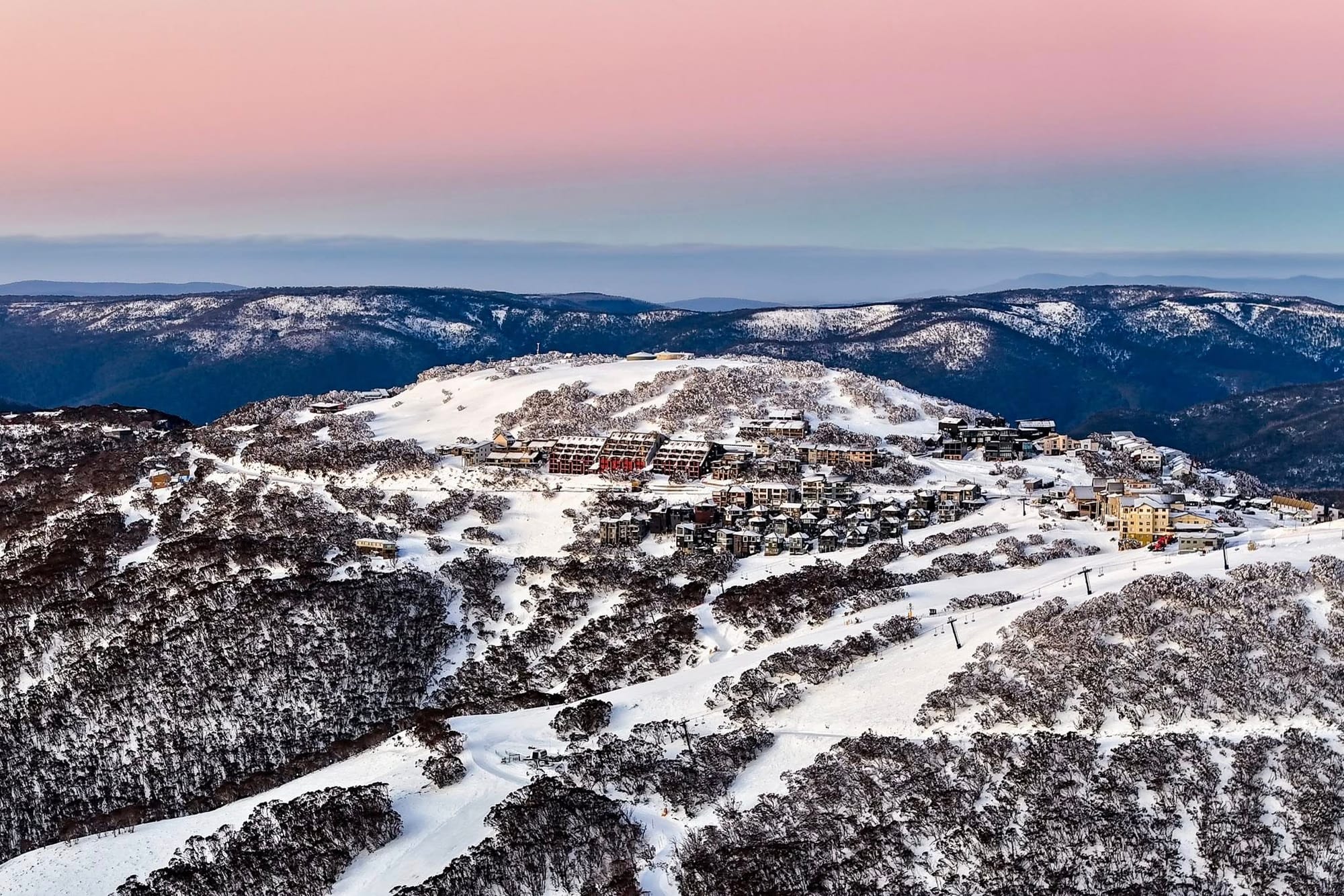
Falls Creek (60/90cm / 24/36”) officially opened its Summit Chairlift on 11 July 2025, giving seasoned riders access to more advanced terrain, steeper runs, and spectacular alpine views. This lift opening offers guests access to both groomed runs and off-piste terrain, and with the International Poma also opening, it is now the first in the state to be 100% open.
"It's been an incredible few days here at Falls Creek, with snow falling steadily and more in the forecast next week," said Sarah Gamon, Falls Creek Ski Lifts’ Field Marketing Coordinator on Saturday. "Winter is in full swing with 56 centimetres of fresh snow blanketing the mountain so far this week. We're thrilled to have the Summit Chairlift open, which allows access to more of our advanced terrain. It gives skiers and boarders access to steeper runs and stunning alpine views."
Thredbo (55/102cm / 22/41”) is still posting the country’s deepest base.
AUSTRALIA FORECAST
After last week's snowfall, Australia’s alpine resorts are heading into the second half of July with a promising forecast, as a series of cold fronts continues to deliver fresh snow and good skiing conditions across New South Wales and Victoria. Light to moderate daily snowfalls are expected through to the weekend, with the snowline dropping to around 1,000 metres on Thursday and Friday, allowing lower slopes to benefit from fresh cover. Temperatures will remain cold, with overnight lows dipping to -4°C and daytime highs staying well below seasonal averages. This sustained chill is helping preserve the natural snowpack, which is already deeper than at the same point last season.
NEW ZEALAND REPORT
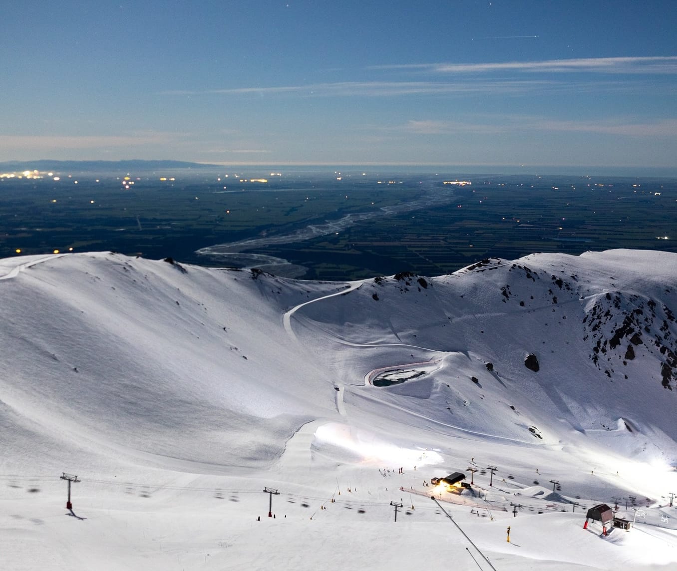
A mixed picture across New Zealand, with Mt Hutt (105/155cm / 42/62”) on the South Island one of several resorts close to fully open, and also posting the deepest base in the Southern Hemisphere (and the world) at present. By contrast, the already troubled Mt Ruapehu resorts on the North Island are again battling poor snow cover, with Turoa hoping for financial support again, having little terrain open despite heroic efforts by staff. Whakapapa posted a 20cm (8”) accumulation on Wednesday morning and noted an improving forecast. Despite a few light snowfalls recently, the resort is currently open thanks to artificial snowmaking, with just a few runs available. Back on the South Island, Coronet Peak (50/70cm / 20/28”) and The Remarkables (30/100cm / 12/40”) are also close to fully open. It's been a pretty good start to the week, with 5–10cm (2–4”) snowfalls daily, and temperatures in the -5 to +3°C range.
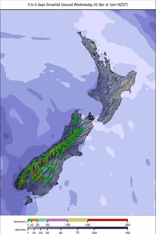
NEW ZEALAND FORECAST
Kiwi ski areas are forecast to receive 10–35cm (4–14”) of new snow by the weekend, with Treble Cone one of those likely to see the biggest falls. South Island centres like Cardrona, Coronet Peak, and The Remarkables will most likely see much less, though. Freezing levels should stay low, and daytime highs at elevation will hover around -2°C to 4°C. The cold snap is helping maintain solid base depths. There’ll be intermittent sunshine and cloud cover, and light winds across most regions.
ARGENTINA REPORT
It’s been a mixed week of weather for most Argentinian ski areas, with several moderate snowfalls (10–20cm / 4–8” accumulations typically), most recently over the past few days for the majority of the country’s ski areas. Temperatures have been fairly favourable, with overnight lows hitting -5 to -8°C, although daytime highs have been up to +6 to +8°C. It’s colder and more consistently snowy down south at Cerro Castor (60/80cm / 24/32”) in Tierra del Fuego Province, which also has the highest percentage of terrain open in the country at 60%. For the rest, it's mostly 10–40% open, with the ongoing sub-par season start for snow cover. The largest resort, Cerro Catedral (5/50cm / 2/20”), still only has about 5km (3 miles) of runs open, unfortunately.
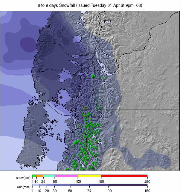
ARGENTINA FORECAST
Unfortunately, there's no sign of a massive improvement for Argentinian ski areas through the latter half of this week. It's looking mostly dry again, with just light to moderate snowfalls to end the week for most areas, although again the far south (Cerro Castor) should see more consistent (if not huge) snowfalls.
CHILE REPORT
Chile as a whole continues to post some of the best conditions in the world right now. It has been a fairly dry, sunny week, with temperatures at ski elevations ranging from -5°C to 4°C—ideal for snow retention, with most resorts having built healthy bases through June. There’s been intermittent sunshine and cloud cover, winds remaining moderate, and freezing levels hovering near 2,000–2,500m. The Tres Valles area linking Valle Nevado (30/110cm / 12/44”), El Colorado (30/125cm / 12/50”), and La Parva (35/125cm / 14/50”) remains in great shape, almost 100% open for around 120km (75 miles) of slopes in total—the most in the world at present. Portillo (35/130cm / 14/52”) is almost fully open and is posting the deepest base in South America at present.
CHILE FORECAST
Fresh snowfall is expected across several Chilean ski areas in the latter part of this week, with cooler temperatures helping preserve coverage at altitude. Pucon has up to 44cm (17") of new snow forecast—likely the biggest dump in the country, with Nevados de Chillán not far behind.
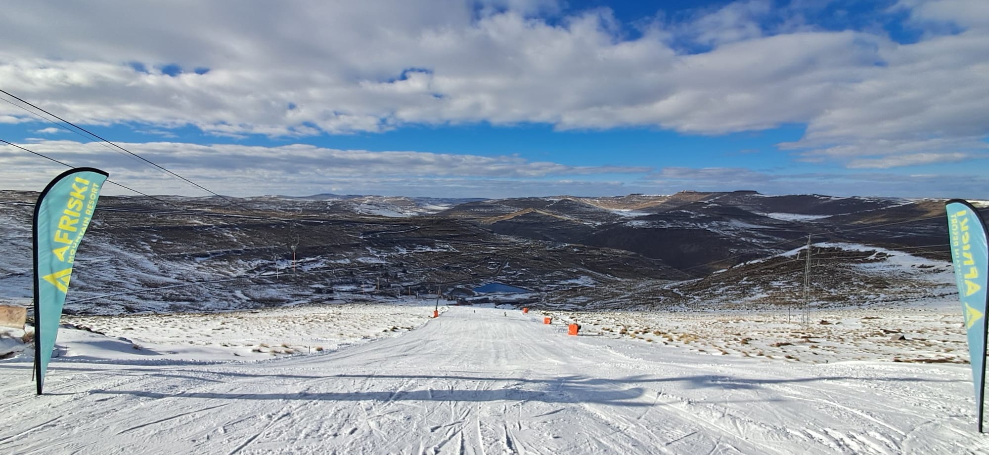
LESOTHO REPORT
Lesotho’s Afriski (10/30cm / 4/12”) is reporting the best conditions of the season to date, with snowmakers reaching the top of the main slope, pylon 8. “Having achieved this is a true mark of dedication from everyone—especially the snowmaker team, the groomers, and the engineers—for making sure there was ample water and power supply throughout! Above all, we cherish Mother Nature for blessing us with so much powder; we couldn't have expected this on Afriski's 25th anniversary,” a resort spokesperson said. The surface is reported to be groomed and firm in the mornings, softening slightly by afternoon. There’s been no fresh snow reported since early July, and the freezing level has been hovering near 3,000–3,300m, helping preserve the snowpack. Winds remain light to moderate, and humidity is low.
LESOTHO FORECAST
A slight dip in temperatures is forecast to end the week, with cloudier skies and a small chance of precipitation (up to 16%). Next week should see a return to mostly sunny weather, with no fresh snow forecast.