Europe Weekly Snow Roundup #286
Weekly Snow News for Europe, updated 29 October 2025: Heavy snow blanketed the Alps with 20–40cm (8–16”) falls, kick-starting the 2025/26 ski season amid subzero temperatures.
- Major snowfalls transform the Alps ahead of the 2025/26 season
- Austria tops global chart for open ski areas
- Swiss glaciers deepen with world-leading snow depths
- Scandinavian slopes stay open amid early subzero stretch
- Italian resorts gear up for November openings and Olympic prep
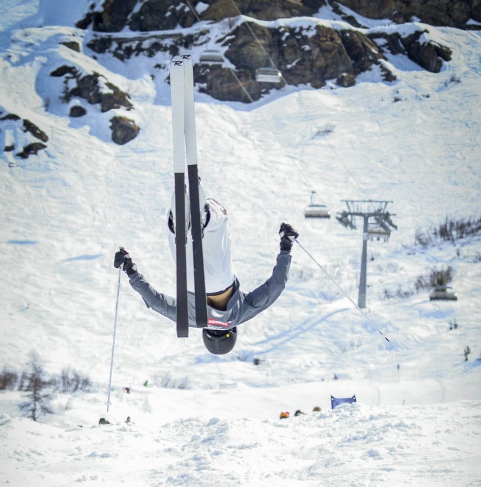
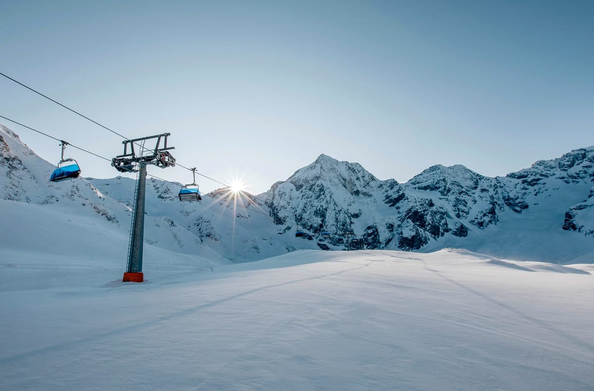
Alps Snow Report and Ski Conditions 2025/26
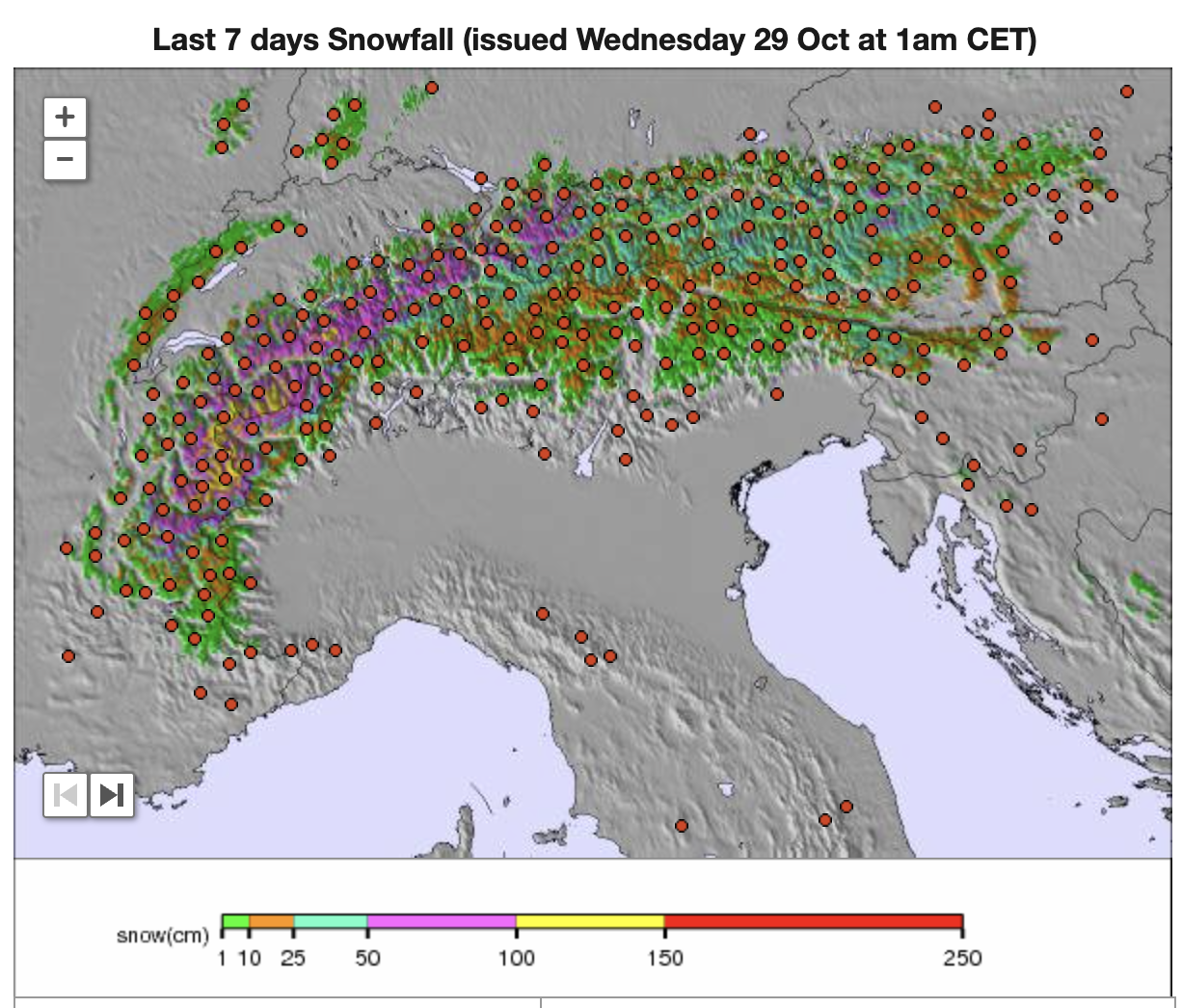
A series of snowstorms around the weekend brought some wild weather at times. Still, the first significant snowfall accumulations of the autumn/fall to the Alps, along with low temperatures for snowmaking. Ski areas where the season hasn’t started yet noted that they were busy base building with the influx of white gold, whilst already-open glacier areas reported additional lift and terrain openings as well as powder conditions on their pistes.
The French ski season is now just over three weeks away, with the country’s ski areas posting 20-40cm (8-16”) accumulations from multiple snowstorms around the weekend. Tignes and Val Thorens, both opening in just 23 days, did particularly well. Les Menuires will also join them with an opening in 23 days in November, followed soon after by Les Deux Alpes on 29 November.
Elsewhere in Europe, there was more snowfall in the Carpathian, Tatra, and Dolomite mountains, with the season start here now about a month away. It’s also been cold at northerly latitudes, with some Scandinavian resorts remaining subzero day and night over the past week and recording a few centimetres of snowfall. There was a dusting of snow on peaks in the Grampians of Scotland at the weekend, too.
Austria Snow Report and Ski Conditions 2025/26
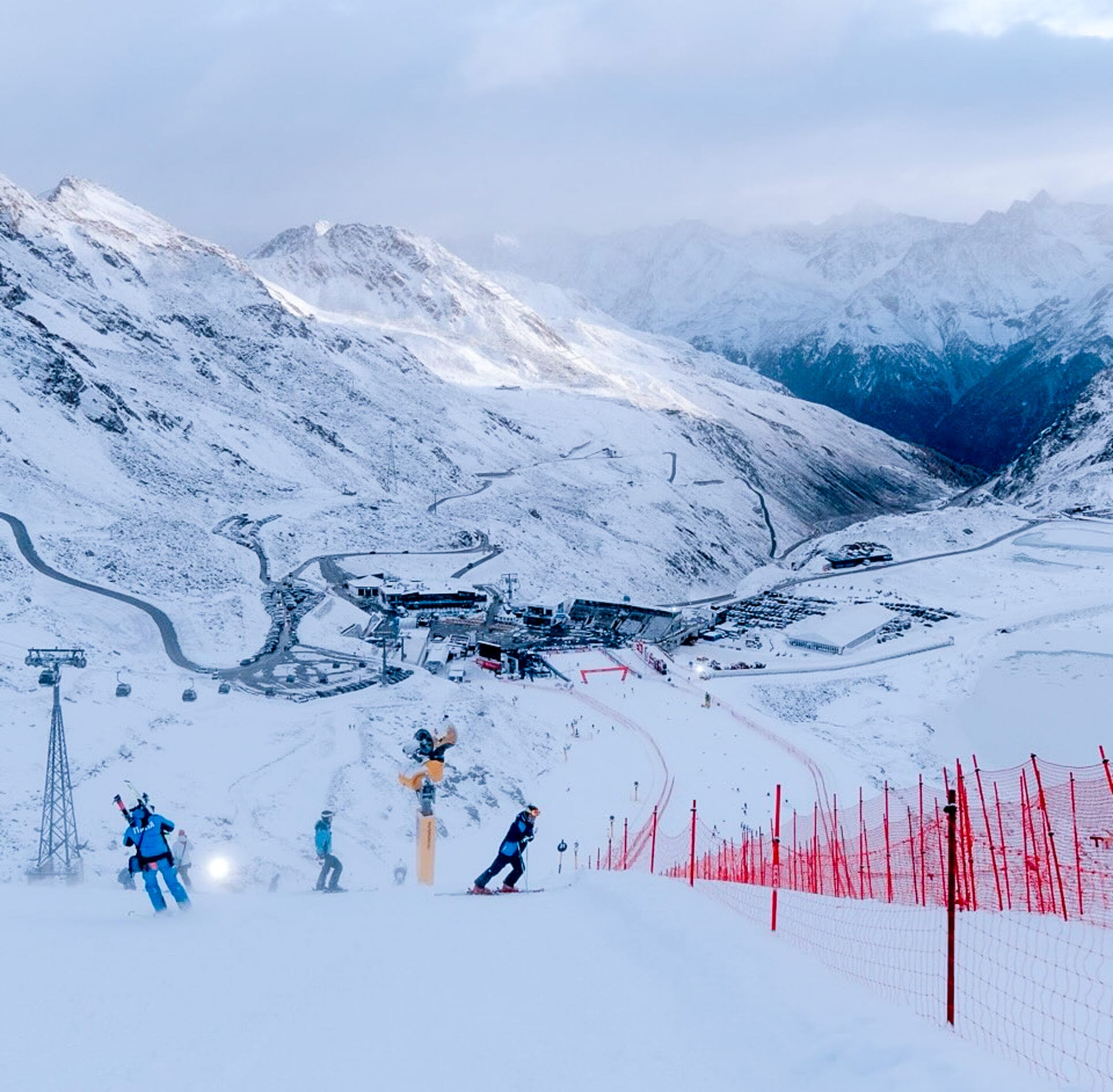
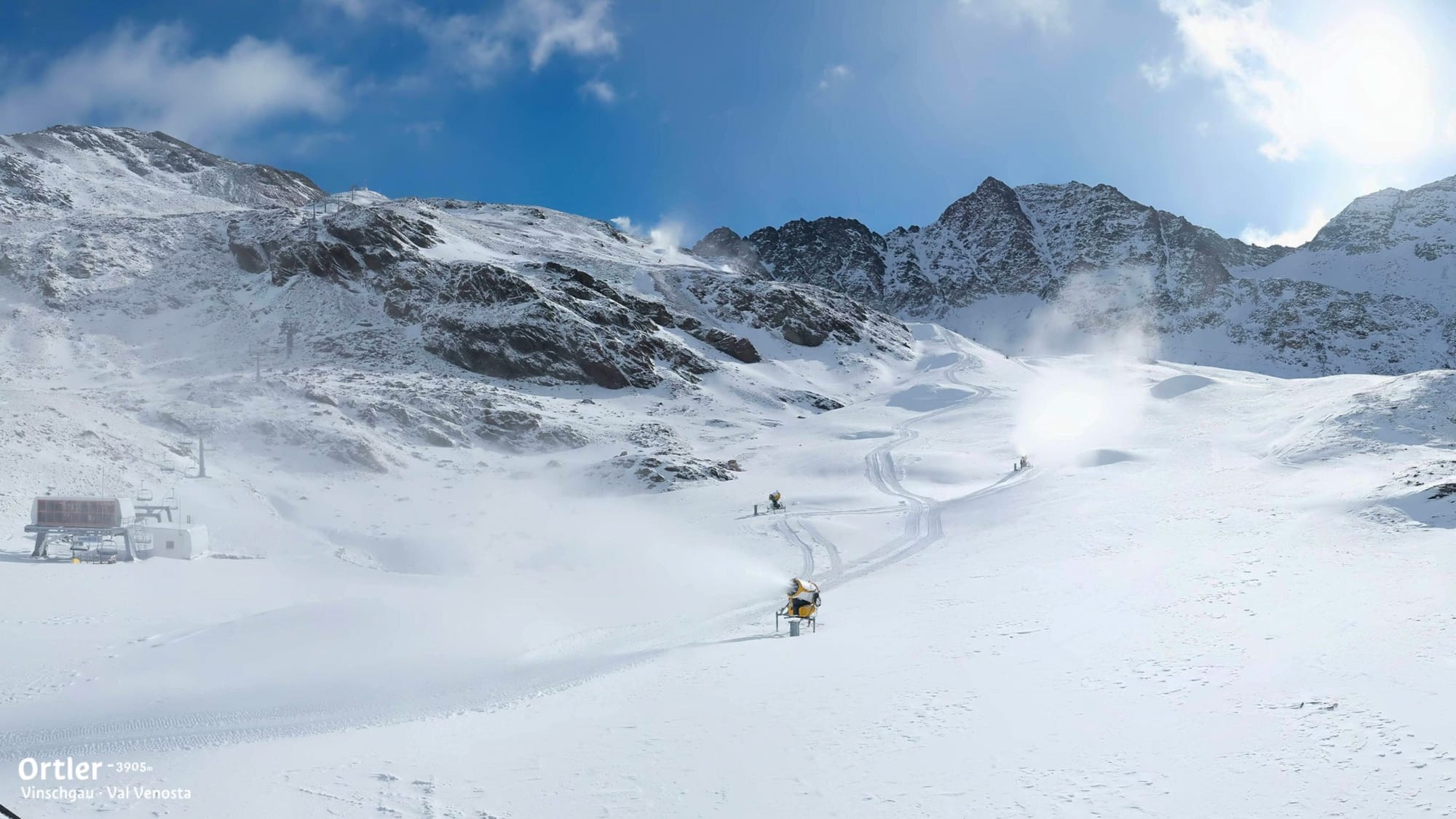
Austria continues to have the most ski areas open in the world, just ahead of Switzerland. There remain seven glacier areas to choose from, and it’s been a good week with the most significant snowfalls of the autumn so far, bringing powder conditions for the weekend for those lucky enough to already be out on the slopes. It was a big weekend at Solden (20/41cm / 8/16”), which hosted the opening weekend of the FIS 25-26 Alpine Skiing World Cup Tour over the weekend, just after scoring a 20cm (8”) snowfall at the end of last week. It also opened new terrain for the thousands of fans arriving to watch the races and ski themselves, becoming the first in the northern hemisphere to reach 30km (19 miles) of slopes open for the 25-26 season already.

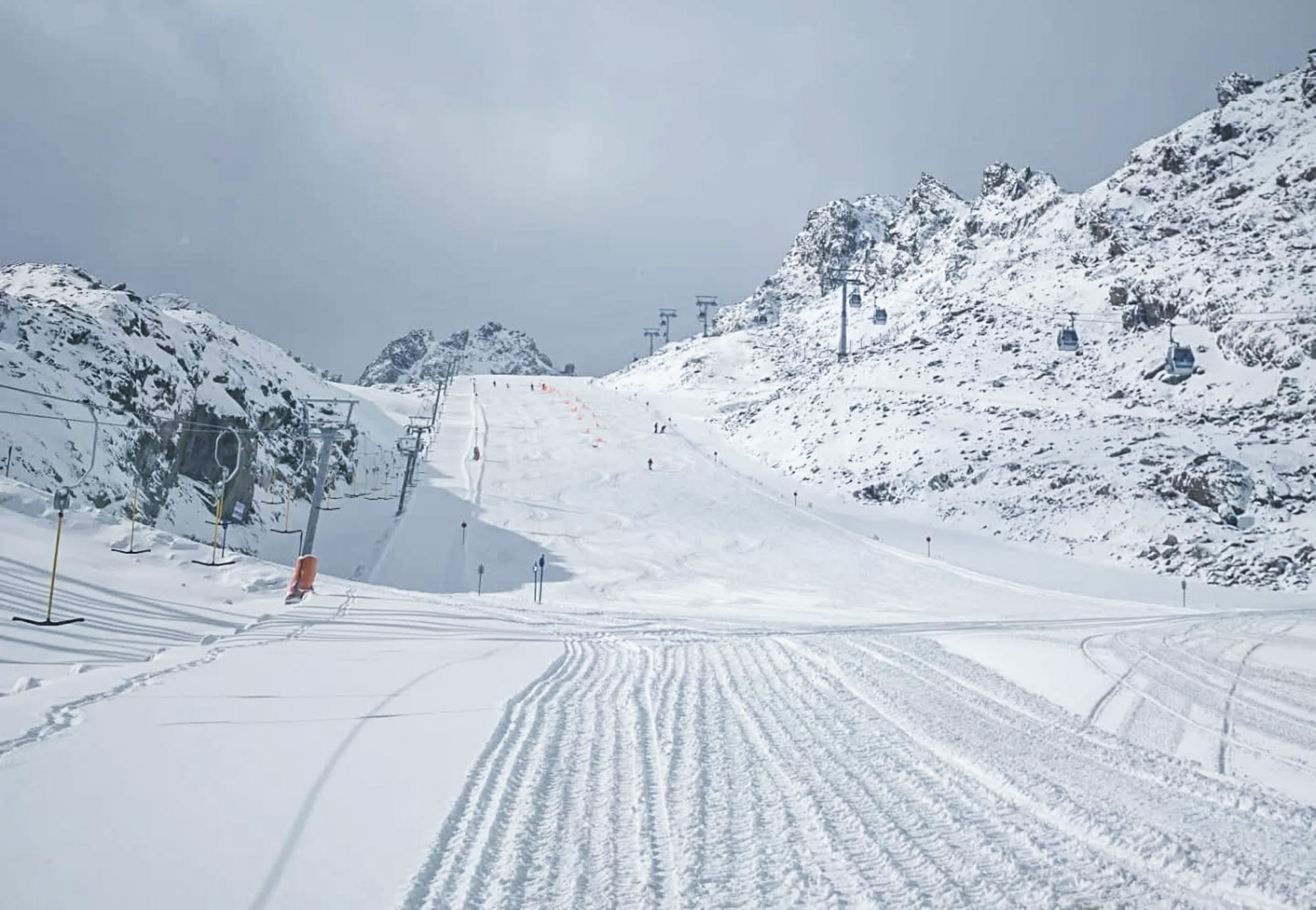
Images from Stubai Glacier on 24th October
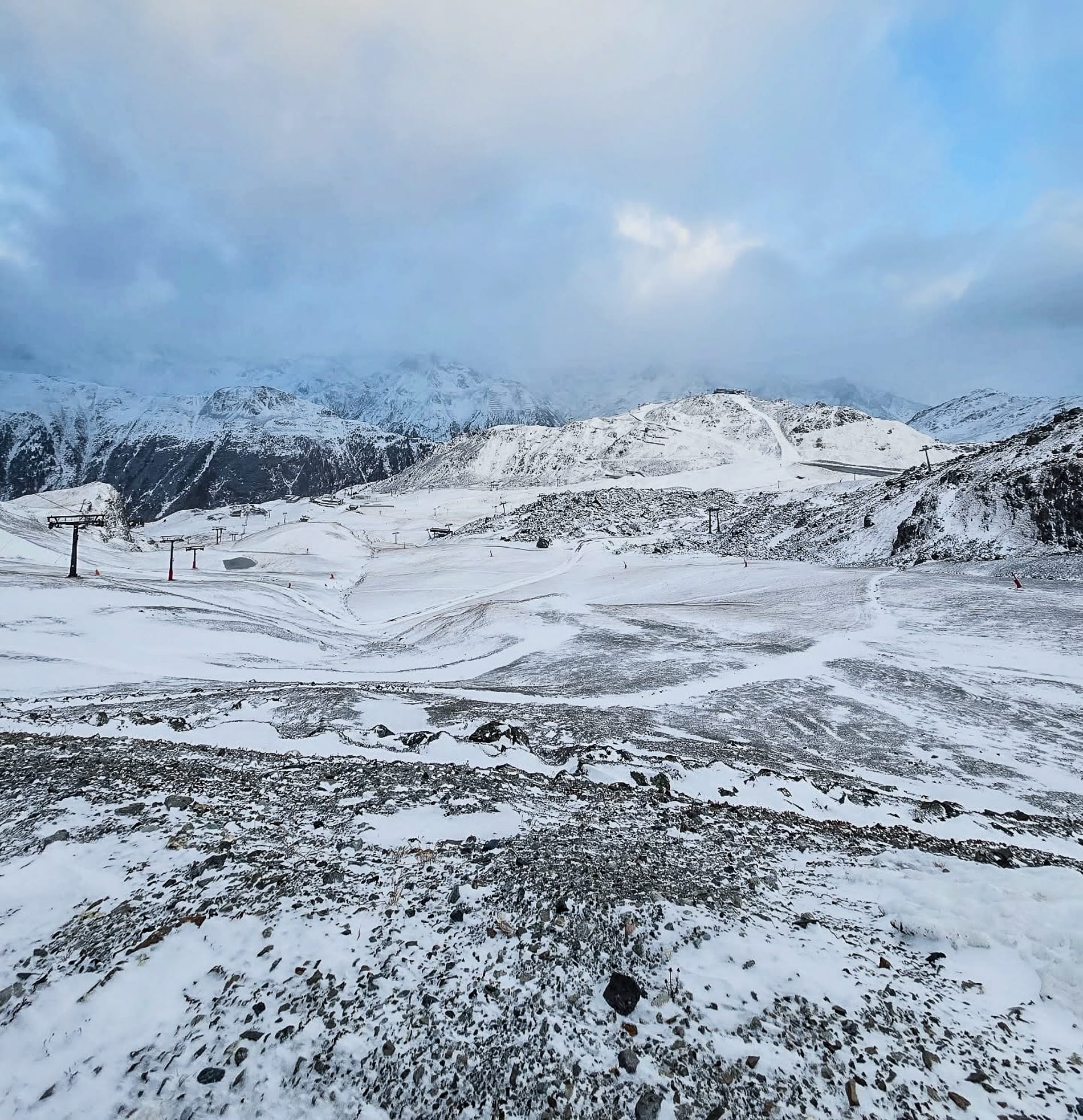
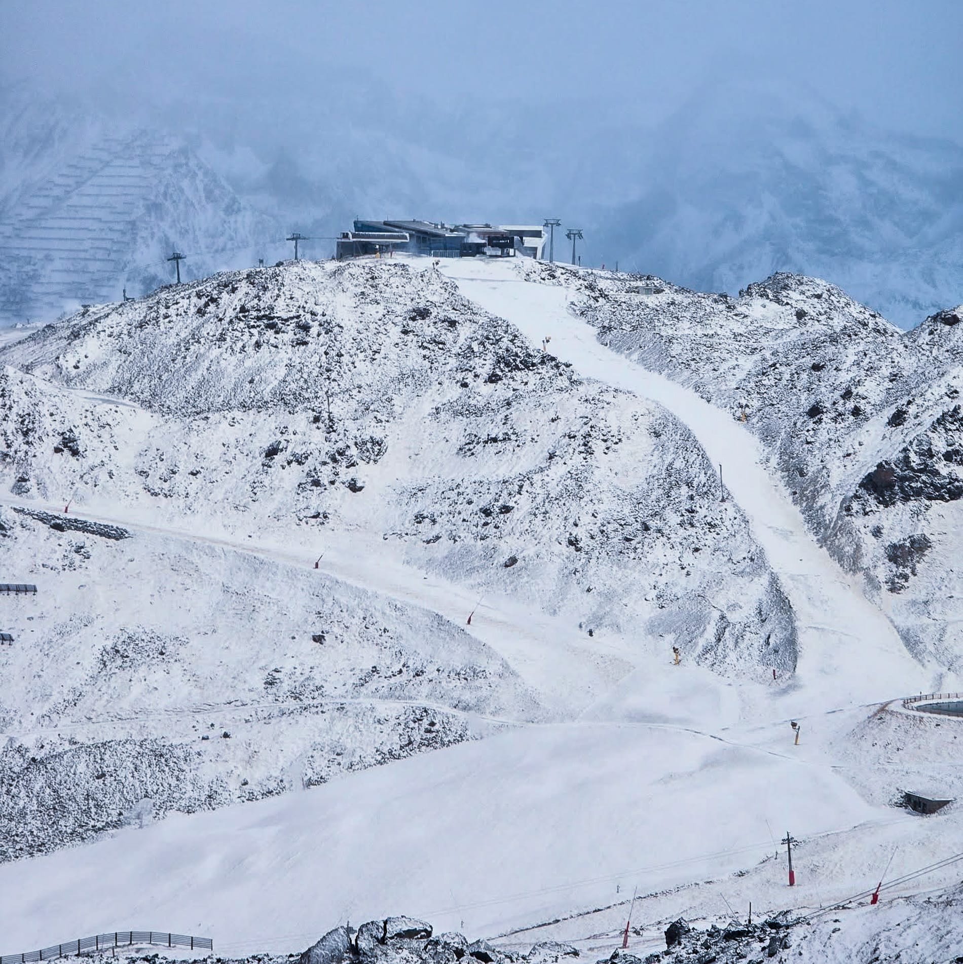
Solden has leapfrogged Hintertux (0/25cm / 0/10”), which also reported fresh snowfall, and as a result, it’s opened more terrain too, up to 27km (17 miles) of slopes with the Kaserer 1 drag lift, the latest to begin 25/26 season operations there. The Stubai Glacier (10/30cm / 4/12”) has also expanded its open terrain, now up to 16km (10 miles) of slopes following a 20cm (8”) accumulation with the Eisjoch chairlift serving slope No. 5, its latest to start operating for the season. The Kitzsteinhorn (0/80cm / 0/32”) reports 13km (8 miles) of runs available and open with fresh snow cover are the Kaunertal (15/25cm / 6/10”), Molltal (0/50cm / 0/20”) and Pitztal (30/60cm / 12/.24”) with up to 10km (7 miles) open each.
Kaunteral and Kitzsteinhorn, Austria earlier this week
Austrian Alps Snow Forecast
It should be a snowy start to November, following a snowy end to October, with further fresh accumulations expected across the Austrian Alps later this week. Significant snowfall is forecast for high-altitude areas, with the heaviest falls, as expected, above 2,000m. Temperatures should also remain low and well below freezing overnight above 1,800m, enabling snowmakers to continue their base-building activities.
Italian Alps Snow Report and Ski Conditions 2025/26
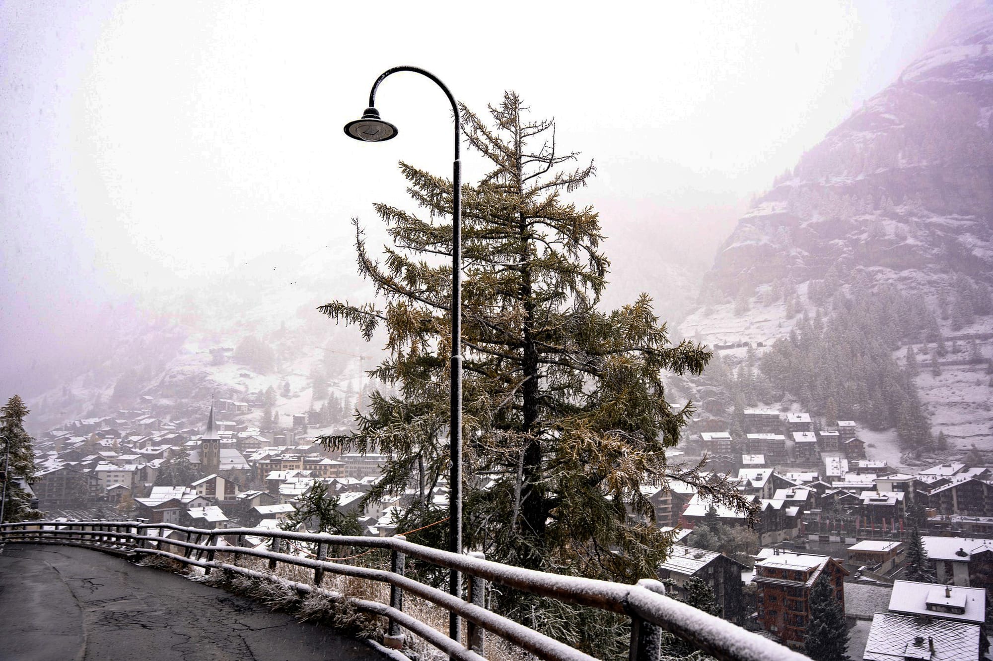
We’re set to reach four Italian ski areas open from the coming weekend, with Sulden opening in just two days, as the country experienced the snowfalls of the past week. Val Senales (0/28cm / 0/11”) and Passo Stelvio (15/100cm / 6/40”) are already open, both reporting powder conditions. Stelvio was one of the few to note a positive increase in their snow depth statistics following the snowfall. Skiers in Cervinia (0/120cm / 0/48”) briefly faced difficulties as lift access was cut to the glacier slopes above Zermatt during the storm’s peak. Still, they also enjoyed the fresh cover once it reopened.
Elsewhere, there was some fresh snowfall on high Italian peaks, and Cortina d’Ampezzo reported their snowmaking systems firing up with the season start just a month away, and the 2026 Winter Olympics only three months from kick-off. Sestriere, in the Via Lattea region, will open on late November 29.
Italian Alps Snow Forecast
The Italian Alps and Dolomites will experience colder air and fresh snowfall, especially in the northwest, with up to 48 cm (19 inches) expected in the western Alps. Anticipate highs around 0–6°C and lows reaching -5°C, with snowfall peaking on Friday and Saturday. Winds are expected to remain light to moderate, with freezing levels below 1800 m, helping preserve snow. Lower resorts may see a mix of rain and snow, but high-altitude terrain looks promising.
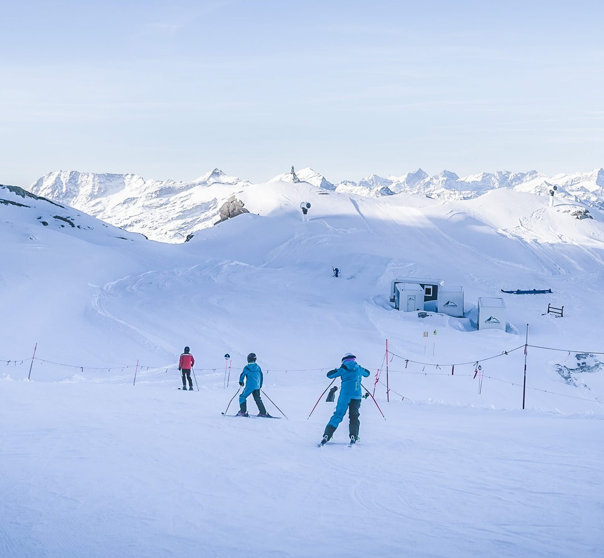
Switzerland Snow Report and Ski Conditions 2025/26
Swiss ski areas experienced snowfall down to as low as 1500m at the end of last week and the start of this week. However, low visibility due to the weather conditions led some areas, including Saas-Fee (5/160cm / 0/56”), to close temporarily over the weekend until skies cleared. The resort reports that its snow depth, already the deepest in the world at present, has increased by 20cm (8”) following the storm. The link to Cervinia on the Italian side of Zermatt’s Matterhorn Glacier Paradise summer ski area (0/1290cm / 0/48”) was also temporarily closed, and the amount of terrain accessible from the Swiss side was reduced, although some sections remained open to enjoy the fresh snow.
Engelberg’s Titlis Glacier (0/85cm / 0/34”) and the Diavolezza Glacier (0/50cm / 0/20”) are both still open; the latter operates at weekends only, each offering only a few kilometres of slopes. Overall, five Swiss ski areas remain open, including the terrain park at Murren, and early-season excitement is building with Verbier and Thyon-Printze both opening in just two days, while Les Diablerets follows in nine. The first slopes are also expected to open at Adelboden and the Glacier 3000 slopes near Gstaad over the coming weekends.
Swiss Alps Snow Forecast
The Swiss Alps will face further low temperatures and fresh snowfall, especially above 1800 m. Alpine highs will range from 0 to 7°C, with lows dropping to -5°c. Resorts such as Zermatt, Verbier, and Engelberg could see up to 15 cm (6 inches) of snow, mainly on Friday and Saturday. Winds remain light to moderate, aiding lift operations. High-altitude terrain is well prepared for November openings, while lower slopes may see a mix of rain and snow. Conditions are favourable for early piste preparation, with snowmaking increasing.
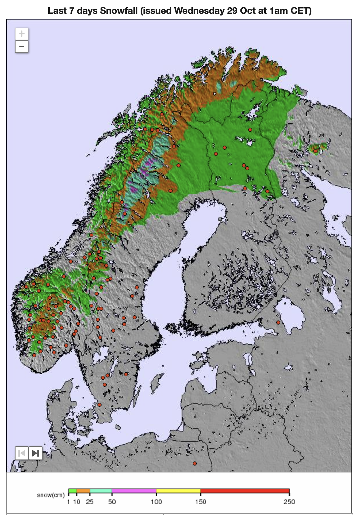
Scandinavia Ski Season Update and Snow Forecast 2025/26
We have the same four ski areas open across Scandinavia. Norway’s Galdhøpiggen Glacier (20/50 cm / 8/20 inches) has experienced sub-zero highs between -1°C and -3°C and light snowfall over the past week. It has about a fortnight left of its 2025 season, having opened back in May. There’s also Sweden’s Kåbdalis (30/40 cm / 12/16 inches), where temperatures have dropped as low as -11°C to -14°C, with light winds and some moderate snowfall on top of the slope it created from farmed snow stockpiled through summer and spread back out on its slopes earlier this month.
In Finland, Levi (10/30 cm / 4/12 inches) saw temperatures ranging from -1°C to 4°C, with some good snowfalls on its slopes, also created by snow farming. Ruka (10/30 cm / 4/12 inches) was slightly warmer, with a mix of rain and sleet. All four areas have 1-2 km (about a mile) of runs open at this early stage.
Scandinavia Weather and Snow Forecast
Over the rest of this week, Galdhøpiggen is forecast to stay cold and snowy, with highs around -7°C, up to 4 cm of snow, and strong winds (45 km/h), which could create serious wind chill and potentially affect lifts. Kåbdalis will experience milder temperatures, but Levi is expected to have consistent sub-zero temperatures (-2°C to -7°C), light snow (0.5 cm), and good snowmaking conditions. Ruka remains near freezing with light snow (1.2 cm), moderate winds (20 km/h), and variable freezing levels.