
Ski Lessons by SkiBro
BOOK NOW
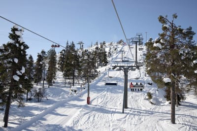
Ski lessons in Les Diablerets
Book now


Les Diablerets Weather (Next 3 days): The snow forecast for Les Diablerets is: A light fall of snow, heaviest on Thu night. Turning milder with light rain (total 3.0mm) on Sat night. Freeze-thaw conditions (max 5°C on Sun morning, min -3°C on Thu night). Wind will be generally light.
Les Diablerets Weather (Days 4-6): Mild with heavy rain (total 20.0mm), heaviest during Mon afternoon. Becoming colder with a moderate fall of snow heaviest on Mon afternoon. Freeze-thaw conditions (max 6°C on Sun afternoon, min -1°C on Tue morning). Wind will be generally light.
| Resort | Snow Depth | Temp. (°C) | Wind (km/h) | Weather | ||
|---|---|---|---|---|---|---|
| Top Lift: | 0.0 m | -4 | ||||
| Middle Lift: | 0 | |||||
| Bottom Lift: | 0.0 m | 5 |
Latest snow reports near Les Diablerets:
Continuous moderate rain reported from Aigle at 479 metres elevation 7 kms WSW of Leysin but it is forecast cold enough for snow at higher elevations in the ski area from Leysin
Moderate rain reported from Sion at 339 metres elevation only 2 kms NW of Veysonnaz-Printse but it is forecast cold enough for snow at higher elevations in the ski area from Veysonnaz-Printse
Light rain reported from Sion at 339 metres elevation only 4 kms NNE of Haute Nendaz but it is forecast cold enough for snow at higher elevations in the ski area from Haute Nendaz

Thu 2 | Friday 3 | Saturday 4 | Sunday 5 | Monday 6 | Tuesday 7 | Wednesday 8 | ||||||||||||||
PM | night | AM | PM | night | AM | PM | night | AM | PM | night | AM | PM | night | AM | PM | night | AM | PM | night | |
light snow | mod. snow | light snow | light snow | light snow | cloudy | cloudy | light snow | cloudy | mod. rain | light rain | light rain | light snow | light snow | light snow | light snow | light snow | cloudy | cloudy | some clouds | |
km/h | ||||||||||||||||||||
Snow map |  |  |  |  |  |  |  | |||||||||||||
4 | 6 | — | — | 1.0 | — | — | 2.0 | — | — | — | — | 4 | 4 | 2.0 | 1.0 | — | — | — | — | |
— | — | — | — | — | — | — | 3 | — | 6 | 5 | 2.0 | 7 | — | — | — | — | — | — | — | |
max°C | 0 | -2 | -2 | -1 | -1 | 2 | 4 | 3 | 5 | 6 | 4 | 4 | 3 | 1 | -1 | 0 | 0 | 2 | 4 | 4 |
min°C | -1 | -3 | -3 | -1 | -3 | -1 | 3 | 2 | 2 | 5 | 3 | 3 | 1 | 0 | -1 | -1 | 0 | 0 | 3 | 2 |
-4 | -6 | -3 | -1 | -5 | -4 | 0 | -1 | -1 | 2 | 1 | 0 | -2 | -2 | -3 | -3 | -2 | -4 | 1 | 2 | |
99 | 98 | 92 | 89 | 83 | 58 | 77 | 95 | 80 | 92 | 87 | 93 | 97 | 98 | 99 | 87 | 88 | 71 | 73 | 64 | |
1900 | 1650 | 1750 | 2000 | 1700 | 2400 | 2600 | 2450 | 2750 | 2800 | 2850 | 2700 | 2350 | 2200 | 1950 | 2150 | 2050 | 2550 | 2650 | 3150 | |
— | — | 6:13 | — | — | 6:11 | — | — | 6:09 | — | — | 6:09 | — | — | 6:07 | — | — | 6:05 | — | — | |
— | 8:42 | — | — | 8:43 | — | — | 8:44 | — | — | 8:45 | — | — | 8:46 | — | — | 8:47 | — | — | 8:49 | |
A light fall of snow, heaviest on Thu night. Turning milder with light rain (total 3.0mm) on Sat night. Freeze-thaw conditions (max 5°C on Sun morning, min -3°C on Thu night). Wind will be generally light.
Mild with heavy rain (total 20.0mm), heaviest during Mon afternoon. Becoming colder with a moderate fall of snow heaviest on Mon afternoon. Freeze-thaw conditions (max 6°C on Sun afternoon, min -1°C on Tue morning). Wind will be generally light.
Latest snow reports near Les Diablerets:
Continuous moderate rain reported from Aigle at 479 metres elevation 7 kms WSW of Leysin but it is forecast cold enough for snow at higher elevations in the ski area from Leysin
Moderate rain reported from Sion at 339 metres elevation only 2 kms NW of Veysonnaz-Printse but it is forecast cold enough for snow at higher elevations in the ski area from Veysonnaz-Printse
Light rain reported from Sion at 339 metres elevation only 4 kms NNE of Haute Nendaz but it is forecast cold enough for snow at higher elevations in the ski area from Haute Nendaz
| Top snow depth: | 0 cm |
|---|---|
| Bottom snow depth: | 0 cm |
| Fresh snowfall depth: | — |
| Last snowfall: | 28 Apr 2024 |
| Snow Alerts | Create Alert |
0.4 | Bluebird Powder days Fresh snow, mostly sunny, light wind. |
|---|---|
0.8 | Powder days Fresh snow, limited sun, any wind. |
0.1 | Bluebird days Average snow, mostly sunny, light wind. |
The above table gives the weather forecast for Les Diablerets at the specific elevation of 2100 m. Our sophisticated weather models allow us to provide snow forecasts for the top, middle and bottom ski stations of Les Diablerets. To access the weather forecasts for the other elevations, use the tab navigation above the table. For a wider view of the weather, check out the Weather Map of Switzerland.
Click here to read further information on freezing levels and how we forecast our temperatures.
Overall 4.3 Based on 12 votes and 11 reviews
Les Diablerets is linked to the Glacier3000 with a regular Free Ski Bus throughout the Day. We stayed near Vers L'Eglise which was wonderful and easy to get to the ski lifts where parking is free. Great skiing with links via chair to Villars so the skiing is very varied and substantial. Would highly recommend this resort for all abilities. We were there for New Year week. We had great snow. The Downhill Junior Olympics are being held in Les Diablerets this weekend so we skied an Olympic Run! Highly recommend this resort.
Maria from United Kingdom writes:
Les Diablerets is linked to the Glacier3000 with a regular Free Ski Bus throughout the Day.
We stayed near Vers L'Eglise which was wonderful and easy to get to the ski lifts where parking is free.
Great skiing with links via chair to Villars so the skiing is very varied and substantial.
Would highly recommend this resort for all abilities.
We were there for New Year week. We had great snow.
The Downhill Junior Olympics are being held in Les Diablerets this weekend so we skied an Olympic Run! Highly recommend this resort.
The Les Diablerets skiing weather widget is available to embed on external websites free of charge. It provides a daily summary of our Les Diablerets snow forecast and current weather conditions. Simply go to the feed configuration page and follow the 3 simple steps to grab the custom html code snippet and paste it into your own site. You can choose the snow forecast elevation (summit, mid-mountain or bottom lift) and metric/imperial units for the snow forecast feed to suit your own website…. Click here to get the code.
View detailed snow forecast for Les Diablerets at:
snow-forecast.com


 Nearest