World Snow News 40
World Snow News Update for June 6 2008
Snow Forecast | Alps | New Zealand | Australia | N. America | S. America | Sign Up
Welcome to the first 2008 Southern Hemisphere roundup of worldwide snow conditions with weather prospects for the week ahead from www.snow-forecast.com. This is the first snow-forecast editorial of the 2008 southern hemisphere season. No doubt if you are a southern hemisphere skier, you may not have visited the site since last season so welcome back! We hope that you enjoy the many additions that we have made to the website including longer-range forecasts and weather hindcasts. From next week we will try and get these editorials done in time for the Australasian weekend.
 |
Following a remarkable northern hemisphere winter, the most severe for decades in many places, everyone has been wondering what the weather gods have in store for the southern season. On the one hand we hear about global warming every day, but the fact is that we have just experienced the most widespread great snow conditions for decades. Exceptions were so few that we can just list them: Scotland, the Pyrenees and parts of the American Southwest had pretty ordinary seasons but everywhere else did incredibly well. By late season, even Scotland had a few weeks of fantastic snow conditions. What the Pyrenees and Sierra Nevada lacked in snow they made up for in sunny days. Sadly, in our opinion and certainly the opinion of the vast majority of climatologists, it was just a blip, easily explainable by the solar minimum and the prevailing La Nina. It does not mark a permanent return to the snowsure conditions of several decades ago. On a slightly more positive note, global models suggest the undeniable hiatus in the relentless trend towards warming may persist for a few more years. |
Early indicators for the southern ski season pick up where the northern one left off and are good to excellent. In Australia, autumn delivered unusually cold and windy weather to Melbourne and more especially Sydney and there were heavy pre-season snowfalls at the ski resorts. Sadly, the most recent precipitation in the Snowy Mountains was all rain, but by liberally applying the man-made stuff to the natural base, enough cover exists for resorts in Australia to get off to an early start by opening at the weekend. Snow conditions are far from ideal at present but opening weekend is more about the social events anyway. The meteorological consensus based on nearby sea temperatures in the Southern Ocean and Tasman taken together with the current La Nina weather pattern is that Australia can expect a better than average ski season and that the recent mild spell is just a blip. The Bureau of Meteorology has been unusually bold in predicting an exceptionally good ski season.
In our view, it is way too early to call the second half of the season with any confidence. The crucial temperature of equatorial Pacific waters that shape the regional weather patterns around the Pacific basin currently show a steadily moderating La Nina. Beyond about 6 to 8 weeks there is no consensus amongst the computer models as to whether this pattern, so favourable for the Australian ski season, will return to neutral conditions or whether a new La Nina or even an El Nino will develop (neutral conditions seem to be becoming the exception of late). This throws the second half of the southern ski season into doubt.
New Zealand certainly does best in strong El Nino conditions which favour stronger SW flow on the NZ side of the Tasman. Even if an El Nino began in late winter, it would be several months too late for New Zealand so on this basiswe can probably rule out a really great NZ season overall. Summer in New Zealand was an absolute scorcher as forecast and drought conditions even spread to the usually wet Waikato region on the west of North Island - almost without precedent. About 3 weeks ago the settled weather pattern broke and although that was much to late to top up the hydro-electric dams in South Island, it has at least brought relief to farmers and returned the countryside to its usual verdant green. The break in the weather was also very welcome at the ski resorts because a lot of that rain fell as snow on mountains, all the way from Otago to Tongariro. South Island saw the best of it and Coronet Peak, which opens this weekend, has a 45cm base that is part natural and part man-made. These are the best conditions for the time of year on record and certainly the pick of Australasia. With a southerly about to sweep across the country this weekend, the prospects get better too. Other resorts in New Zealand are scheduled to open on successive weekends and by the first weekend in July, hopefully they will all be in full swing. Hopefully, the superb club fields at Temple Basin and Olympus will have much better season's than last year when the snow distribution in the Canterbury region was so uneven due to strong winds. Whereas these two were almost always closed Broken River, which is located about mid way between them, had an incredibly good season that lasted into November.
Summary:
-
Fantastic start to the season in the Andes. Place to be - Chile
- Resorts opening early - great early season conditions
- A cold and snowy week in the southern Andes
- Good start to the season in New Zealand.
- Big southerly storm this weekend will dump
- Coronet Peak to open for skiing on Saturday 7th
- Big southerly storm this weekend will dump
- Fair start to the season in Australia, despite early promise
- Most resorts opening at the weekend, but not great snow yet
- Weather pattern points to a good ski season here
- Alpine resorts have seen rain fall on the glaciers
- Resorts in France and Switzerland on hold
- Head to the glaciers of Austria and Switzerland instead
- Expect some fresh snow at altitude soon
- Resorts in France and Switzerland on hold
- North America has summer skiing available too
- Summer and winter skiing overlaps at Whistler
- Snow is still falling at Timberline in Oregon
- Summer and winter skiing overlaps at Whistler
The Alps
Glacier resorts are enjoying the legacy of a long and snowy winter in the form of deep bases (6.4m at Dachstein) and a lower snowline than usual for the season. Despite this, recent rain to high altitudes has temporarily closed the glacier at Zermatt. In France, Tignes is closed in preparation for the summer ski season which is scheduled to commence on 21st June. Val d'Isere is scheduled to open for the summer ski season on 28th June 2008 Les Deux Alpes is scheduled to open for summer snowsports on 14th June. Similarly, Kitzsteinhorn glacier at Kaprun is now closed in preparation for the summer ski season. The glacier will open for summer skiing on 21st June.The Molltal glacier is closed until the 20th June when it will reopen for its summer ski season. However, other resorts in Austria are open: 19km of pistes are open across four slopes on the Stubai glacier and Dachstein is open too. It is possible to ski down to the middle terminal at Hintertux and they have between 20 and 40km of piste open depending on conditions. In Italy, two red runs are open on the Presena glacier along with the Sinistra black run. The wet weather has arrived and this is expected to continue through the weekend, making the snow wet and heavy. Val Senales is scheduled to open on 14th June for summer skiing. Cervinia is scheduled to open for summer snowsports until 5th July. It will stay quite unsettled across the Alps over the next week or so with rain and snow on the glaciers for several days. Freezing levels will remain at about 3000m until mid-week when it turns much cooler and fresh snow penetrates briefly to below 2000m. Disappointing mild and damp conditions for the late season resorts in northern Scandinavia.
New Zealand
Watch out for up to 10cm of snow on the higher roads of South Island over the next few days as a cold front introduces a wintry blast. This is great news for the ski resorts, most of which already have a respectable base of snow for the time of year and some like Coronet Peak are way ahead of where they usually are at the start of June. The North Island resorts of Whakapapa and Turoa are scheduled to open on Saturday 14th June. They have a pretty good coverage of snow, better at Turoa, but the rocky nature of the volcanic slopes mean that they need a lot more than most to really get going, especially off-piste. The weather should oblige by providing moderate snowfalls on Saturday night - expect about 10 cm of windblown snow. A mostly dry week to follow with frosty nights and fairly mild days from Tuesday. This should give way to more cloud and hopefully a little snow by Friday above mid station. Conditions at Ruapehu upon its opening weekend depend heavily on what falls in the next few days and where the strong wind moves it. On South Island the weather pattern is very similar. Mt Lyford has a 20cm base and hopes to open early on the 14th after one more fall of snow. They should receive a good fall this weekend. Moving further south, Mount Hutt is often the first resort to open in Australasia and although it has been pipped by a week this year it should also be able to open on the 14th. With a 35cm base ahead of the imminent weekend southerly, they certainly look to be good to go. Apart from Coronet Peak, where they have up to 65cm of snow already and open in a few hours, other resorts in Canterbury and Otago are even not aiming to open for at least another 2 or 3 weeks. After spending $30 million on snowmaking equipment it looks as if Coronet Peak has more than compensated for its lack of altitude.
Australia
Several weeks ago it looked as if there would be great natural snow conditions for the start of the season but since then rain has come along and spoiled things. Even so, most resorts are opening this weekend and there is enough natural and man-made snow for some, skiing but most of the emphasis is on the social side of things. At Perisher Blue consistently low temperatures have allowed the snowmaking guns to churn out a torrent of snow across Front Valley almost nightly. According to John Palmer, Snowmaking Manager for the resort, the snowmaking is set to continue whenever conditions are optimal. "We have been lucky to have such consistently good conditions for snowmaking since we started on 13 May 2008." As mentioned above, the weather models still predict a good season in Australia but we must admit that the next week or so is not all that encouraging for the natural stuff. The northerly winds are too mild and almost all precipitation will fall as rain even about the tops, this falling mainly on Monday and Tuesday. There is a good chance that a weak low exiting through Bass Strait by the end of the week will introduce cooler air with snow showers in its wake but with pressure quickly building from the west any showers will be short lived. At least the cold and dry nights that follow will allow snowmaking to resume.
North America
The wet weather that has dampened the snow this week at Whistler is forecast to continue throughout the weekend but with some snow falling high up. Clearing Saturday and becoming mild again this week. Summer glacier skiing on Blackcomb Mountain begins on Monday 9th. Snow is currently falling in Oregon at Timberline on a base of nearly 4m and the conditions are great. The Pucci lift is running from 8am until 2.30pm and the Stormin Norman and Magic Mile lifts could open, weather permitting. The present snowfalls are forecast to continue into next week although a brief mild spell will make things heavy on Sunday and more especially from Thursday when freezing levels clear the summit.
Utah's longest ski and snowboard season has got longer at Snowbird where resort officials have announced that they will be open for skiing and riding on weekends through to Sunday, June 15, conditions permitting. Snowbird will offer the Tram and Little Cloud lifts over the weekend of June 13th-15th from 9am to 3pm. and service advanced and expert terrain only. Additional weekend spring skiing after June 15 will be determined by weather and snow conditions. The spring lift ticket price is $59 per day and tickets will be sold at the Snowbird Center only, accessed by Snowbird Entry 2. Snowbird is currently offering an Endless Winter Ski & Board Package that includes lodging and a lift ticket beginning at $79 per person, per night.
South America
Excellent early season snowfalls have blanketed the Chilean with a brilliant white cover. The Three Valleys resorts of El Colorado and La Parva have between 1 and 1.5m os snow already and were scheduled to open on 14th June, but it now looks like it will be possible to ski at both resorts this weekend. The ski season at Ski Portillo, Chile will also start one week early due to epic conditions after 2m of early season snow covered the ski area. The resort will be opening on June 14th instead of the original date of June 21st. Portillo combines old-world elegance, breathtaking scenery and epic skiing, all in an intimate resort that accommodates only 450 guests a week, offering an exclusive and hassle-free winter vacation. New this season are weeks when one or two children (depending on the week) ski, eat and stay free. There are also "girlfriends weeks" when four women ski and stay for the price of three. Resorts in Argentina are yet to open, however all southern resorts can expect to see at least one or two heavy snowfalls over the next 10 days as a high pressure system anchors itself well off the Pacific coast and directs a cold SW flow across the region with embedded bands of snow. 2007 was a remarkable season across the Andes but even that season did not start as strongly as the present one has. Our best guess is that the great conditions will only last as long as the present La Nina and as mentioned above there is a chance that in just two months it will have faded away.
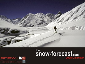
Lastly, a request: we are looking for volunteers to help us translate our site into popular languages and also putting out a call for more excellent photo submissions for our 2009 calendar. Contact us if you can help!
That's it for this week. This roundup along with all our past ones can be viewed online in our snow blog archive.
Best wishes,
The snow-forecast team
Please click here if you would like to unsubscribe from the newsletter
 Nearest