This Winter’s El Niño, The Facts & The Fiction
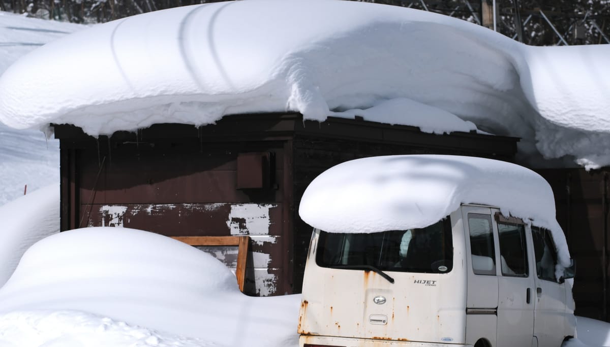
With a so-called “Super El Niño” forecast to have a significant effect on the regions around the Pacific this winter, the question skiers are asking is simple: book now or wait, and where are the best odds?
With a so-called “Super El Niño” forecast to have a significant effect on the regions around the Pacific this winter, the question skiers are asking is simple: book now or wait, and where are the best odds?
Much of the coverage over the past month has run two different NOAA measurements together as though one confirmed the other, which has made this event sound more certain than it is. Here we set out what the forecasts actually say, and where they stop being reliable.
What Are La Niña and El Niño And How Do They Differ?
El Niño and La Niña are Pacific Ocean climate anomalies that affect weather worldwide, but with the greatest impact on countries around the Pacific. El Niño warms the central and eastern equatorial Pacific, driving the jet stream south and typically favouring Southern California, Arizona and the southern Rockies. La Niña cools the same region, usually pushing storms north and favouring the Pacific Northwest and northern Rockies.
So What’s A "Super El Niño”?
It is worth being aware that the term “Super El Niño" is not a meteorological one from the National Oceanic and Atmospheric Administration (NOAA), the United States government science agency that actually forecasts the strength of La Niña and El Niño at any time. Instead, it’s a media term used to add some drama to headlines. It effectively means a very strong El Niño event, and this one very likely will qualify.
Just How Strong Will It Be?
On the current scale NOAA now uses it looks like this winter will see a probable record strength, although that’s not yet certain. NOAA has changed their measurement system for La Niña/El Niño, so that winter 1982-83, more than 40 years ago, now takes the record. Before that change, the winter of 2015-16 was the strongest ever measured on the old scale.
NOAA changed its scale of measurement in February this year. Its new scale strips out the general warming of the world’s oceans, so a 2026 event can be compared fairly with a 1983 one, and on that basis NOAA forecasts a peak of just under 2.5C above normal. A separate analysis by Zeke Hausfather at Berkeley Earth, taking the median of 667 model runs across 14 forecasting systems, arrives at 3.6C on the older scale. Both are right. They are simply not the same measurement, and quoting one to support the other is where most of this month’s coverage has gone wrong.
To put the older figure in context: across a patch of ocean roughly the size of the lower 48, water that would normally sit at 26 to 27C would be nearer 30C. Neither number is a water temperature in itself; both describe how far above normal that patch is running.
Where Will The El Niño Be Strongest?
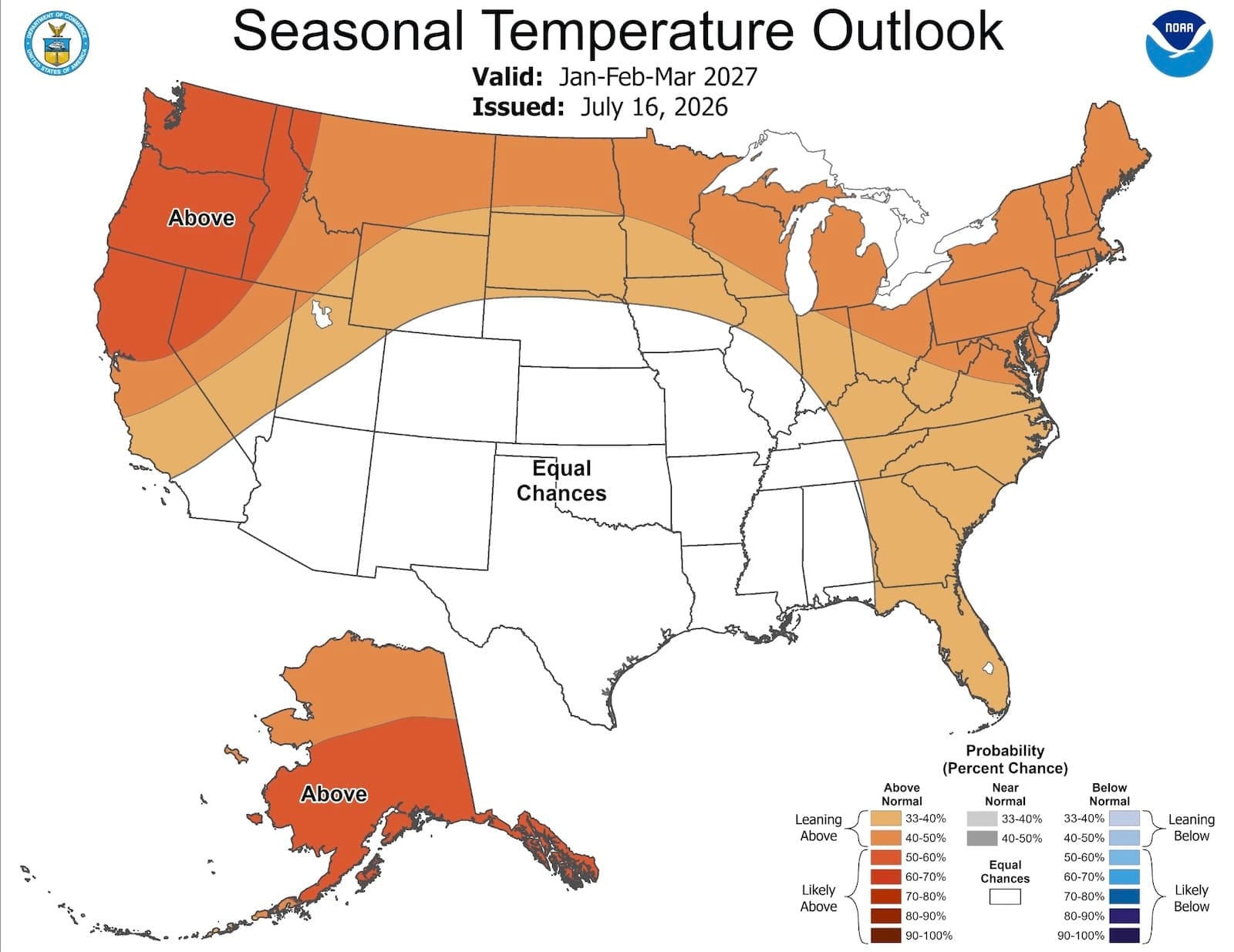
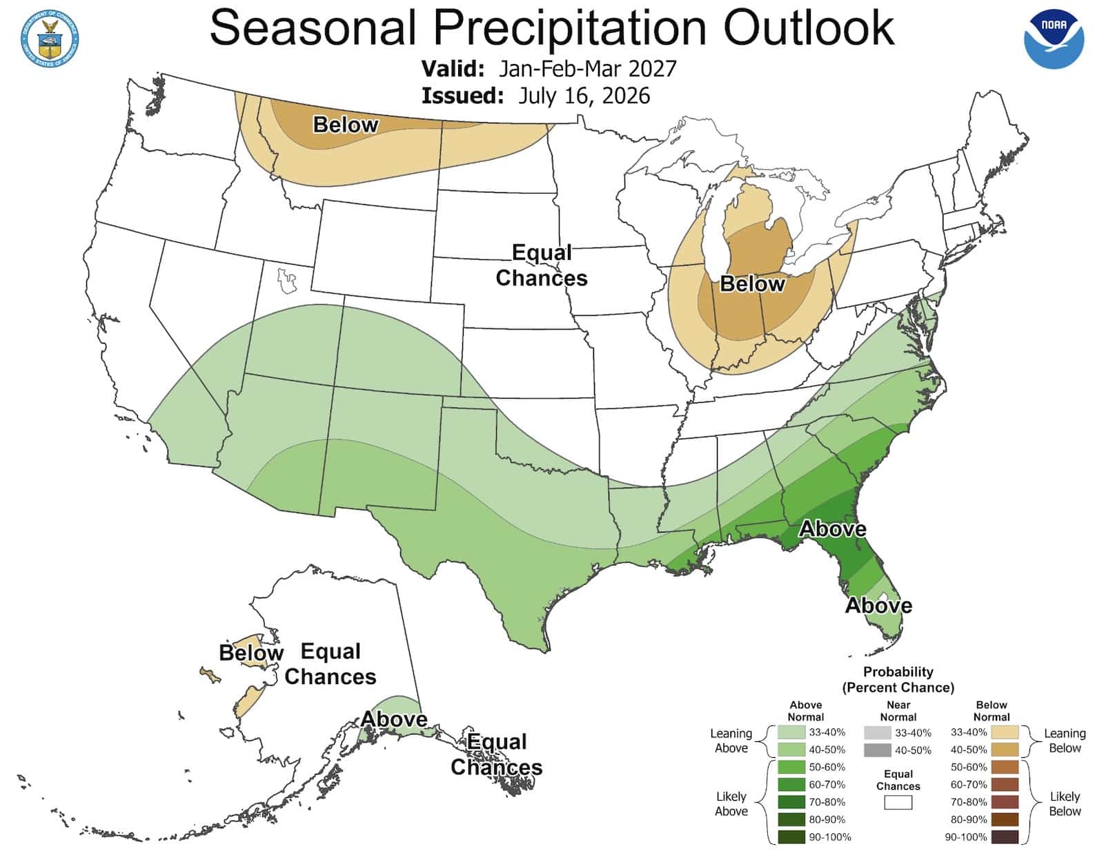
There's a clear pattern across Western North America, a north-to-south split. The northern mountains look warm, the southern ones look wet, and everything in between is genuinely uncertain.
NOAA suggest the ski states of Washington, Oregon, Idaho and Montana carry the clearest warm signal, with the Pacific Northwest likely to see the strongest for above-normal temperatures from October through winter, with below-normal precipitation across the northern tier. The main problem for ski areas in the Northwest, though, is likely to be warmth more than drought. Snow will still fall up high, but at mid-mountain it may arrive wet, so resorts with low bases carry the most risk, and elevation is what will save the season.
By contrast, New Mexico and Arizona look best. Above-normal precipitation from October, with near-normal temperatures added on top for mid-winter. Taos, Ski Santa Fe and Snowbowl are in the sweet spot.
Southern Utah and the southern Sierra sit at the edge of this area, with the outlook for Tahoe, northern Utah and Colorado currently genuinely uncertain. NOAA has all three at equal chances on precipitation, which doesn't mean average. It means the models have no lean either way and storms can still deliver. Temperatures run above normal throughout, so those with plenty of high terrain look most likely to benefit.
The East is more difficult to predict. On the one hand, it will most likely be a warmer winter, and there's no enhanced storm track for New England, but on the other it shouldn't be dry either. The Great Lakes will probably lose out because lake-effect snow needs cold air moving over warmer water, and this pattern brings mild air.
All that said, the last record El Niño in 2015-16 delivered the opposite of the forecast in the two biggest ski regions. More on that below.
What About Western Canada?
NOAA is a US agency and its seasonal maps stop at the border, which is why Canada is missing from most of the coverage. Environment and Climate Change Canada takes a similar view of the pattern, though.
ECCC research scientist Bill Merryfield has said El Niño winters tend to combine a precipitation deficit with warmer temperatures, which usually means less snow on the ground, particularly in western British Columbia and Alberta. He also notes those effects often carry on into spring and sometimes late spring, so the tail end of the season is as exposed as the middle of it.
In practice it splits much the same way as the American Northwest. On the coast the problem is the snow line rather than the moisture: Whistler can still take a battering from Pacific systems, but warm storms drag the rain line uphill. Inland, across interior BC and the Canadian Rockies, the issue is longer gaps between storms and a need for cold air to arrive at the right moment. Higher terrain is the hedge in both cases.
As with everything else here, this is a tilt rather than a forecast.
When Will The El Niño Be Strongest?
NOAA’s confidence that this will qualify as a very strong event is highest for October to December and eases after that. That is a statement about the ocean, not about when the snow falls. The atmospheric knock-on over North America typically lags the ocean by a couple of months, so El Niño’s influence on storm tracks usually shows up most clearly from January through March. An early peak in the index is not a reason to expect an early peak in snowfall.
The practical advice, whenever you go, is to book high, favour north-facing terrain, and keep dates flexible if you can. Treat the Southwest as the likely winner rather than the certain one. And given the Northwest came in wet in two of the three big events, treat it as the risk rather than the write-off.
Currently, certainty that the El Niño will be strong diminishes from November onwards. Anyone booking January now is guessing. By late October they'll be guessing with much better information.
What is NOAA Saying Exactly?
Three different NOAA numbers are being quoted and sometimes misquoted. Firstly, they’re 97% certain about the duration of the El Niño (but not 97% certain how strong it will be). NOAA is close to certain the event will still be running through early spring 2027, so covers the whole ski season.
NOAA also puts the odds at 81% that the event reaches “very strong” during October to December, which would rank it among the largest since records began in 1950. That figure eases to 75% for November to January and lower after that. Note that this is the probability of the event being classified very strong, not a measure of how much snow will fall.
NOAA's next monthly ENSO update is 13 August, and the official winter outlook lands mid-October.
The Big Caveat That Most Super El Niño Forecasts Are Missing
There have been only three very strong El Niños in the modern record: 1982-83, 1997-98, and 2015-16, and all three produced different regional outcomes, and each time the outcomes weren't as clear-cut as forecasting models suggest. The impact was also different each time.
In 1982-83, it rained along the entire West Coast, including the expected to be dry Northwest. In 2015-16, the pattern more or less reversed, wet in the north and dry in the south.
The Northwest actually came in wet in two of those three winters.
2015-16 is the most interesting. Southern California stayed dry, the drought carried on, and the Pacific Northwest came in wet, which is the opposite of what almost everyone forecast.
The exact distribution of Pacific warmth may have played a part, but that is still not fully agreed. A NOAA-supported study by Cash and Burls concluded that unpredictable circulation high in the atmosphere off the West Coast was primarily responsible. The same study puts a number on it: even in Southern California, where the El Niño link is strongest, it accounts for at most a third of how wet the winter turns out, and usually nearer a fifth. In Northern California it is under a tenth, and not statistically significant. So when we say Tahoe is a coin toss, that is the actual figure rather than a hedge.
The lesson is that El Niño strength alone doesn't determine where the storms go.
A further factor is just where the warm water sits in the Pacific and what the atmosphere above it decides to do, which matters just as much as how warm it gets. No headline number tells you either.
And finally, it's worth noting that averaging many weather forecasting model runs tends to exaggerate El Niño's apparent influence, because averaging strips out the unpredictable weather that actually determines most seasons.
For those forecasting this coming winter, including ourselves, keep in mind that nobody has ever been able to check these forecasts against an El Niño this big, because there has never been one.
The Strong El Niño Is Likely To Be Bad News for Japanese Snow
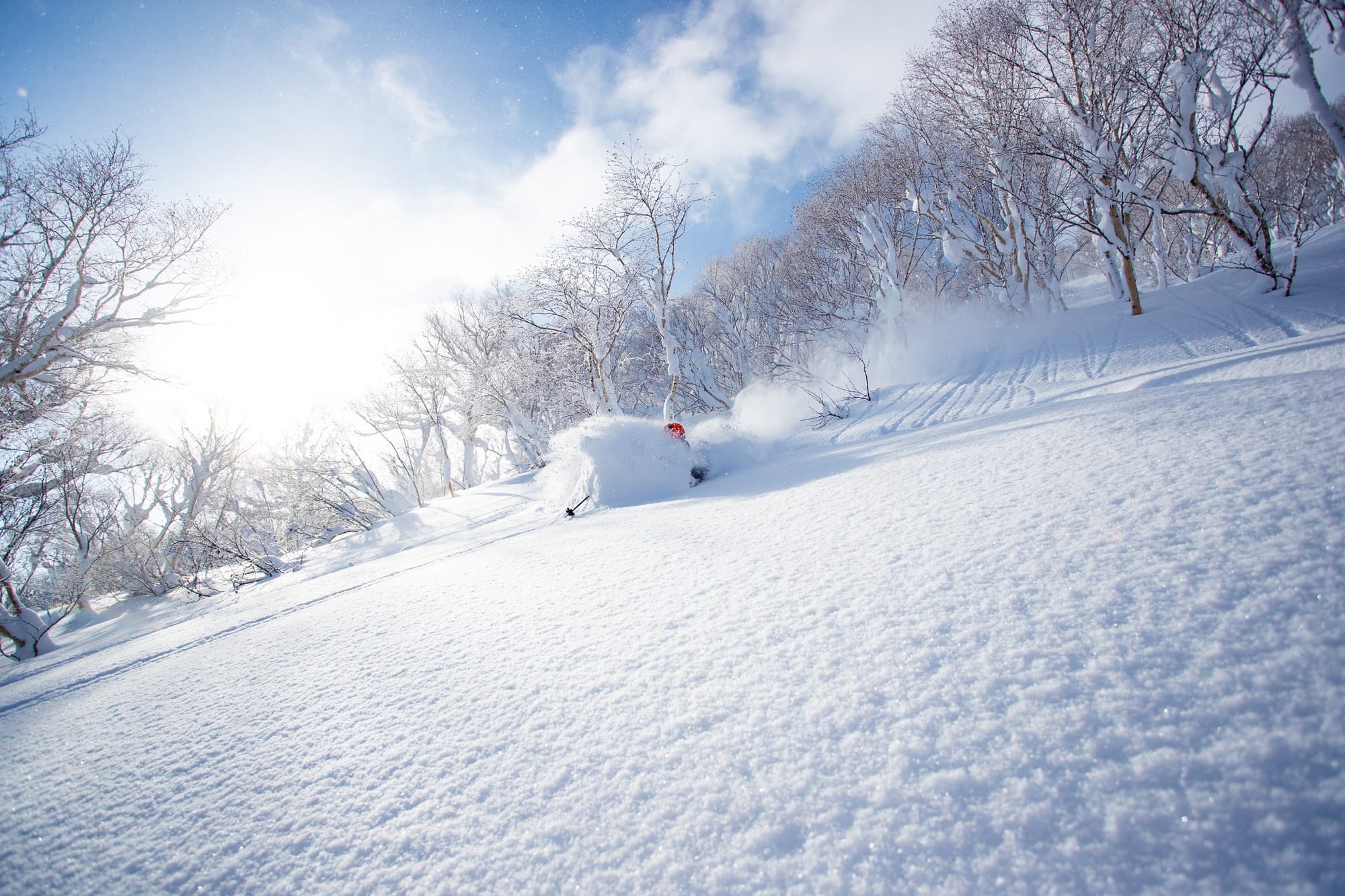
El Niño’s effect on snow varies enormously by continent, and Japan carries probably the clearest signal anywhere. It is a negative one. Japan’s powder depends on cold Siberian air crossing the warm Sea of Japan, and El Niño tends to weaken that flow. El Niño winters there bring fewer sustained cold outbreaks and a higher snow line, with Hokkaido usually holding up better than Honshu. Individual storms can still deliver, but the season-long tilt is real.
El Niño Is Largely Irrelevant To Europe’s Alps
Some reports circulating claim that El Niño affects the Alps in the same way it does mountain ranges around the Pacific. It does not. The strength of El Niño or La Niña tells you almost nothing about how Alpine snowfall will play out, beyond its contribution to a generally warmer planet. Alpine winters are dominated by a different system much closer to home, the North Atlantic Oscillation. El Niño does nudge that system, but the direction of the nudge reverses partway through the season, pushing one way in November and December and the other way in January and February. Any single claim about El Niño and the Alps is therefore wrong roughly half the time. Altitude remains the only reliable guide.
Sources
Zeke Hausfather, Berkeley Earth, 13 July 2026
Environment and Climate Change Canada seasonal guidance, and comments by Bill Merryfield.
NOAA’s next monthly ENSO update is 13 August 2026; the official US winter outlook lands mid-October.