

Global Weekly Snow Roundup #320
Weekly Snow News for the world, updated 25 June 2026: Chile and New Zealand's seasons proper set to begin, Tignes and Sunshine reopen for summer skiing. weekend as Riksgransen ends its 2026 season.

Next 4 days weather summary:Moderate rain (total 11.0mm), heaviest on Sun night. Very mild (max 16°C on Sun afternoon, min 9°C on Sun night). Wind will be generally light. | Days 5-7 weather summary:Some drizzle, heaviest during Tue night. Very mild (max 14°C on Fri afternoon, min 9°C on Wed night). Wind will be generally light. | |||||||||||||||
Sunday 28 | Monday 29 | Tuesday 30 | Wednesday 1 | Thursday 2 | ||||||||||||
night | AM | PM | night | AM | PM | night | AM | PM | night | AM | PM | night | AM | PM | night | |
clear | clear | t-storm risk | rain shwrs | clear | t-storm risk | rain shwrs | clear | t-storm risk | rain shwrs | clear | clear | clear | clear | clear | clear | |
km/h | ||||||||||||||||
Snow map |  |  |  |  |  |  | ||||||||||
— | — | — | — | — | — | — | — | — | — | — | — | — | — | — | — | |
mm | — | — | 1 | 4 | — | 2 | 3 | — | 1 | 1 | — | — | — | — | — | — |
max °C | 14 | 15 | 16 | 14 | 11 | 13 | 11 | 11 | 13 | 11 | 12 | 12 | 11 | 11 | 12 | 12 |
min °C | 13 | 13 | 15 | 9 | 9 | 11 | 9 | 10 | 12 | 10 | 10 | 12 | 9 | 10 | 12 | 10 |
chill °C | 11 | 12 | 14 | 8 | 8 | 10 | 7 | 10 | 12 | 8 | 9 | 12 | 7 | 8 | 11 | 8 |
Humid % | 49 | 39 | 51 | 65 | 60 | 74 | 85 | 73 | 82 | 79 | 56 | 59 | 47 | 43 | 54 | 48 |
Freeze m | 4650 | 4600 | 4650 | 4500 | 4200 | 4350 | 4300 | 4200 | 4350 | 4500 | 4550 | 4500 | 4700 | 4500 | 4550 | 4600 |
— | 6:16 | — | — | 6:18 | — | — | 6:18 | — | — | 6:18 | — | — | 6:18 | — | — | |
— | — | — | 9:34 | — | — | 9:34 | — | — | 9:34 | — | — | 9:34 | — | — | 9:34 | |
Go pro and carve into:
Avalanche information: European Avalanche Warning Services (EAWS)
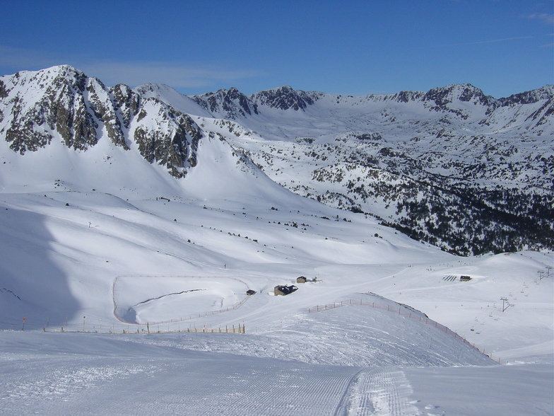
Latest snow reports near Grandvalira-Pas de la Casa:
| Top snow depth: | — |
|---|---|
| Bottom snow depth: | — |
| Fresh snowfall depth: | — |
| Last snowfall: | 18 May 2026 |
| Snow Alerts | Create Alert |
0.0 | Bluebird Powder days Fresh snow, mostly sunny, light wind. |
|---|---|
0.0 | Powder days Fresh snow, limited sun, any wind. |
0.0 | Bluebird days Average snow, mostly sunny, light wind. |
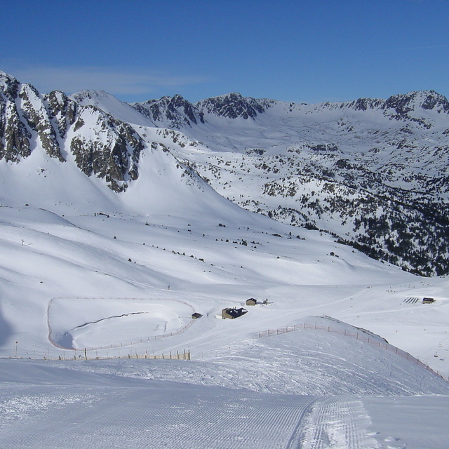
The above table gives the weather forecast for Grandvalira-Pas de la Casa at the specific elevation of 2640 m. Our sophisticated weather models allow us to provide snow forecasts for the top, middle and bottom ski stations of Grandvalira-Pas de la Casa. To access the weather forecasts for the other elevations, use the tab navigation above the table. For a wider view of the weather, check out the Weather Map of Andorra.
Click here to read further information on freezing levels and how we forecast our temperatures.
Overall 4.2 Based on 32 votes and 30 reviews
Just returned from Pas. 5 great snow days, really enjoyed the skiing. Been several times before but won't be rushing back. Pretty it ain't but once on the mountain truly breathtaking. The y really have pared everything to the bone. Many lifts had only one person working them, there was no organisation of many of the lift queues. Big queues and chairs going up half full, several card readers not working adding to the queues, unhelpful staff....the list goes on. Lack of reliable ski buses, what's the matter with these people. Snow clearing very poor parking a nightmare. Will they never learn? Whilst Grandvalira will never be ski in/ out it would make the experience far more pleasant if there was a ski bus instead of having to drive to the lifts, queue for parking and put cold boots on in a car park.
Sue Hester from Spain writes:
Just returned from Pas. 5 great snow days, really enjoyed the skiing. Been several times before but won't be rushing back. Pretty it ain't but once on the mountain truly breathtaking. The y really have pared everything to the bone. Many lifts had only one person working them, there was no organisation of many of the lift queues. Big queues and chairs going up half full, several card readers not working adding to the queues, unhelpful staff....the list goes on. Lack of reliable ski buses, what's the matter with these people.
Snow clearing very poor parking a nightmare.
Will they never learn? Whilst Grandvalira will never be ski in/ out it would make the experience far more pleasant if there was a ski bus instead of having to drive to the lifts, queue for parking and put cold boots on in a car park.
Read 29 more reviews of Grandvalira-Pas de la Casa or submit your own


 Nearest