

Portillo Re-Opens To Guests Arriving By Helicopter
Chile’s famous Portillo ski resort is reported to have re-opened to guests arriving by helicopter after being cut off by road for more than two weeks by over 6m/20 feet of snowfall.

Next 3 days weather summary:Heavy rain (total 25.0mm), heaviest during Mon night. Very mild (max 18°C on Mon afternoon, min 11°C on Mon night). Wind will be generally light. | Days 4-6 weather summary:Heavy rain (total 35.0mm), heaviest during Thu night. Very mild (max 18°C on Sat afternoon, min 11°C on Thu night). Wind will be generally light. | |||||||||||||||||
Monday 3 | Tuesday 4 | Wednesday 5 | Thursday 6 | Friday 7 | Saturday 8 | |||||||||||||
AM | PM | night | AM | PM | night | AM | PM | night | AM | PM | night | AM | PM | night | AM | PM | night | |
some clouds | cloudy | rain shwrs | clear | rain shwrs | rain shwrs | clear | t-storm risk | t-storm risk | t-storm risk | mod. rain | rain shwrs | t-storm risk | t-storm risk | rain shwrs | clear | some clouds | rain shwrs | |
km/h | ||||||||||||||||||
Snow map |  |  |  |  |  |  | ||||||||||||
— | — | — | — | — | — | — | — | — | — | — | — | — | — | — | — | — | — | |
mm | — | — | 15 | — | 1 | 2 | — | 1 | 6 | 4 | 9 | 9 | 1 | 4 | 3 | — | — | 5 |
max °C | 17 | 18 | 14 | 14 | 16 | 14 | 15 | 17 | 14 | 13 | 14 | 12 | 14 | 15 | 13 | 16 | 18 | 15 |
min °C | 14 | 18 | 11 | 12 | 15 | 12 | 13 | 17 | 12 | 12 | 13 | 11 | 12 | 14 | 12 | 13 | 18 | 13 |
chill °C | 13 | 18 | 9 | 12 | 15 | 12 | 13 | 17 | 11 | 11 | 12 | 10 | 10 | 14 | 11 | 12 | 18 | 13 |
Humid % | 52 | 51 | 66 | 53 | 62 | 76 | 63 | 63 | 77 | 74 | 86 | 78 | 73 | 79 | 67 | 52 | 47 | 58 |
Freeze m | 4550 | 4650 | 4300 | 4250 | 4450 | 4450 | 4450 | 4650 | 4550 | 4300 | 4400 | 4450 | 4400 | 4450 | 4550 | 4550 | 4750 | 4650 |
6:46 | — | — | 6:47 | — | — | 6:48 | — | — | 6:48 | — | — | 6:50 | — | — | 6:50 | — | — | |
— | — | 9:10 | — | — | 9:09 | — | — | 9:07 | — | — | 9:07 | — | — | 9:06 | — | — | 9:05 | |
Go pro and carve into:
Avalanche information: European Avalanche Warning Services (EAWS)
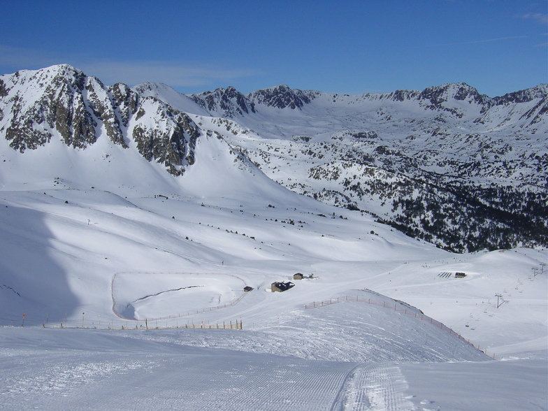
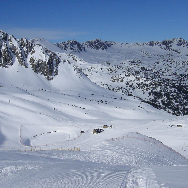
Latest snow reports near Grandvalira-Pas de la Casa:
| Top snow depth: | — |
|---|---|
| Bottom snow depth: | — |
| Fresh snowfall depth: | — |
| Last snowfall: | 18 May 2026 |
| Snow Alerts | Create Alert |
0.0 | Bluebird Powder days Fresh snow, mostly sunny, light wind. |
|---|---|
0.0 | Powder days Fresh snow, limited sun, any wind. |
0.0 | Bluebird days Average snow, mostly sunny, light wind. |
The above table gives the weather forecast for Grandvalira-Pas de la Casa at the specific elevation of 2345 m. Our sophisticated weather models allow us to provide snow forecasts for the top, middle and bottom ski stations of Grandvalira-Pas de la Casa. To access the weather forecasts for the other elevations, use the tab navigation above the table. For a wider view of the weather, check out the Weather Map of Andorra.
Click here to read further information on freezing levels and how we forecast our temperatures.
Overall 4.2 Based on 32 votes and 30 reviews
The ski school is terrible. We booked my daughter for the 'snow garden' which they describe on their website as 'a gentle and enjoyable introduction to skiing and the snow, with activities and games designed especially for young children. There were no activities or games. The poor children sat on a bench from 9.30-10.30 doing absolutely nothing. When they went on the slopes (10.30-12.15), there were 11 children (aged under 5) per instructor so they just waited and waited for their turn. They basically went down about 3 metres once or twice as all their time was spent waiting. I felt so sorry not only for my daughter but all the children who just had to spend all morning waiting with nothing to do.
Sarika Brown from United Kingdom writes:
The ski school is terrible. We booked my daughter for the 'snow garden' which they describe on their website as 'a gentle and enjoyable introduction to skiing and the snow, with activities and games designed especially for young children. There were no activities or games. The poor children sat on a bench from 9.30-10.30 doing absolutely nothing. When they went on the slopes (10.30-12.15), there were 11 children (aged under 5) per instructor so they just waited and waited for their turn. They basically went down about 3 metres once or twice as all their time was spent waiting. I felt so sorry not only for my daughter but all the children who just had to spend all morning waiting with nothing to do.
Read 29 more reviews of Grandvalira-Pas de la Casa or submit your own


 Nearest