

Banff Sunshine Village Opening for Summer Skiing
Banff Sunshine Village has confirmed it will reopen for a fortnight of summer skiing, from this weekend. The only ski area in Canada to be open into July.

Next 4 days weather summary:Light rain (total 4.0mm), mostly falling on Fri afternoon. Very mild (max 14°C on Thu afternoon, min 7°C on Tue night). Winds increasing (calm on Tue night, fresh winds from the SE by Fri morning). | Days 5-7 weather summary:Moderate rain (total 13.0mm), heaviest on Fri night. Very mild (max 13°C on Sun afternoon, min 10°C on Fri night). Winds decreasing (fresh winds from the NNW on Fri night, calm by Sun night). | |||||||||||||||
Wednesday 24 | Thursday 25 | Friday 26 | Saturday 27 | Sunday 28 | ||||||||||||
night | AM | PM | night | AM | PM | night | AM | PM | night | AM | PM | night | AM | PM | night | |
clear | some clouds | clear | clear | clear | some clouds | some clouds | cloudy | light rain | heavy rain | rain shwrs | clear | clear | clear | clear | clear | |
km/h | ||||||||||||||||
Snow map | 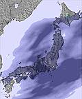 | 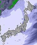 |  |  |  |  | ||||||||||
— | — | — | — | — | — | — | — | — | — | — | — | — | — | — | — | |
mm | — | — | — | — | — | — | — | — | 4 | 12 | 1 | — | — | — | — | — |
max °C | 9 | 11 | 12 | 11 | 13 | 14 | 14 | 13 | 12 | 12 | 11 | 12 | 12 | 12 | 13 | 11 |
min °C | 7 | 10 | 11 | 11 | 13 | 14 | 13 | 12 | 12 | 10 | 10 | 11 | 11 | 11 | 13 | 10 |
chill °C | 7 | 9 | 10 | 10 | 11 | 13 | 11 | 9 | 11 | 6 | 7 | 9 | 8 | 9 | 12 | 10 |
Humid % | 81 | 51 | 76 | 62 | 53 | 63 | 78 | 87 | 90 | 100 | 87 | 87 | 71 | 70 | 63 | 84 |
Freeze m | 2600 | 2850 | 2950 | 3300 | 3550 | 3650 | 3800 | 3650 | 3650 | 3500 | 3350 | 3400 | 3100 | 3150 | 3400 | 3550 |
— | 3:59 | — | — | 3:59 | — | — | 4:00 | — | — | 4:00 | — | — | 4:00 | — | — | |
— | — | 7:19 | — | — | 7:19 | — | — | 7:19 | — | — | 7:19 | — | — | 7:19 | — | |
Go pro and carve into:
Avalanche information: Japan Avalanche Network
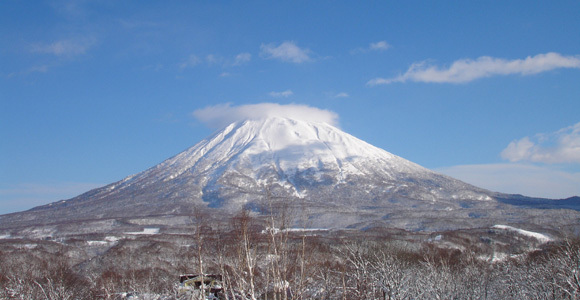
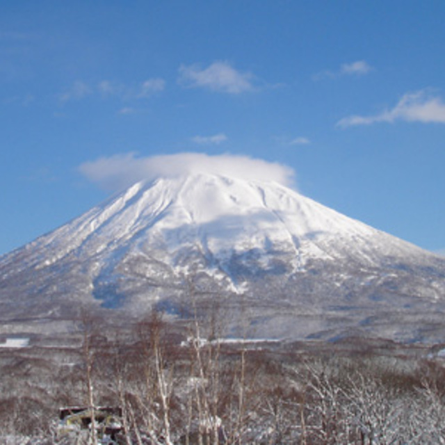
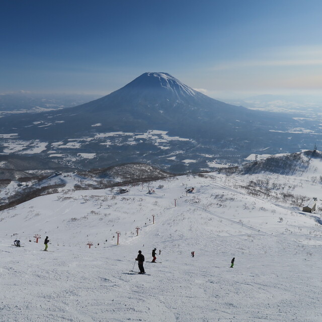
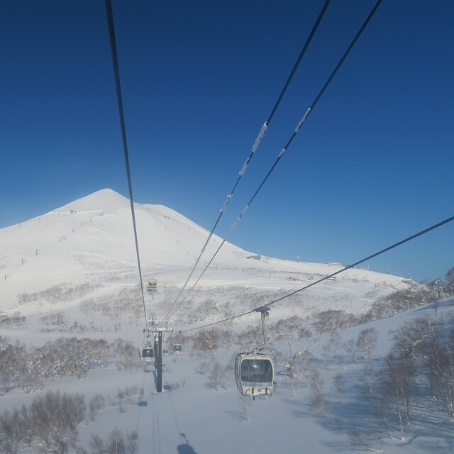
Latest snow reports near Niseko Village:
| Top snow depth: | — |
|---|---|
| Bottom snow depth: | — |
| Fresh snowfall depth: | — |
| Last snowfall: | 4 May 2026 |
| Snow Alerts | Create Alert |
0.0 | Bluebird Powder days Fresh snow, mostly sunny, light wind. |
|---|---|
0.0 | Powder days Fresh snow, limited sun, any wind. |
0.0 | Bluebird days Average snow, mostly sunny, light wind. |
The above table gives the weather forecast for Niseko Village at the specific elevation of 1170 m. Our sophisticated weather models allow us to provide snow forecasts for the top, middle and bottom ski stations of Niseko Village. To access the weather forecasts for the other elevations, use the tab navigation above the table. For a wider view of the weather, check out the Weather Map of Japan.
Click here to read further information on freezing levels and how we forecast our temperatures.
Overall 4.4 Based on 1 vote and 3 reviews
Niseko Village is a great resort and has extremely user-friendly ski-in/ski-out services. I was in Niseko Village for 2009 Xmas to ski or, to be exact, learn to ski. Can't comment on the instructors because I have no comparison. However, the arrangement made by Hilton Niseko Village to assist skiers/boarders alike were really fantastic. Simply ski down the slope, take off your skis/board, enter the hotel building and within 10 steps there are welcoming hands from a counter help to store your equipment and right next to this, a second counter stores your boots in exchange for your own shoes. This will be the reverse when you want to go out skiing/boarding and the lift and gondola are only 10 to 20 steps after exiting the hotel building. Totally trouble-free and energy saving. Moreover, these are all carried out with broad smiles.
Kenneth from Hong Kong writes:
Niseko Village is a great resort and has extremely user-friendly ski-in/ski-out services. I was in Niseko Village for 2009 Xmas to ski or, to be exact, learn to ski. Can't comment on the instructors because I have no comparison. However, the arrangement made by Hilton Niseko Village to assist skiers/boarders alike were really fantastic. Simply ski down the slope, take off your skis/board, enter the hotel building and within 10 steps there are welcoming hands from a counter help to store your equipment and right next to this, a second counter stores your boots in exchange for your own shoes. This will be the reverse when you want to go out skiing/boarding and the lift and gondola are only 10 to 20 steps after exiting the hotel building. Totally trouble-free and energy saving. Moreover, these are all carried out with broad smiles.


 Nearest