

North America Weekly Snow Roundup #321
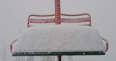
Weekly Snow News for North America, updated 2 July 2026: Beartooth Basin summer ski area ends 2026 season with fresh snow falling and Banff's Sunshine celebrates Canada Day on the slopes.

Next 3 days weather summary:Light rain (total 3.0mm), mostly falling on Thu morning. Warm (max 21°C on Thu afternoon, min 10°C on Fri night). Winds increasing (calm on Thu morning, fresh winds from the NNW by Fri afternoon). | Days 4-6 weather summary:Light rain (total 6.0mm), mostly falling on Sun night. Warm (max 24°C on Tue afternoon, min 13°C on Sun morning). Mainly fresh winds. | |||||||||||||||||
Thursday 2 | Friday 3 | Saturday 4 | Sunday 5 | Monday 6 | Tuesday 7 | |||||||||||||
AM | PM | night | AM | PM | night | AM | PM | night | AM | PM | night | AM | PM | night | AM | PM | night | |
light rain | some clouds | clear | some clouds | some clouds | clear | clear | some clouds | some clouds | cloudy | some clouds | rain shwrs | light rain | rain shwrs | some clouds | clear | some clouds | light rain | |
km/h | ||||||||||||||||||
Snow map | 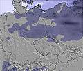 | 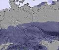 | 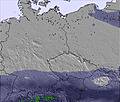 |  |  |  | ||||||||||||
— | — | — | — | — | — | — | — | — | — | — | — | — | — | — | — | — | — | |
mm | 3 | — | — | — | — | — | — | — | — | — | — | 1 | 2 | 2 | — | — | — | 1 |
max °C | 17 | 21 | 19 | 20 | 21 | 17 | 15 | 18 | 16 | 15 | 18 | 17 | 14 | 18 | 17 | 19 | 24 | 19 |
min °C | 17 | 19 | 15 | 18 | 20 | 10 | 13 | 17 | 12 | 13 | 15 | 13 | 13 | 17 | 13 | 16 | 23 | 15 |
chill °C | 17 | 19 | 14 | 18 | 19 | 7 | 11 | 16 | 10 | 11 | 13 | 11 | 11 | 16 | 12 | 15 | 23 | 13 |
Humid % | 84 | 54 | 57 | 50 | 37 | 60 | 51 | 40 | 60 | 63 | 53 | 83 | 80 | 57 | 73 | 58 | 31 | 61 |
Freeze m | 3900 | 3900 | 4000 | 3500 | 3650 | 3200 | 3150 | 3250 | 2950 | 2950 | 3250 | 3250 | 3150 | 3200 | 3250 | 3400 | 3550 | 3300 |
4:48 | — | — | 4:50 | — | — | 4:50 | — | — | 4:50 | — | — | 4:52 | — | — | 4:52 | — | — | |
— | — | 8:45 | — | — | 8:45 | — | — | 8:45 | — | — | 8:45 | — | — | 8:45 | — | — | 8:45 | |
Go pro and carve into:
Latest snow reports near Nagy-Hideghegy:
| Top snow depth: | — |
|---|---|
| Bottom snow depth: | — |
| Fresh snowfall depth: | — |
| Last snowfall: | 19 Feb 2026 |
| Snow Alerts | Create Alert |
0.0 | Bluebird Powder days Fresh snow, mostly sunny, light wind. |
|---|---|
0.0 | Powder days Fresh snow, limited sun, any wind. |
0.0 | Bluebird days Average snow, mostly sunny, light wind. |
The above table gives the weather forecast for Nagy-Hideghegy at the specific elevation of 858 m. Our sophisticated weather models allow us to provide snow forecasts for the top, middle and bottom ski stations of Nagy-Hideghegy. To access the weather forecasts for the other elevations, use the tab navigation above the table. For a wider view of the weather, check out the Weather Map of Hungary.
Click here to read further information on freezing levels and how we forecast our temperatures.


 Nearest