
Visiting Mont-aux-Sources
Helpful resort information to assist planning your trip.
- Opens—
- Closes—
- Accommodation—
- Restaurants | Bars— | —
- Nearest Airport Durban
- Nearest Train Station —
- Tourist Office Website
- Tourist Office Phone—
Mont-aux-Sources Features
The terrain at Mont-aux-Sources includes:
- Halfpipes—
- Terrain Parks—
- X-Country—
- Ski Hire—
What's it like at Mont-aux-Sources?
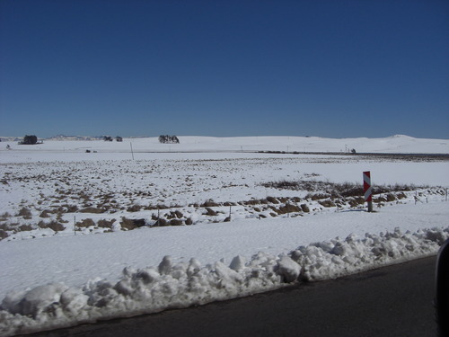
Mont-aux-Sources is a mountain block, forming one of the highest and most spectacular portions of the Drakensberg. It includes the Sentinel, a spectacular wall of 1,000 vertical feet. The high point of the massif is actually an inconspicuous protuberance, but it is important in that it forms the triangular corner where Lesotho meets the South African provinces of Natal and Orange Free State. The Mont-aux-Sources mountain is also the source for three major rivers (hence the name Mont-aux-Sources), which in places plunge spectacularly down the mountain wall. Tugela Falls, for example, is a series of five cascades which tumbles nearly 3000 feet over the east wall. The Mont-aux-Sources mountain is part of the Royal Natal National Park, which has a well developed system of marked trails, and includes many freestanding rocks in addition to the challenging walls.
Explore Mont-aux-Sources Location Map
Interactive Mont-aux-Sources trail map and piste map. View the piste and trails as well as the surrounding terrain and mountain contours for backcountry action. Find and compare nearby resorts by clicking on the resort markers.

When's the snowiest month to visit Mont-aux-Sources?
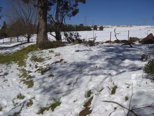
What's the snow currently like in Mont-aux-Sources?
A summary of the current snow conditions in Mont-aux-Sources. View more information on the Mont-aux-Sources detailed snow report page.
- Piste Condition—
- Off-piste Condition—

| Upper snow depth: | ||
|---|---|---|
| Lower snow depth: | ||
Visitor Reviews of Mont-aux-Sources
Debbie Miller from United States writes:
I LOVED climbing this mountain. Of all my activities in 14 years of living in southern Africa as a child, this was my favorite .. the view, the process of the climb .. love the freedom & the challenge
Resorts close to Mont-aux-Sources
Discover ski resorts near Mont-aux-Sources. Click below to view there ski resort guides.
 Afriski Mountain ResortLast snow: 4.0 cm Thu 02 Jul
 Lifts: 4
 Pistes: 220 km away
 TiffindellLast snow: 1.0 cm Thu 02 JulLifts: 5Pistes: 2237 km away
- MatroosbergLast snow: 6.0 cm Sun 28 JunLifts: 1Pistes: —1019 km away
 Mount HermonLast snow: 2.0 cm Mon 04 MayLifts: 10Pistes: —6937 km away
 Zaarour ClubLast snow: 1.0 cm Tue 05 MayLifts: 6Pistes: —7004 km away
 Nearest