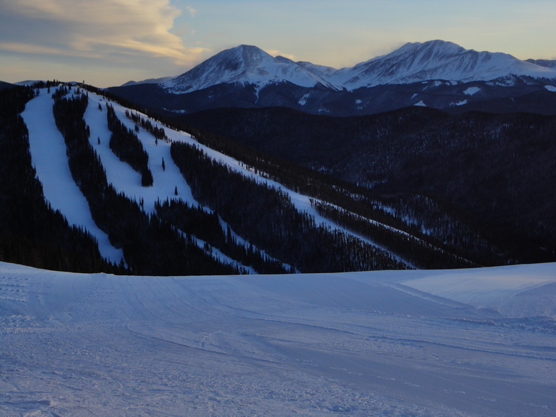
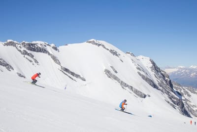
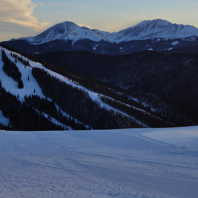
comScore pixel
Keystone snow
Ski USA - Colorado

Keystone Snow Forecast

Weather Forecast for Keystone at 2764 m
Issued: 5 am  01 Apr 2026 (local time)

New snow in Keystone

1.8cm0.7in
Wed 1st (PM)
The snow forecast for Keystone is: Mild with moderate rain (total 10.0mm) on Wed afternoon, Becoming colder with a light covering of snow, mostly falling on Wed afternoon. Freeze-thaw conditions (max 7°C on Thu afternoon, min -9°C on Fri night). Wind will be generally light.

Keystone Weather (Next 3 days): The snow forecast for Keystone is: Mild with moderate rain (total 10.0mm) on Wed afternoon, Becoming colder with a light covering of snow, mostly falling on Wed afternoon. Freeze-thaw conditions (max 7°C on Thu afternoon, min -9°C on Fri night). Wind will be generally light.

Keystone Weather (Days 4-6): Some drizzle, heaviest during Mon night. Freeze-thaw conditions (max 10°C on Mon afternoon, min -4°C on Sat night). Wind will be generally light.


Keystone Live Weather

ResortSnow DepthTemp. (°C)Wind (km/h)Weather
Top Lift: 0.7m
-2
20
snow showers
Middle Lift: 
1
10
snow showers
Bottom Lift: 0.4m
4
5
rain showers
6 Day Forecast
Issued: 5 am 01 Apr 2026 / Updates in ::
Change Forecast Height
Choose Forecast
Last 6 daysScroll left for last 6 daysNow
Wednesday
1
Thursday
2
Friday
3
Saturday
4
Sunday
5
Monday
6
AM
PM
night
AM
PM
night
AM
PM
night
AM
PM
night
AM
PM
night
AM
PM
night
light rain
light snow
snow showers
clear
clear
snow showers
snow showers
light snow
snow showers
clear
clear
clear
clear
part cloud
part cloud
clear
part cloud
snow showers
light rain
light snow
snow shwrs
clear
clear
snow shwrs
snow shwrs
light snow
snow shwrs
clear
clear
clear
clear
some clouds
some clouds
clear
some clouds
snow shwrs
 km/h
5
S
5
WNW
10
WNW
10
W
20
WSW
10
W
20
WNW
25
WNW
5
WNW
5
WNW
10
WNW
0
SE
5
SSE
5
SW
5
S
5
WSW
5
W
5
SSE
Snow map
1
2
1
1
3
7
1
max °C
4
2
0
5
7
2
-4
-3
-5
3
5
-3
7
9
2
9
10
3
min °C
4
2
-4
2
5
-8
-7
-4
-9
-2
4
-4
3
8
-1
5
8
1
2
0
-7
-1
1
-13
-14
-10
-9
-5
2
-4
2
8
-1
5
8
-1
77
90
97
62
43
88
46
59
93
64
29
66
39
22
63
39
20
93
3400
3150
2600
3050
3700
2700
1700
2300
1750
2400
3500
2400
3200
3900
2950
3500
4000
3050
Sea lvl1000m2000m3000m4000m5000m
-3-5-7-3-1-8-12-10-13-6-2-9-21-5-12-442-246-3-6-4-715-4591792
Sunrise
6:48
6:47
6:45
6:43
6:41
6:39
Sunset
7:27
7:28
7:29
7:30
7:30
7:31

Snow Radar

Submit a report Eyeball Reporter

Latest snow reports near Keystone:

  • 21 km away from Keystone

    5 hours ago
    weather station observation

    Light snow reported from Red Cliff Pass Airport at 11732 feet one mile SSE of Copper Mountain but it is probably falling as rain at the bottom of the ski area from Copper Mountain

  • 21 km away from Keystone

    10 hours ago
    weather station observation

    Light snow reported from Red Cliff Pass Airport at 11732 feet one mile SSE of Copper Mountain but it is probably falling as rain apart from near the top of the ski area from Copper Mountain

  • 21 km away from Keystone

    15 hours ago
    weather station observation

    Light snow reported from Red Cliff Pass Airport at 11732 feet one mile SSE of Copper Mountain Ski Resort from Copper Mountain

Keystone Snow Conditions

Top snow depth:66cm
Bottom snow depth:40cm
Fresh snowfall depth:2cm
Last snowfall:31 Mar 2026
Snow AlertsCreate Alert
Other resorts in USA - Colorado are reporting: powder (1) / good piste (1)

Ski deals in Keystone
Find Your Trip

Snow History

Week 1 of April has on average:
0.6
Bluebird Powder days
Fresh snow, mostly sunny, light wind.
1.6
Powder days
Fresh snow, limited sun, any wind.
0.2
Bluebird days
Average snow, mostly sunny, light wind.

Map placeholder