

Portillo Re-Opens To Guests Arriving By Helicopter
Chile’s famous Portillo ski resort is reported to have re-opened to guests arriving by helicopter after being cut off by road for more than two weeks by over 6m/20 feet of snowfall.

Next 3 days weather summary:Mostly dry. Warm (max 25°C on Mon morning, min 8°C on Mon night). Wind will be generally light. | Days 4-6 weather summary:Mostly dry. Warm (max 27°C on Fri afternoon, min 12°C on Thu night). Wind will be generally light. | |||||||||||||||||
Monday 3 | Tuesday 4 | Wednesday 5 | Thursday 6 | Friday 7 | Saturday 8 | |||||||||||||
AM | PM | night | AM | PM | night | AM | PM | night | AM | PM | night | AM | PM | night | AM | PM | night | |
some clouds | some clouds | clear | some clouds | cloudy | some clouds | clear | some clouds | clear | clear | some clouds | clear | clear | some clouds | some clouds | some clouds | cloudy | some clouds | |
km/h | ||||||||||||||||||
Snow map |  |  |  | 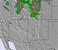 | 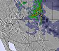 | 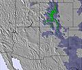 | ||||||||||||
— | — | — | — | — | — | — | — | — | — | — | — | — | — | — | — | — | — | |
mm | — | — | — | — | — | — | — | — | — | — | — | — | — | — | — | — | — | — |
max °C | 25 | 23 | 16 | 23 | 24 | 14 | 21 | 23 | 13 | 23 | 25 | 14 | 25 | 27 | 16 | 26 | 27 | 15 |
min °C | 22 | 23 | 8 | 17 | 23 | 9 | 17 | 22 | 10 | 19 | 24 | 12 | 22 | 26 | 13 | 23 | 23 | 13 |
chill °C | 22 | 23 | 7 | 17 | 23 | 9 | 17 | 22 | 10 | 19 | 24 | 12 | 22 | 26 | 13 | 23 | 23 | 13 |
Humid % | 21 | 24 | 61 | 38 | 15 | 78 | 16 | 8 | 16 | 12 | 10 | 19 | 14 | 9 | 28 | 15 | 11 | 36 |
Freeze m | 5550 | 5600 | 4800 | 5250 | 5500 | 4750 | 5200 | 5500 | 4900 | 5300 | 5500 | 5000 | 5450 | 5650 | 5100 | 5450 | 5700 | 5100 |
6:03 | — | — | 6:05 | — | — | 6:05 | — | — | 6:07 | — | — | 6:07 | — | — | 6:09 | — | — | |
— | 8:14 | — | — | 8:13 | — | — | 8:12 | — | — | 8:10 | — | — | 8:09 | — | — | 8:08 | — | |
Go pro and carve into:
Avalanche information: Colorado Avalanche Information Center
Latest snow reports near Keystone:
| Top snow depth: | 0 cm |
|---|---|
| Bottom snow depth: | 0 cm |
| Fresh snowfall depth: | — |
| Last snowfall: | 22 May 2026 |
| Snow Alerts | Create Alert |
0.0 | Bluebird Powder days Fresh snow, mostly sunny, light wind. |
|---|---|
0.0 | Powder days Fresh snow, limited sun, any wind. |
0.0 | Bluebird days Average snow, mostly sunny, light wind. |
The above table gives the weather forecast for Keystone at the specific elevation of 2764 m. Our sophisticated weather models allow us to provide snow forecasts for the top, middle and bottom ski stations of Keystone. To access the weather forecasts for the other elevations, use the tab navigation above the table. For a wider view of the weather, check out the Weather Map of United States.
Click here to read further information on freezing levels and how we forecast our temperatures.
Overall 4.0 Based on 16 votes and 5 reviews
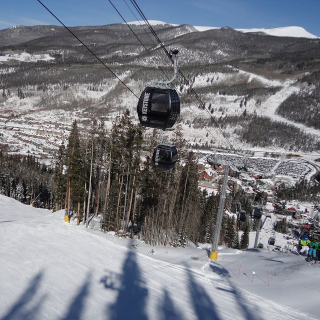
I'm here at Keystone this season and in response to below they now have a $30M upgrade into a new gondola that fits 8 people and gets to the summit in less than 12minutes (fast as) also has a mid station you can down load before the last hard pack snow (bottom of river run) that often gets stripped from beginner snowboarders sliding down it so that has been fixed now. They also have free bus services. As for being bitterly cold, of course this is the rocky mountains, that's why we are here. Enjoy, Lee - Snowboard Instructor (Keystone,co and Mt Hutt, NZ) Email - [email protected]
Lee Wilson (970)368-0165 from New Zealand writes:
I'm here at Keystone this season and in response to below they now have a $30M upgrade into a new gondola that fits 8 people and gets to the summit in less than 12minutes (fast as) also has a mid station you can down load before the last hard pack snow (bottom of river run) that often gets stripped from beginner snowboarders sliding down it so that has been fixed now. They also have free bus services. As for being bitterly cold, of course this is the rocky mountains, that's why we are here.
Enjoy,
Lee - Snowboard Instructor (Keystone,co and Mt Hutt, NZ)
Email - [email protected]


 Nearest