

Global Weekly Snow Roundup #320
Weekly Snow News for the world, updated 25 June 2026: Chile and New Zealand's seasons proper set to begin, Tignes and Sunshine reopen for summer skiing. weekend as Riksgransen ends its 2026 season.

Next 3 days weather summary:Moderate rain (total 11.0mm), heaviest on Sun night. Warm (max 24°C on Sun afternoon, min 11°C on Sun night). Wind will be generally light. | Days 4-6 weather summary:Mostly dry. Warm (max 22°C on Thu afternoon, min 10°C on Wed night). Wind will be generally light. | |||||||||||||||||
Sunday 28 | Monday 29 | Tuesday 30 | Wednesday 1 | Thursday 2 | Friday 3 | |||||||||||||
AM | PM | night | AM | PM | night | AM | PM | night | AM | PM | night | AM | PM | night | AM | PM | night | |
clear | t-storm risk | rain shwrs | clear | t-storm risk | rain shwrs | clear | t-storm risk | rain shwrs | clear | some clouds | some clouds | clear | some clouds | clear | clear | clear | clear | |
km/h | ||||||||||||||||||
Snow map | 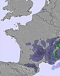 |  |  |  |  |  | ||||||||||||
— | — | — | — | — | — | — | — | — | — | — | — | — | — | — | — | — | — | |
mm | — | 1 | 3 | — | 2 | 3 | — | 1 | 1 | — | — | — | — | — | — | — | — | — |
max °C | 23 | 24 | 20 | 18 | 20 | 16 | 19 | 22 | 17 | 19 | 21 | 17 | 19 | 22 | 17 | 19 | 22 | 18 |
min °C | 18 | 22 | 11 | 12 | 17 | 11 | 14 | 19 | 11 | 13 | 20 | 10 | 13 | 22 | 10 | 12 | 21 | 11 |
chill °C | 18 | 22 | 11 | 12 | 17 | 11 | 14 | 19 | 11 | 13 | 20 | 10 | 13 | 22 | 9 | 12 | 21 | 11 |
Humid % | 35 | 48 | 89 | 61 | 71 | 92 | 60 | 64 | 89 | 60 | 55 | 85 | 47 | 44 | 80 | 43 | 38 | 60 |
Freeze m | 4550 | 4550 | 4300 | 4200 | 4300 | 4300 | 4150 | 4350 | 4400 | 4550 | 4600 | 4700 | 4600 | 4750 | 4550 | 4600 | 4600 | 4900 |
6:16 | — | — | 6:18 | — | — | 6:18 | — | — | 6:18 | — | — | 6:18 | — | — | 6:20 | — | — | |
— | — | 9:35 | — | — | 9:35 | — | — | 9:35 | — | — | 9:34 | — | — | 9:34 | — | — | 9:34 | |
Go pro and carve into:
Avalanche information: European Avalanche Warning Services (EAWS)
Latest snow reports near Grandvalira El Tarter:
| Top snow depth: | — |
|---|---|
| Bottom snow depth: | — |
| Fresh snowfall depth: | — |
| Last snowfall: | 17 May 2026 |
| Snow Alerts | Create Alert |
0.0 | Bluebird Powder days Fresh snow, mostly sunny, light wind. |
|---|---|
0.0 | Powder days Fresh snow, limited sun, any wind. |
0.0 | Bluebird days Average snow, mostly sunny, light wind. |

The above table gives the weather forecast for Grandvalira El Tarter at the specific elevation of 1676 m. Our sophisticated weather models allow us to provide snow forecasts for the top, middle and bottom ski stations of Grandvalira El Tarter. To access the weather forecasts for the other elevations, use the tab navigation above the table. For a wider view of the weather, check out the Weather Map of Andorra.
Click here to read further information on freezing levels and how we forecast our temperatures.
Overall 4.2 Based on 23 votes and 6 reviews
Grandvalira has undergone extensive investment over the last decade or so. Not a year has gone by without some form of infrastructure civil engineering work being completed to improve the visitor experience. The Pisteurs (ski patrol) do an excellent job and decent well equipped medical facilities are located at the base of the slopes. Andorra is no longer the destination it was say 15 - 20 years ago - it will very likely be barely recognisable to anyone that visited that long ago. The lift system is modern, efficient and impressive. There are just over 200km of piste - enough to keep most recreational skiers busy for the typical week ski holiday. There are a lot of options for Beginners and Intermediate / Advanced Intermediate skiers and things are family friendly. There are two World Cup ski runs - Avet (Soldeu) and Aliga (El Tarter). There is also the Riberal (Grau Roig) that is used for World Cup Speed Skiing. Grandvalira has set aside inbound Freeride areas and in recent years Arcalis has been added to the Grandvalira ski pass - Arcalis is a stop on the Freeride World Tour. There is a dedicated Freeride Centre as part of the ski school. There are three snowparks (El Tarter / Peretol / Grau Roig) for freestyle skiers. Accommodation across the Grandvalira resorts is high standard (often 4*+ rated) and is relatively reasonably priced - there are also activities and day out options for non-skiers including duty free shopping and the large Caldera Spa in Andorra La Vella. El Tarter is generally quieter and laid back - typically bed by 10 pm / 11pm - entertainment is usually centered around the hotels for the evening. That said L'Aberset (El Tarter) in the early evening on a Saturday is the Apres place to be, with Ibiza DJs playing to packed outside audiences. Soldeu is generally somewhat busier with a later bedtime and a wider choice of bars etc. Pas De La Casa is much more of a party town with partying into the early hours. Something for everyone? Expect to pay about 3 / 3.5 Euros for a large beer - that's good value when skiing? The ski school has an excellent reputation and employs British & Irish ski instructors to cater for British & Irish (and other English speaking) visitors. It can get extremely busy on a Saturday - so that's the day to take a break from the slopes if you are going to take a break from skiing /boarding. We visit Grandvalira every year and meet up with others (British, Irish, French & Spanish) that do exactly the same.
Marcus Summers from United Kingdom writes:
Grandvalira has undergone extensive investment over the last decade or so.
Not a year has gone by without some form of infrastructure civil engineering work being completed to improve the visitor experience.
The Pisteurs (ski patrol) do an excellent job and decent well equipped medical facilities are located at the base of the slopes.
Andorra is no longer the destination it was say 15 - 20 years ago - it will very likely be barely recognisable to anyone that visited that long ago.
The lift system is modern, efficient and impressive.
There are just over 200km of piste - enough to keep most recreational skiers busy for the typical week ski holiday.
There are a lot of options for Beginners and Intermediate / Advanced Intermediate skiers and things are family friendly.
There are two World Cup ski runs - Avet (Soldeu) and Aliga (El Tarter).
There is also the Riberal (Grau Roig) that is used for World Cup Speed Skiing.
Grandvalira has set aside inbound Freeride areas and in recent years Arcalis has been added to the Grandvalira ski pass - Arcalis is a stop on the Freeride World Tour.
There is a dedicated Freeride Centre as part of the ski school.
There are three snowparks (El Tarter / Peretol / Grau Roig) for freestyle skiers.
Accommodation across the Grandvalira resorts is high standard (often 4*+ rated) and is relatively reasonably priced - there are also activities and day out options for non-skiers including duty free shopping and the large Caldera Spa in Andorra La Vella.
El Tarter is generally quieter and laid back - typically bed by 10 pm / 11pm - entertainment is usually centered around the hotels for the evening.
That said L'Aberset (El Tarter) in the early evening on a Saturday is the Apres place to be, with Ibiza DJs playing to packed outside audiences.
Soldeu is generally somewhat busier with a later bedtime and a wider choice of bars etc.
Pas De La Casa is much more of a party town with partying into the early hours.
Something for everyone?
Expect to pay about 3 / 3.5 Euros for a large beer - that's good value when skiing?
The ski school has an excellent reputation and employs British & Irish ski instructors to cater for British & Irish (and other English speaking) visitors.
It can get extremely busy on a Saturday - so that's the day to take a break from the slopes if you are going to take a break from skiing /boarding.
We visit Grandvalira every year and meet up with others (British, Irish, French & Spanish) that do exactly the same.
Read 5 more reviews of Grandvalira El Tarter or submit your own


 Nearest