

Portillo Re-Opens To Guests Arriving By Helicopter
Chile’s famous Portillo ski resort is reported to have re-opened to guests arriving by helicopter after being cut off by road for more than two weeks by over 6m/20 feet of snowfall.

Next 3 days weather summary:Heavy rain (total 31.0mm), heaviest during Wed afternoon. Very mild (max 13°C on Wed morning, min 7°C on Wed night). Wind will be generally light. | Days 4-6 weather summary:Light rain (total 3.0mm), mostly falling on Fri afternoon. Very mild (max 12°C on Thu afternoon, min 6°C on Thu night). Winds increasing (calm on Thu night, fresh winds from the SW by Fri night). | |||||||||||||||||
Monday 3 | Tuesday 4 | Wednesday 5 | Thursday 6 | Friday 7 | Saturday 8 | |||||||||||||
AM | PM | night | AM | PM | night | AM | PM | night | AM | PM | night | AM | PM | night | AM | PM | night | |
light rain | light rain | mod. rain | light rain | light rain | light rain | light rain | mod. rain | light rain | some clouds | cloudy | some clouds | cloudy | rain shwrs | cloudy | light rain | light rain | some clouds | |
km/h | ||||||||||||||||||
Snow map |  |  |  | 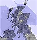 | 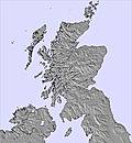 |  | ||||||||||||
— | — | — | — | — | — | — | — | — | — | — | — | — | — | — | — | — | — | |
mm | 2 | 2 | 7 | 3 | 2 | 4 | 4 | 6 | 1 | — | — | — | — | 1 | — | 1 | 1 | — |
max °C | 11 | 11 | 10 | 10 | 11 | 11 | 13 | 13 | 9 | 11 | 12 | 8 | 11 | 12 | 9 | 11 | 12 | 9 |
min °C | 10 | 10 | 9 | 10 | 11 | 11 | 12 | 11 | 7 | 9 | 11 | 6 | 10 | 12 | 8 | 10 | 11 | 8 |
chill °C | 9 | 8 | 7 | 7 | 10 | 10 | 12 | 9 | 4 | 7 | 10 | 4 | 8 | 10 | 5 | 7 | 8 | 4 |
Humid % | 89 | 94 | 92 | 99 | 99 | 96 | 95 | 92 | 94 | 78 | 62 | 71 | 75 | 77 | 92 | 95 | 84 | 84 |
Freeze m | 2450 | 2600 | 3000 | 3250 | 3250 | 3100 | 2800 | 2750 | 2300 | 1900 | 2350 | 2300 | 2150 | 2250 | 2500 | 3050 | 3200 | 2650 |
5:16 | — | — | 5:18 | — | — | 5:20 | — | — | 5:22 | — | — | 5:24 | — | — | 5:26 | — | — | |
— | 9:22 | — | — | 9:20 | — | — | 9:17 | — | — | 9:15 | — | — | 9:13 | — | — | 9:10 | — | |
Go pro and carve into:
Avalanche information: European Avalanche Warning Services (EAWS)
Latest snow reports near Glenshee:
| Top snow depth: | 0 cm |
|---|---|
| Bottom snow depth: | 0 cm |
| Fresh snowfall depth: | — |
| Last snowfall: | 17 May 2026 |
| Snow Alerts | Create Alert |
0.0 | Bluebird Powder days Fresh snow, mostly sunny, light wind. |
|---|---|
0.0 | Powder days Fresh snow, limited sun, any wind. |
0.0 | Bluebird days Average snow, mostly sunny, light wind. |
The above table gives the weather forecast for Glenshee at the specific elevation of 654 m. Our sophisticated weather models allow us to provide snow forecasts for the top, middle and bottom ski stations of Glenshee. To access the weather forecasts for the other elevations, use the tab navigation above the table. For a wider view of the weather, check out the Weather Map of United Kingdom.
Click here to read further information on freezing levels and how we forecast our temperatures.
Overall 3.2 Based on 36 votes and 49 reviews
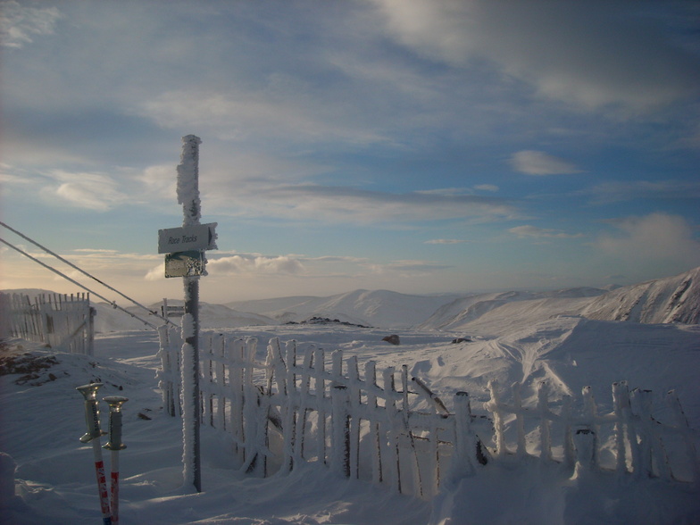
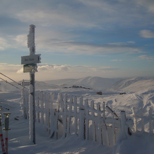
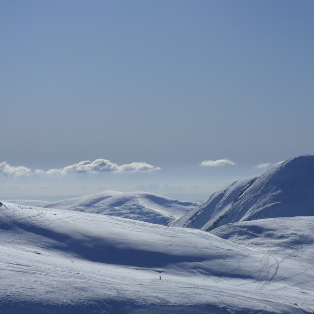
I've skied at Glenshee on and off since 1996. While not on the scale of the Alps, the area is very enjoyable with a variety of runs, especially the Glas Maol area which is wide open and without the snow fencing which characterises the rest of the ski area, allowing multiple lines to be taken. The Scottish weather can be "character forming" at times, but if you watch the weather and choose your days carefully, Scotland is one of the most rewarding places I've ever skied. The sense of "remoteness" and "wilderness" is second to none. It's also worth noting that the old Cairnwell chair was replaced in 2015.
Tim W from United Kingdom writes:
I've skied at Glenshee on and off since 1996. While not on the scale of the Alps, the area is very enjoyable with a variety of runs, especially the Glas Maol area which is wide open and without the snow fencing which characterises the rest of the ski area, allowing multiple lines to be taken. The Scottish weather can be "character forming" at times, but if you watch the weather and choose your days carefully, Scotland is one of the most rewarding places I've ever skied. The sense of "remoteness" and "wilderness" is second to none.
It's also worth noting that the old Cairnwell chair was replaced in 2015.


 Nearest