

America’s Next Indoor Snow Centre Takes Shape
Construction of a new indoor snow centre for skiers, boarders and tubers appears to be making good progress at Heritage Farm in Wayne County, West Virginia.

Next 4 days weather summary:Some drizzle, heaviest during Tue night. Very mild (max 11°C on Fri afternoon, min 5°C on Tue night). Wind will be generally light. | Days 5-7 weather summary:Heavy rain (total 37.0mm), heaviest during Sat night. Very mild (max 14°C on Sat afternoon, min 4°C on Sun night). Wind will be generally light. | |||||||||||||||
Wednesday 22 | Thursday 23 | Friday 24 | Saturday 25 | Sunday 26 | ||||||||||||
night | AM | PM | night | AM | PM | night | AM | PM | night | AM | PM | night | AM | PM | night | |
rain shwrs | clear | clear | clear | some clouds | clear | clear | clear | clear | clear | some clouds | t-storm risk | heavy rain | t-storm risk | rain shwrs | rain shwrs | |
km/h | ||||||||||||||||
Snow map |  |  |  |  |  |  | ||||||||||
— | — | — | — | — | — | — | — | — | — | — | — | — | — | — | — | |
mm | 1 | — | — | — | — | — | — | — | — | — | — | 1 | 23 | 4 | 6 | 3 |
max °C | 6 | 8 | 9 | 8 | 7 | 8 | 8 | 10 | 11 | 11 | 13 | 14 | 11 | 6 | 5 | 5 |
min °C | 5 | 7 | 8 | 6 | 6 | 7 | 6 | 8 | 10 | 10 | 12 | 13 | 6 | 6 | 5 | 4 |
chill °C | 3 | 7 | 7 | 4 | 4 | 5 | 4 | 7 | 10 | 9 | 11 | 13 | 5 | 5 | 3 | 2 |
Humid % | 45 | 28 | 59 | 36 | 46 | 58 | 28 | 15 | 47 | 26 | 31 | 48 | 93 | 85 | 90 | 87 |
Freeze m | 3700 | 3800 | 3900 | 3900 | 3600 | 3700 | 4000 | 4300 | 4200 | 4450 | 4350 | 4400 | 3550 | 3500 | 3450 | 3450 |
— | 6:01 | — | — | 6:01 | — | — | 6:03 | — | — | 6:05 | — | — | 6:05 | — | — | |
— | — | — | 9:13 | — | — | 9:12 | — | — | 9:10 | — | — | 9:09 | — | — | 9:08 | |
Go pro and carve into:
Avalanche information: European Avalanche Warning Services (EAWS)
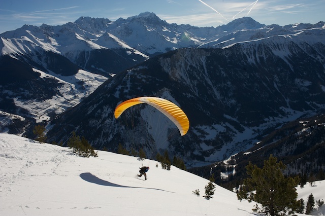
Latest snow reports near Champex-Lac:
| Top snow depth: | — |
|---|---|
| Bottom snow depth: | — |
| Fresh snowfall depth: | — |
| Last snowfall: | 10 Jun 2026 |
| Snow Alerts | Create Alert |
0.0 | Bluebird Powder days Fresh snow, mostly sunny, light wind. |
|---|---|
0.1 | Powder days Fresh snow, limited sun, any wind. |
0.0 | Bluebird days Average snow, mostly sunny, light wind. |
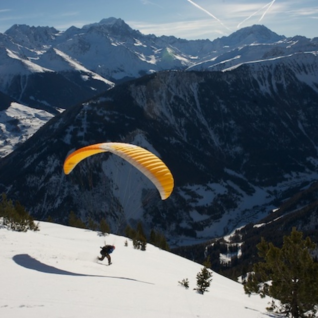

The above table gives the weather forecast for Champex-Lac at the specific elevation of 2671 m. Our sophisticated weather models allow us to provide snow forecasts for the top, middle and bottom ski stations of Champex-Lac. To access the weather forecasts for the other elevations, use the tab navigation above the table. For a wider view of the weather, check out the Weather Map of Switzerland.
Click here to read further information on freezing levels and how we forecast our temperatures.
Overall 3.8 Based on 3 votes and 5 reviews
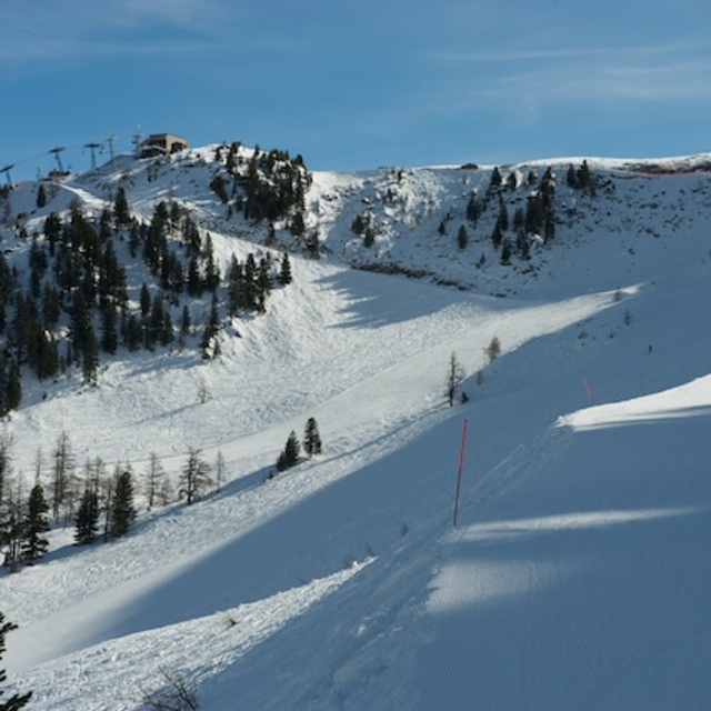
A real find here. Trees and open powder fields accessible from the lift (yes it is old but there is no one here!). You don't come here to ski on piste but you CAN ski powder days after Verbier is skied out. Excellent touring options - chutes and steeps easy to get to. North facing too. For those in the know...
Per from Sweden writes:
A real find here. Trees and open powder fields accessible from the lift (yes it is old but there is no one here!). You don't come here to ski on piste but you CAN ski powder days after Verbier is skied out. Excellent touring options - chutes and steeps easy to get to. North facing too. For those in the know...


 Nearest