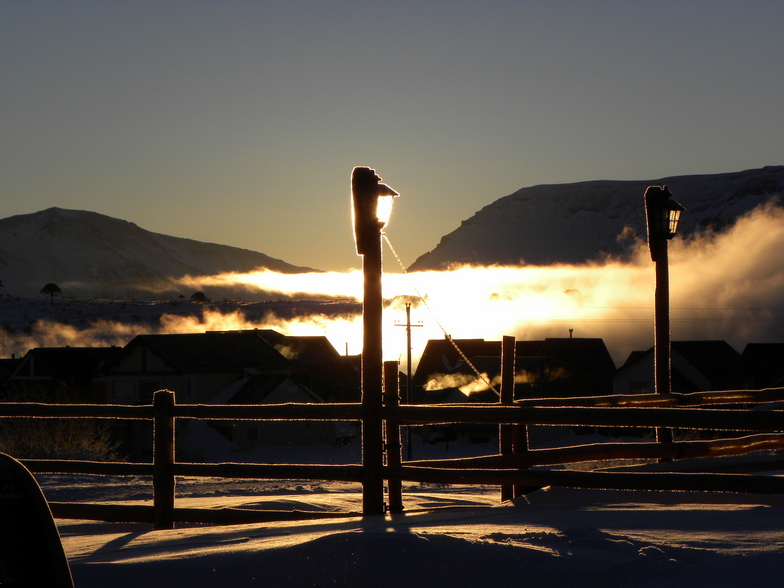


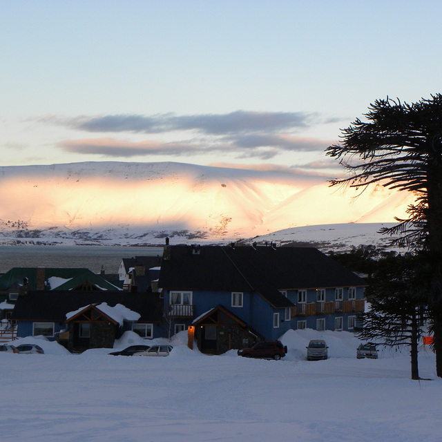
Portillo Re-Opens To Guests Arriving By Helicopter
Chile’s famous Portillo ski resort is reported to have re-opened to guests arriving by helicopter after being cut off by road for more than two weeks by over 6m/20 feet of snowfall.

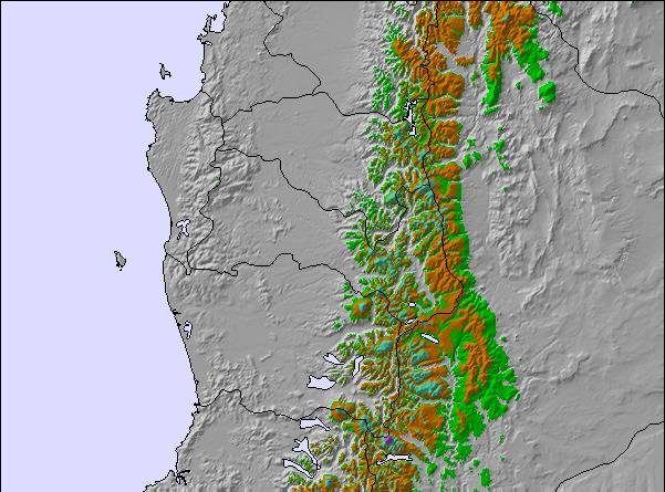
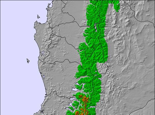
Next 3 days weather summary:A heavy fall of snow, heaviest during Wed night. Temperatures will be below freezing (max 0°C on Mon afternoon, min -6°C on Wed night). Winds increasing (moderate winds from the NW on Mon afternoon, near gales from the NW by Wed afternoon). | Days 4-6 weather summary:A heavy fall of snow, heaviest during Fri afternoon. Temperatures will be below freezing (max -5°C on Thu morning, min -11°C on Sat night). Winds decreasing (gales from the WNW on Fri afternoon, moderate winds from the W by Sat night). | |||||||||||||||||
Monday 3 | Tuesday 4 | Wednesday 5 | Thursday 6 | Friday 7 | Saturday 8 | |||||||||||||
AM | PM | night | AM | PM | night | AM | PM | night | AM | PM | night | AM | PM | night | AM | PM | night | |
light snow | light snow | light snow | light snow | cloudy | snow shwrs | snow shwrs | heavy snow | heavy snow | snow shwrs | snow shwrs | heavy snow | heavy snow | heavy snow | heavy snow | light snow | mod. snow | heavy snow | |
km/h | ||||||||||||||||||
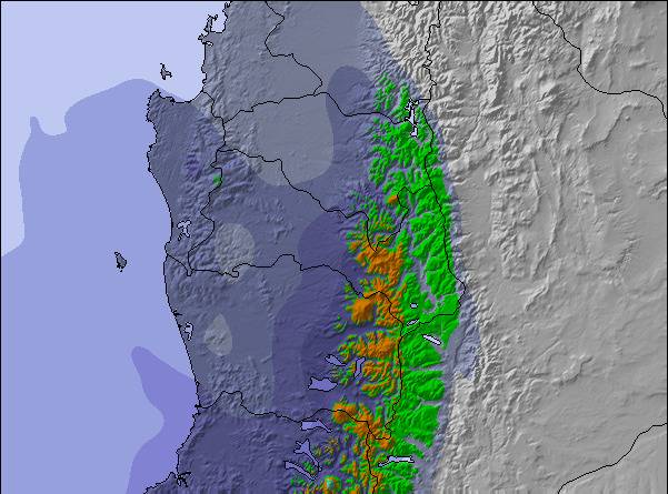
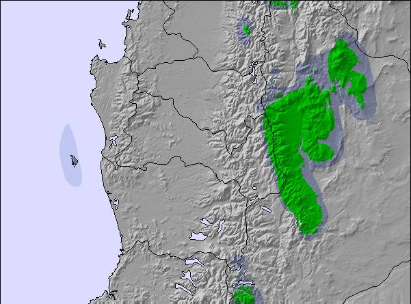
Snow map | 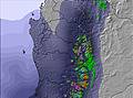 | 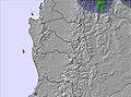 | 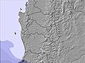 | 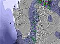 | 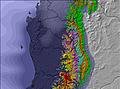 | 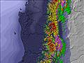 | ||||||||||||
2 | 1 | 1 | — | — | — | 1 | 10 | 24 | 1 | 1 | 12 | 14 | 27 | 18 | 5 | 8 | 11 | |
mm | — | — | — | — | — | — | — | — | — | — | — | — | — | — | — | — | — | — |
max °C | -1 | 0 | 0 | 0 | 0 | -2 | 0 | 0 | -4 | -5 | -5 | -6 | -5 | -5 | -8 | -9 | -8 | -9 |
min °C | -2 | -1 | -1 | -1 | 0 | -3 | -2 | -1 | -6 | -6 | -5 | -6 | -5 | -7 | -10 | -9 | -8 | -11 |
chill °C | -9 | -7 | -8 | -8 | -7 | -10 | -10 | -9 | -16 | -15 | -14 | -15 | -15 | -18 | -20 | -19 | -18 | -20 |
Humid % | 97 | 98 | 98 | 76 | 69 | 85 | 94 | 93 | 96 | 74 | 73 | 97 | 97 | 97 | 95 | 95 | 93 | 95 |
Freeze m | 1650 | 1900 | 2000 | 1950 | 2150 | 1300 | 1550 | 2000 | 1350 | 850 | 1250 | 1100 | 1250 | 1300 | 750 | 650 | 950 | 650 |
8:41 | — | — | 8:41 | — | — | 8:40 | — | — | 8:38 | — | — | 8:37 | — | — | 8:37 | — | — | |
— | 6:58 | — | — | 6:59 | — | — | 7:00 | — | — | 7:00 | — | — | 7:00 | — | — | 7:01 | — | |
Go pro and carve into:
Avalanche information: Centro de Información de Avalanchas CIAV
Latest snow reports near Caviahue:
| Top snow depth: | 120 cm |
|---|---|
| Bottom snow depth: | 60 cm |
| Fresh snowfall depth: | 53 cm |
| Last snowfall: | 2 Aug 2026 |
| Snow Alerts | Create Alert |
0.4 | Bluebird Powder days Fresh snow, mostly sunny, light wind. |
|---|---|
1.9 | Powder days Fresh snow, limited sun, any wind. |
0.6 | Bluebird days Average snow, mostly sunny, light wind. |
The above table gives the weather forecast for Caviahue at the specific elevation of 2045 m. Our sophisticated weather models allow us to provide snow forecasts for the top, middle and bottom ski stations of Caviahue. To access the weather forecasts for the other elevations, use the tab navigation above the table. For a wider view of the weather, check out the Weather Map of Argentina.
Click here to read further information on freezing levels and how we forecast our temperatures.
Overall 3.6 Based on 71 votes and 158 reviews
Muy buenas pistas, lástima que tienen pocos medios de elevación y cuando corre un poco de viento no funcionan las telesillas, quedan muy poca pista. Deberían solucionar ese tema porque es la patagonia y siempre corre viento. Los medios son viejos, los modernos funcionan con viento. Un paraíso mal aprovechado y explotado.
Beatriz Miranda from Argentina writes:
Muy buenas pistas, lástima que tienen pocos medios de elevación y cuando corre un poco de viento no funcionan las telesillas, quedan muy poca pista. Deberían solucionar ese tema porque es la patagonia y siempre corre viento. Los medios son viejos, los modernos funcionan con viento. Un paraíso mal aprovechado y explotado.

 Nearest