

Global Weekly Snow Roundup #314
Weekly Global Snow News, updated 14 May 2026: Fresh snowfall in Argentina, Australia and Lesotho signals winter’s approach, while Japan maintains the world’s deepest snowpack.

Next 3 days weather summary:Light rain (total 7.0mm), mostly falling on Sat afternoon. Freeze-thaw conditions (max 8°C on Mon afternoon, min -1°C on Sat morning). Winds increasing (calm on Sat night, fresh winds from the WSW by Sun night). | Days 4-6 weather summary:Light rain (total 4.0mm), mostly falling on Tue morning. Very mild (max 17°C on Thu afternoon, min 4°C on Tue morning). Winds decreasing (fresh winds from the WSW on Tue afternoon, calm by Wed night). | |||||||||||||||||
Saturday 16 | Sunday 17 | Monday 18 | Tuesday 19 | Wednesday 20 | Thursday 21 | |||||||||||||
AM | PM | night | AM | PM | night | AM | PM | night | AM | PM | night | AM | PM | night | AM | PM | night | |
snow shwrs | light rain | cloudy | light rain | rain shwrs | light rain | cloudy | light rain | cloudy | light rain | light rain | some clouds | clear | clear | some clouds | some clouds | clear | clear | |
km/h | ||||||||||||||||||
Snow map |  |  |  |  |  |  | ||||||||||||
1 | — | — | — | — | — | — | — | — | — | — | — | — | — | — | — | — | — | |
— | 2 | — | 1 | 1 | 1 | — | 2 | — | 2 | 2 | — | — | — | — | — | — | — | |
max °C | 0 | 6 | 5 | 3 | 7 | 6 | 6 | 8 | 5 | 5 | 7 | 7 | 11 | 15 | 12 | 13 | 17 | 15 |
min °C | -1 | 4 | 0 | 3 | 5 | 2 | 2 | 6 | 4 | 4 | 6 | 5 | 7 | 13 | 8 | 10 | 16 | 11 |
-6 | 0 | -2 | 0 | 2 | -3 | -2 | 1 | -1 | -1 | 1 | 2 | 5 | 12 | 8 | 10 | 16 | 11 | |
92 | 51 | 79 | 95 | 80 | 97 | 79 | 78 | 75 | 98 | 97 | 89 | 57 | 41 | 62 | 55 | 43 | 38 | |
1300 | 1950 | 1950 | 1850 | 2300 | 2100 | 2000 | 2100 | 2450 | 2650 | 3000 | 2900 | 3250 | 3250 | 3800 | 3950 | 4100 | 4050 | |
6:16 | — | — | 6:16 | — | — | 6:15 | — | — | 6:13 | — | — | 6:13 | — | — | 6:11 | — | — | |
— | — | 9:12 | — | — | 9:13 | — | — | 9:14 | — | — | 9:15 | — | — | 9:16 | — | — | 9:17 | |
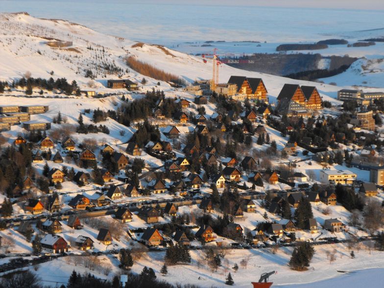
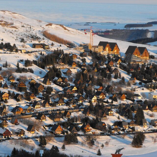
Latest snow reports near Besse Super Besse:
It is snowing steadily in Le Mont-Dore. from Le Mont-Dore
| Top snow depth: | — |
|---|---|
| Bottom snow depth: | — |
| Fresh snowfall depth: | 13 cm |
| Last snowfall: | 15 May 2026 |
| Snow Alerts | Create Alert |
0.0 | Bluebird Powder days Fresh snow, mostly sunny, light wind. |
|---|---|
0.0 | Powder days Fresh snow, limited sun, any wind. |
0.0 | Bluebird days Average snow, mostly sunny, light wind. |
The above table gives the weather forecast for Besse Super Besse at the specific elevation of 1350 m. Our sophisticated weather models allow us to provide snow forecasts for the top, middle and bottom ski stations of Besse Super Besse. To access the weather forecasts for the other elevations, use the tab navigation above the table. For a wider view of the weather, check out the Weather Map of France.
Click here to read further information on freezing levels and how we forecast our temperatures.
Overall 3.8 Based on 18 votes and 4 reviews
Due to my parents owning a chalet just down the road from Besse, I have skied at Super Besse (Besse Super Besse) for a number of years. The resort has improved considerably over recent years with the introduction of snow cannons on most (if not all) pistes, a new chair lift and a new telecabine system opened at Christmas 2008 (this one runs even when it's windy). Advantages of Besse Super Besse: lower than Alpine prices, access to Le Mont Dore (listed in the top 10 off-piste areas) when there is enough snow for the liason to be open, attractive medieval town of Besse near by. Disadvantages at Besse Super Besse: weather can often be very bleak, white-outs and high winds are common, Super Besse is not high enough to have a glacier so there isn't a snow guarantee.
Alex Huert from United Kingdom writes:
Due to my parents owning a chalet just down the road from Besse, I have skied at Super Besse (Besse Super Besse) for a number of years.
The resort has improved considerably over recent years with the introduction of snow cannons on most (if not all) pistes, a new chair lift and a new telecabine system opened at Christmas 2008 (this one runs even when it's windy).
Advantages of Besse Super Besse: lower than Alpine prices, access to Le Mont Dore (listed in the top 10 off-piste areas) when there is enough snow for the liason to be open, attractive medieval town of Besse near by.
Disadvantages at Besse Super Besse: weather can often be very bleak, white-outs and high winds are common, Super Besse is not high enough to have a glacier so there isn't a snow guarantee.


 Nearest