

Global Weekly Snow Roundup #314
Weekly Global Snow News, updated 14 May 2026: Fresh snowfall in Argentina, Australia and Lesotho signals winter’s approach, while Japan maintains the world’s deepest snowpack.

Next 3 days weather summary:A moderate fall of snow, heaviest on Mon night. Freeze-thaw conditions (max 1°C on Mon afternoon, min -6°C on Sat morning). Wind will be generally light. | Days 4-6 weather summary:Light rain (total 3.0mm), mostly falling on Wed afternoon. Freeze-thaw conditions (max 8°C on Thu afternoon, min -1°C on Tue morning). Wind will be generally light. | |||||||||||||||||
Saturday 16 | Sunday 17 | Monday 18 | Tuesday 19 | Wednesday 20 | Thursday 21 | |||||||||||||
AM | PM | night | AM | PM | night | AM | PM | night | AM | PM | night | AM | PM | night | AM | PM | night | |
light snow | light snow | snow shwrs | clear | snow shwrs | snow shwrs | light snow | light snow | mod. snow | some clouds | some clouds | light snow | light snow | light rain | rain shwrs | some clouds | some clouds | clear | |
km/h | ||||||||||||||||||
Snow map |  |  |  |  |  |  | ||||||||||||
3 | 1 | 1 | — | — | — | — | 1 | 8 | — | — | — | — | — | — | — | — | — | |
— | — | — | — | — | — | — | — | — | — | — | — | — | 2 | 1 | — | — | — | |
max °C | -6 | -5 | -5 | -3 | 0 | -1 | -1 | 1 | 0 | 0 | 2 | 1 | 2 | 4 | 3 | 4 | 8 | 6 |
min °C | -6 | -5 | -6 | -4 | -1 | -2 | -1 | 0 | -2 | -1 | 1 | 1 | 1 | 3 | 2 | 3 | 6 | 5 |
-12 | -10 | -9 | -4 | -1 | -5 | -3 | -3 | -4 | -3 | 1 | 1 | -1 | 1 | 0 | 1 | 4 | 3 | |
89 | 94 | 75 | 68 | 84 | 89 | 89 | 85 | 94 | 76 | 80 | 97 | 78 | 83 | 82 | 83 | 56 | 51 | |
1600 | 1850 | 1500 | 2050 | 2400 | 2150 | 2350 | 2600 | 2100 | 2400 | 2700 | 2550 | 2700 | 2900 | 2900 | 2900 | 3400 | 3500 | |
5:39 | — | — | 5:37 | — | — | 5:37 | — | — | 5:35 | — | — | 5:35 | — | — | 5:33 | — | — | |
— | — | 8:44 | — | — | 8:45 | — | — | 8:46 | — | — | 8:47 | — | — | 8:49 | — | — | 8:50 | |
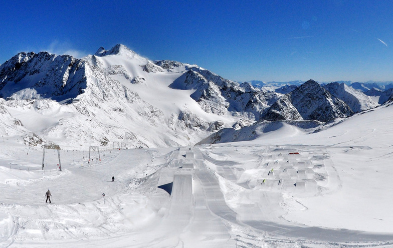
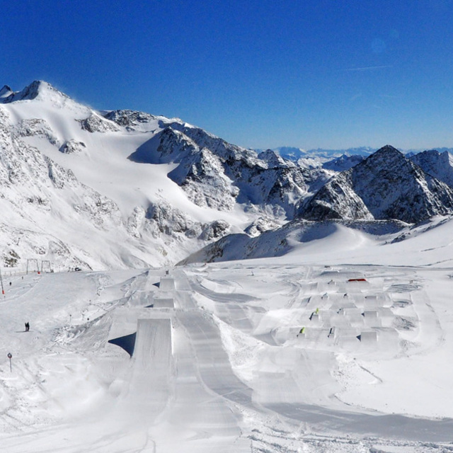
Latest snow reports near Stubai Glacier:
| Top snow depth: | 335 cm |
|---|---|
| Bottom snow depth: | — |
| Fresh snowfall depth: | 49 cm |
| Last snowfall: | 15 May 2026 |
| Snow Alerts | Create Alert |
0.7 | Bluebird Powder days Fresh snow, mostly sunny, light wind. |
|---|---|
1.2 | Powder days Fresh snow, limited sun, any wind. |
0.1 | Bluebird days Average snow, mostly sunny, light wind. |
The above table gives the weather forecast for Stubai Glacier at the specific elevation of 2450 m. Our sophisticated weather models allow us to provide snow forecasts for the top, middle and bottom ski stations of Stubai Glacier. To access the weather forecasts for the other elevations, use the tab navigation above the table. For a wider view of the weather, check out the Weather Map of Austria.
Click here to read further information on freezing levels and how we forecast our temperatures.
Overall 4.1 Based on 23 votes and 19 reviews
The resort is great, beautiful scenery and comfy hotels. Skied here twice in November. Unfortunately, ski teams prepare here in early season and, in my experience, ski dangerously. My husband - very experienced skier - was airlifted to hospital this week after one of the slalom skiers smashed into him (then he and adult he was with skied on without stopping). We won’t come here again.
Amy from United Kingdom writes:
The resort is great, beautiful scenery and comfy hotels. Skied here twice in November. Unfortunately, ski teams prepare here in early season and, in my experience, ski dangerously. My husband - very experienced skier - was airlifted to hospital this week after one of the slalom skiers smashed into him (then he and adult he was with skied on without stopping). We won’t come here again.


 Nearest