

Global Weekly Snow Roundup #314
Weekly Global Snow News, updated 14 May 2026: Fresh snowfall in Argentina, Australia and Lesotho signals winter’s approach, while Japan maintains the world’s deepest snowpack.

Next 3 days weather summary:A dusting of snow. Milder later with heavy rain (total 21.0mm) on Mon night. Freeze-thaw conditions (max 6°C on Mon afternoon, min -8°C on Sat night). Wind will be generally light. | Days 4-6 weather summary:Light rain (total 8.0mm), mostly falling on Tue night. Very mild (max 14°C on Thu afternoon, min 3°C on Tue morning). Wind will be generally light. | |||||||||||||||||
Saturday 16 | Sunday 17 | Monday 18 | Tuesday 19 | Wednesday 20 | Thursday 21 | |||||||||||||
AM | PM | night | AM | PM | night | AM | PM | night | AM | PM | night | AM | PM | night | AM | PM | night | |
light snow | light snow | snow shwrs | clear | rain shwrs | rain shwrs | light rain | light rain | light snow | some clouds | some clouds | light rain | light rain | light rain | rain shwrs | some clouds | some clouds | clear | |
km/h | ||||||||||||||||||
Snow map |  |  |  |  |  |  | ||||||||||||
2 | 1 | — | — | — | — | — | — | — | — | — | — | — | — | — | — | — | — | |
— | — | — | — | 1 | 1 | 1 | 2 | 16 | — | — | 4 | 1 | 2 | 1 | — | — | — | |
max °C | 0 | 2 | 0 | 3 | 5 | 3 | 5 | 6 | 4 | 4 | 7 | 6 | 6 | 10 | 7 | 10 | 14 | 10 |
min °C | -1 | 1 | -8 | 0 | 5 | 1 | 3 | 6 | -2 | 3 | 6 | 4 | 5 | 9 | 3 | 7 | 14 | 5 |
-5 | -3 | -8 | 0 | 5 | -2 | 2 | 4 | -2 | 3 | 6 | 4 | 4 | 8 | 1 | 6 | 14 | 4 | |
89 | 88 | 84 | 72 | 87 | 91 | 88 | 81 | 96 | 88 | 81 | 98 | 86 | 74 | 89 | 72 | 45 | 74 | |
1600 | 1850 | 1500 | 2050 | 2400 | 2150 | 2350 | 2600 | 2100 | 2400 | 2700 | 2550 | 2700 | 2900 | 2900 | 2900 | 3400 | 3500 | |
5:39 | — | — | 5:37 | — | — | 5:37 | — | — | 5:35 | — | — | 5:35 | — | — | 5:33 | — | — | |
— | — | 8:44 | — | — | 8:45 | — | — | 8:46 | — | — | 8:47 | — | — | 8:49 | — | — | 8:50 | |
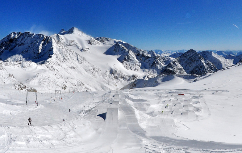
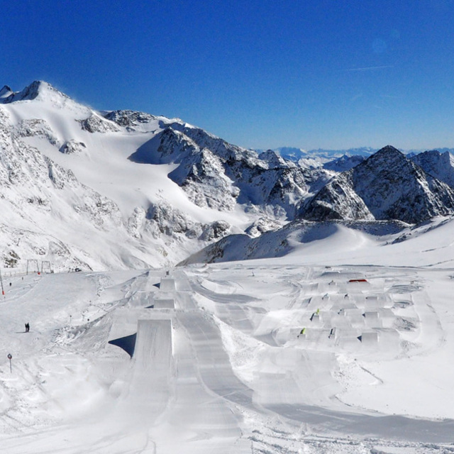
Latest snow reports near Stubai Glacier:
| Top snow depth: | 335 cm |
|---|---|
| Bottom snow depth: | — |
| Fresh snowfall depth: | 49 cm |
| Last snowfall: | 15 May 2026 |
| Snow Alerts | Create Alert |
0.0 | Bluebird Powder days Fresh snow, mostly sunny, light wind. |
|---|---|
0.1 | Powder days Fresh snow, limited sun, any wind. |
0.0 | Bluebird days Average snow, mostly sunny, light wind. |
The above table gives the weather forecast for Stubai Glacier at the specific elevation of 1700 m. Our sophisticated weather models allow us to provide snow forecasts for the top, middle and bottom ski stations of Stubai Glacier. To access the weather forecasts for the other elevations, use the tab navigation above the table. For a wider view of the weather, check out the Weather Map of Austria.
Click here to read further information on freezing levels and how we forecast our temperatures.
Overall 4.1 Based on 23 votes and 19 reviews
Love this place. We always go in April. New 360 gondola is huge and eliminates any queues. Apres-ski at the bottom is excellent. Dresdner hut very cool place to stop for lunch. Ice igloo bar at the very top is a must, Runs for everyone, beginners upwards. Word of warning: if you intend skiing the long semi-piste to the bottom, I took my three down last year and there are some very narrow parts with deep crevices if you are not a good skier. Not fit for young kids or nervous types. Always stay in Neustift now. Excellent village with plenty of Austrian apres.
Andy mumby from United Kingdom writes:
Love this place. We always go in April.
New 360 gondola is huge and eliminates any queues.
Apres-ski at the bottom is excellent.
Dresdner hut very cool place to stop for lunch.
Ice igloo bar at the very top is a must,
Runs for everyone, beginners upwards.
Word of warning: if you intend skiing the long semi-piste to the bottom, I took my three down last year and there are some very narrow parts with deep crevices if you are not a good skier. Not fit for young kids or nervous types.
Always stay in Neustift now. Excellent village with plenty of Austrian apres.


 Nearest